 Block
San Ildefonso Pueblo, New Mexico
20 topographic sheets cover this place, the earliest surveyed in 1892 and the latest in 2002. It stands in the Santa Fe North census division. It lies in ZIP code area 87506. It stands on Pojoaque River. The Survey maps it on the Espanola quadrangle. 624 people lived here at the 2020 count. It stands 5,548 feet above sea level.
On record in San Ildefonso Pueblo
Buildings and businesses the archive holds for this place. Each opens its own page, with the source record it came from.
On the National Register within a mile 1 record
The National Register names another town for these. They stand within one mile of this settlement's coordinate.
 San Ildefonso Pueblolisted 1974 · 0.0 miles away
Surveyed buildings and structures 2 records
- Kiva, San Ildefonso Pueblofederal building survey, 1 photograph
- Pueblo of San Ildefonso, State Road 4 Vicinity, San Ildefonso Pueblofederal building survey, 3 photographs
Population over time
3 figuresSan Ildefonso Pueblo grew from 458 to 624 between 2000 and 2020. These are the recorded population figures Wikidata holds for this place, reached through the Geographic Names Information System number this page is keyed on rather than by name, so they belong to this place and not to another of the same name. Most are census counts, but not all are: an early figure may be a founding or settlement estimate, and an estimate published within five years of a census is left out. The change column is computed, and is left blank where more than 20 years separate a figure from the one before it, because a gap that long is not a change between two counts.
| Year | People | Change |
|---|---|---|
| 2000 | 458 | |
| 2010 | 524 | +66 (+14%) |
| 2020 | 624 | +100 (+19%) |
Topographic sheets covering this place
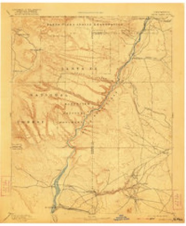
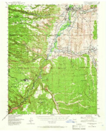
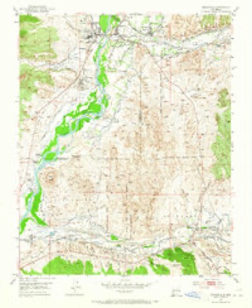
10 surveys from 20 printed sheetsMatched by testing this settlement's coordinate against the published boundary of every sheet in the United States Geological Survey's historical collection. Each opens the scanned sheet at the Survey.
- 1892 USGS Santa Clara quadrangle1:125000, 4 printings
- 1953 USGS Espanola quadrangle1:62500, 3 printings
- 1953 USGS Espanola quadrangle1:24000, 3 printings
- 1958 USGS Albuquerque quadrangle1:250000
- 1962 USGS Albuquerque quadrangle1:250000
- 1963 USGS Albuquerque quadrangle1:250000, 3 printings
- 1978 USGS Los Alamos quadrangle1:100000
- 1983 USGS Albuquerque quadrangle1:250000
- 1984 USGS Espanola quadrangle1:24000, 2 printings
- 2002 USGS Espanola quadrangle1:24000
Photographs
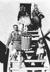
1 photograph,Taken for the Office of War Information and the Farm Security Administration, who photographed the country between 1935 and 1944. Works of United States government photographers, with no known restriction on use. Each opens its catalogue record.
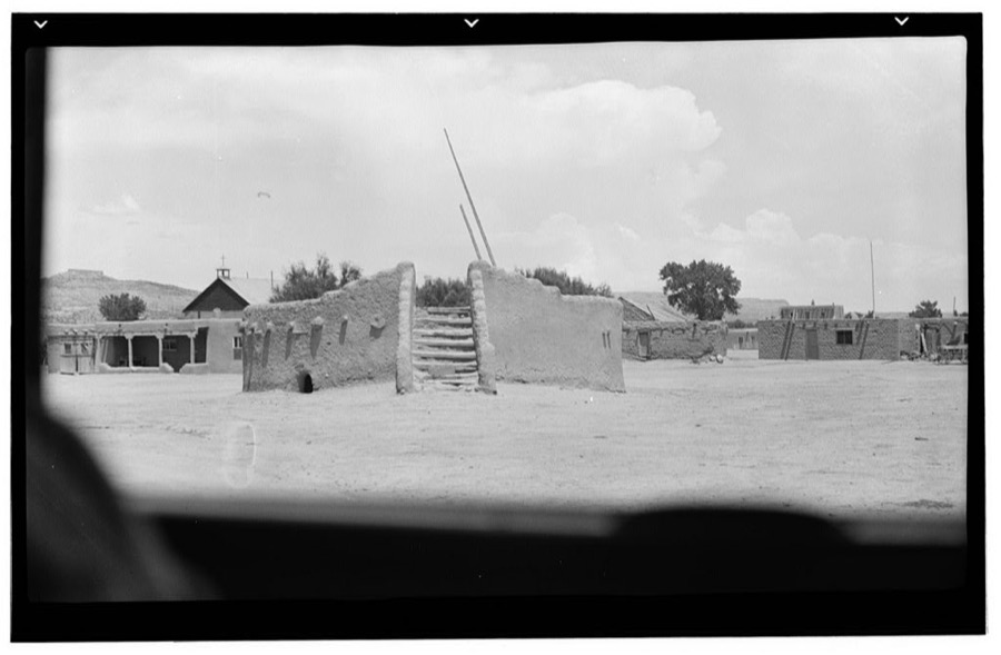
Photographer not recorded. Library of Congress
Fires near this place
87 since 1992Regional context, not property-specific evidence. The federal wildfire occurrence database lists 87 fires within 5 miles of San Ildefonso Pueblo between 1992 and 2020, burning about 250 acres in total. 6 started naturally. 11 were recorded as arson. Distance is straight-line from the map coordinates, so a fire counted here may appear on a neighbouring settlement's page as well.
| Reported cause | Fires |
|---|---|
| Debris and open burning | 38 |
| Missing data/not specified/undetermined | 17 |
| Arson/incendiarism | 11 |
| Natural | 6 |
| Recreation and ceremony | 6 |
| Equipment and vehicle use | 2 |
| Smoking | 2 |
| Other causes | 2 |
| Misuse of fire by a minor | 2 |
| Fireworks | 1 |
The most recent of them, most recent first, with the day each was reported and the service that recorded it.
| Date | Cause | Size | Reported by | Name on the report |
|---|---|---|---|---|
| 7 September 2001 | Debris and open burning | under an acre | Northern Pueblos Agency | BROKEN AX |
| 14 September 2017 | Debris and open burning | under an acre | Northern Pueblos Agency | DUMP 2 |
| 6 July 2011 | Missing data/not specified/undetermined | under an acre | Northern Pueblos Agency | ELM |
| 4 July 2013 | Arson/incendiarism | under an acre | Northern Pueblos Agency | 6 MILE |
| 2 July 1992 | Smoking | under an acre | Albuquerque District Office | SECO |
| 16 July 2020 | Missing data/not specified/undetermined | 1.2 acres | Northern Pueblos Agency | JACONA 2 |
| 16 July 2019 | Natural | 1.2 acres | Taos Field Office | ARROYO |
| 16 July 2019 | Natural | under an acre | Taos Field Office | JUNIPER |
Settlements close enough to share some of these fires:
Mines and quarries near this place
6 within 5 milesRegional context, not property-specific evidence. The federal mineral resources record lists 6 workings within 5 miles of San Ildefonso Pueblo: 6 unknowns. None of them still produces. What was taken out: Sand and Gravel, Construction, Pumice. Distance is straight-line from the map coordinates, so a quarry counted here may appear on a neighbouring settlement's page as well.
| Where | Site | Commodity | Status | Recorded |
|---|---|---|---|---|
| White Eagle Pumice Mine 2 | Pumice | Unknown | ||
| Materials Pit | Sand and Gravel, Construction | Unknown | ||
| Materials Pit | Sand and Gravel, Construction | Unknown | ||
| Materials Pits | Sand and Gravel, Construction | Unknown | ||
| Materials Pits | Sand and Gravel, Construction | Unknown | ||
| Materials Pits | Sand and Gravel, Construction | Unknown |
Storms near this place
14 since 2000Regional context, not property-specific evidence. The National Weather Service names San Ildefonso Pueblo in 14 storm reports between 2000 and 2025: 7 flash flood, 3 thunderstorm wind, 2 flood, 2 hail. No death or injury is recorded in these reports. Each account below is quoted exactly as the forecast office filed it, from the NOAA Storm Events Database, and each date opens the federal record of that event.
| When | Event | Place named | Harm | What the report says |
|---|---|---|---|---|
| September 2013 | Flood | San Ildefonso Pueblo | $50,000 | Mudslide reported along NM 502 at Totavi gas station. Power lines also downed in the area. Significant flooding along NM 30. |
| July 2021 | Flash Flood | San Ildefonso Pueblo | $10,000 | Trained spotters near Jaconita reported flash flooding in the area from heavy rain. The spotters' truck became stuck in the flood waters and mud flow, but no injuries were reported. Damages are estimated for water damage to the truck. |
| October 2017 | Flash Flood | San Ildefonso Pueblo | $5,000 | County road 84 washed out in El Rancho. |
| September 2013 | Flood | San Ildefonso Pueblo | $5,000 | Water over roadways and several bridges along NM 502 and 30. One car was stuck in the water. |
| September 2011 | Flash Flood | San Ildefonso Pueblo | $2,500 | There was considerable amounts of mud and rocks across New Mexico State Highways 4 and 502. |
| August 2020 | Hail | San Ildefonso Pueblo | $2,000 | A CoCoRaHS observer reported one inch hail from a severe thunderstorm west of Santa Fe. The observer also reported damaged shingles from the hail. Damage amounts are a rough estimate. |
| September 2025 | Flash Flood | San Ildefonso Pueblo | - | Heavy rainfall from thunderstorms resulted in Dry Creek Road to County Road 84 near the Rio Pojoaque to become impassable due to water over the roadways. Additionally, the intersection at the end of NM 502 and Cities of Gold Road in Pojoaque became impassible due to 4 feet of water over the roadways. |
| July 2020 | Thunderstorm Wind | San Ildefonso Pueblo | - | A weather station near San Ildefonso Pueblo recorded a 60 mph wind gust with a severe thunderstorm. |
| July 2019 | Flash Flood | San Ildefonso Pueblo | - | Eastbound lanes of NM-502 were closed due to water, mud, rocks, and debris flowing over the roadway due to torrential rainfall. The closure was reduced to one lane after water receded in the area. A public weather station in nearby White Rock reported 2.21 inches of rainfall from this storm. |
| May 2017 | Hail | San Ildefonso Pueblo | - | Quarter size hail along CR-502 near El Rancho covering the roadway. |
| July 2014 | Flash Flood | San Ildefonso Pueblo | - | A water rescue occurred in El Rancho from flash flooding. |
| June 2013 | Thunderstorm Wind | San Ildefonso Pueblo | - | White Rock Los Alamos National Lab array 54. |
| July 2013 | Thunderstorm Wind | San Ildefonso Pueblo | - | Mesonet site recorded a 58mph wind gust as an isolated cell moved from NW to the SE across the area. |
| July 2000 | Flash Flood | San Ildefonso Pueblo | - | no account filed |
Nearest settlements
The eight closest, with where each one stands in the county. Distances are straight-line, computed from the Geographic Names Information System coordinates.
Elsewhere
Matched on this settlement's Geographic Names Information System number rather than its name, so it cannot be a different place of the same name in another state.
| Wikipedia article on San Ildefonso Pueblo | An encyclopaedic summary. Its text is share-alike, so it is linked here rather than copied. |
| Wikidata item Q1481173 | The structured record the population and elevation above come from. Public domain (CC0). |
Provenance
This settlement is recorded in the Geographic Names Information System as feature 933092. The sheet list is computed by point-in-boundary test against the United States Geological Survey's historical topographic inventory. Both are works of the United States government and carry no copyright under 17 U.S.C. 105.
Wildfire. Short, Karen C. 2022. Spatial wildfire occurrence data for the United States, 1992-2020 [FPA_FOD_20221014]. 6th Edition. Fort Collins, CO: Forest Service Research Data Archive. https://doi.org/10.2737/RDS-2013-0009.6 Collected with United States Government funding and usable without additional permissions or fees.
Mines and quarries. USGS Mineral Resources Data System (MRDS) https://mrdata.usgs.gov/mrds/ A work of the United States government, no copyright under 17 U.S.C. 105.
Storms. NOAA National Centers for Environmental Information, Storm Events Database https://www.ncei.noaa.gov/stormevents/ A work of the United States government, no copyright under 17 U.S.C. 105. Narratives are quoted verbatim from the National Weather Service report and are not edited or summarised.