 Block
White Oaks, New Mexico
15 topographic sheets cover this place, the earliest surveyed in 1934 and the latest in 2004. It stands in the Carrizozo census division. It lies in ZIP code area 88301. It lies in White Oaks Draw. The Survey maps it on the White Oaks South quadrangle. It stands 6,329 feet above sea level.
On record in White Oaks
Buildings and businesses the archive holds for this place. Each opens its own page, with the source record it came from.
On the National Register 1 record
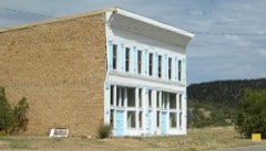 White Oaks Historic Districtlisted 1970
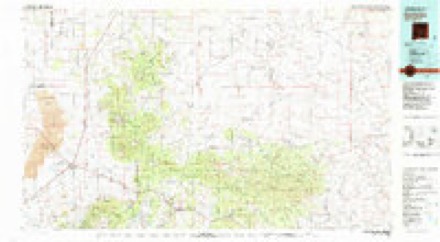
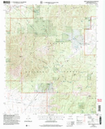
Topographic sheets covering this place
9 surveys from 15 printed sheetsMatched by testing this settlement's coordinate against the published boundary of every sheet in the United States Geological Survey's historical collection. Each opens the scanned sheet at the Survey.
- 1934 USGS Capitan quadrangle1:48000
- 1934 USGS Capitan quadrangle1:62500, 2 printings
- 1937 USGS Capitan quadrangle1:62500, 3 printings
- 1955 USGS Roswell quadrangle1:250000, 3 printings
- 1958 USGS Roswell quadrangle1:250000
- 1962 USGS Roswell quadrangle1:250000
- 1973 USGS White Oaks South quadrangle1:24000
- 1981 USGS Carrizozo quadrangle1:100000, 2 printings
- 2004 USGS White Oaks South quadrangle1:24000
Fires near this place
47 since 1992Regional context, not property-specific evidence. The federal wildfire occurrence database lists 47 fires within 5 miles of White Oaks between 1992 and 2020, burning about 11,133 acres in total. 37 started naturally. None was recorded as arson. Distance is straight-line from the map coordinates, so a fire counted here may appear on a neighbouring settlement's page as well.
| Reported cause | Fires |
|---|---|
| Natural | 37 |
| Missing data/not specified/undetermined | 5 |
| Debris and open burning | 3 |
| Railroad operations and maintenance | 1 |
| Equipment and vehicle use | 1 |
The most recent of them, most recent first, with the day each was reported and the service that recorded it.
| Date | Cause | Size | Reported by | Name on the report |
|---|---|---|---|---|
| 8 August 2016 | Natural | under an acre | Lincoln National Forest | PATOS |
| 21 August 2020 | Natural | 2.0 acres | Lincoln National Forest | PATOS |
| 18 August 2009 | Natural | under an acre | Lincoln National Forest | PATOS |
| 15 August 2011 | Natural | 2.1 acres | Lincoln National Forest | MADDEN |
| 7 July 1992 | Natural | 3.0 acres | Lincoln National Forest | not named |
| 4 July 2003 | Natural | under an acre | Lincoln National Forest | TRICK |
| 24 July 2000 | Natural | 1.5 acres | Lincoln National Forest | JOHNNIE |
| 21 July 2019 | Natural | under an acre | Lincoln National Forest | PATOS |
Settlements close enough to share some of these fires:
Mines and quarries near this place
10 of 37 shownRegional context, not property-specific evidence. The federal mineral resources record lists 37 workings within 5 miles of White Oaks: 21 past producers, 11 occurrences, 4 prospects, 1 unknown. None of them still produces. What was taken out: Iron, Gold, Silver, Tungsten, Fluorine-Fluorite. Distance is straight-line from the map coordinates, so a quarry counted here may appear on a neighbouring settlement's page as well.
| Where | Site | Commodity | Status | Recorded |
|---|---|---|---|---|
| Eagle Nest No 1&2 White Oaks Dist | Thorium, Uranium | Occurrence | ||
| Homestake South | Tungsten | Past Producer | ||
| White Oaks District | Gold, Tungsten | Past Producer | QUARTZ VEINS | |
| House Mines Prince | Iron, Uranium | Occurrence | Gypsum, Magnetite | |
| Julia Ann Prospect | Fluorine-Fluorite | Prospect | ||
| Lone Mountain Prospect 1966 | Fluorine-Fluorite | Occurrence | Fluorite | |
| Section 2 Occurrence | Uranium | Occurrence | Vein | |
| Little Mack Mine | Gold, Silver, Tungsten | Past Producer | 1885, 1940 | |
| North and South Homestake Mines | Gold, Silver, Tungsten | Past Producer | 1879, 1950 | |
| Old Abe Mine | Gold, Silver, Tungsten | Past Producer | 1879, 1890, 1951 |
Storms near this place
2 since 2017Regional context, not property-specific evidence. The National Weather Service names White Oaks in 2 storm reports in 2017: 1 tornado, 1 funnel cloud. No death or injury is recorded in these reports. Each account below is quoted exactly as the forecast office filed it, from the NOAA Storm Events Database, and each date opens the federal record of that event.
| When | Event | Place named | Harm | What the report says |
|---|---|---|---|---|
| May 2017 | Tornado (EF0) | White Oaks | - | Storm chaser video showed the well-developed funnel cloud spotted by many observers near Carrizozo touched down for about one minute. An area of dust was observed swirling on the ground beneath a solid condensation funnel elevated off the ground. No damage observed. |
| May 2017 | Funnel Cloud | White Oaks | - | Emergency manager spotted a brief funnel cloud to the northeast of Carrizozo. |
Newspapers printed here
5,301 digitised pages4 papers published in this town, digitised by the Library of Congress and free to read: 1,212 issues, 5,301 pages. Every page is searchable, so a name or a street can be looked for directly in what the town printed about itself at the time.
| Newspaper | Published |
|---|---|
| The Old Abe Eagle | 189? |
| White Oaks Golden Era | 188? to 18?? |
| White Oaks Eagle | 189? to 190? |
| The Lincoln County Leader | 1882 to 189? |
What the paper printed
35,487 wordsFront pages of the local paper, read from the Library of Congress scans: 15 issues spread across its run from 1882 to 1903, 35,487 words in total. Each is reproduced on its own page, exactly as the recogniser returned it.
These pages read less well than anything else here, and the number is worth stating: about three words in four come through cleanly, against nine in ten for the building records. An 1896 broadsheet sets eight-point type in seven columns on microfilm, which is the hardest thing in this archive to read by machine. We tested our own recognisers against the Library's and they were not better, so the Library's text is what appears, with the wholly unreadable columns removed. Read it as a guide to what the paper covered, and follow the link to the scan before quoting anything.
| Issue | Paper | Length |
|---|---|---|
| 1895-07-18 | White Oaks Eagle | 2,599 words |
| 1903-08-06 | White Oaks Eagle | 894 words |
| 1882-10-21 | The Lincoln County Leader | 1,938 words |
| 1882-11-11 | The Lincoln County Leader | 3,183 words |
| 1882-11-25 | The Lincoln County Leader | 2,083 words |
| 1882-12-16 | The Lincoln County Leader | 580 words |
| 1882-12-30 | The Lincoln County Leader | 742 words |
| 1891-11-20 | The Old Abe Eagle | 4,423 words |
| 1891-12-11 | The Old Abe Eagle | 2,777 words |
| 1891-12-18 | The Old Abe Eagle | 2,121 words |
| 1895-07-11 | The Old Abe Eagle | 2,063 words |
| 1883-12-13 | White Oaks Golden Era | 2,827 words |
| 1883-12-20 | White Oaks Golden Era | 2,928 words |
| 1883-12-27 | White Oaks Golden Era | 3,093 words |
| 1884-07-03 | White Oaks Golden Era | 3,236 words |
Nearest settlements
The eight closest, with where each one stands in the county. Distances are straight-line, computed from the Geographic Names Information System coordinates.
| Map | Place | Distance | Sheets |
|---|---|---|---|
| Manchester (historical) | 2.7 miles | 14 | |
| Robsart | 5.2 miles | 14 | |
| Reventon | 6.1 miles | 10 | |
| Coyote | 6.4 miles | 12 | |
| Jicarilla | 9.2 miles | 10 | |
| Vera Cruz (historical) | 9.9 miles | 15 | |
| Carrizozo | 10.4 miles | 14 | |
| Largo | 11.0 miles | 11 |
Elsewhere
Matched on this settlement's Geographic Names Information System number rather than its name, so it cannot be a different place of the same name in another state.
| Wikipedia article on White Oaks | An encyclopaedic summary. Its text is share-alike, so it is linked here rather than copied. |
| Wikidata item Q7995155 | The structured record the population and elevation above come from. Public domain (CC0). |
Provenance
This settlement is recorded in the Geographic Names Information System as feature 912313. The sheet list is computed by point-in-boundary test against the United States Geological Survey's historical topographic inventory. Both are works of the United States government and carry no copyright under 17 U.S.C. 105.
Wildfire. Short, Karen C. 2022. Spatial wildfire occurrence data for the United States, 1992-2020 [FPA_FOD_20221014]. 6th Edition. Fort Collins, CO: Forest Service Research Data Archive. https://doi.org/10.2737/RDS-2013-0009.6 Collected with United States Government funding and usable without additional permissions or fees.
Mines and quarries. USGS Mineral Resources Data System (MRDS) https://mrdata.usgs.gov/mrds/ A work of the United States government, no copyright under 17 U.S.C. 105.
Storms. NOAA National Centers for Environmental Information, Storm Events Database https://www.ncei.noaa.gov/stormevents/ A work of the United States government, no copyright under 17 U.S.C. 105. Narratives are quoted verbatim from the National Weather Service report and are not edited or summarised.