 Block
From the record
One of 79 National Register listings published here for Santa Fe County · listed in 2012 · category: Site.
Sources: the National Register database, National Park Service
Listed on the National Register of Historic Places in 2012.
One of 79 National Register listings published here for Santa Fe County · listed in 2012 · category: Site.
Sources: the National Register database, National Park Service
Regional context, not property-specific evidence. The federal wildfire occurrence database lists 97 fires within 5 miles of Santa Fe Trail-Apache Canyon Bridge Site between 1992 and 2020, burning about 503 acres in total. 47 started naturally. 2 were recorded as arson. Distance is straight-line from the map coordinates, so a fire counted here may appear on a neighbouring settlement's page as well.
| Reported cause | Fires |
|---|---|
| Natural | 47 |
| Missing data/not specified/undetermined | 34 |
| Equipment and vehicle use | 4 |
| Debris and open burning | 4 |
| Smoking | 3 |
| Recreation and ceremony | 2 |
| Arson/incendiarism | 2 |
| Railroad operations and maintenance | 1 |
The most recent of them, most recent first, with the day each was reported and the service that recorded it.
| Date | Cause | Size | Reported by | Name on the report |
|---|---|---|---|---|
| 5 September 2018 | Natural | under an acre | Santa Fe National Forest | HAGEN |
| 28 September 2018 | Natural | under an acre | Santa Fe National Forest | COUGAR RIDGE |
| 9 August 2000 | Natural | under an acre | Santa Fe National Forest | ARMANDO |
| 7 August 2000 | Natural | under an acre | Santa Fe National Forest | ORTIGA |
| 5 August 2013 | Natural | 1.0 acres | Santa Fe National Forest | ALAMITOS |
| 4 August 2013 | Natural | under an acre | New Mexico State Forestry Division | SACRED |
| 27 August 2000 | Natural | 1.5 acres | Santa Fe National Forest | GLORIETA |
| 22 August 2017 | Natural | under an acre | Bernalillo District | HAGEN FIRE |
Regional context, not property-specific evidence. The federal mineral resources record lists 6 workings within 5 miles of Santa Fe Trail-Apache Canyon Bridge Site: 2 occurrences, 2 prospects, 2 past producers. None of them still produces. What was taken out: Copper, Iron, Silver. Distance is straight-line from the map coordinates, so a quarry counted here may appear on a neighbouring settlement's page as well.
| Where | Site | Commodity | Status | Recorded |
|---|---|---|---|---|
| Fairview Lode Mine | Copper, Silver | Occurrence | 1910 | |
| Kennedy | Iron | Past Producer | ||
| Kennedy Mine | Iron | Past Producer | 1900 | |
| Kunklin | Copper | Prospect | ||
| Paytiamo Deposit | Copper | Occurrence | 1942 | |
| Paytiano | Copper | Prospect |
Regional context, not property-specific evidence. The National Weather Service names Glorieta, the town this property stands in, in 16 storm reports between 1998 and 2024: 12 hail, 3 flash flood, 1 tornado. No death or injury is recorded in these reports. Each account below is quoted exactly as the forecast office filed it, from the NOAA Storm Events Database, and each date opens the federal record of that event.
| When | Event | Place named | Harm | What the report says |
|---|---|---|---|---|
| June 2017 | Hail | Glorieta | $1,000,000 | Tennis ball size produced major damage between Glorieta and Pecos. House windows and skylights were blown out. Vehicle windshields smashed and significant damage to vehicles. |
| October 2012 | Tornado (EF0) | Glorieta | $50,000 | Numerous large ponderosa pine trees snapped in half. Log cabin under construction received considerable damage with debris lofted into nearby trees. |
| May 2021 | Hail | Glorieta | $15,000 | Various sources in Glorieta reported quarter to ping pong size hail from a severe thunderstorm that was moving north through the area. The hail was also responsible for causing minor damage to one Glorieta resident's house by ripping holes in their gutters and tearing off pieces of stucco from their house. Damages are estimated for the house damage. |
| August 2012 | Flash Flood | Glorieta | $2,000 | Heavy rainfall caused a mud and boulders to slide onto Interstate 25 southbound between mile markers 298 and 299 near Glorieta. |
| July 2024 | Flash Flood | Glorieta | - | NMDOT reported difficulty driving on NM Highway 50 between mile markers 1 and 3 due to standing water and debris over the roadway. |
| July 2024 | Flash Flood | Glorieta | - | KOB relayed a viewer report of flash flooding on NM Highway 50 near exit 299 near Glorieta, NM. There was a foot of water over the roadway. |
| May 2021 | Hail | Glorieta | - | A trained spotter estimated penny size hail from a strong thunderstorm southeast of Santa Fe. |
| March 2019 | Hail | Glorieta | - | Hail up to the size of quarters reported in Glorieta. |
| August 2018 | Hail | Glorieta | - | Hail up to the size of quarters near Glorieta. |
| June 2017 | Hail | Glorieta | - | Hail up to the size of hen eggs north of Glorieta. |
| May 2016 | Hail | Glorieta | - | Nickel size hail in the high terrain east of Santa Fe. |
| October 2012 | Hail | Glorieta | - | Nickel hail 5 miles north northeast of Glorieta accompanied by very heavy rain and lightning. |
| June 2014 | Hail | Glorieta | - | no account filed |
| August 2008 | Hail | Glorieta | - | no account filed |
| June 2002 | Hail | Glorieta | - | no account filed |
| September 1998 | Hail | Glorieta | - | no account filed |
No historic map-sheet match is published for this property yet. That does not mean no map exists. This record needs a coordinate-quality review before it can be joined to a sheet boundary. Browse the county's mapped places while that work is pending.
Other National Register properties close enough to walk or drive between, ordered by distance from this one. Both positions come from the same geocoding pass that matched these properties to their map sheets.
| Photograph | Property | Distance | Listed |
|---|---|---|---|
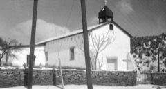 | Nuestra Senora de Luz Church and Cemetery | 2.1 miles | 1995 |
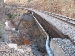 | Apache Canyon Railroad Bridge | 5.0 miles | 1979 |
 | Pflueger General Merchandise Store and Annex Saloon | 7.6 miles | 1987 |
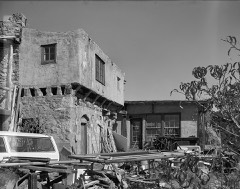 | Seton Village | 8.0 miles | 1966 |
| National Archives record | The nomination case file for reference 12000912 in Record Group 79. |
| Santa Fe County | All 79 listed properties in this county. |