 Block
From the record
One of 79 National Register listings published here for Santa Fe County · listed in 2015 · category: Building · built in 1905.
Sources: the National Register database, National Park Service
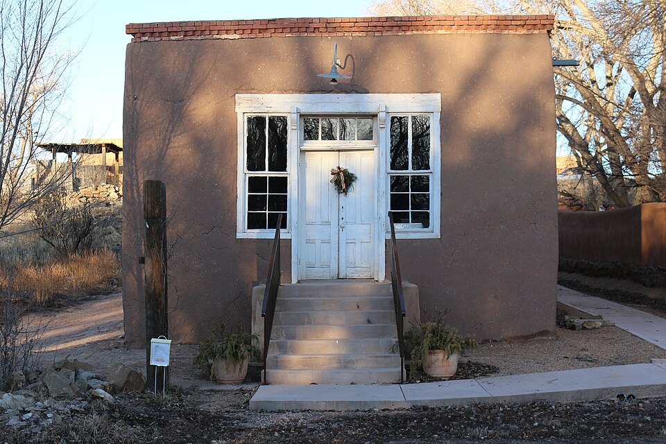
Built in 1905. Listed on the National Register of Historic Places in 2015.
One of 79 National Register listings published here for Santa Fe County · listed in 2015 · category: Building · built in 1905.
Sources: the National Register database, National Park Service
Regional context, not property-specific evidence. The federal wildfire occurrence database lists 14 fires within 5 miles of San Jose Hall between 1994 and 2020, burning about 132 acres in total. 4 started naturally. None was recorded as arson. Distance is straight-line from the map coordinates, so a fire counted here may appear on a neighbouring settlement's page as well.
| Reported cause | Fires |
|---|---|
| Missing data/not specified/undetermined | 6 |
| Natural | 4 |
| Equipment and vehicle use | 1 |
| Power generation/transmission/distribution | 1 |
| Railroad operations and maintenance | 1 |
| Smoking | 1 |
The most recent of them, most recent first, with the day each was reported and the service that recorded it.
| Date | Cause | Size | Reported by | Name on the report |
|---|---|---|---|---|
| 24 August 2002 | Railroad operations and maintenance | under an acre | New Mexico State Forestry Division | TRESTLE |
| 4 July 1994 | Missing data/not specified/undetermined | under an acre | New Mexico State Forestry Division | GALISTEO |
| 2 July 2002 | Natural | under an acre | New Mexico State Forestry Division | BADBOY |
| 12 July 2000 | Equipment and vehicle use | 7.0 acres | New Mexico State Forestry Division | L-D |
| 7 June 2016 | Natural | 10 acres | Bernalillo District | CERRO PELON |
| 5 June 2020 | Power generation/transmission/distribution | under an acre | Bernalillo District | 20-61700617X |
| 30 June 1998 | Missing data/not specified/undetermined | 15 acres | New Mexico State Forestry Division | SANCRISTOBAL |
| 3 June 2018 | Natural | under an acre | Bernalillo District | GALISTEO |
Regional context, not property-specific evidence. The National Weather Service names Galisteo, the town this property stands in, in 5 storm reports between 1997 and 2017: 2 flood, 2 flash flood, 1 funnel cloud. No death or injury is recorded in these reports. Each account below is quoted exactly as the forecast office filed it, from the NOAA Storm Events Database, and each date opens the federal record of that event.
| When | Event | Place named | Harm | What the report says |
|---|---|---|---|---|
| October 2017 | Flash Flood | Galisteo | - | Large rocks and boulders washed over county road 42 near Galisteo. Road closed. Galisteo Creek below Galisteo Dam crested at 10.84 feet, the second highest crest on record since 1971. |
| August 2015 | Flood | Galisteo | - | The river gage along Galisteo Creek below Galisteo rose to above minor flood stage at 1 am on the 11th due to rains late on the 10th. It peaked above moderate flood stage around by 330am before dropping below moderate flood stage around 515am, and completely below minor flood stage at 730am. |
| September 2013 | Flood | Galisteo | - | The Galisteo Creek below Galisteo Dam measured its highest crest on record dating back to 1971. The gage was above action stage between 9pm on the 15th and 3pm on the 16th with a record peak crest of 2,850 cfs. Low lying areas along the creek were flooded. NM 22 and Pueblo Route 85 were closed due to flooded arroyo over roadways. |
| July 2013 | Flash Flood | Galisteo | - | A trained spotter reported that heavy rains had washed out roads in his neighborhood. His neighbor called to relay that 3 inches of rain fell in an hour causing major flooding on roads. He later reported that the culvert into an arroyo could not handle the volume of water and washed out Deer Tank Rd. Deer Tank Rd. was impassable for much of the evening and next morning. Water on roads of 3ft deep and 50-60ft wide were reported (all dirt roads). Radar showed an isolated thunderstorm over the area that stayed in the general vicinity for over an hour. Highest reflectivity was 66dBz. Storm total precipitation estimates had numerous values greater than 3.5. |
| June 1997 | Funnel Cloud | Galisteo | - | Galisteo residents observed a brief funnel cloud. |
No historic map-sheet match is published for this property yet. That does not mean no map exists. This record needs a coordinate-quality review before it can be joined to a sheet boundary. Browse the county's mapped places while that work is pending.
Other National Register properties close enough to walk or drive between, ordered by distance from this one. Both positions come from the same geocoding pass that matched these properties to their map sheets.
| Photograph | Property | Distance | Listed |
|---|---|---|---|
 | Pflueger General Merchandise Store and Annex Saloon | 7.0 miles | 1987 |
| National Archives record | The nomination case file for reference 15000264 in Record Group 79. |
| Santa Fe County | All 79 listed properties in this county. |