
BlockBefore
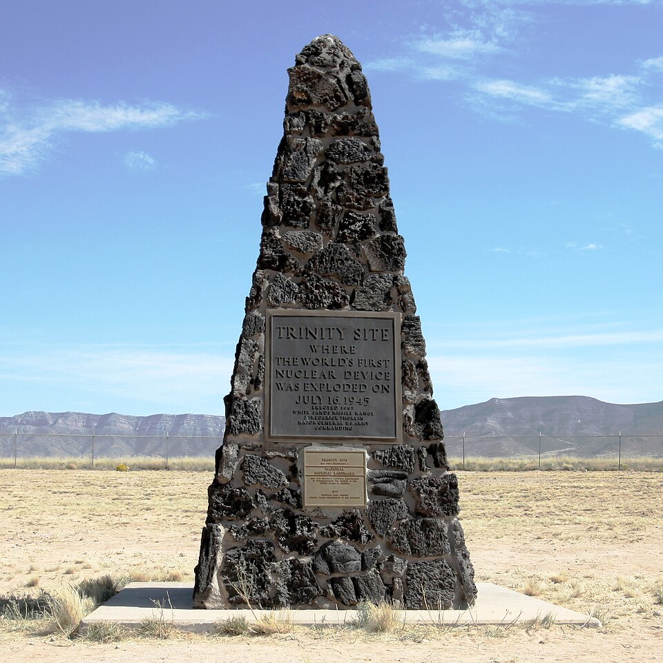
Photograph of Trinity Site
Photograph by Samat Jain, Public domain. Via Wikimedia Commons.

Trinity Site

A National Historic Landmark. Listed on the National Register of Historic Places in 1966.

From the record

One of 38 National Register listings published here for Socorro County · listed in 1966 · category: District · a National Historic Landmark.

Sources: the case file at the National Archives · the National Register database, National Park Service

The listing

  • Address. 25 mi. S of U.S. 380 on White Sands Missile Range, Bingham
  • When was it listed? October 1966
  • Category. district
  • Census division. Claunch
  • National Register reference number. 66000493 - the number the National Park Service assigned this property when it was listed, and the key its nomination file is catalogued under at the National Archives.

Storms near this property

22 since 1998

Regional context, not property-specific evidence. The National Weather Service names Bingham, the town this property stands in, in 22 storm reports between 1998 and 2025: 16 thunderstorm wind, 4 flash flood, 2 hail. No death or injury is recorded in these reports. Each account below is quoted exactly as the forecast office filed it, from the NOAA Storm Events Database, and each date opens the federal record of that event.

WhenEvent Place namedHarm What the report says
July 2013Flash FloodBingham$600,000Numerous reports of roads flooded, washed out, and damaged along the Socorro County stretch of U.S. 380. Emergency Manager indicated cost of damage was near 1.2 million dollars.
June 2025Thunderstorm WindBingham-The mesonet station at Little Burro on the White Sands Missile Range measured a peak wind gust of 63 mph from nearby virga showers and dry thunderstorms.
July 2025Thunderstorm WindBingham-Severe thunderstorms in the area resulted in a peak wind gust of 64 mph at the Tower 6 mesonet station on the White Sands Missile Range.
July 2025Thunderstorm WindBingham-Severe thunderstorms in the area resulted in a peak wind gust of 75 mph at the Little Burro mesonet station on the White Sands Missile Range.
July 2025Thunderstorm WindBingham-A severe thunderstorm resulted in a peak wind gust of 83 mph at the Chupadera RAWS on the White Sands Missile Range.
July 2024Thunderstorm WindBingham-The Little Burro mesonet on the White Sand Missile Range observed a peak wind gust of 64 mph from nearby thunderstorms.
July 2024Thunderstorm WindBingham-WSM40 Mine White Sands Missile Range recorded a 63mph thunderstorm wind gust.
July 2024Thunderstorm WindBingham-Nearby thunderstorms resulted in a peak wind gust of 68 mph at the Mine Mesonet on the White Sands Missile Range.
September 2024Thunderstorm WindBingham-Thunderstorms produced a peak wind gust of 62 mph at the Mine mesonet on the White Sands Missile Range.
August 2023Flash FloodBingham-There were several flood areas along White Sands Missile Range Road Seven. Water was two to three feet deep with mud and debris on the road.
June 2022Thunderstorm WindBingham-A White Sands Missile Range mesonet station south of Bingham measured a 66 mph wind gust likely associated with thunderstorm outflow.
May 2019Thunderstorm WindBingham-A thunderstorm moving quickly northeast through White Sands Missile Range produced an outflow wind gust up to 60 mph.
June 2017Thunderstorm WindBingham-White Sands Missile Range Mine station.
May 2017Thunderstorm WindBingham-Thunderstorm outflow crossing White Sands Missile Range produced a peak wind gust to 65 mph.
May 2016Thunderstorm WindBingham-Spotter reported an extreme downburst wind ahead of storm with gust near 80 mph in Bingham. No damage was incurred.
July 2013Thunderstorm WindBingham-Wind gust recorded at a RAWS site.
June 2013HailBingham-Penny size hail 2 miles northeast of Bingham.
August 2002Flash FloodBingham-Heavy rains during the late night flooded numerous lower wather crossings and washed out several culverts in northern Socorro County.
July 1998Flash FloodBingham-Up to four inches of standing water was reported near Bingham after heavy rain of 0.90 inch in about 15 minutes. Low water crossings were flooded for about 2 hours.
August 2008Thunderstorm WindBingham-no account filed
October 2000HailBingham-no account filed

Every storm recorded in Socorro County

Map coverage status

No historic map-sheet match is published for this property yet. That does not mean no map exists. This record needs a coordinate-quality review before it can be joined to a sheet boundary. Browse the county's mapped places while that work is pending.

Sources for this property

National Archives recordThe nomination case file for reference 66000493 in Record Group 79.
Socorro CountyAll 38 listed properties in this county.

Provenance

  • Listing record. National Park Service National Register of Historic Places, listed-properties dataset, current to 2026-05-22.
  • Map join. Address geocoded through the United States Census geocoder, then tested against the published boundary of every sheet in the USGS Historical Topographic Map Collection.
  • How this page is made. Listing fields come from federal records; map-sheet coverage is a labelled coordinate-to-boundary calculation, not a source-field claim.
  • Storms. NOAA National Centers for Environmental Information, Storm Events Database https://www.ncei.noaa.gov/stormevents/ A work of the United States government, no copyright under 17 U.S.C. 105. Narratives are quoted verbatim from the National Weather Service report and are not edited or summarised.