| August 1997 | Lightning | Santa Fe | 1 killed, 2 hurt | A 41 year old man hiking near the summit of Santa Fe Baldy (12600 ft) was killed by lightning. The man's 12 year old son and another hiker were knocked down by the lightning but only slightly injured. |
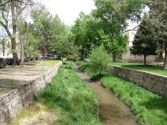
| July 2008 | Flash Flood | Santa Fe | 1 killed, $25,000 | Flash flooding struck the northeast part of Santa Fe. Arroyos became torrents and overflowed their banks in some instances. Major street flooding ensued in some locations, especially along Lorenzo Road which saw mud deposited two feet deep. One man drowned when he was swept down an arroyo. An unoccupied automobile was damaged when it was also swept down an arroyo. Flash flooding occurred at the Morales Bridge on the north side of town, and a home was flooded on Circle Dr nearby. |
| August 2006 | Lightning | Santa Fe | 2 hurt | Two men in their 20s were struck by lightning while standing on rebar rods at a Santa Fe construction site. One man recovered immediately, but the other had to be revived with CPR. |
| July 1998 | Thunderstorm Wind | Santa Fe | 1 hurt, $1,000 | no account filed |
| August 1998 | Lightning | Santa Fe | 1 hurt | A 30-year old man was struck by lightning when he left his residence as a thunderstorm faded. |
| August 1998 | Lightning | Santa Fe | 1 hurt | A 44-year old man was resuscitated by coworkers after suffering a near fatal, single lightning strike while working on a church roof. |
| July 1998 | Flash Flood | Santa Fe | 1 hurt | no account filed |
| December 2007 | Thunderstorm Wind | Santa Fe | $100,000 | Horse stalls, trailers and bleachers were blown over near Rodeo Rd and Richards Ave. A light tower was completely bent over. Truck windows were broken out and a chain link fence was ripped from its posts. |
| August 1996 | Flash Flood | Santa Fe | $90,000 | no account filed |
| July 2007 | Flash Flood | Santa Fe | $70,000 | no account filed |
| July 1996 | Lightning | Santa Fe | $60,000 | no account filed |
| August 2011 | Flash Flood | Santa Fe | $50,000 | Flash flooding was reported in homes on Galisteo Street, within the Forest Circle Street and Calle Torreador subdivisions, Miguel Chaves Road and the Tuscany at St. Francis Apartments. Street flooding was also reported on portions of Cerrillos, St. Francis Dr., and St. Michaels Road. |
| August 2004 | Flash Flood | Santa Fe | $50,000 | Several vehicles were damaged and a number of rooms at a guest lodge were flooded by mud and debris when a small flash flood formed along Bishop's Lodge Road in eastern Santa Fe. |
| September 2014 | Flash Flood | Santa Fe | $20,000 | Writer from the Santa Fe newspaper reported that there was damage to E.J. Martinez Elementary School from flash flooding. It was reported that there was damage to 3 classrooms, the gym, and an office. |
| May 2021 | Hail | Santa Fe | $10,000 | A COOP observer near Santa Fe reported penny size hail from a strong thunderstorm. The hail reportedly caused damage and dents to a Santa Fe resident's three cars. Damages are estimated for the dent damage to the three cars. |
| July 2008 | Flash Flood | Santa Fe | $10,000 | Heavy rain caused major street flooding for the second consecutive evening in northeast Santa Fe. Lorenzo Road had mud deposited nearly 2 feet deep. |
| August 2015 | Flash Flood | Santa Fe | $5,000 | Public weather station reported 3.35 inches of rainfall in 1 hour near Las Campanas. Video showed flash flood waters flowing quickly over East Sunrise Road northwest of Santa Fe, making it impassable. The water depth was reported to be between 1 and 1.5 feet. |
| July 2010 | Flash Flood | Santa Fe | $5,000 | Heavy rain caused an awning at the Giant gas station to collapse and fall on three cars at the intersection of Sawmill Rd. and St. Francis Dr. |
| July 2007 | Flash Flood | Santa Fe | $5,000 | Thunderstorms produced heavy rain which caused street flooding between 1 and 2 feet deep at the intersection of Cerillos Road and Camino Carlos Rey. Cars were stalled in the intersection. A section of Rodeo Road was closed due to flooding. Two homes on the east side of town experienced flooding. |
| June 1996 | Thunderstorm Wind | Santa Fe | $5,000 | no account filed |
| July 2007 | Lightning | Santa Fe | $2,000 | Lightning struck a tree in the yard of a Santa Fe residence. The shock wave from the strike shattered two windows in the house. |
| August 2014 | Lightning | Santa Fe | $1,000 | Santa Fe police reported that a lightning strike downed a power line and started a small brush fire at 1945 Cerrillos Road in Santa Fe. The fire is shown in a YouTube video burning for nearly 10 minutes before fire officials extinguished the blaze. |
| May 2025 | Hail | Santa Fe | - | Nickel size hail in Santa Fe. |
| May 2025 | Hail | Santa Fe | - | A trained spotter near the Santa Fe Plaza observed lots of accumulating penny size hail from a strong thunderstorm. |
| September 2024 | Thunderstorm Wind | Santa Fe | - | Large sycamore tree limbs up to 2 inches in diameter were snapped near the Santa Fe Railyards. |
| October 2024 | Hail | Santa Fe | - | A line of strong storms dropped penny size hail across Santa Fe. |
| May 2021 | Funnel Cloud | Santa Fe | - | A funnel cloud from a strong thunderstorm was spotted near the Santa Fe airport. The funnel cloud never touched down, and no damage was reported. |
| May 2021 | Hail | Santa Fe | - | A COOP observer reported penny size hail from a strong thunderstorm moving north near Santa Fe. |
| May 2021 | Hail | Santa Fe | - | A CoCoRaHS observer reported one inch hail from a severe thunderstorm northeast of Santa Fe. |
| July 2021 | Hail | Santa Fe | - | Multiple observers reported one inch hail from a severe thunderstorm near Santa Fe. |
| June 2019 | Hail | Santa Fe | - | Hail up to the size of quarters in Santa Fe. |
| June 2019 | Hail | Santa Fe | - | Nickel size hail in Santa Fe. |
| June 2019 | Hail | Santa Fe | - | Hail up to the size of ping pong balls in downtown Santa Fe. |
| June 2019 | Funnel Cloud | Santa Fe | - | A well-defined funnel cloud was observed in Santa Fe. |
| June 2019 | Hail | Santa Fe | - | Quarter size hail in Santa Fe. |
| July 2018 | Flash Flood | Santa Fe | - | Flash flooding in the area of Agua Fria and Upper Hills. Roads closed. |
| July 2018 | Hail | Santa Fe | - | Hail up to the size of pennies was reported in Santa Fe. |
| July 2015 | Hail | Santa Fe | - | Spotter reported nickel to half dollar size hail southeast of Santa Fe. |
| July 2015 | Hail | Santa Fe | - | Quarter size hail north of highway 599 three miles west of highway 285. |
| August 2014 | Flash Flood | Santa Fe | - | Local Broadcast media shared a photo of a car that was stranded due to flooding at 5th Street and St. Michaels Dr. in Santa Fe. The driver drove into deep water that had accumulated on roadways from short duration, very heavy rainfall. |
| July 2013 | Lightning | Santa Fe | - | The Santa Fe New Mexican ran story about lightning hitting a large cottonwood tree in the Santa Fe Plaza. The bolt hit the tree and sent branches flying into a nearby crowd of people that were gathered in downtown for weekend festivities. Newspaper reporting that at least one man was injured from flying debris while another had breathing problems for a short time. |
| August 2011 | Flash Flood | Santa Fe | - | Santa Fe police reported home evacuations near the intersection of Valmora Road and Serafina Street. Water was reported to be two feet deep and 40 feet wide. Two feet of water was also reported at the intersection of Rodeo Road and Old Pecos Trail. Cars attempting to drive through the water stalled. Two feet of water was also reported to have flooded a home at the Rainbow Vision Condominium Complex at I-25 and St. Francis Dr. Spotters in the area reported between 1 and 1.8 inches of rain in one hours time. |
| June 2005 | Flash Flood | Santa Fe | - | Heavy rain caused widespread street flooding in southern Santa Fe. |
| July 2001 | Hail | Santa Fe | - | Nickel size hail was reported in the Eldorado area. |
| July 2000 | Thunderstorm Wind | Santa Fe | - | A strong thunderstorm produced copious small hail and gusty winds of near 55 mph which downed several small trees near Santa Fe. |
| June 1995 | Hail | Santa Fe | - | State Police reported pea- to dime-size hail one to two inches deep covering Interstate 25 and then golf ball-size hail at the race track just southwest of Santa Fe. |
| June 1995 | Hail | Santa Fe | - | State Police reported pea- to dime-size hail one to two inches deep covering Interstate 25 and then golf ball-size hail at the race track just southwest of Santa Fe. |
| May 1994 | Hail | Santa Fe | - | A thunderstorm over Santa Fe produced widespread small hail with some stones near ping-pong ball-size which caused damage to several cars. |
| July 2015 | Hail | Santa Fe | - | no account filed |
| July 2015 | Hail | Santa Fe | - | no account filed |
| July 2015 | Hail | Santa Fe | - | no account filed |
| July 2015 | Hail | Santa Fe | - | no account filed |
| July 2014 | Hail | Santa Fe | - | no account filed |
| June 2014 | Hail | Santa Fe | - | no account filed |
| July 2013 | Hail | Santa Fe | - | no account filed |
| August 2013 | Hail | Santa Fe | - | no account filed |
| July 2009 | Hail | Santa Fe | - | no account filed |
| July 2009 | Hail | Santa Fe | - | no account filed |
| May 2006 | Hail | Santa Fe | - | no account filed |
| July 2005 | Hail | Santa Fe | - | no account filed |
 Block