 Block
From the record
One of 38 National Register listings published here for Socorro County · listed in 1980 · category: Building.
Sources: the case file at the National Archives · the National Register database, National Park Service
Listed on the National Register of Historic Places in 1980.
One of 38 National Register listings published here for Socorro County · listed in 1980 · category: Building.
Sources: the case file at the National Archives · the National Register database, National Park Service
Regional context, not property-specific evidence. The federal wildfire occurrence database lists 44 fires within 5 miles of MacDonald Merchandise Building between 1992 and 2020, burning about 228 acres in total. 25 started naturally. None was recorded as arson. Distance is straight-line from the map coordinates, so a fire counted here may appear on a neighbouring settlement's page as well.
| Reported cause | Fires |
|---|---|
| Natural | 25 |
| Debris and open burning | 8 |
| Missing data/not specified/undetermined | 4 |
| Recreation and ceremony | 2 |
| Equipment and vehicle use | 2 |
| Smoking | 2 |
| Fireworks | 1 |
The most recent of them, most recent first, with the day each was reported and the service that recorded it.
| Date | Cause | Size | Reported by | Name on the report |
|---|---|---|---|---|
| 31 August 2018 | Natural | under an acre | Cibola National Forest | JORDON CANYON |
| 3 August 2003 | Natural | under an acre | Cibola National Forest | ELLIS |
| 25 August 1997 | Natural | under an acre | Cibola National Forest | MILL |
| 9 July 2013 | Natural | under an acre | Socorro Field Office | KELLY |
| 4 July 2007 | Fireworks | under an acre | Cibola National Forest | HWY 169 |
| 28 July 1993 | Natural | under an acre | Cibola National Forest | not named |
| 28 July 1993 | Natural | under an acre | Cibola National Forest | not named |
| 26 July 2006 | Natural | under an acre | Cibola National Forest | NORTH PEAK |
Regional context, not property-specific evidence. The federal mineral resources record lists 57 workings within 5 miles of MacDonald Merchandise Building: 32 past producers, 18 prospects, 3 occurrences, 2 unknowns. 2 still produce. What was taken out: Zinc, Lead, Silver, Gold, Zinc, Silver, Lead, Copper, Lead, Zinc. Distance is straight-line from the map coordinates, so a quarry counted here may appear on a neighbouring settlement's page as well.
| Where | Site | Commodity | Status | Recorded |
|---|---|---|---|---|
| Anchor | Zinc, Silver, Lead | Past Producer | ||
| Belle Claim Patented In 1882 | Lead, Silver, Copper, Gold, Zinc | Past Producer | 1957 | |
| Cavalier | Silver, Lead | Prospect | ||
| Cavern and Grand Ledge | Lead, Copper | Past Producer | ||
| Ellis Canyon Prospect | Silver, Copper, Lead | Past Producer | Replacement | |
| Germany | Lead, Copper, Zinc, Silver | Past Producer | ||
| Gofor and Spire Mine | Gold, Copper, Silver | Occurrence | Chalcocite, Covellite, Pyrite | |
| Hardscrabble | Zinc, Lead, Copper, Silver | Past Producer | ||
| Heister | Lead, Barium-Barite | Occurrence | ||
| Jack Frost Mine | Lead, Silver, Zinc, Copper, Vanadium, Barium-Barite, Fluorine-Fluorite | Past Producer | 1925 |
Regional context, not property-specific evidence. The National Weather Service names Magdalena, the town this property stands in, in 13 storm reports between 1998 and 2025: 5 flash flood, 4 hail, 2 thunderstorm wind, 1 funnel cloud. No death or injury is recorded in these reports. Each account below is quoted exactly as the forecast office filed it, from the NOAA Storm Events Database, and each date opens the federal record of that event.
| When | Event | Place named | Harm | What the report says |
|---|---|---|---|---|
| July 2022 | Flash Flood | Magdalena | $50,000 | Forest thinning in the Magdalena Mountains resulted in a flash flooding event that made it easier for water to rush down an unnamed canyon. Floodwaters left behind a pile of debris 6 feet high and 20 feet wide that included steel fence posts and barbed wire, damaged trailed, and boulders that were 200 to 300 pounds. Damages are estimated. |
| August 2008 | Lightning | Magdalena | $30,000 | no account filed |
| July 2010 | Flash Flood | Magdalena | $10,000 | A large landslide washed out the dirt road leading to the Magdalena Ridge Observatory and Langmuir Laboratory for Atmospheric Research. |
| August 2012 | Flash Flood | Magdalena | $5,000 | Sixty feet of forest service road 101 washed out and remained closed for over twelve hours. Culverts along road washed out as well with estimates that water was four feet deep. Public works and local law enforcements ferried 40 people living in the canyon that work in Magdalena with large four wheel drive vehicles after the water receded. |
| September 2025 | Thunderstorm Wind | Magdalena | - | A trained spotter in Magdalena reported an estimated peak wind gust of about 60 mph from a severe thunderstorm. |
| July 2021 | Thunderstorm Wind | Magdalena | - | A trained spotter near Magdalena estimated 60 mph wind gusts from a severe thunderstorm. |
| August 2019 | Flash Flood | Magdalena | - | A large amount of boulders, rocks, mud, and debris damaged a section of Water Canyon Road. |
| August 2015 | Flash Flood | Magdalena | - | U.S. Highway 60 closed due to high water at mile marker 124. |
| May 2012 | Hail | Magdalena | - | Half dollar size hail reported in Magdalena. |
| May 2007 | Hail | Magdalena | - | Funnel cloud reported by EMT north of Alamo. |
| August 1998 | Funnel Cloud | Magdalena | - | A funnel cloud was spotted from the Langmuir Lightning Research Lab in the Magdalena mountains. |
| July 1998 | Hail | Magdalena | - | A brief hail storm damaged trees and broke several winds. |
| June 2003 | Hail | Magdalena | - | no account filed |
No historic map-sheet match is published for this property yet. That does not mean no map exists. This record needs a coordinate-quality review before it can be joined to a sheet boundary. Browse the county's mapped places while that work is pending.
Other National Register properties close enough to walk or drive between, ordered by distance from this one. Both positions come from the same geocoding pass that matched these properties to their map sheets.
| Photograph | Property | Distance | Listed |
|---|---|---|---|
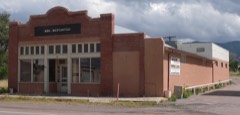 | Salome Store | under 500 feet | 1982 |
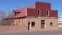 | Salome Warehouse | under 500 feet | 1982 |
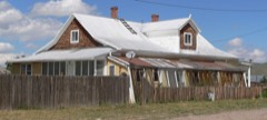 | Aragon House | under 500 feet | 1982 |
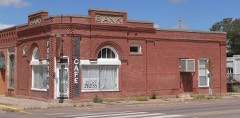 | Bank of Magdalena | 0.1 miles | 1982 |
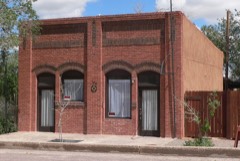 | Main Street Commercial Building | 0.1 miles | 1982 |
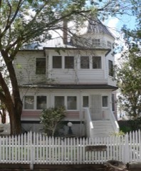 | MacTavish House | 0.1 miles | 1982 |
| National Archives record | The nomination case file for reference 80002573 in Record Group 79. |
| Socorro County | All 38 listed properties in this county. |