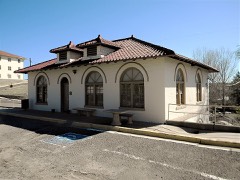
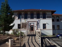
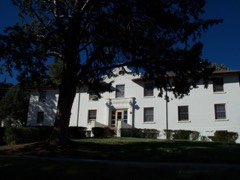
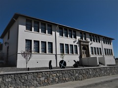
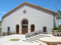
Listed on the National Register of Historic Places in 1983.
From the record
“The Silver City North Addition Historic District is a residential historic district in Silver City, New Mexico. The district includes several blocks on the north side of College Avenue; the area between West and Santa Rita Streets is especially significant.”
Wikipedia article Silver City North Addition Historic District, CC BY-SA 4.0.
One of 45 National Register listings published here for Grant County · listed in 1983 · category: District.
National Register reference number.83001620- the number the National Park Service assigned this property when it was listed, and the key its nomination file is catalogued under at the National Archives.
Fires near this property
121 since 1992
Regional context, not property-specific
evidence. The
federal wildfire occurrence database
lists 121 fires within 5 miles of Silver City Historic District North Addition
between 1992 and 2020, burning about 2,196 acres in total. 17 started naturally. 4 were recorded as arson.
Distance is straight-line from the map coordinates, so a fire counted
here may appear on a neighbouring settlement's page as well.
Reported cause
Fires
Missing data/not specified/undetermined
58
Natural
17
Recreation and ceremony
14
Equipment and vehicle use
9
Debris and open burning
8
Smoking
5
Arson/incendiarism
4
Fireworks
2
Misuse of fire by a minor
2
Power generation/transmission/distribution
1
Other causes
1
The most recent of
them, most recent first, with the day each was reported and the service
that recorded it.
Regional context, not property-specific
evidence. The federal mineral resources record lists
27 workings within 5 miles of Silver City Historic District North Addition: 18 past producers, 5 prospects, 2 unknowns, 1 producer.
1 still produces. What was taken out: Silver, Manganese, Iron, Sand and Gravel, Construction, Silver, Manganese, Iron. Distance is straight-line from the
map coordinates, so a quarry counted here may appear on a neighbouring
settlement's page as well.
Regional context, not property-specific
evidence. The National Weather Service names
Silver City, the town this property stands in, in 38 storm reports between 1999 and 2024: 18 hail, 14 flash flood, 5 thunderstorm wind, 1 heavy rain.
The reports record 2 deaths. Each account below is quoted exactly as the forecast office
filed it, from the NOAA Storm Events Database, and each date
opens the federal record of that event.
Widespread rainfall amounts of 2 inches to almost 3.5 inches occurred around Silver City in the early morning hours. A water rescue was necessary in Tyrone. One vehicle was swept away in the Pinos Altos Creek low water crossing on East 19th Street. The vehicle became wedged in culvert running under US 180, but the driver and occupant were washed downstream. One body was recovered about 0.8 miles downstream near the confluence with Silva Creek. A second body was recovered about 1.2 miles downstream in the Silver City big ditch reach of San Vicente Arroyo near the Broadway Street bridge.
A slow moving severe thundertorm formed just north of Silver City and gradually moved southward across the western half of town and into neighboring Tyrone. Hail, mainly 3/4 inch in diameter, fell for 40 minutes and accumulated up to 6 inches. Within this time, hailstones up to 1.25 inches in diameter fell briefly. Vegetation was stripped, skylights were broken and numerous roofs suffered damage. Automobiles were left with small dents. Snowplows were required to clear the two major highways in western Silver City.
A strong dry microburst blew over a storage shed and ripped off a metal awning. The debris from the awning caused damage to several vehicles at two nearby automobile dealerships.
Hail up to half dollar size covered the ground in mainly extreme north and northwest Silver City. At least one broken window (and minor injury from the broken glass) was reported.
Numerous roads were closed along and near Highway 180 in Silver City due to flash flooding. Other cities affected by the flooding included Santa Clara around Twin Sisters Peak Road and numerous roads around Bayard and Hurley. Rainfall amounts around this area averaged 1 to 2 inches in a couple of hours with a maximum of 4.50 inches in Bayard.
Reports from 911 Dispatch and amateur radio reported serious street flooding between Silver City and Pinos Altos. Reports of at least 5 inches of water were covering streets in downtown Silver City.
Up to 1.5 inches of rain within 30 minutes resulted in flash flooding in the north portion of Silver City. At least one road was closed due to high water.
Heavy thunderstorm rains caused widespread flooding and flash flooding in the Silver City area. As much as 2.4 inches of rain fell within 40 minutes. Flooding occurred along Pinos Altos Creek from the northeastern side of Silver City to the center of downtown Silver City. Several homes were flooded on the west side of the creek along with a number of parked cars. Roads along the creek were clogged with mud,rocks and debris rendering them impassable for a short time. The Silver City golf course had several cart paths washed out and much of the course was under water.
A severe thunderstorm produced hail up to golf ball size in the Silver City area. Smaller hail accumulated to a depth of six inches in Silver City and along N.M. route 90 south of Silver City.
2 papers published in this town,
digitised by the Library of Congress and free to read: 334 issues,
2,908 pages. Every page is searchable, so a name or a street can be
looked for directly in what the town printed about itself at the time.
No historic map-sheet match is published
for this property yet. That does not mean no map exists. This record needs
a coordinate-quality review before it can be joined to a sheet boundary.
Browse the county's mapped places while that work is
pending.
Listed places nearby
6 within 8 miles
Other National Register properties close
enough to walk or drive between, ordered by distance from this one. Both
positions come from the same geocoding pass that matched these properties
to their map sheets.
Listing record. National Park Service National Register of Historic Places, listed-properties dataset, current to 2026-05-22.
Map join. Address geocoded through the United States Census geocoder, then tested against the published boundary of every sheet in the USGS Historical Topographic Map Collection.
How this page is made. Listing fields come from federal records; map-sheet coverage is a labelled coordinate-to-boundary calculation, not a source-field claim.
Wildfire. Short, Karen C. 2022. Spatial wildfire occurrence data for the United States, 1992-2020 [FPA_FOD_20221014]. 6th Edition. Fort Collins, CO: Forest Service Research Data Archive. https://doi.org/10.2737/RDS-2013-0009.6 Collected with United States Government funding and usable without additional permissions or fees.
Mines and quarries. USGS Mineral Resources Data System (MRDS) https://mrdata.usgs.gov/mrds/ A work of the United States government, no copyright under 17 U.S.C. 105.
Storms. NOAA National Centers for Environmental Information, Storm Events Database https://www.ncei.noaa.gov/stormevents/ A work of the United States government, no copyright under 17 U.S.C. 105. Narratives are quoted verbatim from the National Weather Service report and are not edited or summarised.
 Block