 Block
From the record
One of 40 National Register listings published here for Taos County · listed in 1984 · category: Building.
Sources: the case file at the National Archives · the National Register database, National Park Service
Listed on the National Register of Historic Places in 1984.
One of 40 National Register listings published here for Taos County · listed in 1984 · category: Building.
Sources: the case file at the National Archives · the National Register database, National Park Service
Regional context, not property-specific evidence. The federal wildfire occurrence database lists 66 fires within 5 miles of Orin Mallette Cabin between 1992 and 2020, burning about 30 acres in total. 9 started naturally. None was recorded as arson. Distance is straight-line from the map coordinates, so a fire counted here may appear on a neighbouring settlement's page as well.
| Reported cause | Fires |
|---|---|
| Recreation and ceremony | 48 |
| Natural | 9 |
| Missing data/not specified/undetermined | 4 |
| Power generation/transmission/distribution | 3 |
| Equipment and vehicle use | 1 |
| Debris and open burning | 1 |
The most recent of them, most recent first, with the day each was reported and the service that recorded it.
| Date | Cause | Size | Reported by | Name on the report |
|---|---|---|---|---|
| 7 September 2020 | Recreation and ceremony | under an acre | Carson National Forest | CABRESTO CREEK ACF |
| 7 September 2020 | Recreation and ceremony | under an acre | Carson National Forest | YETI ACF |
| 7 September 2020 | Recreation and ceremony | under an acre | Carson National Forest | LOG JAM ACF |
| 7 September 2020 | Recreation and ceremony | under an acre | Carson National Forest | DOG ACF |
| 20 September 2015 | Recreation and ceremony | 5.0 acres | Carson National Forest | TRAIL CANYON |
| 19 September 2018 | Recreation and ceremony | under an acre | Carson National Forest | VIGAS |
| 14 September 1992 | Debris and open burning | 5.0 acres | Carson National Forest | not named |
| 5 August 2019 | Natural | under an acre | Cimarron District | 20-20310163X |
Regional context, not property-specific evidence. The federal mineral resources record lists 70 workings within 5 miles of Orin Mallette Cabin: 41 prospects, 21 past producers, 4 occurrences, 3 producers. 3 still produce. What was taken out: Gold, Molybdenum, Gold, Silver, Lead, Zinc. Distance is straight-line from the map coordinates, so a quarry counted here may appear on a neighbouring settlement's page as well.
| Where | Site | Commodity | Status | Recorded |
|---|---|---|---|---|
| Ajax Tunnel Prospect | Silver, Gold, Copper, Lead | Prospect | ||
| Bernhardt Prospects | Copper, Silver, Lead, Molybdenum, Zinc | Prospect | ||
| Bitter Creek Group | Uranium | Prospect | ||
| Copper King Mine | Copper, Molybdenum | Past Producer | ||
| Dyke Tunnel Prospect | Molybdenum, Gold, Copper | Prospect | ||
| Enderman Prospect | Silver, Molybdenum | Prospect | ||
| Esther Prospect | Lead, Copper | Prospect | ||
| Golden Goose | Gold, Calcium | Prospect | ||
| Granite | Copper, Molybdenum | Past Producer | ||
| Hornet Group | Zinc, Lead, Manganese | Past Producer |
Regional context, not property-specific evidence. The National Weather Service names Red River, the town this property stands in, in 9 storm reports between 1999 and 2025: 5 flash flood, 2 hail, 1 lightning, 1 debris flow. The reports record 1 injury. Each account below is quoted exactly as the forecast office filed it, from the NOAA Storm Events Database, and each date opens the federal record of that event.
| When | Event | Place named | Harm | What the report says |
|---|---|---|---|---|
| September 1999 | Lightning | Red River | 1 hurt | A 40 year North Carolina man hiking on Wheeler Peak fell 100 feet after being struck by lightning. |
| July 2025 | Debris Flow | Red River | $50,000 | Monsoon rains resulted in a mudslide along NM Highway 38 at mile marker 9 approximately 3 miles west of Red River. Both lanes were closed with no estimated time of return to service. Rainfall over a period of time this summer resulting in a gradual loosening of the hillside is the likely culprit of this mudslide. Damage cost is an estimate of cleanup. |
| July 2015 | Flash Flood | Red River | $25,000 | Heavy rain caused a mudslide along NM 38, causing it to close for 2 hours. The rain also caused a rockslide to close all but one lane of County Road 578. |
| July 2015 | Flash Flood | Red River | $5,000 | Fire marshal reported a tremendous sudden burst of torrential rainfall. A fast flowing mudslide surged over highway 38 between mile markers 8 and 9. A video of the event was posted to FB. |
| May 2021 | Hail | Red River | - | A member of the public in Red River reported penny size hail from a strong thunderstorm. |
| July 2018 | Flash Flood | Red River | - | NM-38 closed due to mud slide over the roadway. |
| August 2018 | Hail | Red River | - | Hail up to the size of quarters at Bobcat Pass. |
| August 2017 | Flash Flood | Red River | - | A mudslide closed state road 38 two miles west of Red River. |
| July 2017 | Flash Flood | Red River | - | Large mudslide over state highway 138 at mile marker 9. Large boulders covered the highway. Road closed for nearly four hours. |
1 paper published in this town, digitised by the Library of Congress and free to read: 122 issues, 566 pages. Every page is searchable, so a name or a street can be looked for directly in what the town printed about itself at the time.
| Newspaper | Published |
|---|---|
| Red River Prospector | 1900 to 190? |
No historic map-sheet match is published for this property yet. That does not mean no map exists. This record needs a coordinate-quality review before it can be joined to a sheet boundary. Browse the county's mapped places while that work is pending.
Other National Register properties close enough to walk or drive between, ordered by distance from this one. Both positions come from the same geocoding pass that matched these properties to their map sheets.
| Photograph | Property | Distance | Listed |
|---|---|---|---|
| Pierce-Fuller House | 0.9 miles | 1984 | |
| Sylvester M. Mallette Cabin | 1.3 miles | 1984 | |
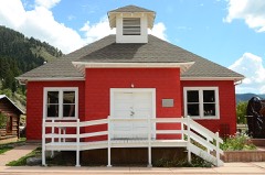 | Red River Schoolhouse | 1.5 miles | 1984 |
| Brigham J. Young House | 1.5 miles | 1984 | |
| Melson-Oldham Cabin | 2.6 miles | 1984 | |
| Black Copper Mine and Stamp Mill | 5.8 miles | 2000 |
| National Archives record | The nomination case file for reference 84003055 in Record Group 79. |
| Taos County | All 40 listed properties in this county. |