 Block
From the record
One of 104 National Register listings published here for San Miguel County · listed in 1985 · category: Building.
Sources: the case file at the National Archives · the National Register database, National Park Service
Listed on the National Register of Historic Places in 1985.
One of 104 National Register listings published here for San Miguel County · listed in 1985 · category: Building.
Sources: the case file at the National Archives · the National Register database, National Park Service
Regional context, not property-specific evidence. The federal wildfire occurrence database lists 95 fires within 5 miles of House at 921 S. Pacific between 1994 and 2020, burning about 1,675 acres in total. 24 started naturally. None was recorded as arson. Distance is straight-line from the map coordinates, so a fire counted here may appear on a neighbouring settlement's page as well.
| Reported cause | Fires |
|---|---|
| Missing data/not specified/undetermined | 53 |
| Natural | 24 |
| Debris and open burning | 6 |
| Equipment and vehicle use | 4 |
| Smoking | 3 |
| Misuse of fire by a minor | 3 |
| Power generation/transmission/distribution | 1 |
| Recreation and ceremony | 1 |
The most recent of them, most recent first, with the day each was reported and the service that recorded it.
| Date | Cause | Size | Reported by | Name on the report |
|---|---|---|---|---|
| 18 September 2000 | Natural | 175 acres | New Mexico State Forestry Division | MOON |
| 8 August 2005 | Natural | 2.0 acres | New Mexico State Forestry Division | BARNETT |
| 7 August 2008 | Natural | under an acre | Las Vegas National Wildlife Refuge | RANGE UNIT 7 |
| 7 August 2003 | Natural | under an acre | New Mexico State Forestry Division | PETERSON |
| 29 August 2002 | Natural | under an acre | New Mexico State Forestry Division | OWL |
| 14 August 2012 | Natural | 1.3 acres | Las Vegas District | ALAMITO |
| 1 August 2020 | Debris and open burning | under an acre | Las Vegas District | 21-40340165X |
| 6 July 1998 | Missing data/not specified/undetermined | 7.0 acres | New Mexico State Forestry Division | PIEDRA |
Regional context, not property-specific evidence. The federal mineral resources record lists 17 workings within 5 miles of House at 921 S. Pacific: 16 unknowns, 1 occurrence. None of them still produces. What was taken out: Sand and Gravel, Construction, Uranium. Distance is straight-line from the map coordinates, so a quarry counted here may appear on a neighbouring settlement's page as well.
| Where | Site | Commodity | Status | Recorded |
|---|---|---|---|---|
| Los Vigiles | Uranium | Occurrence | ||
| Marquez Pit | Sand and Gravel, Construction | Unknown | ||
| Materials Pit | Sand and Gravel, Construction | Unknown | ||
| Materials Pit | Sand and Gravel, Construction | Unknown | ||
| Materials Pit | Sand and Gravel, Construction | Unknown | ||
| Materials Pit | Sand and Gravel, Construction | Unknown | ||
| Materials Pit | Sand and Gravel, Construction | Unknown | ||
| Materials Pit | Sand and Gravel, Construction | Unknown | ||
| Materials Pit | Sand and Gravel, Construction | Unknown | ||
| Materials Pit | Sand and Gravel, Construction | Unknown |
Regional context, not property-specific evidence. The National Weather Service names Las Vegas, the town this property stands in, in 52 storm reports between 1995 and 2025: 45 hail, 4 flash flood, 1 tornado, 1 thunderstorm wind. No death or injury is recorded in these reports. Each account below is quoted exactly as the forecast office filed it, from the NOAA Storm Events Database, and each date opens the federal record of that event.
| When | Event | Place named | Harm | What the report says |
|---|---|---|---|---|
| June 2024 | Flash Flood | Las Vegas | $1,000,000 | Flash flooding from heavy rains closed NM Highway 65 from mile markers 2 to 4 or one mile south of Montezuma where culverts were washed out. Flowing water 1 to 3 feet deep also reported over El Llano Road, Cinder Road, Palo Verde Road and at the intersection of 7th Street and Mills Avenue. Road closures were also reported along State Road 65 at Campus and El Camino, as well as along 8th Street north of Mills Avenue. Robertson Cardinal football field was completely covered in standing water. The Las Vegas Water Treatment Plant also flooded. A mandatory evacuation order was issued at 9:54pm MDT for this area due to the dangerous flooding across Las Vegas to Montezuma. Damage is an estimated given very limited information. |
| August 1996 | Hail | Las Vegas | $80,000 | no account filed |
| June 1995 | Hail | Las Vegas | $10,000 | Hail ranging from quarter to golf ball-size damaged mobile homes and vehicles in Las Vegas and also five miles south of the city. |
| July 1998 | Flash Flood | Las Vegas | $2,000 | Heavy thunderstorms produced small hail and brief flash flooding from near Gallinas southeast into Las Vegas. Damage was limited to rural road washouts. |
| October 2023 | Hail | Las Vegas | $1,000 | The Las Vegas Animal Care shelter suffered hail damage. A window was knocked out, and crates and kennels were damaged. There were no injuries reported. |
| October 2023 | Hail | Las Vegas | $1,000 | The District Ranger for the U.S. Forest Service in Las Vegas reported half-dollar sized hail at their district office building. Hail damage to the roof was reported with a leak resulting from the damage. |
| May 2025 | Hail | Las Vegas | - | A trained spotter just west of downtown Las Vegas observed 2 inches of nickel size hail from a strong thunderstorm. |
| July 2024 | Flash Flood | Las Vegas | - | Flash flooding occurred in Las Vegas on Mills Avenue near the state Behavior Health Institute Building. |
| October 2024 | Hail | Las Vegas | - | A strong storm dropped nickel size hail in Las Vegas, NM close to Grande Ave. |
| October 2023 | Hail | Las Vegas | - | A copious amount of nickel to quarter sized hail resulted in the dispatch of New Mexico Department of Transportation snowplows on Interstate 25. |
| October 2023 | Hail | Las Vegas | - | Nickel to quarter size hail accumulated to about 3 inches deep in some parts downtown Las Vegas, NM. There was minor flooding that resulted in town. |
| July 2020 | Hail | Las Vegas | - | Very large hail was observed with a severe thunderstorm that moved south through Las Vegas. Various sources reported hail ranging from the size of quarters to golf balls. |
| August 2017 | Hail | Las Vegas | - | Hail up to the size of golf balls in Las Vegas. |
| June 2017 | Hail | Las Vegas | - | Hail at least the size of hen eggs fell near Las Vegas. |
| August 2017 | Hail | Las Vegas | - | Hail up to the size of quarters near Las Vegas. |
| July 2017 | Flash Flood | Las Vegas | - | Flash flooding along Gallinas Creek. Low water crossings and intersections flooded. Roads impassable. |
| June 2014 | Hail | Las Vegas | - | Numerous hail stones between quarter and half dollar size indicated in photo by storm chaser. |
| May 2009 | Hail | Las Vegas | - | Hail accumulated to around 4 inches in depth. |
| September 2003 | Heavy Rain | Las Vegas | - | Heavy rain of 3 inches in 90 minutes caused Tecolote Creek to overflow onto Road 283 near Camp Bluehaven and San Geronimo. |
| July 2002 | Thunderstorm Wind | Las Vegas | - | Marble sized hail covered Interstate 25 up to eight inches deep at mile marker 350-352 north of Las Vegas. |
| May 2001 | Hail | Las Vegas | - | Hail 3 to 5 inches deep covered Interstate 25 north of Las Vegas. |
| August 1998 | Tornado (F0) | Las Vegas | - | Several funnel clouds were reported during a five minute period near McAlister Lake. A brief tornado touchdown overturned a cattle feeder. |
| July 2023 | Hail | Las Vegas | - | no account filed |
| July 2013 | Hail | Las Vegas | - | no account filed |
| July 2013 | Hail | Las Vegas | - | no account filed |
| August 2012 | Hail | Las Vegas | - | no account filed |
| May 2010 | Hail | Las Vegas | - | no account filed |
| May 2009 | Hail | Las Vegas | - | no account filed |
| June 2009 | Hail | Las Vegas | - | no account filed |
| June 2008 | Hail | Las Vegas | - | no account filed |
| June 2006 | Hail | Las Vegas | - | no account filed |
| September 2006 | Hail | Las Vegas | - | no account filed |
| May 2005 | Hail | Las Vegas | - | no account filed |
| May 2005 | Hail | Las Vegas | - | no account filed |
| May 2005 | Hail | Las Vegas | - | no account filed |
| May 2005 | Hail | Las Vegas | - | no account filed |
| May 2005 | Hail | Las Vegas | - | no account filed |
| June 2005 | Hail | Las Vegas | - | no account filed |
| June 2005 | Hail | Las Vegas | - | no account filed |
| June 2005 | Hail | Las Vegas | - | no account filed |
| June 2005 | Hail | Las Vegas | - | no account filed |
| September 2005 | Hail | Las Vegas | - | no account filed |
| June 2004 | Hail | Las Vegas | - | no account filed |
| June 2004 | Hail | Las Vegas | - | no account filed |
| June 2003 | Hail | Las Vegas | - | no account filed |
| August 1997 | Hail | Las Vegas | - | no account filed |
| May 1997 | Hail | Las Vegas | - | no account filed |
| July 1997 | Hail | Las Vegas | - | no account filed |
| September 1997 | Hail | Las Vegas | - | no account filed |
| June 1996 | Hail | Las Vegas | - | no account filed |
| August 1996 | Hail | Las Vegas | - | no account filed |
| June 1995 | Hail | Las Vegas | - | no account filed |
8 papers published in this town, digitised by the Library of Congress and free to read: 7,735 issues, 42,362 pages. Every page is searchable, so a name or a street can be looked for directly in what the town printed about itself at the time.
| Newspaper | Published |
|---|---|
| El Independiente | 1894 to 19?? |
| Las Vegas Gazette | 1872 to 18?? |
| Las Vegas Daily Gazette | 1881 to 1886 |
| Las Vegas Morning Gazette | 18?? to 1881 |
| Daily Gazette | 1879 to 1880 |
| The Las Vegas Gazette | 1886 |
| The Las Vegas Weekly Optic and Stock Grower | 1898 to 190? |
| Las Vegas Daily Optic | 1880 to 1908 |
No historic map-sheet match is published for this property yet. That does not mean no map exists. This record needs a coordinate-quality review before it can be joined to a sheet boundary. Browse the county's mapped places while that work is pending.
Other National Register properties close enough to walk or drive between, ordered by distance from this one. Both positions come from the same geocoding pass that matched these properties to their map sheets.
| Photograph | Property | Distance | Listed |
|---|---|---|---|
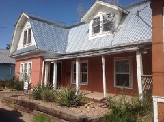 | Arturo Angel House | under 500 feet | 1985 |
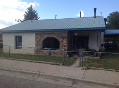 | House at 312 Tecolote | under 500 feet | 1985 |
| House at 921 Chavez | under 500 feet | 1985 | |
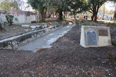 | Acequia Madre | 0.1 miles | 1987 |
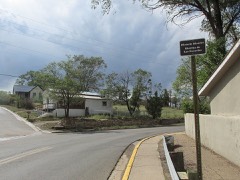 | Distrito de las Escuelas | 0.1 miles | 1980 |
| Eugenio Gatignole House | 0.2 miles | 1985 |
| National Archives record | The nomination case file for reference 85002608 in Record Group 79. |
| San Miguel County | All 104 listed properties in this county. |