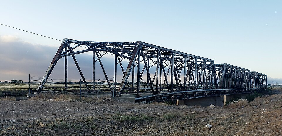
| October 2024 | Flash Flood | Hagerman | $10,000,000 | The NM Department of Transportation reported river flooding along the Rio Felix south of Roswell overtopping and damaging the U.S. Highway 285 bridge, and overtopping the NM State Highway 2 bridge just north of Hagerman closing both bridges. Flooding from heavy rains and poor drainage also extended over much of Dexter just north of Hagerman. Damage is an estimate. A Flood Warning was issued and repeatedly extended until local reports of the water receding came from local Emergency Management. |
| July 2021 | Flash Flood | Hagerman | $250,000 | Heavy rain led to the rapid rise of the Rio Felix near Hagerman with the gauge on Wiggins Lane measuring a maximum crest of 11.4 feet. The Chaves County emergency manager reported significant flash flooding across all low water crossings near the Rio Felix. Rapidly flowing water resulted in damage to a bridge on Morgan Road. The flash flooding also forced the closure of several Hagerman roads, including Cherokee Road, Lincoln Avenue, and Shoshoni Road. Damages are estimated for the structural damage to the bridge as well as an unknown amount of damage to nearby homes and businesses along the Rio Felix. |
| June 2024 | Thunderstorm Wind | Hagerman | $200,000 | A peak wind gust of 91mph was reported by a trained spotter near Hagerman. Corresponding thunderstorm wind damage as relayed by the police chief and the Roswell Daily News included a barn and pivot on Morgan Road, a portion of a metal roof being torn off from a residence, and 40 to 50 electric poles and 8 transmission lines. There were several reports of fallen trees in town as well, including one at the Hagerman Public Schools. The Chaves County Undersheriff also reported a road closure along U.S. Highway 285 between mile markers 83 and 90 due to traffic accidences induced by low visibility brownout conditions. Thankfully, there were no reports of injuries or fatalities. Damage is an estimate. |
| June 2024 | Lightning | Hagerman | $50,000 | Lightning struck a tree in the front yard of a residence at 207 Linden Street in Hagerman, NM. The large and very alive tree was split down its main trunk with large branches causing damage to the roof of the house and their vehicle. |
| July 2008 | Thunderstorm Wind | Hagerman | $50,000 | Thunderstorm wind gusts in excess of 80 mph struck the southeast side of Hagerman. Outbuildings sustained heavy damage to doors and roofs and empty grain bins were destroyed. In addition, several small to medium size trees were uprooted. An estimated 2 inches of rain in 30 minutes accompanied the wet microburst. |
| July 2009 | Flash Flood | Hagerman | $25,000 | Highway 249 east of Hagerman was closed with damage to the road due to water overflowing the Rio Felix. |
| June 2024 | Tornado (EF0) | Hagerman | $10,000 | Multiple reports of a landspout, possibly multiple landspouts just east of Hagerman were collected and relayed by the Hagerman Police Chief. A poorly constructed and dilapidated trailer home was destroyed by this landspout. Time is estimated based on a corresponding wind gust measurement and radar data. Path is also based on the multiple reports on the east side of Hagerman likely aligning up to be the one landspout that tracked northward. |
| May 2021 | Thunderstorm Wind | Hagerman | $10,000 | A trained spotter near Hagerman reported a snapped power pole along Morgan Road west of New Mexico State Road 2 as the result of a severe thunderstorm. Damages are estimated for the loss of the power pole. |
| July 2009 | Flash Flood | Hagerman | $5,000 | Heavy rain caused the normally dry Rio Felix to rise ten feet and flood Morgan road west of Hagerman. |
| July 2009 | Flash Flood | Hagerman | $5,000 | Heavy rain caused the normally dry Rio Felix to rise 10 feet and flood Lincoln road west of Hagerman. |
| July 2009 | Flash Flood | Hagerman | $5,000 | The Rio Felix was flowing at a depth of ten feet and began to flood the area around Cherokee Road, three miles west of Hagerman. |
| May 2011 | Thunderstorm Wind | Hagerman | $3,000 | An amateur radio operator reported one third of his metal roof was blown off is home from a microburst at 425 Stephens St., two miles southwest of Hagerman. |
| June 2019 | Thunderstorm Wind | Hagerman | $2,000 | A shed was destroyed by thunderstorm outflow winds. Damage amounts are estimated for a small shed. |
| June 2024 | Tornado (EFU) | Hagerman | - | Multiple reports of a landspout, or landspouts were relayed by the Hagerman Police Chief on the west side of town. This landspout was reported to have begun on the southwest side of town reaching the RV Park at Argyle Street and Wichita Road. No damage was attributed to this individual landspout. Timing is based on limited radar data. |
| May 2024 | Flash Flood | Hagerman | - | Sheriffs Office reported the normally dry Rio Felix overtopped Morgan Road west of Hagerman. Lincoln and Cherokee Roads were also flooded. Roads were closed due to dangerous flows. |
| June 2023 | Hail | Hagerman | - | Public service in Chaves County reported penny size hail on roadway. Roadway was closed for reasons outside of hail accumulation. |
| May 2021 | Thunderstorm Wind | Hagerman | - | A trained spotter measured a 60 mph wind gust from a severe thunderstorm near Hagerman. |
| July 2021 | Thunderstorm Wind | Hagerman | - | Hagerman law enforcement estimated a 60 mph wind gust from a severe thunderstorm moving northeast through the area. |
| July 2021 | Hail | Hagerman | - | A trained spotter near Hagerman reported penny size hail from a strong thunderstorm tracking northeast through the area. |
| July 2021 | Funnel Cloud | Hagerman | - | The Chaves County emergency manager reported a brief funnel cloud near Hagerman. |
| June 2019 | Thunderstorm Wind | Hagerman | - | Thunderstorm outflow winds gusted up to 70 mph near Hagerman. Power flashes were observed. |
| May 2011 | Hail | Hagerman | - | Hagerman Police Department reported golf ball sized hail along State Road 249 east of Hagerman. |
| April 2010 | Hail | Hagerman | - | Nickel sized hail was reported at 630pm MST and quickly grew to Quarter size hail and continued until 740pm MST. The hail covered the ground. |
| July 2000 | Flash Flood | Hagerman | - | Roads were closed by flash flooding in Hagerman and nearby rural areas. |
| June 1999 | Flash Flood | Hagerman | - | High water from the Rio Felix covered roads near Hagerman. |
| July 1997 | Thunderstorm Wind | Hagerman | - | Hagerman Police reported about 10 minutes of 60 mph gusts from city HAZMET equipment. |
| December 1997 | Tornado (F0) | Hagerman | - | A thunderstorm which developed along a cold front moving into south central Chaves County produced a small, brief tornado. The tornado formed in an environment of northeast surface winds and moderate southwest winds aloft. This is only the second recorded tornado for December in New Mexico. Previously a tornado was reported December 26, 1966 near Pojoaque in Santa Fe County. |
| May 1995 | Hail | Hagerman | - | A severe thunderstorm pounded northern Eddy County with hail to golf ball-size and reached north into southern Chaves County with dime-size hail. Damage of $1.5 million at Artesia included numerous cars dented and with broken windshields, and considerable hail damage to homes, businesses and school buildings. |
| April 2010 | Hail | Hagerman | - | no account filed |
| May 2005 | Tornado (F0) | Hagerman | - | no account filed |
| April 2005 | Hail | Hagerman | - | no account filed |
| June 2005 | Hail | Hagerman | - | no account filed |
| October 2003 | Hail | Hagerman | - | no account filed |
| May 1999 | Hail | Hagerman | - | no account filed |
| October 1998 | Hail | Hagerman | - | no account filed |
| August 1997 | Hail | Hagerman | - | no account filed |
| August 1997 | Flash Flood | Hagerman | - | no account filed |
| May 1994 | Hail | Hagerman | - | no account filed |
 Block