GEOGRAPHICAL DATA LATITUDE AND LONGITUDE COORDINA TES DEFINING THE CENTER POINT OF A PROPERTY APPROXIMATE ACREAGE OF NOMINATED PROPERTY: LIST ALL STATES AND COUNTIES FOR PROPERTIES OVERLAPPING STATE OR COUNTY BOUNDARIES FORM PREPARED BY May, 1972 1982 Velma Avenue T2. STATE LIAISON OFFICER CERTIFICATION NATIONAL REGISTER VERIFICATION As the designated State Liaison Officer for the Na- I hereby certify that this property is included in the tional Historic Preservation Act of 1966 (Public Law 89-665), I hereby nominate this property for inclusion evaluated according to the criteria and procedures set forth by the National Park Service.
The recommended 039 LONGITUDE Degrees Seconds LATITUDE Minutes Name DATE Local ORGANIZATION Title STATE COUNTY Ohio Degrees Minutes Seconds National Columbus CORNER CODE Judith Kitchen, Architectural Historian The Ohio Historical Society ATTEST: National Register. 8.5 acres NAME AND TITLE: level of significance of this nomination is: DEFINING A RECTANGLE LOCATING THE PROPERTY CITY OR TOWN: in the National Register and certify that it has been OF LESS THAN TEN ACRES E 358940 Chief, Office of Archeology and Historic Preservation Keeper of The National Register GP 0 901.087 MAJOR BIBLIOGRAPHICAL REFERENCES STREET AND NUMBER: JUL 131972 EDITORIAL REVIEW Federal Register entry 12-5-7 2 Register no.OCT ° 6 1972 KEEPER Maps Acknowledge Re-submit BRANCH CHIEF HISTORIAN TECH REVIEW National Register write-up ARCHEOLOGIST Photos Send-back REGISTER Working number RECEIVED.
Tairfield PROPERTY T.13.72.1056 NATIC Form 10-301 UNITED STATES DEPARTMENT OF THE INTERIOR (July 1969) NATIONAL PARK SERVICE OCT 2 6 1972 AND/OR HISTORIC: Wilson, Nathaniel. House STREET AND NUM BER: Lancaster vicinity JUL 13 1U72 TO BE INCLUDED ON ALL MAPS 1. Property broundaries where required. 2. North arrow. S. Latitude and longitude reference.
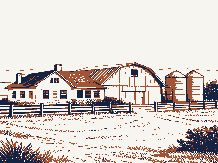
045 1958 039 COUNTY DATE Fairfield STATE REQUIREMENTS NAME 1:24000 CODE COMMON: REGISTE MAP REFERENCE SOURCE: Ohio LOCATION SCALE: PROPERTY MAP FORM ENTRY NUMBER NATIONAL REGISTER OF HISTORIC PLACES Willow Lane Farm Cincinnati-Zanesville Road (Ohio Route #22) CITY OR TOWN: (Type all entries -attach to or enclose with map) FOR NPS USE ONLY NATIONA GEOLOGICAL SURVEY AMANDA, OHIO UNITED STATES OHIO- FAIRFIRI.D CO ROAD CLASSIFICATION Mapped, edited, and published by the Geological Survey DEPARTMENT OF THE INTERIOR 7.5 MINUTE SERIES (TOPOGRAPHIC) July 10, 1972 Wiiliam J. Murtagh, Keeper submitted as EMERGENCIES . - approved the submission of these nominations upon the recommenda- oi their historical advisor, William G.
Keener, curator of history Lin of application forms submitted and reasons for their emergency IuLow Lane Farm, Concord Hall, and Chestnut Ridge Farm, all Lancaster ine structures or their immediate environs. bee Theater, Hamilton County--this building is threatened by demolition, unerabie and architecturally valuable public building of the state of Ohio. REGIST Society. NATIONAL this instance the mayor personally is spearheading the preservation to certify that the Ohio Historic Site Preservation Advisory will also certify that owners of subject landmarks have been notified Sincerely caster, in which case the mayor of the city in question has been notifie Lonal Register tted herewith are six (6) compieted National Register application 5 ace as follows: State House, Franklin County--to call public attention to the most ualify a number of subject buildings for public preservation funds.
1972 tencion upon this valuable assemblage of buildings and to assist and vement of that community. ice of Archeology and Historic Preservation OCT 2 6 1972 Hamilton County Mx. Daniel R. Porter Director, Northeast Region NRowland :mm 10/25/72 Location STATE Name Date Entered ENTRIES IN THE NATIONAL REGISTER Also Notified Cincinnati Cuvier Press Club Hon. William B. Saxbe Lancaster vicinity State Lialson Officer The Ohio Historleal Seclaty Bon. Donald D. Clancy Willow Lane Farm Fairfield County
 Block
Block