
BlockBefore
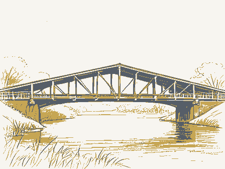
Decorative drawing: a timber truss bridge spanning a river on stone piers, side elevation. Not a photograph of this place.

Nomination for Stonelick Covered Bridge

The case file that argued this property on to the National Register: 1,381 words across 10 pages, filed in 1974. Read by 4 independent recognisers, of which at least 3 had to agree before a line was published.

Source document Held by the National Archives in Record Group 79 as reference 74001419, where it exists only as a scan with no text layer. The words below were read off that scan by 4 independent recognisers at two resolutions. Only lines that at least 3 of them returned identically appear below; where they disagreed, the line is withheld rather than guessed, so some of the form's furniture is missing. Spelling is never corrected, so a stray character that all the readers agreed on is the recogniser's and the typewriter's.. Nothing is summarised, corrected or written by this site. See the catalogue record, or return to the property.

From the form

The catalogue entry the section above was filed under.

Form 10-300 UNITED STATES DEPARTMENT OF THE INTERIOR X State (Rev. 6-72) NATIONAL PARK SERVICE - County NATIONAL REGISTER OF HISTORIC PLACES INVENTORY - NOMINATION FORM FOR NPS USE ONLY (Type all entries - complete applicable sections) SEP 1 0 1974 AND/OR HISTORIC: CONGRESSIONAL DISTRICT: #6 Vm. H.

Harsha (Check One) TO THE PUBLIC - In Process - Being Considered - Preservation work E Transportation Educational - OWNER'S NAME: LOCATION OF LEGAL DESCRIPTION COURTHOUSE, REGISTRY OF DEEDS, ETC: TITLE OF SURVEY: - Federal - Local DEPOSITORY FOR SURVEY RECORDS: 039 025 LOCATION Batavia Religious Court House CLASSIFICATION Government CATEGORY OWNERSHIP NAME Both District ACCESSIBLE Agricultural Entertainment Restricted Private STATUS Military Commercial Unoccupied REGISTER Park Yes: Clermont County Private Residence Building Museum Clermont Public Scientific Perintowm Covered Bridge Public Acquisition: COMMON: Structure Columbus CODE Object Stonelick Covered Bridge REPRESENTATION IN EXISTING SURVEYS Ohio Historical Society ENTRY DATE STREET AND NUMBER: Industrial Survey of Historical Features of Southwestern Ohio Ohio OWNER OF PROPERTY 1982 Velma Avenue CITY OR TOWN: - Comments APR 2 3197 PRESENT USE (Check One or More as Appropriate) Site NATIONAL ENTRY NUMBER County road 16 - Deteriorated Et Unaltered ] Moved E Original Site vertical siding, boarded almost to the eaves.

The abutments are 1ine so that it can be straightened again. William Howe was the first CONDITION DESCRIPTION stone. Excellent NATIONAL REGISTER Ruins Unexposed the original construction. Perintown in Clermont County.The bridge has a sheet metal roof and The structure under consideration is a one-span wooden truss covered Howe truss marked the end of the all-wood bridge truss.The Howe truss bridge as near as possible to its original construction by using the iron verticals can be tightened when the bridge begins to sag out of was extremely popular, especially with the railroads. to combat the inherent weakness of the all-wood truss in which the uprights of previous bridge trusses, such as the Long truss, with iron rods which could be adjusted with nuts and turnbuckles.

Thus, these The overhead clearance is 15' 5".The Howe truss was patented in 1840 (Check One) PR 2 3 197 DESCRIBE THE PRESENT AND ORIGINAL (if known) PHYSICAL APPEARANCE

Description of the property

Fair replaced, new joists and flooring was installed and the entire struc- concrete.The county engineer states that they attempt to keep the repaired.The end posts and the decayed ends of the bottom chords were advance in the progress of bridge design because it replaced the wooden by William Howe of Spencer,Mass. The Howe truss marked a definite ture was painted.In l97l, the stone abutments were reinforced with the years.In l970,the roof was replaced and the bridge seats were a 136.5'clear span.The overall width is 22'with a 16' 5"roadway. Good PERIOD (Check One or More as Appropriate) - Pre-Columbian! - 15th Century SPECIFIC DATE(S) (If Applicable and Known) AREAS OF

Statement of significance

1s very picturesque. It is painted a deep red on siding and portals Last covered bridge in Clermont County and one of only 18 Howe trusses 1878 SIGNIFICANCE Communications Conservation Commerce losophy Architecture Transportation Military Aboriginal REGISTER itarian Prehistoric Agriculture Landscape Music ture shows the Patchell Farm and the covered bridge.In addition to Industry Theater Social/Human- Sculpture it is sometimes referred to as the Perintown Bridge for the nearby Invention being quite sturdy and in excellent condition, the Stonelick Bridge Urban Planning left in Ohio.It is certainly one of the finest Howe trusses in the town.This bridge was built in 1878 and a sketch of it can be seen Science Religion/Phi. in the l880 History of Clermont County by Louis H. Everts.This pic- Education serve it. Art state.

and both siding and portals are finished with battens.This is the The people of Clermont County are very proud of their covered bridge and the county officals are doing everything in their power to pre- The Stonelick Bridge takes its name rrom the creek it spans although

The rest of the file

Bibliography, boundary description, and the people who prepared and reviewed the nomination.

MAJOR BIBLIOGRAPHICAL REFERENCES 1957, p- 18 and 19 Co., 1969, p. 39. Record Books of the Southern Ohio Covered Bridge Association, Inc., Vol. 1, GEOGRAPHICAL DATA LATITUDE AND LONGITUDE COORDINATES DEFINING THE LENTER POINI OF A PHOPERTY DEFINING A RECTANGLE LOCATING THE PROPERTY OF LESS THAN TEN ACRES [LIST ALL STATES AND COUNTIES FOR PROPERTIES OVERLAPPING STATE OR COUNTY BOUNDARIES APK 2 3 1974 FORM PREPARED BY March 20, 1974 Whitehead Road CITY OR TOWN: STATE LIAISON OFFICER CERTIFICATION As the designated State Liaison Officer for the Na- I hereby certify that this property is included in the tional Historic Preservation Act of 1966 (Public Law Nationa 1 Register.

89-665), I hereby nominate this property for inclusion in the National Register and certify that it has been evaluated according to the c-iteria and procedures set Director, Office of Archeology and Historic Preservation NAME AND * U.S. GOVERNMENT PRINTING OFFICE : 1973-729-147/1442 3-I 039 Seconds LONGITUDE ORGANIZATION LATITUDE ATTEST: STATE COUNTY DATE CODE Title CORNER NATIONAL Columbus Clermont County. Degrees Minutes Seconds Ohio Covered Bridge Committee Miriam F. Wood STREET AND NUMBER: level of significance of this nomination is: Allen, Richard S., "Covered Bridges of the Middle West", Stephan Greene N39 ° 07 - forth by the National Park Service. The recommended Ly Keeper of The National Registe Allen, Richard S., Everts, Louis Ho, "History of Clermont County", 1880, p. 544.

Degrees 4334900 Minutes NAME AND TITLE: 4, 23.74,670 PHOTOS 2 CONTROL REVIEW SEP 1 0 1974 INT: 1538-73 PROPERTY KEEPER Entered Re-submit Send-back MAPS Federal Register entry WORKING NUMBER TECH REVIEW National Register Write-up HISTORIAN BRANCH CHIEF REVIEW UNIT CHIEF 10/3 ARCHEOLOGIST TO HAER 4.25. Clermont UNITED STATES DEPARTMENT OF THE INTERIOR Form No. 10-301a NATIONAL PARK SERVICE COMMON: Stonelick Covered Bridge LOCA TION NEGATIVE FILED AT: 3155 Whitehead Road, Columbus, Ohio 43204 DESCRIBE VIEW, DIRECTION, ETC. West side of bridge, looking east * U.S.

GOVERNMENT PRINTING OFFICE: 1973-729-152/1446 II - I PROPERTY OF THE NATIONAL MEGISTER 027 COUNTY DATE NAME CODE 039 REGISTE STATE PHOTO REFERENCE Ohio PROPERTY PHOTOGRAPH FORM Clermont FOR NPS USE ONLY NATIONAL REGISTER OF HISTORIC PLACES County road 16 (Type all entries -attach to or enclose with photograph) STREET AND NUMBER: IDENTIFICATION CITY OR TOWN: (7/72) Earl Malott PHOTO CREDIT: ENTRY NUMBER 2 miles east of perintown TONS WEIGHT LIMIT Form No. 10-301a UNITED STATES DEPARTMENT OF THE INTERIOR LOCA TION PHOTO CREDIT: Earl Malott DATE OF PHOTO: February 1974 DESCRIBE VIEW, DIRECTION, ETC.

South portal of the bridgo, lo0king north * US GOVERNMENT PRINTING OFFICE: 1973-729-152/1446 III - | 039 027 NAME DATE COUNTY IDENTIFICATION SEP NATIONAL CODE REGISTER COMMON: STATE PHOTO REFERENCE Ohio PROPERTY PHOTOGRAPH FORM CITY OR TOWN: NATIONAL REGISTER OF HISTORIC PLACES 2 Miles east of Perintown STREET AND NUMBER: NATIONAL PARK SERVICE (Type all entries-attach to or enclose with photograph) County road 16 (7/72) FOR NPS USE ONLY PROPERTY OF THE NATIONAL REGISTER RECEIVED Stonelick Covered Bridge NEGATIVE FILED AT: 3155 Whitehead Road, Columbus, Ohio 43204 APR 1 3 1974 AND/OR HISTORIC: Clermont Perintown Covered Bridge Form No. 10-301 UNITED STATES DEPARTMENT OF THE INTERIOR NATIONAL PARK SERVICE Rev. 7-72 FOR NPS USE ONLY AND/ OR HISTORIC: Perintown Covered Bridge MAP REFERENCE U.S.G.S. Goshen Quadrangal SCALE: 1:24000 1. Property broundaries where required. 2. North arrow. 3.

Latitude and longitude reference. * U.S. GOVERNMENT PRINTING OFFICE : 1973-729-148/1441 3-l 039 027 NAME DATE REGISTER COUNTY REQUIREMENTS NATIONAL CODE STATE Ohio Couaty road 16 SOURCE: PROPERTY MAP FORM NATIONAL REGISTER OF HISTORIC PLACES LOCATION (Type all entries-attach to or enclose with map) CITY OR TOWN: STREET AND NUM BER: Clermont 2 miles east of Perintown TO BE INCLUDED ON ALL MAPS GOSHEN QUADRANGLE GEOLOGICAL SURVEY UNITED STATES OHIO-CLERMONT CO Longitude N3907.5W8407.5/7.5 DEPARTMENT OF THE INTERIOR Polyconic projection.1927 North American datum GOSHEN, OHIO U.S. Route State Route 39° 07' 55' SEP 10 1S74 Parka Covered Bridge Mr. Daniel R. Porter Hon. Clarence E.

Miller The Ohio Historical Society Coluabus, Ohio 43211 PR MMOTT: p1 9/12/74 Location Director STATE Muskingun County Date Entered Name ENTRIES IN THE NATIONAL REGISTER Fairfield County Also Notified Stonelick Covered Bridge Lockville vicinity Salt Creek Covered Bridge Chalfont vicinity Lockville Canal Locks Perry County Hartinsville vicinity Regional Director, Midwest Region Perintowm vicinity Norwich vicinity Clinton County State Bistoric Preservation Officer Clermont County Hartinsville Road Covered Bridge Interstate #7l at 17th Avenue