MAJOR BIBLIOGRAPHICAL REFERENCES 1880, pages 23 & 25. Printing Company, 1969, page 12. Sheet on Kirker Bridge, 12/4/51. Volume 1, Adams Cou nty.
GEOGRAPHICAL DATA LATITUDE AND LONGITUDE COORDINATES DEFINING A RECTANGLE LOCATING THE PROPERTY DEFINING THE LENTER POINI OF A PHOPERTY OF LESS THAN TEN ACRES W 83° UTM 17 273840 4295830 APPROXIMATE ACREAGE OF NOMINATED PROPERTY: ILTST ALL STATES AND COUNTIES FOR PROPERTIES OVERLAPPING STATE OR COUNTY BOUNDARIES CODE COUNTY AUG 1 9 1975 FORM PREPARED BY Miriam F- Wood STATE LIAISON OFFICER CERTIFICATION NATIONAL REGISTER VERIFICATION As the designated State Liaison Officer for the Na- I hereby certify that this property is included in the tional Historic Preservation Act of 1966 (Public Law 89-665), I hereby nominate this property for inclusion in the National Register and certify that it has been evaluated according to the c-iteria and procedures set Director, Office of Archeology and Historic Preservation National [ Local O * U.S.
GOVERNMENT PRINTING OFFICE : 1973-729-147/1442 3-l 039 LONGITUDE LATITUDE Name DATE Title ATTEST: ORGANIZATION CORNER CODE STATE REGISTER Columbus RECEIVED Degrees Minutes Seconds Ohio Southern Ohio Covered Bridge Association, Inc. Record Books, Less than one acre. Caldwell's Atlas and Historical Sketch of Adams County, Ohio, 3155 Whitehead Road CITY OR TOWN: NAME AND TITLE: level of significance of this nomination is: STREET AND NUMBER: Mug.1,1975 Ohio Covered Bridge Committee Nationa 1 Register. forth by the National Park Service.
The recommended Degrees Seconds Minutes Ketcham, Bryan E.,Covered Bridges on the Byways of Ohio,Oxford 12-8-76 State Ohio Photos 2 ARCHITECTURAL HISTORIAN OCT 2 3 1975 National Register Write-up KEEPER OTHER ARCHEOLOGIST TECHNICAL HAER Send-back Maps Re-submit Review Adams HISTORIAN Federal Register Entry United States Department of the Interior National Park Service WAso No.7 REVIEW UNIT CHIEF 2-3-76 Working Number8. 19. 75. 151 9 INT:21 OOBRANCH CHIEF Inventory 3BA 9/4 Entered CONTROL 10:17.75 Adams County, Ohio NPS Number PROPERTY OF THE NATIONAL REGISTER North Portal, west side,Loo Ring Southeast Southportal, west side, Loo king northeast 3/25 NPS Number ClooX PROPERTY OF THE NATIONAL REGISTER Form No. 10-301a NATIONAL PARK SERVICE AND/OR HISTORIC: DATE OF PHOTO: March 25, 1975 NEGATIVE FILED AT: 3155 Whitehead Road Columbus, oh1o 43204 DESCRIBE VIEW, DIRECTION, ETC.
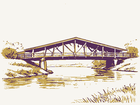
South portal, west side, looking northeast 039 NAME DATE 001 REGISTER Adams NATIONAL COUNTY RECEIVED STATE PHOTO REFERENCE CODE IDENTIFICATION PROPERTY PHOTOGRAPH FORM ENTRY NUMBER NATIONAL REGISTER OF HISTORIC PLACES CITY OR TOWN: (Type all entries-attach to or enclose with photograph) 5 miles southwest of West Union UNITED STATES DEPARTMENT OF THE INTERIOR Ohio FOR NPS USE ONLY STREET AND NUMBER: just off SR 136 (7/72) OCT 2 8 1975 COMMON: Kirker Covered Bridge U.S. GOVERNMENT PRINTING OFFICE: AUG191975 Miriam Wood PHOTO CREDIT: 876.167 Form No. 10-301 UNITED STATES DEPARTMENT OF THE INTERIOR Rev. 7-72 NATIONAL PARK SERVICE (Type all entries -attach to or enclose with map) CT 2 9 1975 STREET AND NUM BER: SCALE: 1:24000 TO BE INCLUDED ON ALL MAPS AUG 1 9 1975 1. Property broundaries where required. 2. North arrow. 3. Latitude and longitude reference. * U.S.
GOVERNMENT PRINTING O 039 1973-729-148/1441 001 NAME RECEIVED REQUIREMENTS COUNTY DATE Kirker Covered Bridge CODE STATE Adams LOCATION MAP REFERENCE ENTRY NUMBER NATIONAL REGISTER OF HISTORIC PLACES COMMON: AND/OR HISTORIC: SOURCE: 5 miles outhwest of West Union PROPERTY MAP FORM U.S.G.S.
West Union, Ohio Quadrangle Ohio CITY OR TOWN: FOR NPS USE ONLY just east of SR 136 1961 WEST UNION QUADRANGLE GEOLOGICAL SURVEY DEPARTMENT OF THE INTERIOR AUG 19 1975 UTM 17 273840 4295830 NATIONAL UNITED STATES WEST UNION, OHIO RECEIVED STATE OF OHIO OCT 2 9 1975 Columbus, Ohio 43211 PR MMOTT: p1 11.13.75 INT: 2950-75 Location STATE Name Kirker Covered Bridge Cuyahoga County West Union Regional Director, Midwest Region Date Entered Gaskins-Malany House Clermont County State Historic Preservation Officer Berea ENTRIES IN THE NATIONAL REGISTER Lyceum Village Square and German Wallace College Adams County Interstate 7l at 17th Avenue Locust Corner vicinity Also Notified Hon.James v. Stanton De. Thomas H. Smith 3 date of entry: / Kirker Covered Bridge 5) LOCATION street & number vicinity of V SW of Union off SR 136 V West Union 8 ADMINISTRATOR: ONO 1)CONGRESS.
DISTRICT 12)SOURCE of NOMINATION D FEDERAL if state who prepared form? 3 WITHIN NATICNAL HISTORIC LANDMARK? 1S ACREAGE -YES NAME 1 CONDITION - deteriorated 17 features: Oruins Omoved ÇO NOT INTACT-O Dunexposed - Unknown Ounexcavated EM NOT APPLICABLE -7 - No Access (19 ADAPTIVE USE IS PROPERTY A HISTORIC DISTRICT?
Dyes Lino 2 AREAS OF SIGNIFICANCE : DENGINEERING - 11 -RECREATION -28 CLAIMS: explain - LAW - 16 - RELIGION- 22 DARCHEOLOGY - historic- 1 - COMMUNICATIONS-1 - LITERATURE - 17 C SCIENCE- 23 DURBAN PLANNING-31 'oldest' D D AGRICULTURE -3 C CONSERVATION -8 C HEALTH-27 C MILITARY - 18 C ARCHITECTURE-4 C ECONOMICS-9 C INDUSTRY-13 C MUSIC- 19 - SOCIAL / CULTURAL - 30 'only' D CART-5 - EDUCATION-10 CO INVENTION - 14 - PHILOSOPHY -20 - TRANSPORTATION-25 3 funetions *dates of initial construction: major alterations: /950 2 architectural style(s): 3 landscape architect / garden designer: S interior decorator: @ artist: Sartisan: EVENTS : A IF ADDITIONAL SPACE NEEDED, NUMBER & PUT ON REVERSES Midwest county ASSOCIATION STATE Adams PERSONAL: ENTERTAINMENT-26 SETTLEMENT-29 historic events: NATIONAL REGISTER DATA SHEET CURRENTLY: WHEN HISTORICALLY SIGNIFICANT: SUBSTANTIALLY INTACT-1 INSTITUTIONAL: 3NATIONAL REGISTER WRITE-UP V10-29-75 reviewers initials SAVED?YES Jaltered DNAME as it appears on federal register: Dexcellent 2OTHER NAMES: Doriginal site THIN NATIONAL REGISTER HISTORIC DISTRICT?
"first' GNPS REGION: 001 coursed 4 county code: Oreconstructed - LANDSCAPE ARCH.- 15 - POLITICS / GOVT.* 21 -ARCHEOLOGY - prehistoric-2 -EXPLORATION - 12 hestoric site S master builder: @builder/contractor: _date - Late 18603 Sengineer: ETHNIC GROUP LOCAL PRIVATE ORGANIZATION COMMERCE-6
 Block
Block