MAJOR BIBLIOGRAPHICAL REFERENCES Allen, Richard S., "Covered Bridges of the Middle West," Stephan Greene Press, 1970, p. 45. 1957, p. 16 and 17. Co., Oxford, Ohio, 1969, p. 166. River Valley Covered Bridge Society Bulletin, p. 7, Fall 1971, Volumn 18, #2. 10. GEOGRAPHICAL DATA DEFINING A RECTANGLE LOCATING THE PROPERTY DEFINING THE LENTER POINI OF A PROPERTY OF LESS THAN TEN ACRES N 39° 31: |16 694 700 4377 160 MAY 02 1975 FORM PREPARED BY National - 26, 1974 As the designated State Liaison Officer for the Na- I hereby certify that this property is included in the tional Historic Preservation Act of 1966 (Public Law 89-665), I hereby nominate this property for inclusion in the National Register and certify that it has been evaluated according to the c-iteria and procedures set Director, Office of Archeology and Historic Preservation 'JUN 3 1975 * U.S.
GOVERNMENT PRINTING OFFICE : 1973-729-147/1442 3-l 039 Local Degrees Seconds COUNTY LATITUDE Name UTM ATTEST: CORNER STATE REGISTER LONGITUDE ORGANIZATION Minutes Title Columbus Degrees Minutes Seconds RECEIVED CODE STATE LIAISON OFFICER CERTIFICATION Ohio Covered Bridge Committee NATIONAL REGISTER VERIFICATION 3155 Whitehead Road LATITUDE AND LONGITUDE COORDINATES NAME AND TITLE: Miriam F. Wood STREET AND NUMBER: National Register. less than one level of significance of this nomination is: Ohio CITY OR TOWN: Date Wilson, Raymond E., "Oxford, Ohio has a Unique Covered Bridge, " Connecticut W 84° APPROXIMA TE ACREAGE OF NOMINATED PROPERTY: ILIST ALL STATES AND COUNTIES FOR PROPERTIES OVERLAPPING STATE OR COUNTY BOUNDARIES forth by the National Park Service.
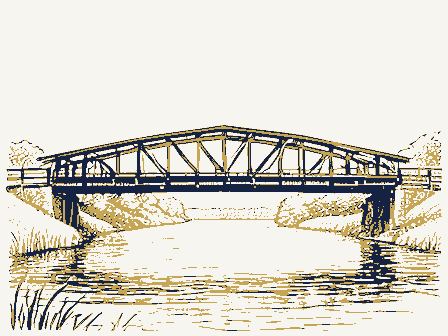
The recommended Allen, Richard S., "Covered Bridges of the Northeast", Stepahn Greene Press, Photos _ ARCHITECTURAL HISTORIAN Bad pix. Accept Endy REVIEW UNIT CHIEF Re-submit 5,29,75 CONTROL OTHER KEEPER ARCHEOLOGIST Inventory HAER Entered JUN51975 TECHNICAL HISTORIAN Maps Review Butler Cole Federal Register Entry National Register Write-up BRANCH CHIEF 5.6.75 Working Number 5, 2, 75, 857 5.30.75 JUN 5 United States Department of the Interior National Park Service WASO No. 7 UNITED STATES DEPARTMENT OF THE INTERIOR Form No. 10-301a NATIONAL PARK SERVICE FOR NPS USE ONLY AND/OR HISTORIC: Pugh's Mill Covered Bridge LOCA TION CITY OR TOWN: NEGATIVE FILED AT: 3155 Whitehead Road, Columbus, Ohio 13204 MAY 02 1975 DESCRIBE VIEW, DIRECTION, ETC. West side of bridge, looking east * US.
GOVERNMENT PRINTING OFFICE: 1973-729-152/1446 II - 1 Butler COUNTY DATE REGISTER NAME 039 NATIONAL STATE IDENTIFICATION RECEIVED CODE COMMON: (Type all entries - attach to or enclose with photograph) 017 PHOTO REFERENCE Ohio Jeffrey Shroyer Just west off SR 732 PHOTO CREDIT: PROPERTY PHOTOGRAPH FORM ENTRY NUMBER Black Covered Bridge (7/72) STREET AND NUMBER: NATIONAL REGISTER OF HISTORIC PLACES 1 mile north of Oxford DATE OF PHOTO: January 1974 PROPERTY OF THE NATONAL REGISTER UNITED STATES DEPARTMENT OF THE INTERIOR Form No. 10-301a NATIONAL PARK SERVICE FOR NPS USE ONLY COMMON: Black Covered Bridge LOCA TION STREET AND NUMBER: CITY OR TOWN: 1 mile north of Oxford DATE OF PHOTO: January 1974 NEGATIVE FILED AT: 3155 Whitehead Road, Columbus, Ohio 43204 DESCRIBE VIEW, DIRECTION, ETC. * U.S.
GOVERNMENT PRINTING OFFICE: 1973-729-152/1446 III - 1 039 Butler COUNTY REGISTER NAME 017 DATE NATIONAL STATE IDENTIFICATION PHOTO REFERENCE CODE Ohio Interior view of the trusses ENTRY NUMBER PROPERTY OF THE NATORAL REGISTER NATIONAL REGISTER OF HISTORIC PLACES (Type all entries - attach to or enclose with photograph) Just west off SR 732 PROPERTY PHOTOGRAPH FORM (7/72) PHOTO CREDIT: Jeffrey Shrover MAT 02-1975 AND/OR HISTORIC: Pugh's Mill Covered Bridge Form No. 10-301a UNITED STATES DEPARTMENT OF THE INTERIOR NATIONAL PARK SERVICE FOR NPS USE ONLY (Type all entries -attach to or enclose with photograph) JUN 5 NAME AND/OR HISTORIC: Pugh's Mill Covered Bridge LOCA TION STREET AND NUMBER: CITY OR TOWN: 1 mile north of oxford PHOTO CREDIT: Jeffrey Shroyer DATE OF PHOTO: January 1974 NEGATIVE FILED AT: 3155 Whitehead Road, Columbus, Ohie 43204 DESCRIBE VIEW, DIRECTION, ETC.
South portal, east side of bridge, looking northwest * US GOVERNMENT PRINTING OFFICE 1973-729-152/1446 III - 1 039 Butler 017 IDENTIFICATION COUNTY DATE RECEIVED STATE CODE PHOTO REFERENCE PROPERTY PHOTOGRAPH FORM (7/72) NATIONAL REGISTER OF HISTORIC PLACES ENTRY NUMBER Just west off SR 732 Ohio MAY 08 1975 FREGIS EER COMMON: Black Covered Bridge NATONAL Form No. 10-301 UNITED STATES DEPARTMENT OF THE INTERIOR Rev. 7-72 FOR NPS USE ONLY COMMON: Black Covered Bridge AND/OR HISTORIC: Pugh's Mill Covered Bridge STREET AND NUM BER: 1 mile north of Oxford Oxford Quadrangal SCALE: 1:24000 1. Property broundaries where required. 2. North arrow. 3. Latitude and longitude reference.
039 Butler 1961 REQUIREMENTS COUNTY DATE NAME REGISTER NATIONAL CODE STATE 017 NATIONAL REGISTER OF HISTORIC PLACES SOURCE: MAP REFERENCE PROPERTY MAP FORM Ohio Just west off SR 732 LOCATION NATIONAL PARK SERVICE (Type all entries-attach to or enclose with map) CITY OR TOWN: TO BE INCLUDED ON ALL MAPS OXFORD, OXFORD QUADRANGLE DEPARTMENT OF THE INTERIOR - Sate Route Black Covered Bridge UNITED STATES DEPARTMENT OF HIGHWAYS 7.5 MINUTE SERIES (TOPOGRAPHIC) GEOLOGICAL SURVEY 16 694 700 4377 160 W [40 4406" April 29, 1975 Dr. William Murtagh, Keeper 18th & C Streets, N.W. Washington, D.C. 20240 Dear Dr.
Murtagh: Providence Historic District, Lucas County The Dayton Arcade, Montgomery County MeGraw House, Crawford County Davis, Anson, House- Franklin County First Church of Christ Scientist, Lorain County Lorain County Courthouse, Lorain County Gillett-Shoemaker-Welsh House, Lucas County Hhaskins, Liberty Whitcomb, House, Lucas County Hooker-Van Fleet House, Lucas County Manhattan Building, Lucas County Root, A.I. & E.R., Homestead, Medina County Foreaker Covered Bridge, Monroe County Ausenbaugh-McE1henny House, Montgomery County Braden, J.M., House, Portage County Cascade House, Portage County Brubaker Covered Bridge, Preble County MAY 02 1975 Ohio Historical Center 1-71& 17th Avenue Columbus, Ohio 43211 (614) 466-8727 REGISTER National Park Service RECEIVED Ohio Historic Preservation Office our intent to register.
Department of the Interior National Register of Historic Places NATIONAL Lockington Covered Bridge, Shelby County NEW SUBMISSIONS: Medina Public Square Architectural District, Medina County Black Covered Bridge, Butler County Advisory Board and owners of subject properties have been informed of Transmitted herewith are twenty-one (2l) completed National Register EMERGENCY SUBMISSIONS:These plan to apply for 1976 grants-in-aid. forms.All have been approved by the Ohio Historic Site Preservation April 29, 1975 Keys, Richard T., House, and Barn, Trumbull County Dr. Thomas Smith Director, Ohio Historical Society MAY 02 1975 Sincerely, enclosures REGISTER RECEIVED NATIONAL' State Historic Preservation Officer TS/g1k Sherman, Robert, Residence, Trumbull County Dx. Thomas H. Smith Bon.
Wayne Le Hays Columbus, Ohio 6/10/75 Location STATE 43211 Name MMott/row Butler County ENTRIES IN THE NATIONAL REGISTER Chillicothe Director Oxford vicinity Date Entered Regional Director, Midwest Region Also Notified Graysville vicinity Adena Mound State Historic Preservation Officer Ross County Monroe County Wedala Covered Bridge Ion. John H. Glean, Jx. Hon. Robert Taft, Jr. NATIONAL REGISTER DATA SHEET NAME as it appears on federal register: 2 OTHER NAMES: 3) date of entry: 4 county code: 5) LOCATION street & number 1 mi. N of Oxford off SR 732 [ONO 1CONGRESS. DISTRICT 12)SOURCE of NOMINATION OO YES.
NAME - deteriorated 17 Eeatures: Dexcellent Oruins Omoved OO NOT INTACT-O Dunexposed - Unknown -unexcavated 20 NOT APPLICABLE -7 - No Access JAREAS OF SIGNIFICANCE : DENGINEERING -11 -RECREATION -28 OCLAIMS: explain 'first'O DARCHEOLOGY -prehistoric -2 C LAW- 16 - SETTLEMENT-29 - ARCHEOLOGY-historic-1 - COMMUNICATIONS-7 - LITERATURE - 17 C SCIENCE- 23 'oldest' O - AGRICULTURE -3 - CONSERVATION- 8 C HEALTH -27 - MILITARY- 18 C ARCHITECTURE-4 - ECONOMICS-9 - INDUSTRY- 13 - MUSIC - 19 -] SOCIAL / CULTURAL - 30 'only' D - ART-5 - EDUCATION-10 C INVENTION -14 - PHILOSOPHY -20 - TRANSPORTATION - 25 2 functions 2dates of initial construction: hitovie site 3 architectural style(s): 2master builder: Bartisan: LIF ADDITIONAL SPACE NEEDED, NUMBER & PUT ON REVERSE Midwest ASSOCIATION Butler 017 FEDERAL ENTERTAINMENT-26 Oxford INSTITUTIONAL: ACREAGE 6-5-75 CURRENTLY: STATE WHEN HISTORICALLY SIGNIFICANT: COMMERCE-6 PRIVATE ORGANIZATION SUBSTANTIALLY INTACT-1 ADMINISTRATOR: Dfair URBAN PLANNING-31 Daltered major alterations: Black Covered Bridge historic events: NATIONAL REGISTER WRITE-UP WITHIN NATIONAL HISTORIC LANDMARK?
SAVED?YES vicinity of GNPS REGION: LOCAL Doriginal site EXPLORATION-12 C.1869 1 CONDITION Oreconstructed )ADAPTIVE USE AYES OONO IS PROPERTY A HISTORIC DISTRICT? Dyes Cma C RELIGION- 22 - SOCIAL/HUMANITARIAN -24 @ engineer: 3g artist: @bullder/contractor: Long - date- ETHNIC GROUP Pugh's Mill Covered Bridge 4OTHER(SPECIFY) Dgood ITHIN NATIONAL REGISTER HISTORIC DISTRICT?
 Block
Block