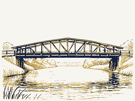
SIGNIFICANCE Landscape Transportation Science Agriculture itarian bridge in Coshocton County. Literature The Helmick Covered Bridge is one of our most picturesque Education Music Invention Theater Industry Sculpture The Helmick Covered Bridge is also the last public covered masonry work on bridges in the vicinity, so despite the Religion/Phi county records, it would seem that Mr. Shrake had some help Social/Human- The Helmick Bridge was built in l863 by John Shrake of takes its name from a Delaware Indian Chief.Private Newark, Ohio.According to county records, Mr. Shrake built building this bridge.John Shrake was a well-known builder state maps, although there is little there today. Other (Specify) AREAS OF SIGNIFICANCE both superstructure and abutments for $2,107.15. However, on There was once & sawmill, post- Art gotten hamlet of Helmick.
of covered bridges in Coshocton, Licking and Tuscarawas STATEMENT OF SIGNIFICANCE (Check One or More as Appropriate) Victor,1863.A Fredertck Victor is known to have done MAJOR BIBLIOGRAPHICAL REFERENCES Oxford Printing Company, 1969, page47. LATITUDE AND LONGITUDE COORDINATES DEFINING A RECTANGLE LOCATING THE PROPERTY DEFINING THE LENTER POIN I OF A PROPERTY OF LESS THAN TEN ACRES W81 ° 56° FORM PREPARED BY November 28, 1974 As the designated State Liaison Officer for the Na- I hereby certify that this property is included in the tional Historic Preservation Act of 1966 (Public Law 89-665), I hereby nominate this property for inclusion Nationa 1 Register. in the National Register and certify that it has been evaluated according to the c-iteria and procedures set Director, Office of Archeology and Historic Preservation JUN 1 7 1975 * U.S.
GOVERNMENT PRINTING OFFICE : 1973-729-147/1442 3-l 039 Seconds Degrees 600 ORGANIZATION LONGITUDE Name LATITUDE COUNTY Minutes Title UTM ATTEST: STATE CORNER National DATE CODE Columbus Connecticut River Valley Covered Bridge Society Bulletin, NATIONAL REGISTER VERIFICATION N40 Ohio Covered Bridge Committee STREET AND NUMBER: Miriam F. Wood NAME AND TITLE: 12. STATE LIAISON OFFICER CERTIFICATION Inc., Volume 2, Coshocton County. by Terry Miller, page 5. 10. GEOGRAPHICAL DATA CITY OR TOWN: Ohio 3l55 Whitehead Road forth by the National Park Service.
The recommended level of significance of this nomination is: REGISTER Record Books of the Southern Ohio Covered Bridge Association, Volume #l7,#4, The Covered Bridges of Coshocton County, Ohio, SHPO Working Number 4, 30.75,823 E.Smith ARCHITECTURAL HISTORIAN JUN 1 7 1975 Re-submit OTHER TECHNICAL Entered ARCHEOLOGIST CONTROL Maps Photos 8-5-75 HISTORIAN Review KEEPER Federal Register Entry National Register Write-up Accept REVIEW UNIT CHIEF State Send-back 2. 8. 75 Cole 5-2-75 TO HAER Inventory JB Coshocton INT:2106-74 United States Department of the Interior National Park Service WAso No.7 5.1.75 Form No. 10-301a UNITED STATES DEPARTMENT OF THE INTERIOR NATIONAL PARK SERVICE AND/OR HISTORIC: LOCA TION CITY OR TOWN: PHOTO CREDIT: William E. Jones NEGATIVE FILED AT: 23753 Center Road APR 30-1975 Eomeworth, Ohio 44634 DESCRIBE VIEW, DIRECTION, ETC.
North portal, west side of bridge, looking southeast * US GOVERNMENT PRINTING OFFICE: 1973-729-152/ 1446 II - 1 039 IDENTIFICATION COUNTY STATE CODE Ohio at Helmick PHOTO REFERENCE Township road 25 (7/72) PROPERTY PHOTOGRAPH FORM NATIONAL REGISTER OF HISTORIC PLACES FOR NPS USE ONLY PROPERTY OF THE NATIONAL REGISTER (Type all entries -attach to or enclose with photograph) STREET AND NUMBER: Coshocton COMMON: Helmick Bridge REGISTER NAME ENTRY NUMBER 031 Form No. 10-301a UNITED STATES DEPARTMENT OF THE INTERIOR NATIONAL PARK SERVICE Coshoct on (Type all entries -attach to or enclose with photograph) COMMON: Helmick Covered Bridge AND/OR HISTORIC: STREET AND NUMBER: DATE OF PHOTO: March 19, 1972 NEGATIVE FILED AT: 23753 Center Road APRS 01075 DESCRIBE VIEW, DIRECTION, ETC. West side of bridge, looking east * U.S.
GOVERNMENT PRINTING OFFICE: 1973-729-152/1446 III - I PROPERTY OF THE NATIONAL REGISTER DATE COUNTY NATIONAL STATE REGISTER 031 039 CODE RECEIVED Ohio at Helmick Township road 25 PHOTO REFERENCE LOCATION IDENTIFICATION PROPERTY PHOTOGRAPH FORM ENTRY NUMBER (7/72) NATIONAL REGISTER OF HISTORIC PLACES FOR NPS USE ONLY CITY OR TOWN: Homeworth, Ohio 44034 PHOTO CREDIT: NAME William E. Jones #223 Form No. 10-301a UNITED STATES DEPARTMENT OF THE INTERIOR NATIONAL PARK SERVICE FOR NPS USE ONLY LOCA TION CITY OR TOWN: NEGATIVE FILED AT: 23753 Center Road DESCRIBE VIEW, DIRECTION, ETC. South portal, west side of bridge, looking northeast * U.S.
GOVERNMENT PRINTING OFFICE: 1973-729-152/ 1446 - I PROPERTY OF THE NATIONAL REGISTER 039 DATE COUNTY NATIONAL RECEIVED Coshocton STATE PHOTO REFERENCE REGISTER PROPERTY PHOTOGRAPH FORM CODE Ohio Township road 25 at Helmick (Type all entries - attach to or enclose with photograph) ENTRY NUMBER (7/72) NAME NATIONAL REGISTER OF HISTORIC PLACES AND/OR HISTORIC: STREET AND NUMBER: DATE OF PHOTO: March 19, 1974 IDENTIFICATION COMMON: Helmick Covered Bridge 031 Form No. 10-301 UNITED STATES DEPARTMENT OF THE INTERIOR Rev. 7-72 FOR NPS USE ONLY COMMON: Helmick Covered Bridge STREET AND NUM BER: U.S.G.S. K1l1buck Quadrangal APR30 1975 TO BE INCLUDED ON ALL MAPS 1. Property broundaries where required. 2. North arrow. 3. Latitude and longitude reference. # U.S.
GOVERNMENT PRINTING OFFICE : 1973-729-148/1441 3-l 81975 031 NAME COUNTY Coshocton JUN DATE at Helmick REQUIREMENTS REGISTER STATE CODE NATIONAL LOCATION SOURCE: ENTRY NUMBER MAP REFERENCE PROPERTY MAP FORM 039 Township road 25 AND/OR HISTORIC: NATIONAL PARK SERVICE NATIONAL REGISTER OF HISTORIC PLACES (Type all entries-attach to or enclose with map) Ohio CITY OR TOWN: RECEIVED DEPARTMENT OF HIGHWAY! GEOLOGICAL SURVEY KILLBUCK QUADRANGLE KILLBUCK, OHIO RECEIVED 75 MINUTE SERIES (TOPOGRAPHIC) P W 81° 56'34" APR301975 D - State Route N 4022.5 - W8152.5/7.5 ROAD CLASSIFICATION UNITED STATES DEPARTMENT OF THE INTERIOR STATE OF OHIO 17 419 980 4471 600 Dunhen, Hezekiah, House Hon. Robert Taft, Jr. Hon, Thones L.
Ashley Location Mott Dayton STATE Name Lorain County Date Entered 6/24/75 Also Notified ENTRIES IN THE NATIONAL REGISTER Montgomery County Cuyahoga County Lorain County Courthouse Helnick Covered Bridge Coshocton County Lucaa County The Dayton Arcade (coaplex) Hon.Ronald M.Mottl Bedford Fort Mianis Site Hen. Charles W. Whalen, JI. Hon. Charles A. Mosher Dz. Thonas H. Smith 3 date of entry: 4 county code: Blisstield 4 ®ADMINISTRATOR : CNO 1CONGRESS. DISTRICT 17SOURCE of NOMINATION THIN NATIONAL REGISTER HISTORIC DISTRICT? 5 ACREAGE -YES.
NAME- - deteriorated 1 features: Dexcellent Oruins Dmoved CO NOT INTACT-O Dunexposed - Unknown Ounknown Ounexcavated ZO NOT APPLICABLE -7 - No Access S AREAS OF SIGNIFICANCE : -RECREATION -28 2CLAIMS: explain - LAW- 16 - RELIGION-22 DARCHEOLOGY-historic-1 - COMMUNICATIONS-7 D LITERATURE - 17 - SCIENCE- 23 DURBAN PLANNING-31 'oldest' O C AGRICULTURE -3 - CONSERVATION - 8 C HEALTH -27 CO MILITARY - 18 C ARCHITECTURE-4 C ECONOMICS-9 C INDUSTRY- 13 C MUSIC - 19 CO SOCIAL / CULTURAL-30 CART-5 C EDUCATION-10 C PHILOSOPHY - 20 L TRANSPORTATION - 25 3 functions @dates of initial censtruction: major alterations : Barchitectural style(s) ©landscape architect/ garden designer: * interior decorator: @artist: @)builder Acontractor: give role & date IF ADDITIONAL SPACE NEEDED, NUMBER & PUT ON REVERSE NAMES ASSOCIATION engineer: ENGINEERING-11 FEDERAL SETTLEMENT-29 STATE EVENTS: ENTERTAINMENT-26 PERSONAL: CONDITION CURRENTLY: INSTITUTIONAL: SAVED?YES historic events: WHEN HISTORICALLY SIGNIFICANT: Toity/town LOCAL vicinity of PRIVATE ORGANIZATION WITHIN NATIONAL HISTORIC LANDMARK?
if state who prepared form? Ofair 3NATIONAL REGISTER WRITE-UP GNPS REGION: Coriginal site "first' 2OTHER NAMES: Bridge Oreconstructed >- UNKNOWN-6 CARCHEOLOGY - prehistoric -2 -COMMERCE -6 -EXPLORATION -12 'only' 0 C INVENTION - 14 gmaster builder: Gartisan: Shrate SUBSTANTIALLY INTACT-1 it appears on federal register Ounaltered 4-18-75031 Ogood MIOWEST CNO Sshocton reviewers initialsdato
 Block
Block