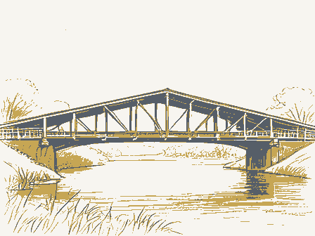
SIGNIFICANCE itarian Invention Music Agriculture Religion/Phi Political Sculpture Social/Human- losophy. The McColly Bridge is an attractive and well-maintained example of the This fine old covered structure is typical of the hundreds of Howe north of the Greenville Treaty Line. truss covered bridges that once spanned the streams of ohio.Only 18 awarded on July 7,1876 called for a Howe truss covered bridge at SPECIFIC DATE(S) (If Applicable and Known) STATEMENT OF SIGNIFICANCE 1876 Art $13.35 per lineal foot.The stonework of the abutments and wingwalls was done by T.B. Stillwell.The name McColly came from Nicholas of these Howe trusses remain today and the McColly Bridge is one of the MAJOR BIBLIOGRAPHICAL REFERENCES 1970, page 45. Iogan County Conmissioners Journal, B, pages 536, 549,568, 574 and 578.
GEOGRAPHICAL DATA LATITUDE AND LONGITUDE COORDINATES DEFINING A RECTANGLE LOCATING THE PROPERTY DEFINING THE CENTER POIN| OF A PHOPERTY OF LESS THAN TEN ACRES ILIST ALL STATES AND COUNTIES FOR PROPERTIES OVERLAPPING STATE OR COUNTY BOUNDARIES FORM PREPARED BY Miriam F. Wood July 17, 1974 STREET AND NUMBER: CITY OR TOWN: NATIONAL REGISTER VERIFICATION As the designated State Liaison Officer for the Na- I hereby certify that this property is included in the tional Historic Preservation Act of 1966 (Public Law 89-665), I hereby nominate this property for inclusion Nationa l Register. in the National Register and certify that it has been evaluated according to the c-iteria and procedures set forth by the National Park Service. The recommended Director, Office of Archeology and Historic Preservation MAY 1 4 1975 * U.S.
GOVERNMENT PRINTING OFFICE : 1973-729-147/1442 3-I 039 FEB281975 Seconds ORGANIZATION Degrees LONGITUDE DATE LATITUDE Columbus CORNER Name STATE NATIONAL Minutes RECEIVED REGISTER COUNTY CODE ATTEST: Degrees Minutes Seconds Ohio STATE LIAISON OFFICER CERTIFICATION Ohio Covered Bridge Committee 3155 Whitehead Road NAME AND TITLE: W83. Allen, Richard S., Covered Bridges of the Middle West, Stephan Greene Press, Ketcham, Bryan Eo, Covered Bridges on the Byways of Ohio, Oxford Printing Southern Ohio Covered Bridge Association Record Books, Volume 5, Logan N40 ° Title Company, 1969, page 106. 17/251830 44761600 Photos - 3.4.
15 Inventory MAY 1 4 1975 Re-submit - IN T:2106-74 OTHER HAER CONTROL Maps ARCHEOLOGIST HISTORIAN Send-back TECHNICAL Review National Register Write-up BRANCH CHIEF Federal Register Entry LEBOVICH 4.14.75 Cols ARCHITECTURAL HISTORIAN REVIEW UNIT CHIEF United States Department of the Interior National Park Service WASO No. 7 KEERER 3-10-75 Logan Form No. 10-301a NATIONAL PARK SERVICE CODE COUNTY: MAY 2 8 1975 COMMON: MicColly Covered Bridge LOCA TION DATE OF PHOTO: May 1974 NEGATIVE FILED AT: 3155 Whitehead Road Celumbus, Ohio 43204 F582 81975 DESCRIBE VIEW, DIRECTION, ETC. East portal of bridge, looking west. * U.S.
GOVERNMENT PRINTING OFFICE: 1973-729-152/1446 II - 1 039 Logan DATE 091 STATE CODE RECEIVED Ohio PHOTO REFERENCE REGISTER IDENTIFICATION PHOTO CREDIT: NATIONAL REGISTER OF HISTORIC PLACES PROPERTY PHOTOGRAPH FORM County road 130 ENTRY NUMBER Donald J.Miller STREET AND NUMBER: 2 miles southeast of Bloom Center AND/OR HISTORIC: CITY OR TOWN: (Type all entries- attach to or enclose with photograph) FOR NPS USE ONLY PROPERTY OF THE NATIONAL REGISTER UNITED STATES DEPARTMENT OF THE INTERIOR (7/72) NAME Form No. 10-301a UNITED STATES DEPARTMENT OF THE INTERIOR MAY 2 8 1975 LOCA TION NEGATIVE FILED AT: 3155 Whitehead Road Columbus, Ohio 43204 DESCRIBE VIEW, DIRECTION, ETC. * U.S.
GOVERNMENT PRINTING OFFICE: 1973-729-152/1446 I - 1 039 Logan DATE COUNTY RECEIVED NATIONAL CODE STATE REGISTER County road 130 PHOTO REFERENCE 2 miles southeast of Bloom Center NATIONAL PARK SERVICE ENTRY NUMBER PHOTO CREDIT: West portal and south side of bridge, looking northeast. FOR NPS USE ONLY STREET AND NUMBER: Ohio AND/OR HISTORIC: PROPERTY PHOTOGRAPH FORM NATIONAL REGISTER OF HISTORIC PLACES CITY OR TOWN: IDENTIFICATION PROPERTY OF THE NAT:ONAL REGISTER (Type all entries-attach to or enclose with photograph) Donald J. Miller (7/72) COMMON: McColly Covered Bridge NAME FEB281975 091 Form No. 10-301 UNITED STATES DEPARTMENT OF THE INTERIOR Rev. 7-72 NATIONAL PARK SERVICE FOR NPS USE ONLY (Type all entries -attach to or enclose with map) MAY 2 8 1975 AND/OR HISTORIC: STREET AND NUM BER: CITY OR TOWN: TO BE INCLUDED ON ALL MAPS 1. Property broundaries where required. 2. North arrow.
3. Latitude and longitude reference. Logan 1961 REQUIREMENTS 039 REGISTER COUNTY LOCATION DATE STATE NATIONAL 1:24000 CODE RECEIVED NAME 091 MAP REFERENCE Ohio SOURCE: SCALE: ENTRY NUMBER 2 miles southeast of Bloom Center NATIONAL REGISTER OF HISTORIC PLACES PROPERTY MAP FORM County road 130 U.S.G.S. Russells Point Quadrangal # U.S. GOVERNMENT PRINTING OFFICE: 1979-729-148/1441 3-1 FEB281975 UNITED STATES HUNTSVILLE QUADRANGLE STATE OF OHIO OF GEOLOGICAL SURVEY Longitude 83° 46" Latitude 40° 31* Dunns Pond Mound ROAD CLASSIFICATION DEPARTMENT OF THE INTERIOR HUNTSVILLE, OHIO OHIO-LOGAN CO MAY 2 8 1975 D.S. Rose Mound Bright, John, Covered Bridge Brown, Charles, Gothic Cottage Marshal1ville vicinity Hon. Robert Taft, Jr. Dz. Thomas H. Smith Hon, Clarence J. Brown Hon. Thomas N. Kindness Hon. Clarence B.
Miller Location 5/28/75 STATE Name Logan County Huron County MMott/row Butler County Cleveland Cuyahoga County Baltimore vicinity ENTRIES IN THE NATIONAL REGISTER Also Notified Bloom Center vicinity North Bloomfield Bohemian National Hall State Historic Preservation Officer The Ohio Historical Society Date Entered Hon. John M. Ashbrook Regional Direcbor, Midwest Region Wayne County McColly Covered Bridge Lagonda Club Building Clark County Interstate 7l at 17th Avenue Fairfield County Hon. Ralph S. Regula Springfield Hon. James V. Stanton Hon. Tennyson Guyer Steuben vicinity, Greenfield Trumbull County Hon. John H. Glenn, Jr. Columbus, Ohio 43211 Director Hon.J.
william Stanton Zinmexman, Ezekiel B., Octagon House OHIO MCCOLLY COVERED BRIDGE Logan County, Ohio 2 OTHER NAMES 4 county code y / town - deteriorated 17)features: Oruins Omoved - Unknown J UNKNOWN -6 -unexcavated ZO NOT APPLICABLE -7 - RECREATION -28 LAW - 16 RELIGION- 22 - SETTLEMENT-29 ZARCHEOLOGY-historic - 1 J COMMUNICATIONS-7 - LITERATURE - 17 SCIENCE- 23 'oldest' O - AGRICULTURE -3 CONSERVATION - 8 - HEALTH-27 - MILITARY - 18 XARCHITECTURE -4 ECONOMICS- 9 INDUSTRY - 13 - MUSIC - 19 TRANSPORTATION - 25 - ART-5 - EDUCATION-10 C INVENTION - 14 - PHILOSOPHY - 20 23) functions V1876 CURRENTLY: Bridge and cement over abutments 26 architectural style(s) PERSONAL:MCNicholas McColly, early area resident who owned land near bridge site Frame with vertical sidinga 13-panel Howe truss of 142' single span, 20) wide; gabled metal roof, open under eaves; Anderson 4/10/78 ETHNIC ASSOCIATION GROUP CONDITION Xaltered artist ADMINISTRATOR XSTATE builder/contra INSTITUTIONAL: EVENTS: vicinity of Dexcellent Xoriginal site NATIONAL REGISTER WRITE-UP Dunexposed NATIONAL REGISTER DATA SHEET URBAN PLANMING-31 SAVED?YES NOT INTACT-O engineer GNPS REGION: late of entry Mc Coll XVES -Unrestricted OCLAIMS: explain -ENGINEERING -11 - SOCIAL / CULTURAL-30 'only' D major alterations: ??
; reinforced with steel I-beams @master builder: © landscape architeot / garden designer: ) interior decorator: Stillwell, mason Green Co. of Sidney, OHl William Howe of Spencer, MA, inventor who paptented the Howe Truss in 1840 SR 130 F. wood Oreconstructed Access - LANDSCAPE ARCH.- 15 - POLITICS / GOVT. - 21| CARCHEOLOGY - prehistoric- - COMMERCE - 5 @architect: LOCAL historic events: ENTERTAINMENT-26 ears on federal NAMES give role & date YES.MAME NAME as it 6NPS 5-28-75091
 Block
Block