MAJOR BIBLIOGRAPHICAL REFERENCES Williams Brothers. History of Franklin and Pickaway Counties. 1880. Bicentennial Commission, 1975. Stephen Barthelmas and Mrs. William Barthelmas 10 GEOGRAPHICAL DATA ACREAGE OF NOMINATED PROPERTY QUADRANGLE NAME JTM REFERENCES See continuation sheet VERBAL BOUNDARY DESCRIPTION STATE _ 11 FORM PREPARED BY 12 STATE HISTORIC PRESERVATION OFFICER CERTIFICATION THE EVALUATED SIGNIFICANCE OF THIS PROPERTY WITHIN THE STATE IS: NATIONAL - LOCAL As the designated State Historic Preservation Officer for the National Historic Preservation Act of 1966 (Public Law 89-665).
I hereby nominate this property for inclusion in the National Register and certify that it has been evaluated according to the criteria and procedures set forth by the National Park Service STATE HISTORIC PRESERVATION OFFICER SIGNATURE I HEREBY CERTIFY THAT THIS PROPERTY IS INCLUDED IN THE NATIONAL REGISTER GPO 921-803 COUNTY CODE NORTHING DATE See continuation sheet Brochure entitled Pickaway County Historical Sites Tour",Pickaway County ZONE EASTING FOR NPS USE ONLY UTM NOT, VERIFIEDOLE SCALE 1:24000 LIST ALL STATES AND COUNTIES FOR PROPERTIES OVERLAPPING STATE OR COUNTY BOUNDARIES CITY OR TOWN ORGANIZATION Columbus ZONE Columbus Landmarks Foundation Willfamsport ELL UNITED STATES DEPARTMENT OF THE INTERIOR FOR HCRS USE ONLY NATIONAL REGISTER OF HISTORIC PLACES INVENTORY -- NOMINATION FORM Horsey-Barthelmas Farm, Circleville vicinity, Pickaway County, Ohio CONTINUATION SHEET barn, with attached shed, a blacksmith shop, and a dry goods store.
These stagecoach stop. Only the log barn remains today. Since these two complexes were built at different times, represent different aspects of 19th century rural life in Ohio, and have always been separated by the public road, it is both logical and perhaps historically accurate to treat them as two 1) UTM Zone 17, EASTING 327400, NORTHING 4380100 the bridge over the southern end of the pond, northeasterly along the construction. FHR-8-300A boundary descriptions.
DATE ENTERED Geographical Data The significant structures of the Horsey-Barthelmas Farm consist of the house, house and the road.The remaining outbuildings west of the house are of recent These proposed boundaries delineate the land which has not been altered by past HERITAGE CONSERVATION AND RECREATION SERVICE structures comprised the commercial complex associated with both farming and the for consideration which provide a buffer zone around the significant structures. Residential Complex- Point source reference located at center of house. (11/78) northeasterly along the southern edge of the drive for a distance of approximately 275';thence south along a line parallel to the west side residential unit and were built about 1825 on the west side of S.R.104.
The projects on S.R.104.Mapping is attached to help clarify the proposed verbal edge of the pond for a distance of 275'to the gravel drive; thence of the house along the drive for a distance of 270'back to the bridge. ITEM NUMBER 10 Around 1840 a second complex was built east of S.R. 104 consisting of the log Verbal Description: Beginning at a point located at the Nw corner of PAGE smokehouse and barn. The house and smokehouse comprise the remains of the NATIONAL REGISTER OF HISTORIC PLACES INVENTORY -- NOMINATION FORM Hor sey-Barthelmas Farm, Circleville vicinity, Pickaway County, Ohio CONTINUATION SHEET ITEM NUMBER Geographical Data cont: 1) UTM Zone 17, EASTING 327510, NORTHING 4380030 point.
PAGE FHR-8-300A DATE ENTERED thence easterly along the dirt drive for a distance of 75'; thence HERITAGE CONSERVATION AND RECREATION SERVICE FOR HCRS USE ONLY axis of the barn; thence northwesterly along the 670' contour for Barn - Point source reference located at center of barn. UNITED STATES DEPARTMENT OF THE INTERIOR (11/78) northeasterly for a distance of 120'along a line parallel to the westerly for a distance of 120'to the NW corner of the frame shed; a distance of 35'; thence 35! along a westerly line back to the starting Working Number6,5, 80, 1486 REVIEW UNIT CHIEF OTHER Inventory KEEPER ARCHEOLOGIST HAER CONTROL Maps Send-back Review Photos HISTORIAN Re-submit Property State National Register Write-up Federal Register Entry BRANCH CHIEF United States Department of the Interior -Heritage Conservation and Recreation Service Accept.
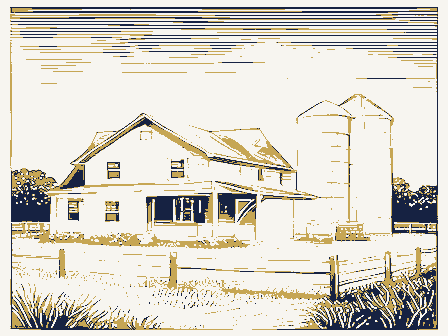
7/21/80 JUN 5 JUL 2 4 1980 Circleville March 1979 Columbus Landmarks Foundation of house and brick smokehouse View of facade and south elevation HORSEY-BARTHELMAS FARM Pickaway County, Ohio 25963 S.R.164 1980 25963 S.R. 104 JUN 5 JUL 2 4 1980 Circleville March 1979 Columbus Landmarkw Foundation View of barn and blacksmith shop HORSEY-BARTHELMAS FARM from the raad Pickaway County, Ohio 1980 Pickaway County, Ohio Photo: Ohio Department of Transportation,1978 JUN 5 Horsey-Barthelmas Farm, Circleville Vicinity, Negative: Same as above Aerial View of Farm Scale: 1 = 250 JUL 24 1980 373 WILLIAMSPORT, OH UNITED STATES DEPARTMENT OF THE INTERIOR GEOLOGICAL SURVEY STATE OF OHIO DIVISION OF GEOLOGICAL SURVEY WILLIAMSPORT QUADRANGLE Mapped, edited, and published by the Geological Survey OHIO 830000 FEET FEB 25 1980 OHIO Department of James A. Rhodes/Governor David L.
Weir/Director 25 South Front Street P. O. Box 899 Columbus, Ohio 43216 February 20, 1980 Mr. David L. Brook State Historic Preservation Officer I-71 and 17th Avenue Re: National Register Nomination Horsey - Barthelmas Farm 25963 S.R. 104 Pickaway County, Ohio Dear Mr. Brook: We have received a copy of your letter dated February 5, 1980, regarding Register of Historic Places. As you may be aware, the Barthelmas Farm is has brought to light several errors which need to be corrected prior to final consideration of the proposed nomination. These items are presented below for your consideration. Part 4 - the property owner's name should be William Barthlemas. Part 7 Description - The existing structures of the original farm braced frame shed present today southwest of the barn is not the The first,seventh, and eighth paragraphs of this section should be revised accordingly.
TRANSPORTATION JUN5 REGISTER NATIONAL Ohio Historical Center resource survey has been conducted.Additional historical research on the original building but situates on the site of the blacksmith located near the south end of a proposed highway project and was discussed in the Preliminary Archaeological Survey Report Barthelmas property and review of the National Register nomination form Mr. David Brook February 20, 1980 Page 2 Barthelmas and Barbara Glouse on November 9, 1854. Paragraph 5 - The drawing referred to is not illustrated in the The remaining outbuildings west of the house are of recent JUN 5 construction. REGISTER drawn (1877).
NATIONAL The significant structures of the Horsey- Barthelmas Farm consist Horsey -Barthelmas Complex was built and used as a stagecoach Historically- The closest town to the Barthelmas Farm was the refer to the town in the nomination form. Paragraph 4- The statement is made that the Horsey Farm was settlement of Westfall located on the site of the Shawnee town purchased in 186l by George Barthelmas.The County Atlas dated the remains of the residential unit and were built about 1825 on the Westfall is still marked on the USGS quadrangle, was the Sisk-Westfall Road) was a farm owned by 187l shows that at that time the farm was owned by Robert County Atlas(published 187l)but is in the possession of the businesses there. settlement substantially declined after 1840. However, since stop, and is located only 3/4 mile away, it may be desirable to 3. Part 8 Barthelmas Family.
The drawing is captioned "G. Barthelness Part 10 front yard, disturbing most of the area between the house and the Significance Geographical Data property was purchased by George Barthelness sometime between principal settlement in the immediate area at the time the west side of S.R.104.The buildings were constructed approximately the time the atlas was published and the picture was County 4,page 23) records the marriage of Conrad Mr.
David Brook February 20, 1980 Page 3 the 1og barn, with attached shed, a blacksmith shop, and a dry goods Since these two complexes were built at different times, represent 1) UMT Zone 17, EASTING 327400, NORTHING 4380100 1) UTM Zone 1Z, EASTING 327510, NORTHING 4380030 barn, southwesterly for a distance of 120' to the NW corner 120' along a line parallel to the axis of the barn; thence 35'; thence 35' along a westerly line back to the starting today. point. boundary descriptions. REGISTER historically accurate to treat them as two different parcels of the the bridge.
southern edge of the drive for a distance of approximately land which has not been altered by past activities and will help northeasterly along the edge of the pond for a distance of S.R.104.Mapping is attached to help clarify the proposed verbal Residential Complex - Point source reference located at center Verbal Description:Beginning at the NW corner of the 275' to the gravel drive;thence northeasterly along the corner of the bridge over the southern end of the pond, with both farming and the stagecoach stop. Only the log barn remains Around 1840 a second complex was built east of S.R. 104 consisting of NATIONAL' Verbal Description:Beginning at a point located at the NW northwesterly along the 670'contour for a distance of of house. 275';thence south along a line parallel to the west side Barn -Point source reference located at center of barn.
a distance of 75'; thence northeasterly for a distance of of the frame shed; thence easterly along the dirt drive for of the house along the drive for a distance of 270'back to In view of this, UMT's centered on the house and barn are significant structures. JUN 5 been separated by the public road, it is both logical and perhaps presented for consideration which provide a buffer zone around the These proposed boundaries delineate the store. These structures comprised the commercial complex associated avoid future problems with maintenance and improvement projects on Mr. David Brook February 20, 1980 Page 4 Charles R. Tripp, P.E. Bureau of Environmental Services CRT: af4 JUN comments.
Administrator REGISTER NATIONAL Attachments OHSPAB meeting.Please advise us of the board's actions regarding these proposed nomination comes up for final review at the April 25,1980, We hope that the preceeding comments will be favorably considered when the Very truly yours, O PROJECT AREA YAP - Figure 11 JUN 5 PROPOSED STATE ROUTE 104 PICKAWAY COUNTY, OHIO 1979 IMPROVEMENT NATIONAL REGISTER ME RUN RECEIVED U.S. DEPARTMENT OF THE INTERIOR HERITAGE CONSERVATION AND RECREATION SERVICE 2. ADDRESS (Tel. No. if needed) June 1978 OFFICE FHR-8-227 TELEPHONE REPORT 614-466-1500 3. SUBJECT, PROJECT NO., ETC. . DETAILS OF DISCUSSION DATE Harris, Stephen R., House, Honorable John H. Glenn, Jr. Honorable Howard M. Metzenbaum Mr. David Brook Columbus, Ohio 43211 For further information, please call the National Register at (202)343-6401.
Location Crawford County Name STATE Byers/mjd 8/7/80 Also Notified Date Entered Circleville vicinity (Rosedale Cottage) Honorable Tennyson Guyer Horsey-Barthelmas Farm Honorable William H. Harsha State Historic Preservation Officer Pickaway County ENTRIES IN THE NATIONAL REGISTER The Ohio Historical Society Interstate 7l at 17th Avenue JUL 2 4 1980 Bucyrus OHIO
 Block
Block