 Block
Lamoille, Nevada
15 topographic sheets cover this place, the earliest surveyed in 1935 and the latest in 1990. It stands in the Elko census division. It lies in ZIP code area 89828. It stands on Snell Creek. The Survey maps it on the Lamoille quadrangle. 130 people lived here at the 2020 count. It stands 5,889 feet above sea level.
On record in Lamoille
Buildings and businesses the archive holds for this place. Each opens its own page, with the source record it came from.
On the National Register 1 record
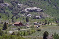 Lamoille Organization Camplisted 2007
Population over time
2 figuresLamoille grew from 105 to 130 between 2010 and 2020. These are the recorded population figures Wikidata holds for this place, reached through the Geographic Names Information System number this page is keyed on rather than by name, so they belong to this place and not to another of the same name. Most are census counts, but not all are: an early figure may be a founding or settlement estimate, and an estimate published within five years of a census is left out. The change column is computed, and is left blank where more than 20 years separate a figure from the one before it, because a gap that long is not a change between two counts.
| Year | People | Change |
|---|---|---|
| 2010 | 105 | |
| 2020 | 130 | +25 (+24%) |
Topographic sheets covering this place
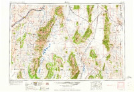
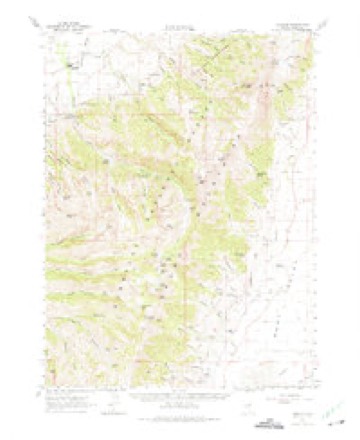
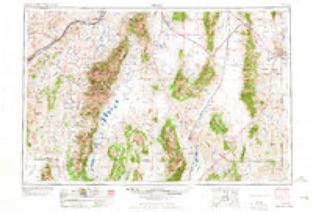
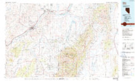
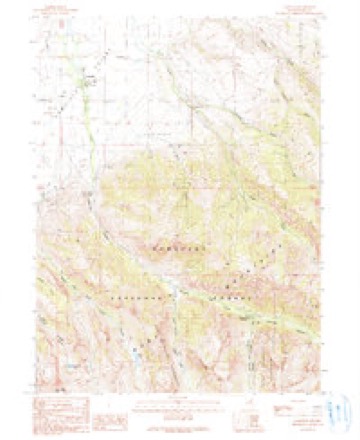
8 surveys from 15 printed sheetsMatched by testing this settlement's coordinate against the published boundary of every sheet in the United States Geological Survey's historical collection. Each opens the scanned sheet at the Survey.
- 1935 USGS Halleck quadrangle1:125000, 3 printings
- 1955 USGS Elko quadrangle1:250000, 3 printings
- 1958 USGS Elko quadrangle1:250000, 2 printings
- 1962 USGS Elko quadrangle1:250000
- 1962 USGS Lamoille quadrangle1:62500, 2 printings
- 1965 USGS Elko quadrangle1:250000
- 1986 USGS Elko quadrangle1:100000
- 1990 USGS Lamoille quadrangle1:24000, 2 printings
Fires near this place
43 since 1999Regional context, not property-specific evidence. The federal wildfire occurrence database lists 43 fires within 5 miles of Lamoille between 1999 and 2020, burning about 10,964 acres in total. 12 started naturally. 1 was recorded as arson. Distance is straight-line from the map coordinates, so a fire counted here may appear on a neighbouring settlement's page as well.
| Reported cause | Fires |
|---|---|
| Missing data/not specified/undetermined | 18 |
| Natural | 12 |
| Equipment and vehicle use | 5 |
| Recreation and ceremony | 4 |
| Debris and open burning | 2 |
| Arson/incendiarism | 1 |
| Power generation/transmission/distribution | 1 |
The most recent of them, most recent first, with the day each was reported and the service that recorded it.
| Date | Cause | Size | Reported by | Name on the report |
|---|---|---|---|---|
| 30 September 2018 | Missing data/not specified/undetermined | 9,205 acres | Humboldt-Toiyabe National Forest | RANGE TWO |
| 3 September 2020 | Missing data/not specified/undetermined | under an acre | Elko County Fire Protection District | LOWER CANYON |
| 11 September 2009 | Recreation and ceremony | under an acre | Humboldt-Toiyabe National Forest | POWER HOUSE |
| 5 August 2012 | Natural | under an acre | Humboldt-Toiyabe National Forest | LAMOILLE |
| 5 August 2012 | Natural | 264 acres | Humboldt-Toiyabe National Forest | COLD CREEK |
| 29 August 2017 | Natural | 1,129 acres | Elko District Office | RABBIT CREEK |
| 27 August 2017 | Missing data/not specified/undetermined | under an acre | Elko District Office | LIONS CAMP |
| 27 August 2017 | Missing data/not specified/undetermined | under an acre | Elko District Office | LAMOILLE |
Settlements close enough to share some of these fires:
Mines and quarries near this place
2 within 5 milesRegional context, not property-specific evidence. The federal mineral resources record lists 2 workings within 5 miles of Lamoille: 2 occurrences. None of them still produces. What was taken out: Stone, Crushed/Broken, Marble, Dimension. Distance is straight-line from the map coordinates, so a quarry counted here may appear on a neighbouring settlement's page as well.
| Where | Site | Commodity | Status | Recorded |
|---|---|---|---|---|
| Bald Mtn | Stone, Crushed/Broken | Occurrence | ||
| Marble Occurrence | Marble, Dimension | Occurrence |
Storms near this place
16 since 2003Regional context, not property-specific evidence. The National Weather Service names Lamoille in 16 storm reports between 2003 and 2023: 6 flash flood, 4 debris flow, 2 thunderstorm wind, 2 flood. No death or injury is recorded in these reports. Each account below is quoted exactly as the forecast office filed it, from the NOAA Storm Events Database, and each date opens the federal record of that event.
| When | Event | Place named | Harm | What the report says |
|---|---|---|---|---|
| August 2021 | Flash Flood | Lamoille | $800,000 | At least 15 different debris flows were caused by previous thunderstorms/heavy rain during the afternoon. Multiple reports came from the US Forest Service, Elko County Road Department, and Nevada Department of Transportation. USFS 660 will be closed until further notice. The height of debris flows is estimated to be between 4 and 8 feet within a 4-mile length of road. |
| June 2010 | Flood | Lamoille | $9,000 | Lamoille Creek swelled by snow melt flooded multiple residential properties and a few businesses in the town of Lamoille. For a brief time water flowed over Lamoille highway. |
| June 2010 | Flood | Lamoille | $7,000 | Flooding of Lamoille Creek undermined a retaining wall in the Thomas Canyon campground. |
| August 2022 | Debris Flow | Lamoille | $5,000 | A 1.5 to 2 mile stretch of road was closed in Lamoille Canyon after a couple of debris flows occurred depositing fine sand, mud, and stones on the roadway. The road was closed for 3 hours for cleanup. The BURN2 RAWS station placed last summer near the Thomas Canyon Campground in Lamoille Canyon measured 0.57 inches of rain in 1 hour, from 15:45 LT to 16:45 LT. At 17:42LT a shift log entry referenced a phone call from a Forest Service representative that said there were some debris flows and that the road was closed. It was reopened at 20:45LT after crews cleared the road. |
| July 2017 | Thunderstorm Wind | Lamoille | $1,000 | Thunderstorm winds estimated up to 60 mph caused damage to a fence. Damages are estimated. |
| July 2023 | Flash Flood | Lamoille | - | Lamoille Canyon Road (Forest Service Road 660) on the Humboldt-Toiyabe National Forests Mountain City-Ruby Mountains-Jarbidge Ranger District near Elko, Nevada, was closed to motorized vehicles from Thomas Canyon Campground to Roads End Trailhead due to multiple debris slides that occurred in Lamoille canyon dude to heavy rainfall. A portable RAWS site in the canyon measured 1.04 inches in an hour preceding the mudslides. |
| April 2023 | Debris Flow | Lamoille | - | Moisture locked up in mountain snow began to melt in Lamoille Canyon from temperatures in the 60s and 70s. This caused large rocks and boulders to fall onto and close USFS-660 from the Powerhouse Group Picnic Area to Thomas Canyon Campground. |
| August 2022 | Debris Flow | Lamoille | - | A USGS Hydrologist relayed through dispatch at approximately 19:15LT that there was a minor debris flow 1.9 miles above the Thomas Canyon Campground. The BURN2 station located at Thomas Canyon Campground recorded 0.15 in the previous 3 hours. Although the Lamoille #3 SNOTEL reported over 1 inch for the past 6 hours, with 0.7 inches reported ending at 1500LT and an additional 0.5 for the hour ending at 1600LT, although SNOTELs only report to the nearest tenth of an inch. Additionally, neither MRMS nor Dual Pol had been reporting anything significant over the Rubies since 1600LT. Although there was some debris on the road, the material was small enough that driving through it was manageable. |
| August 2022 | Debris Flow | Lamoille | - | On the evening of August 12th, Lamoille Canyon received some brief periods of heavy rainfall. The BURN2 site located at the Thomas Canyon Campground in Lamoille Canyon recorded 0.34 inches that fell over a 15-minute span from 2100 to 2115LT. The area continued to get some more rain and ended up with 0.49 inches in 1 hour from 2100 to 2200 LT. Shortly thereafter a debris flow was reported in the area by a hydrologist from the USGS. Some water, mud, silt, and small rocks washed over the road depositing the silt and mud on the roadway. The hydrologist reiterated that 0.25 inches for 15 minutes or 1 inch/hr seem to be a good threshold for debris flows to occur. |
| July 2021 | Flash Flood | Lamoille | - | Prolonged and heavy rainfall from showers parked over the Ruby Mountains produced radar estimated rainfall accumulations of 2 to 3 inches. This caused flash flooding and an area of debris flow including mud, sand, and rock over the roadway. It was estimated some spots of debris be 2 to 4 feet deep on the roadway per photos and first-hand reports. |
| September 2013 | Flash Flood | Lamoille | - | National Weather Service employees reported three separate areas of water, mud, and debris, which flowed across the road in Lamoille Canyon. Most of the flash flooding was below Thomas Canyon campground. |
| September 2013 | Flash Flood | Lamoille | - | NWS employee reported at least 1 foot of mud and debris covered the road. |
| June 2004 | Tornado (F0) | Lamoille | - | Two off duty NWS employees saw small rope-like tornado approximately 5 miles north of the town of Lamoille. It appeared to be moving slowly towards the south. |
| August 2003 | Flash Flood | Lamoille | - | The Elko County sheriff reported a mudslide across the road in Lamoille Canyon blocked half of the roadway. |
| July 2015 | Hail | Lamoille | - | no account filed |
| June 2006 | Thunderstorm Wind | Lamoille | - | no account filed |
Nearest settlements
The eight closest, with where each one stands in the county. Distances are straight-line, computed from the Geographic Names Information System coordinates.
| Map | Place | Distance | Sheets |
|---|---|---|---|
| Pleasant Valley | 2.2 miles | 10 | |
| Voight (historical) | 3.2 miles | 12 | |
| Brennen Ranch | 5.5 miles | 10 | |
| Spring Creek | 5.7 miles | 10 | |
| Lee | 13.0 miles | 10 | |
| Fair Play (historical) | 13.6 miles | 14 | |
| Elburz | 13.9 miles | 11 | |
| Coral Hill (historical) | 14.4 miles | 10 |
Elsewhere
Matched on this settlement's Geographic Names Information System number rather than its name, so it cannot be a different place of the same name in another state.
| Wikipedia article on Lamoille | An encyclopaedic summary. Its text is share-alike, so it is linked here rather than copied. |
| Wikidata item Q3452155 | The structured record the population and elevation above come from. Public domain (CC0). |
Provenance
This settlement is recorded in the Geographic Names Information System as feature 860296. The sheet list is computed by point-in-boundary test against the United States Geological Survey's historical topographic inventory. Both are works of the United States government and carry no copyright under 17 U.S.C. 105.
Wildfire. Short, Karen C. 2022. Spatial wildfire occurrence data for the United States, 1992-2020 [FPA_FOD_20221014]. 6th Edition. Fort Collins, CO: Forest Service Research Data Archive. https://doi.org/10.2737/RDS-2013-0009.6 Collected with United States Government funding and usable without additional permissions or fees.
Mines and quarries. USGS Mineral Resources Data System (MRDS) https://mrdata.usgs.gov/mrds/ A work of the United States government, no copyright under 17 U.S.C. 105.
Storms. NOAA National Centers for Environmental Information, Storm Events Database https://www.ncei.noaa.gov/stormevents/ A work of the United States government, no copyright under 17 U.S.C. 105. Narratives are quoted verbatim from the National Weather Service report and are not edited or summarised.