BlockBefore
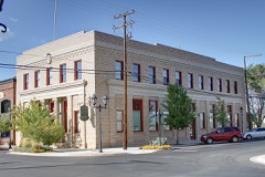
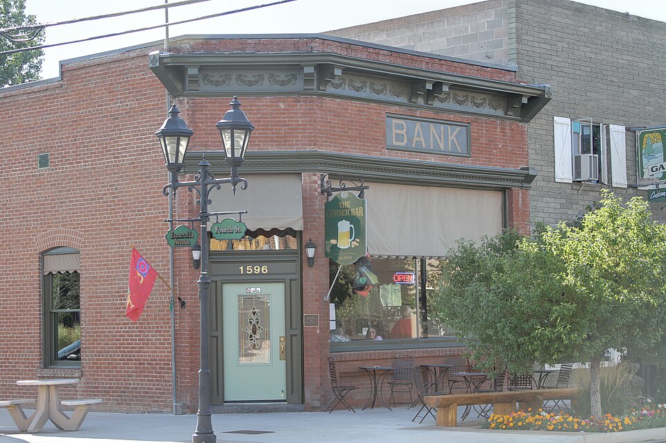
Photograph of Farmer's Bank of Carson Valley
Photograph by Asilvero, CC BY-SA 3.0. Via Wikimedia Commons.

Farmers' Bank of Carson Valley

Listed on the National Register of Historic Places in 2000.

From the record

“Farmer's Bank of Carson Valley is a historic bank building located at 1596 Esmeralda Avenue in Minden, Nevada. The building was built in 1909 to house the Farmer's Bank of Carson Valley, which was chartered in the same year.”

Wikipedia article Farmer's Bank of Carson Valley (1596 Esmeralda Avenue, Minden, Nevada), CC BY-SA 4.0.

One of 24 National Register listings published here for Douglas County · listed in 2000 · category: Building.

Sources: the Wikipedia article · the case file at the National Archives · the National Register database, National Park Service · the Wikipedia article
The listing

  • What is counted as historic. The nomination lists 1 building as contributing to the listing.
  • Address. 1596 Esmeralda Ave., Minden, 89423
  • When was it listed? April 2000
  • Category. building
  • Census division. Gardnerville-Minden
  • Architectural style. Renaissance Revival architecture
  • National Register reference number. 00000338 - the number the National Park Service assigned this property when it was listed, and the key its nomination file is catalogued under at the National Archives.

Fires near this property

19 since 1992

Regional context, not property-specific evidence. The federal wildfire occurrence database lists 19 fires within 5 miles of Farmers' Bank of Carson Valley between 1992 and 2020, burning about 21 acres in total. 4 started naturally. None was recorded as arson. Distance is straight-line from the map coordinates, so a fire counted here may appear on a neighbouring settlement's page as well.

Reported cause Fires
Debris and open burning4
Natural4
Missing data/not specified/undetermined4
Equipment and vehicle use2
Recreation and ceremony2
Misuse of fire by a minor1
Power generation/transmission/distribution1
Firearms and explosives use1

The most recent of them, most recent first, with the day each was reported and the service that recorded it.

DateCause SizeReported by Name on the report
30 August 2009Missing data/not specified/undeterminedunder an acreHumboldt-Toiyabe National ForestWALLEY
3 August 2017Naturalunder an acreHumboldt-Toiyabe National ForestMOTT
29 August 2017Missing data/not specified/undeterminedunder an acreEast Fork Fire and Paramedic District88
23 August 2018Missing data/not specified/undetermined9.0 acresCarson City District OfficeRANCH
31 July 1995Debris and open burningunder an acreCarson City District OfficeBIA 12
28 July 2001Recreation and ceremonyunder an acreLake Tahoe Basin Management UnitWARRIOR
26 July 1997Naturalunder an acreHumboldt-Toiyabe National ForestLOWER ROAD
21 July 1994Recreation and ceremonyunder an acreCarson City District OfficeBAKER

Every fire recorded in Douglas County

Mines and quarries near this property

9 within 5 miles

Regional context, not property-specific evidence. The federal mineral resources record lists 9 workings within 5 miles of Farmers' Bank of Carson Valley: 4 past producers, 3 producers, 2 occurrences. 3 still produce. What was taken out: Sand and Gravel, Construction, Sulfur, Uranium, Thorium, Geothermal. Distance is straight-line from the map coordinates, so a quarry counted here may appear on a neighbouring settlement's page as well.

Where SiteCommodity StatusRecorded
Hunch and Lucky Strike ClaimsUranium, ThoriumOccurrenceAllanite
Sawmill PitStone, Crushed/BrokenProducer
Section 15 Gravel PitSand and Gravel, Construction, SulfurOccurrence
Valleys Hot SpringGeothermalProducer
Bing Materials Pit & PlantSand and Gravel, ConstructionProducer
Gravel PitSand and Gravel, ConstructionPast Producer
Johnson Genoa PitSand and Gravel, ConstructionPast Producer
Nev. Contractors Sand & Gravel PitSand and Gravel, ConstructionPast Producer
Rancho PitSand and Gravel, ConstructionPast Producer

Every working recorded in Douglas County

Storms near this property

8 since 2001

Regional context, not property-specific evidence. The National Weather Service names Minden, the town this property stands in, in 8 storm reports between 2001 and 2018: 4 heavy rain, 2 flood, 1 lightning, 1 flash flood. No death or injury is recorded in these reports. Each account below is quoted exactly as the forecast office filed it, from the NOAA Storm Events Database, and each date opens the federal record of that event.

WhenEvent Place namedHarm What the report says
January 2006FloodMinden$524,000no account filed
July 2001LightningMinden$2,000no account filed
November 2018Heavy RainMinden-CO-OP Observer in Minden reported 0.52 inches of rainfall from 21 November 1100PST to 22 November 0600PST.
April 2018FloodMinden-Trained weather spotter reported that the East Fork of the Carson River was above its banks between Cedarwood Drive and Muller Lane. Ending time of flooding is based upon data from a nearby USGS gauge.
May 2018Heavy RainMinden-COOP observer station MINN2, Minden reported 0.58 inches of rainfall over a 24-hour period from 24 May 0500PST to 25 May 0500PST.
July 2005Flash FloodMinden-Heavy rainfall over the Pine Nut Mountains caused flash flooding in the Johnson Lane area north of Minden. Several roads were closed because of the high water.
July 2003Heavy RainMinden-A spotter measured .60 inches of rain in 15 minutes from a thunderstorm.
November 2002Heavy RainMinden-24 hour rainfall total of 1.75 inches.

Every storm recorded in Douglas County

Map coverage status

No historic map-sheet match is published for this property yet. That does not mean no map exists. This record needs a coordinate-quality review before it can be joined to a sheet boundary. Browse the county's mapped places while that work is pending.

Listed places nearby

6 within 8 miles

Other National Register properties close enough to walk or drive between, ordered by distance from this one. Both positions come from the same geocoding pass that matched these properties to their map sheets.

Photograph PropertyDistance Listed
Carson Valley Improvement Club Hallunder 500 feet1983
Minden Innunder 500 feet1986
Farmers Bank of Carson Valleyunder 500 feet1986
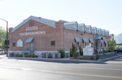
Minden Flour Milling Company0.1 miles1978
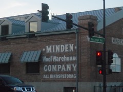
Minden Wool Warehouse0.2 miles1986
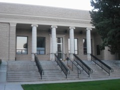
Douglas County Courthouse0.2 miles1986

Sources for this property

National Archives recordThe nomination case file for reference 00000338 in Record Group 79.
Wikipedia articleCommunity-written account of this property, licensed CC BY-SA.
Douglas CountyAll 24 listed properties in this county.

Provenance

  • Listing record. National Park Service National Register of Historic Places, listed-properties dataset, current to 2026-05-22.
  • Map join. Address geocoded through the United States Census geocoder, then tested against the published boundary of every sheet in the USGS Historical Topographic Map Collection.
  • How this page is made. Listing fields come from federal records; map-sheet coverage is a labelled coordinate-to-boundary calculation, not a source-field claim.
  • Wildfire. Short, Karen C. 2022. Spatial wildfire occurrence data for the United States, 1992-2020 [FPA_FOD_20221014]. 6th Edition. Fort Collins, CO: Forest Service Research Data Archive. https://doi.org/10.2737/RDS-2013-0009.6 Collected with United States Government funding and usable without additional permissions or fees.
  • Mines and quarries. USGS Mineral Resources Data System (MRDS) https://mrdata.usgs.gov/mrds/ A work of the United States government, no copyright under 17 U.S.C. 105.
  • Storms. NOAA National Centers for Environmental Information, Storm Events Database https://www.ncei.noaa.gov/stormevents/ A work of the United States government, no copyright under 17 U.S.C. 105. Narratives are quoted verbatim from the National Weather Service report and are not edited or summarised.