BlockBefore
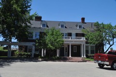
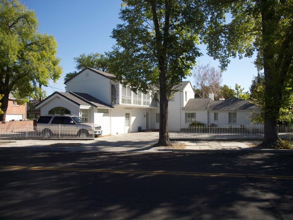
Photograph of Luella Garvey House
Photograph by Gillfoto, CC BY-SA 3.0. Via Wikimedia Commons.

Luella Garvey House

Listed on the National Register of Historic Places in 2004.

From the record

One of 83 National Register listings published here for Washoe County · listed in 2004 · category: Building.

Sources: the case file at the National Archives · the National Register database, National Park Service · the Wikipedia article
The listing

  • What is counted as historic. The nomination lists 1 building as contributing to the listing.
  • Listed as. Garvey, Luella, House - the National Register files a house under its owner's surname.
  • Address. 589-599 California Ave., Reno
  • When was it listed? January 2004
  • Category. building
  • Census division. Reno Southwest
  • Architectural style. Colonial Revival architecture
  • Architect. Paul R. Williams
  • National Register reference number. 03001510 - the number the National Park Service assigned this property when it was listed, and the key its nomination file is catalogued under at the National Archives.

Fires near this property

99 since 1992

Regional context, not property-specific evidence. The federal wildfire occurrence database lists 99 fires within 5 miles of Luella Garvey House between 1992 and 2020, burning about 17,059 acres in total. 9 started naturally. 7 were recorded as arson. Distance is straight-line from the map coordinates, so a fire counted here may appear on a neighbouring settlement's page as well.

Reported cause Fires
Missing data/not specified/undetermined44
Recreation and ceremony11
Natural9
Equipment and vehicle use8
Arson/incendiarism7
Debris and open burning5
Misuse of fire by a minor5
Smoking4
Fireworks3
Power generation/transmission/distribution3

The most recent of them, most recent first, with the day each was reported and the service that recorded it.

DateCause SizeReported by Name on the report
26 September 2019Missing data/not specified/undetermined25 acresHumboldt-Toiyabe National ForestEVANS CREEK
23 September 2006Misuse of fire by a minor5.0 acresHumboldt-Toiyabe National ForestEISENBERG
22 September 2006Missing data/not specified/undetermined2.0 acresHumboldt-Toiyabe National ForestKEYSTONE2
21 September 1994Smokingunder an acreHumboldt-Toiyabe National ForestUSFS 099
20 September 2009Misuse of fire by a minorunder an acreCarson City District OfficeHIGHWAY QUEEN
20 September 1995Recreation and ceremonyunder an acreHumboldt-Toiyabe National ForestCHIP
18 September 2017Natural50 acresCarson City District OfficeWOODCHUCK
17 September 2011Missing data/not specified/undetermined1.5 acresCarson City District OfficeRNOX 22

Every fire recorded in Washoe County

Mines and quarries near this property

10 of 32 shown

Regional context, not property-specific evidence. The federal mineral resources record lists 32 workings within 5 miles of Luella Garvey House: 14 past producers, 11 occurrences, 4 prospects, 2 producers. 3 still produce. What was taken out: Gold, Silver, Sand and Gravel, Construction, Silver, Gold. Distance is straight-line from the map coordinates, so a quarry counted here may appear on a neighbouring settlement's page as well.

Where SiteCommodity StatusRecorded
(Facility) United States Platinum RefineryREE, Uranium, Silver, Platinum, GoldPlant
Arkell MineSilver, Gold, Antimony, Lead, ZincPast ProducerAnglesite, Argentite, Galena, Pyrite, Sphalerite
Black Panther AreaTitanium, MetalOccurrenceVein
Black Panther Mine AreaTitaniumOccurrence
Chalk BluffDiatomitePast Producer
Desert King MineGold, Silver, Lead, Zinc, AntimonyPast ProducerAnglesite, Argentite, Galena, Pyrite, Sphalerite
Moana SpringsGeothermalProducer
Reno MayGold, Silver, Lead, ZincOccurrenceGalena, Pyrite
Unnamed MineGold, Boron-BoratesPast ProducerVein
Unnamed Prospect, Sec 29Silver, Gold, CopperOccurrenceEnargite, Galena, Pyrite, Sphalerite

Every working recorded in Washoe County

Storms near this property

39 since 1993

Regional context, not property-specific evidence. The National Weather Service names Reno, the town this property stands in, in 39 storm reports between 1993 and 2025: 13 heavy rain, 8 hail, 8 thunderstorm wind, 3 lightning. The reports record 5 injuries. Each account below is quoted exactly as the forecast office filed it, from the NOAA Storm Events Database, and each date opens the federal record of that event.

WhenEvent Place namedHarm What the report says
September 2011LightningWest Reno4 hurtLightning from a thunderstorm over the McQueen High School soccer field struck between two sets of bleacher seats on the afternoon of the 24th, causing 4 injuries. Two of the injured went to the hospital and were in stable condition while two others refused treatment. One man had his hair singed and the left half of his shirt burned.
May 1997LightningReno1 hurtA man was struck by lightning while walking in Idlewild Park in Reno, NV. He was injured and taken to the hospital for treatment.
July 2000Dust DevilReno$1,000A dust devil damaged several outdoor booths during a special events celebration.
July 2002Thunderstorm WindReno$1,000no account filed
May 2009Dust DevilReno$500A dust devil was observed in a field west of Pyramid Highway at Calle de la Plata north of Reno.
July 2002Thunderstorm WindReno$500no account filed
July 2025HailReno-Public reported 1 inch hail in south Reno. There were also multiple reports of 0.75 inch hail and accumulating hail throughout the city.
January 2023Heavy RainReno-COCORAHS stations located 1.7 mi E of Sparks, NV (NV-WH-31), and 1.7 mi WSW of Reno, NV (NV-WH-133), reported a 24 hour rainfall amounts of 0.97 and 0.99 inches respectively.
March 2023Heavy RainReno-A COCORAHS, NV-WH-164, located 22.1 mi NNW of Reno, NV, and COCORAHS, NV-WH-19 Verdi, located 9.0 mi W of Reno, NV, reported 24-hour rainfall totals of 1.7 inches and 1.8 inches respectively.
January 2019Heavy RainWest Reno-Mesonet AU849 3 miles west of Reno reported 1.50 inches of rainfall in a 24 hour period from 16 January 0826PST to 17 January 0826PST. Mesonet elevation 5174 feet MSL.
January 2019Heavy RainReno-CoCoRaHS station NV-WH-133 2 miles west-southwest of Reno reported 1.00 inch of rainfall in a 24 hour period from 16 January 0800PST to 17 January 0800PST.
April 2018Heavy RainWest Reno-Trained weather spotter 4 miles south-southwest of Reno reported 0.65 inches of storm total rainfall from 6 April 0210PST to 7 April 1410PST.
May 2018Heavy RainReno-Mesonet station ALMN2, 5 miles southwest of Reno (elevation 6160 feet) reported 1.11 inches of rainfall in a 24-hour period from 16 May 0130PST to 17 May 0130PST.
August 2014HailWest Reno-The hail occurred at McQueen High School.
July 2010Thunderstorm WindWest Reno-This report was from the same thunderstorm that produced the 1655PST gust at the NWS office.
July 2008HailReno-A trained weather spotter reported 3/4 inch hail at the intersection of South McCarran and Kietzke in Reno.
July 2004Tornado (F0)Reno-An F0 tornado was spotted in Cold Springs, north of Reno. No damage was reported. The weak tornado lasted less than 2 minutes.
August 2004Heavy RainReno-A total of 0.75 inches of rain fell in 45 minutes in Palomino Valley north of Reno.
July 2004Flash FloodReno-Flash flooding occurred in Palomino Valley, north of Reno. The main flooding was along Whiskey Springs, Amy, Chieftain, and Pasture View Roads.
June 2003Heavy RainReno-A storm spotter in northwest Reno measured nearly one half inch of rain, .43, from a thunderstorm in less than 20 minutes.
August 2003Heavy RainReno-One half inch of rain fell in 25 minutes from a thunderstorm.
July 2003Heavy RainReno-A weather spotter estimated that .25 inches of rain fell in 10 minutes from a thunderstorm. Minor street flooding was observed.
November 2002Heavy RainReno-Spotter in southwest Reno reported 1.25 inches of rain.
August 2002HailReno-3/4 inch hail
August 2000LightningReno-Newspaper report of several lightning-caused fires. Residents were evacuated, but no homes were lost.
September 1999Thunderstorm WindReno-Thunderstorm wind gusts of 64 mph recorded by automated weather sensor 10 miles NNE of Reno.
September 1999Thunderstorm WindReno-Thunderstorm wind gusts of 60 kts observed at Reno National Weather Service office.
September 1999Thunderstorm WindReno-Spotter report of thunderstorm winds of 63 mph in southwest Reno.
September 1998FloodReno-10 minute rainfall in SW Reno: 0.20 inches due to thunderstorm resulting in minor street flooding and ponding on roads.
September 1998Heavy RainReno-45 minute rainfall: 0.71 inches from thunderstorm reported by spotter 5 miles north of Reno.
July 1997Thunderstorm WindReno-A weather spotter in Reno reported a wind gust to 51 kts from a severe thunderstorm.
August 1997Funnel CloudReno-An off-duty NWS employee reported a funnel cloud just north of Peavine Mountain near Reno. It lasted for about five minutes before dissipating.
October 1993HailReno-One inch diameter hail was reported in the Callahan Ranch area.
October 1993HailReno-Three quarter inch diameter hail was recorded by the Reno National Weather Service office.
October 1993HailReno-A storm spotter reported three quarter inch hail in Hidden Valley.
July 2002Thunderstorm WindReno-no account filed
July 2001WildfireReno-no account filed
January 1997Heavy RainReno-no account filed

Every storm recorded in Washoe County

Map coverage status

No historic map-sheet match is published for this property yet. That does not mean no map exists. This record needs a coordinate-quality review before it can be joined to a sheet boundary. Browse the county's mapped places while that work is pending.

Listed places nearby

6 within 8 miles

Other National Register properties close enough to walk or drive between, ordered by distance from this one. Both positions come from the same geocoding pass that matched these properties to their map sheets.

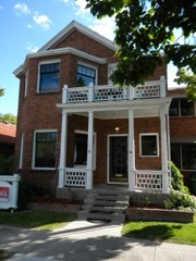
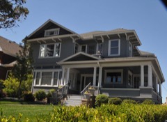
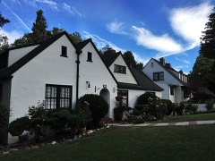
Photograph PropertyDistance Listed
Senator Francis G. Newlands Houseunder 500 feet1966
William J. Graham Houseunder 500 feet1983
Hawkins House0.1 miles1979
Miller-Rowe-Holgate House0.2 miles2005
Joseph H. Gray House0.2 miles1987
Newlands Historic District0.2 miles2016

Sources for this property

National Archives recordThe nomination case file for reference 03001510 in Record Group 79.
Wikipedia articleCommunity-written account of this property, licensed CC BY-SA.
Washoe CountyAll 83 listed properties in this county.

Provenance

  • Listing record. National Park Service National Register of Historic Places, listed-properties dataset, current to 2026-05-22.
  • Map join. Address geocoded through the United States Census geocoder, then tested against the published boundary of every sheet in the USGS Historical Topographic Map Collection.
  • How this page is made. Listing fields come from federal records; map-sheet coverage is a labelled coordinate-to-boundary calculation, not a source-field claim.
  • Wildfire. Short, Karen C. 2022. Spatial wildfire occurrence data for the United States, 1992-2020 [FPA_FOD_20221014]. 6th Edition. Fort Collins, CO: Forest Service Research Data Archive. https://doi.org/10.2737/RDS-2013-0009.6 Collected with United States Government funding and usable without additional permissions or fees.
  • Mines and quarries. USGS Mineral Resources Data System (MRDS) https://mrdata.usgs.gov/mrds/ A work of the United States government, no copyright under 17 U.S.C. 105.
  • Storms. NOAA National Centers for Environmental Information, Storm Events Database https://www.ncei.noaa.gov/stormevents/ A work of the United States government, no copyright under 17 U.S.C. 105. Narratives are quoted verbatim from the National Weather Service report and are not edited or summarised.