BlockBefore
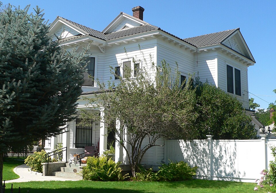
Photograph of Robison House (Sparks, Nevada)
Photograph by Ammodramus, CC0 1.0. Via Wikimedia Commons.

Robison House

Listed on the National Register of Historic Places in 2006.

From the record

“The Robison House in Sparks, Nevada, at 409 13th St., is a historic mansion-like house with Colonial Revival elements built c. 1904. The property includes small rental cottages used in Reno, Nevada's "divorce trade".”

Wikipedia article Robison House (Sparks, Nevada), CC BY-SA 4.0.

One of 83 National Register listings published here for Washoe County · listed in 2006 · category: Building.

Sources: the Wikipedia article · the case file at the National Archives · the National Register database, National Park Service · the Wikipedia article
The listing

  • What is counted as historic. The nomination lists 5 buildingss as contributing to the listing.
  • Address. 409 13th St., Sparks, 89431
  • When was it listed? September 2006
  • Category. building
  • Census division. Sparks
  • Architectural style. Colonial Revival architecture
  • National Register reference number. 06000895 - the number the National Park Service assigned this property when it was listed, and the key its nomination file is catalogued under at the National Archives.

Fires near this property

92 since 1992

Regional context, not property-specific evidence. The federal wildfire occurrence database lists 92 fires within 5 miles of Robison House between 1992 and 2020, burning about 18,506 acres in total. 9 started naturally. 7 were recorded as arson. Distance is straight-line from the map coordinates, so a fire counted here may appear on a neighbouring settlement's page as well.

Reported cause Fires
Missing data/not specified/undetermined40
Equipment and vehicle use10
Natural9
Arson/incendiarism7
Misuse of fire by a minor7
Fireworks5
Debris and open burning5
Smoking4
Power generation/transmission/distribution2
Other causes2
Recreation and ceremony1

The most recent of them, most recent first, with the day each was reported and the service that recorded it.

DateCause SizeReported by Name on the report
9 September 2018Missing data/not specified/undetermined25 acresCarson City District OfficeRIO ALAYNE
3 September 1997Natural379 acresCarson City District OfficeMUSTANG 2
27 September 2019Missing data/not specified/undetermined5.2 acresCarson City District OfficeMARTINI
27 September 2016Missing data/not specified/undeterminedunder an acreCarson City District OfficeMIDDLE FORK
26 September 1999Missing data/not specified/undetermined5.0 acresCarson City District OfficePARK
23 September 2018Misuse of fire by a minor2.6 acresCarson City District OfficeROCKY RIDGE
23 September 2006Misuse of fire by a minor5.0 acresHumboldt-Toiyabe National ForestEISENBERG
21 September 1994Smokingunder an acreHumboldt-Toiyabe National ForestUSFS 099

Every fire recorded in Washoe County

Mines and quarries near this property

10 of 20 shown

Regional context, not property-specific evidence. The federal mineral resources record lists 20 workings within 5 miles of Robison House: 8 past producers, 5 occurrences, 4 prospects, 2 producers. 3 still produce. What was taken out: Silver, Sand and Gravel, Construction, Gold, Silver, Gold. Distance is straight-line from the map coordinates, so a quarry counted here may appear on a neighbouring settlement's page as well.

Where SiteCommodity StatusRecorded
(Facility) United States Platinum RefineryREE, Uranium, Silver, Platinum, GoldPlant
Arkell MineSilver, Gold, Antimony, Lead, ZincPast ProducerAnglesite, Argentite, Galena, Pyrite, Sphalerite
Black Panther Mine AreaTitaniumOccurrence
Desert King MineGold, Silver, Lead, Zinc, AntimonyPast ProducerAnglesite, Argentite, Galena, Pyrite, Sphalerite
Moana SpringsGeothermalProducer
Reno MayGold, Silver, Lead, ZincOccurrenceGalena, Pyrite
Wedekind MineGold, Silver, Lead, Zinc, AntimonyPast ProducerAnglesite, Argentite, Galena, Pyrite, Sphalerite
Wedekind MineSilver, Zinc, Lead, Gold, CopperPast Producer
Mazy MineGold, Silver, Lead, ZincOccurrenceGalena, Pyrite, Sphalerite
Short Ranch PitStone, Crushed/BrokenPast Producer

Every working recorded in Washoe County

Storms near this property

35 since 1998

Regional context, not property-specific evidence. The National Weather Service names Sparks, the town this property stands in, in 35 storm reports between 1998 and 2025: 8 hail, 7 thunderstorm wind, 6 flood, 6 heavy rain. The reports record 1 injury. Each account below is quoted exactly as the forecast office filed it, from the NOAA Storm Events Database, and each date opens the federal record of that event.

WhenEvent Place namedHarm What the report says
August 1999LightningSparks1 hurtMan struck by lightning while trimming a tree
July 2019Heavy RainSparks$60,000KTVN Channel 2 News reported that the roof on Reed High School leaked during heavy rainfall from thunderstorms on the afternoon of 25 July. A nearby mesonet reported 0.21 inches of rainfall from 1703PST to 1803PST. According to Washoe County School District, three sections of the roof were being replaced at the time. All three sections leaked in multiple areas. Walls, ceilings, floors, and 36 computers were damaged by the rain water. Preliminary damage estimates were $40-60K according to the school district.
July 2025Flash FloodSparks$20,000Nevada DOT Reno reported flooding on Rock Blvd which prompted the closure of the road near I-80.
July 2005Flash FloodSparks$5,000Heavy rainfall caused flash flooding in the Spanish Springs area of Sparks. A total of 1.19 inches of rain was recorded at the weather observing station at Spanish Springs High School during a period of 30 to 40 minutes. Muddy water and small rocks flowed down streets above Vista Blvd. in Sparks.
July 2005Thunderstorm WindSparks$3,000Straight-line winds from a thunderstorm downburst caused damage along Pyramid Highway north of Sparks. Roofing tiles and metal siding was damaged on a house. Shingles were also blown off of another house.
July 2005Thunderstorm WindSparks$3,000Strong winds estimated at around 55 kt (63 mph) knocked over small trees and broke tree limbs near Vista Blvd. in Sparks. A stop sign was also reportedly blown over.
June 2006Thunderstorm WindSparks$1,000A wind gust estimated at 39 kt (45 mph) caused damage near Los Altos Parkway in Sparks. The Reno Gazette-Journal reported that a few fences were knocked down by the strong winds. One homeowner had six feet of wood fence destroyed, along with two screen-glass doors that were shattered.
August 1999Thunderstorm WindSparks$500A 14" tree branch was blown onto a car, minor damage reported.
August 2025Flash FloodSparks-Minor debris and roadway flooding on South Rock Blvd along both directions near Hymer Ave in Sparks. Additional flooding was reported throughout the city of Sparks, with rainfall estimations up to 1.15 inches.
July 2024FloodSparks-Law enforcement reported 0.25 mi SW of Sparks, NV, of ponding water over the roadway causing a portion of Rock Blvd to be temporarily closed.
July 2024Heavy RainSparks-A mesonet station NSPA (DRI) located 2.8 mi S of Sparks, NV, reported a total rainfall amount of 0.54 inches.
June 2021FloodSparks-Urban flooding of typical flood prone spots.
June 2021FloodSparks-Training thunderstorms produced heavy rainfall over Spanish Springs, particularly near Pyramid and La Posada. Standing water on many roads and field access impossible. Washoe Alert gauge reported 1.69 inches in 3 hours and that station was not in the core of the storms.
December 2021FloodSparks-NDOT closed I-80 and Rock Blvd underpass due to minor flooding.
December 2018Heavy RainSparks-CO-OP observer SRKN2 in Sparks reported 0.75 inches of rainfall in a 24-hour period from 24 December 0700PST to 25 December 0700PST.
March 2018Heavy RainSparks-CoCoRaHS station NV-WH-87, 1 mile north-northeast of Sparks reported 1.00 inch of storm total rainfall from 20 March 0535PST to 23 March 0535PST.
May 2018Heavy RainSparks-Mesonet C3920, 2 miles north-northeast of Sparks (elevation 4596 feet) reported 0.27 inches of rainfall within 15 minutes from 19 May 1633PST to 1648PST and 0.55 inches of rainfall within an hour from 19 May 1618PST to 1718PST.
May 2018Heavy RainSparks-CoCoRaHS station NV-WH-147, 6 miles south-southwest of Sparks reported 0.61 inches of rainfall in a 24-hour period from 24 May 0600PST to 25 May 0600PST.
July 2015Thunderstorm WindSparks-KRNV News 4 posted a picture of a 70 foot tree which fell onto a house in Sparks.
May 2009HailSparks-A trained weather spotter reported three-quarter-inch hail between Sun Valley and Sparks.
July 2006HailSparks-Nickel size hail (0.88 inch) was reported by an amateur radio operator in Spanish Springs.
July 2005Thunderstorm WindSparks-A 53 kt (61 mph) wind gust was reported at the wind sensor at Spanish Springs High School north of Sparks.
July 2005Thunderstorm WindSparks-A 53 kt (61 mph) wind gust was reported at the Desert Springs RAWS sensor.
June 2005Flash FloodSparks-A flash flood in the Sparks and Spanish Springs area was caused by very heavy rainfall. In a period of two hours 1.57 inches of rain fell in Sparks, causing flash flooding on Sparks Blvd. and at the intersection of Springland Drive and Baring Blvd. in Sparks.
July 2004HailSparks-Golfball-sized hail was reported in Palomino Valley, north of Reno.
August 2002Tornado (F0)Sparks-tornado in Spanish Springs
February 2000Tornado (F0)Sparks-Pilot and public reported a small tornado located 5 miles north of Sparks in Spanish Springs Valley. No injuries were reported and only minor property damage, the amount of which is unknown.
July 1999Tornado (F0)Sparks-Small tornado observed by off-duty NWS meteorologist in the hills east of Sparks. The tornado was on ground for approximately 2 minutes. Tornado remained over unpopulated area causing no damage. Path length and width are estimated.
July 1999FloodSparks-Off-duty NWS hydrologist reported heavy rain from thunderstorms caused street flooding in Sparks with water rising over bumpers on cars and up to businesses along the streets. Several streets temporarily closed. No damage or injuries reported.
September 1998FloodSparks-30 minute rainfall resulting in 8 inches of water flowing through Sparks Rib Cook-Off booths along Pyramid Way and Victorian Square. Minor flooding also reported along Rock Blvd, also in Sparks.
July 2005HailSparks-no account filed
July 2001HailSparks-no account filed

Every storm recorded in Washoe County

Map coverage status

No historic map-sheet match is published for this property yet. That does not mean no map exists. This record needs a coordinate-quality review before it can be joined to a sheet boundary. Browse the county's mapped places while that work is pending.

Listed places nearby

6 within 8 miles

Other National Register properties close enough to walk or drive between, ordered by distance from this one. Both positions come from the same geocoding pass that matched these properties to their map sheets.

Photograph PropertyDistance Listed
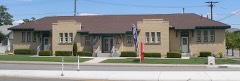
Bank of Sparks0.3 miles2007
Washoe County Library-Sparks Branch0.4 miles1992
Mary Lee Nichols School0.4 miles2002
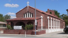
Immaculate Conception Church0.4 miles1992
Field Matron's Cottage1.6 miles2003
Rainier Brewing Company Bottling Plant2.2 miles1980

Sources for this property

National Archives recordThe nomination case file for reference 06000895 in Record Group 79.
Wikipedia articleCommunity-written account of this property, licensed CC BY-SA.
Washoe CountyAll 83 listed properties in this county.

Provenance

  • Listing record. National Park Service National Register of Historic Places, listed-properties dataset, current to 2026-05-22.
  • Map join. Address geocoded through the United States Census geocoder, then tested against the published boundary of every sheet in the USGS Historical Topographic Map Collection.
  • How this page is made. Listing fields come from federal records; map-sheet coverage is a labelled coordinate-to-boundary calculation, not a source-field claim.
  • Wildfire. Short, Karen C. 2022. Spatial wildfire occurrence data for the United States, 1992-2020 [FPA_FOD_20221014]. 6th Edition. Fort Collins, CO: Forest Service Research Data Archive. https://doi.org/10.2737/RDS-2013-0009.6 Collected with United States Government funding and usable without additional permissions or fees.
  • Mines and quarries. USGS Mineral Resources Data System (MRDS) https://mrdata.usgs.gov/mrds/ A work of the United States government, no copyright under 17 U.S.C. 105.
  • Storms. NOAA National Centers for Environmental Information, Storm Events Database https://www.ncei.noaa.gov/stormevents/ A work of the United States government, no copyright under 17 U.S.C. 105. Narratives are quoted verbatim from the National Weather Service report and are not edited or summarised.