 Block
BlockBainbridge, New York
18 topographic sheets cover this place, the earliest surveyed in 1915 and the latest in 1985. It stands in Bainbridge town. It lies in ZIP code area 13733. It stands on Newton Brook. The Survey maps it on the Sidney quadrangle.
Then and now
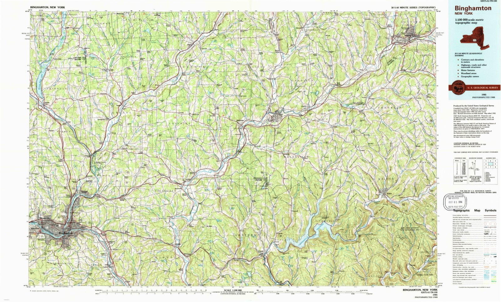
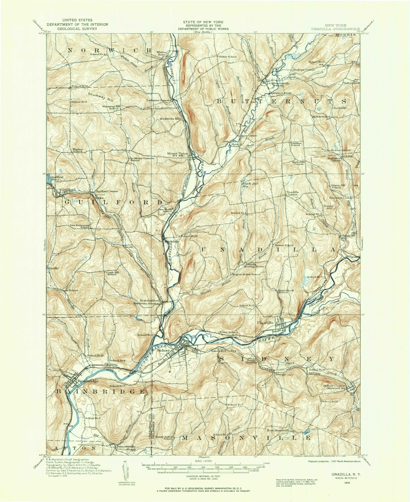
1915 to 1985The same ground, surveyed 70 years apart. Drag the handle to wipe between them. Both sheets are United States Geological Survey originals; neither has been altered.
On record in Bainbridge
Buildings and businesses the archive holds for this place. Each opens its own page, with the source record it came from.
On the National Register 2 records
 Bainbridge Historic Districtlisted 1982
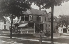 Charles C. Hovey House and Strong Leather Company Milllisted 1996
Topographic sheets covering this place
9 surveys from 18 printed sheetsMatched by testing this settlement's coordinate against the published boundary of every sheet in the United States Geological Survey's historical collection. Each opens the scanned sheet at the Survey.
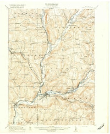
- 1915 USGS Unadilla quadrangle1:62500
- 1918 USGS Unadilla quadrangle1:62500, 6 printings
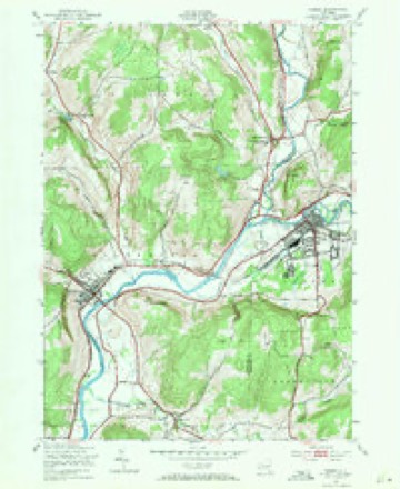
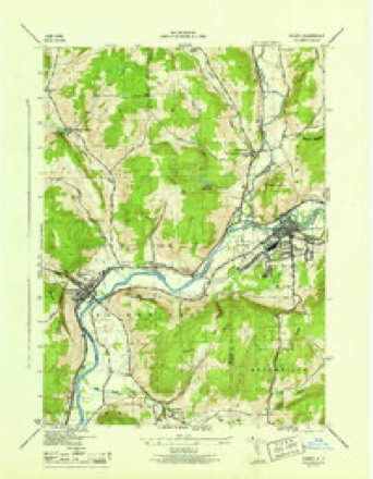
- 1943 USGS Sidney quadrangle1:24000, 3 printings
- 1945 USGS Sidney quadrangle1:31680
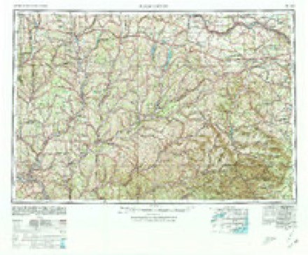
- 1948 USGS Binghamton quadrangle1:250000
- 1950 USGS Binghamton quadrangle1:250000, 2 printings
- 1958 USGS Binghamton quadrangle1:250000
- 1963 USGS Binghamton quadrangle1:250000
- 1985 USGS Binghamton quadrangle1:100000, 2 printings
Fires near this place
114 since 1992Regional context, not property-specific evidence. The federal wildfire occurrence database lists 114 fires within 5 miles of Bainbridge between 1992 and 2020, burning about 170 acres in total. 5 started naturally. 12 were recorded as arson. Distance is straight-line from the map coordinates, so a fire counted here may appear on a neighbouring settlement's page as well.
| Reported cause | Fires |
|---|---|
| Missing data/not specified/undetermined | 52 |
| Debris and open burning | 18 |
| Arson/incendiarism | 12 |
| Equipment and vehicle use | 11 |
| Misuse of fire by a minor | 8 |
| Natural | 5 |
| Smoking | 3 |
| Recreation and ceremony | 2 |
| Power generation/transmission/distribution | 2 |
| Other causes | 1 |
The most recent of them, most recent first, with the day each was reported and the service that recorded it.
| Date | Cause | Size | Reported by | Name on the report |
|---|---|---|---|---|
| 3 August 2002 | Natural | 1.0 acres | New York Forest Rangers | not named |
| 27 August 2003 | Missing data/not specified/undetermined | under an acre | Fire Department of New York | not named |
| 25 August 2001 | Equipment and vehicle use | under an acre | Fire Department of New York | not named |
| 16 August 2006 | Missing data/not specified/undetermined | under an acre | Fire Department of New York | not named |
| 7 July 2008 | Missing data/not specified/undetermined | under an acre | Fire Department of New York | not named |
| 27 July 2006 | Arson/incendiarism | under an acre | Fire Department of New York | not named |
| 20 July 2006 | Missing data/not specified/undetermined | under an acre | Fire Department of New York | not named |
| 2 July 2013 | Missing data/not specified/undetermined | under an acre | Fire Department of New York | N/A |
Settlements close enough to share some of these fires:
Mines and quarries near this place
2 within 5 milesRegional context, not property-specific evidence. The federal mineral resources record lists 2 workings within 5 miles of Bainbridge: 1 producer, 1 past producer. 1 still produces. What was taken out: Sand and Gravel, Construction. Distance is straight-line from the map coordinates, so a quarry counted here may appear on a neighbouring settlement's page as well.
| Where | Site | Commodity | Status | Recorded |
|---|---|---|---|---|
| Afton Town Pit Aldagreen Road | Sand and Gravel, Construction | Producer | ||
| Howe Jesse Sand & Gravel | Sand and Gravel, Construction | Past Producer |
Storms near this place
43 since 1995Regional context, not property-specific evidence. The National Weather Service names Bainbridge in 43 storm reports between 1995 and 2026: 25 thunderstorm wind, 7 flood, 6 flash flood, 4 hail. No death or injury is recorded in these reports. Each account below is quoted exactly as the forecast office filed it, from the NOAA Storm Events Database, and each date opens the federal record of that event.
| When | Event | Place named | Harm | What the report says |
|---|---|---|---|---|
| June 2006 | Flood | Bainbridge | $50,000,000 | no account filed |
| September 2011 | Flood | Bainbridge | $150,000 | A major flood occurred at the Bainbridge, NY river gauge (BAIN6) with a crest of 26.15 feet at 9:30 PM on September 8, 2011. |
| June 2002 | Tornado (F0) | Bainbridge | $50,000 | The tornado initially touched down at the electric generating substation south of the village, on state route 7. Numerous large trees and power lines were downed. The tornado continued in a northeast direction across the Susquehanna River, to county road 39. Here a small barn was flattened and numerous large hardwood trees were sheared off or had limb broken. A tree fell across two cars. One very large, healthy limb fell across the roof of a house causing significant damage. Many smaller buildings were destroyed. The tornado then continued northeast, shearing off more tree limbs, before reaching interstate 88. An eyewitness there backed up his pickup to get out of the way of the tornado. After crossing I-88, more tree damage was evident for about 200 yards. The damage path became more diffuse before it crossed state route 206, where it quickly dissipated. Many trees and wires were downed along the entire route. The total path length was about 1.1 miles. The most intense damage was within the first 0.7 miles. The maximum width of the damage was about 300 yards, with the core damage from the tornado around 75 yards. |
| May 1995 | Thunderstorm Wind | Bainbridge | $50,000 | no account filed |
| April 2011 | Thunderstorm Wind | Bainbridge | $20,000 | Trees were damaged, and there was structural damage between County Route 17 and Rounds Road. |
| November 2006 | Flash Flood | Bainbridge | $15,000 | Roads and bridges flooded by streams. |
| March 2007 | Flood | Bainbridge | $10,000 | Minor flooding occurred on the Susquehanna River at Bainbridge from the morning of March 15th to the morning of the 17th. The river at Bainbridge crested at 15.1 feet which was 2.1 feet over the flood stage of 13 feet. Over an inch of rain combining with snowmelt caused the minor flooding. |
| January 2006 | Flood | Bainbridge | $10,000 | no account filed |
| December 1996 | Flash Flood | Bainbridge | $10,000 | no account filed |
| August 1995 | Thunderstorm Wind | Bainbridge | $6,000 | no account filed |
| July 2022 | Thunderstorm Wind | Bainbridge | $5,000 | Strong thunderstorm winds knocked down multiple trees in Bainbridge. |
| July 2015 | Thunderstorm Wind | Bainbridge | $5,000 | Numerous trees were blown down by severe thunderstorm winds. |
| June 2015 | Thunderstorm Wind | Bainbridge | $5,000 | A severe thunderstorm produced severe winds as it moved across the area. The thunderstorm resulted in trees being knocked over in the Bainbridge-Afton area. |
| March 2007 | Flood | Bainbridge | $5,000 | Minor flooding occurred on the Susquehanna River at Bainbridge from the early morning of March 27th to the early morning of the 28th. The river at Bainbridge crested at 15.3 feet which was 2.3 feet over the flood stage of 13 feet. Continued melting of the snowpack and a period of rainfall on the 24th and 25th led to the minor flooding. |
| May 2004 | Thunderstorm Wind | Bainbridge | $5,000 | Trees down across Route 39. |
| July 1999 | Thunderstorm Wind | Bainbridge | $5,000 | Tree downed on top of car |
| June 2011 | Thunderstorm Wind | Bainbridge | $3,000 | Telephone wires were downed. |
| June 2011 | Thunderstorm Wind | Bainbridge | $3,000 | Telephone wires were downed. |
| June 2009 | Thunderstorm Wind | Bainbridge | $3,000 | Several trees and wires were blown down. |
| July 2007 | Thunderstorm Wind | Bainbridge | $3,000 | Numerous trees were blown down. |
| July 2024 | Thunderstorm Wind | West Bainbridge | $2,500 | Strong thunderstorm winds knocked down trees over Cemetery Road. |
| June 2025 | Flash Flood | West Bainbridge | $2,000 | Water was reported over the roadway on County Road 17 and Searles Hill Road. |
| June 2025 | Flash Flood | West Bainbridge | $2,000 | Water was reported over the roadway on Cooper Schoolhouse Road. |
| August 2017 | Thunderstorm Wind | Bainbridge | $2,000 | A thunderstorm moved across the region and became severe. This thunderstorm produced severe winds and knocked over trees and wires. |
| July 2006 | Flash Flood | Bainbridge | $2,000 | Heavy rain from thunderstorms flooded the junction of Bainbridge-Guilford Road. Route 35 was also flooded. |
| June 2002 | Thunderstorm Wind | Bainbridge | $2,000 | Trees down in Afton and Bainbridge. |
| July 2024 | Thunderstorm Wind | Bainbridge | $1,500 | Strong thunderstorm winds knocked down a large tree onto a home. It was unknown if there was damage to the home. |
| May 2025 | Thunderstorm Wind | Bainbridge | $1,000 | Strong thunderstorm winds knocked down a tree which blocked one lane of a road. |
| July 2010 | Thunderstorm Wind | Bainbridge | $1,000 | Many trees and power lines were blown down. |
| June 2011 | Flash Flood | Bainbridge | - | Heavy rain caused flooding on multiple roads in the town of Bainbridge and New Berlin, including Buttermilk Falls Road, Hunts Pond Road, State Highway 8 and County Route 38. |
| July 2008 | Thunderstorm Wind | Bainbridge | - | Trees limbs and wires were blown down. Power poles were snapped. |
| April 2007 | Flood | Bainbridge | - | The Susquehanna River at Bainbridge rose above the 13 foot flood stage to 13.5 feet at 10:30 pm on April 20th. |
| June 2007 | Thunderstorm Wind | Bainbridge | - | Trees were blown down. |
| June 2007 | Thunderstorm Wind | Bainbridge | - | Trees were blown down. |
| June 2007 | Thunderstorm Wind | Bainbridge | - | Numerous trees and wires were blown down along Route 38. |
| November 2006 | Flood | Bainbridge | - | Heavy rainfall caused minor flooding on the Susquehanna River at Bainbridge. The river went above its flood stage of 13 feet at 4:45 pm on the 16th and crested at 13.48 feet at 2 am on the 18th before falling below flood stage again around mid-morning the 18th. |
| July 2003 | Thunderstorm Wind | Bainbridge | - | Estimated thunderstorm winds by trained spotter. |
| June 2001 | Thunderstorm Wind | Bainbridge | - | Emergency management reported several trees blown down by thunderstorm winds. |
| August 2001 | Thunderstorm Wind | Bainbridge | - | Newspaper reports indicate that a tree off Route 44 caught fire due to a lightning strike. |
| March 2026 | Hail | Bainbridge | - | no account filed |
| May 2014 | Hail | Bainbridge | - | no account filed |
| August 2008 | Hail | Bainbridge | - | no account filed |
| June 2007 | Hail | Bainbridge | - | no account filed |
Nearest settlements
The eight closest, with where each one stands in the county. Distances are straight-line, computed from the Geographic Names Information System coordinates.
| Map | Place | Distance | Sheets |
|---|---|---|---|
| Bennettsville | 3.1 miles | 18 | |
| Middle Bridge | 3.3 miles | 15 | |
| West Bainbridge | 3.7 miles | 17 | |
| North Afton | 3.8 miles | 17 | |
| Union Valley | 3.9 miles | 17 | |
| Yaleville | 4.7 miles | 18 | |
| East Guilford | 5.1 miles | 18 | |
| Afton | 5.2 miles | 17 |
Provenance
This settlement is recorded in the Geographic Names Information System as feature 942805. The sheet list is computed by point-in-boundary test against the United States Geological Survey's historical topographic inventory. Both are works of the United States government and carry no copyright under 17 U.S.C. 105.
Wildfire. Short, Karen C. 2022. Spatial wildfire occurrence data for the United States, 1992-2020 [FPA_FOD_20221014]. 6th Edition. Fort Collins, CO: Forest Service Research Data Archive. https://doi.org/10.2737/RDS-2013-0009.6 Collected with United States Government funding and usable without additional permissions or fees.
Mines and quarries. USGS Mineral Resources Data System (MRDS) https://mrdata.usgs.gov/mrds/ A work of the United States government, no copyright under 17 U.S.C. 105.
Storms. NOAA National Centers for Environmental Information, Storm Events Database https://www.ncei.noaa.gov/stormevents/ A work of the United States government, no copyright under 17 U.S.C. 105. Narratives are quoted verbatim from the National Weather Service report and are not edited or summarised.