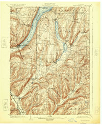
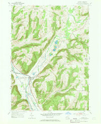
Listed on the National Register of Historic Places in 2005. 7 historic topographic surveys show this location, the earliest from 1903.
From the record
“Wood Road Metal Truss Bridge is a historic Baltimore (petit) truss bridge located at Campbell in Steuben County, New York. It was constructed in 1897 by the Phoenix Iron Works of Phoenixville, Pennsylvania and spans the Cohocton River.”
Wikipedia article Wood Road Metal Truss Bridge, CC BY-SA 4.0.
One of 63 National Register listings published here for Steuben County · listed in 2005 · category: Structure.
National Register reference number.05000169- the number the National Park Service assigned this property when it was listed, and the key its nomination file is catalogued under at the National Archives.
Fires near this property
97 since 1992
Regional context, not property-specific
evidence. The
federal wildfire occurrence database
lists 97 fires within 5 miles of Wood Road Metal Truss Bridge
between 1992 and 2020, burning about 127 acres in total. 5 started naturally. 7 were recorded as arson.
Distance is straight-line from the map coordinates, so a fire counted
here may appear on a neighbouring settlement's page as well.
Reported cause
Fires
Missing data/not specified/undetermined
43
Debris and open burning
25
Equipment and vehicle use
8
Arson/incendiarism
7
Natural
5
Smoking
4
Power generation/transmission/distribution
2
Recreation and ceremony
2
Misuse of fire by a minor
1
The most recent of
them, most recent first, with the day each was reported and the service
that recorded it.
Regional context, not property-specific
evidence. The federal mineral resources record lists
5 workings within 5 miles of Wood Road Metal Truss Bridge: 4 producers, 1 past producer.
4 still produce. What was taken out: Sand and Gravel, Construction, Salt. Distance is straight-line from the
map coordinates, so a quarry counted here may appear on a neighbouring
settlement's page as well.
Regional context, not property-specific
evidence. The National Weather Service names
Campbell, the town this property stands in, in 26 storm reports between 1994 and 2025: 15 thunderstorm wind, 3 hail, 3 flash flood, 2 lightning.
No death or injury is recorded in these reports. Each account below is quoted exactly as the forecast office
filed it, from the NOAA Storm Events Database, and each date
opens the federal record of that event.
The tornado first touched down on a hillside just west of Hough Road, in the town of Campbell. As the tornado topped the crest of the hill and descended towards Hough Road, dozens of trees were either snapped off or uprooted, in a swath about 150 yards wide. Included in this grove of trees were numerous large healthy hardwoods. As the tornado crossed Hough Road, it damaged two homes and a storage barn. The houses sustained mostly roof and siding damage, while the barn (actually bolted to a foundation) was moved off of its cement padding, with heavy damage to the roof and two of the walls, with its shingles blown westward back across Hough Road and into a field. A large camper was also blown cross-wise about 6 inches. Several large pine trees were uprooted on these properties, and facing northeastward. The tornado was estimated to be EF1 strength at this location.||Farther northeast, sporadic tree snaps and uproots were noted, until an area of heavier damage was once again seen near Tannery Road, just west of the Cohocton River. Once again, a swath of trees were either snapper or uprooted, just behind a residence southwest of Tannery Road. Again, many large healthy trees were included in this group, including some hardwoods, with a chaotic damage pattern noted. An EF1 rating was estimated at this location. The tornado appeared to have lifted for a brief time, with little damage noted to the residence itself.||A short distance further to the northeast, the storm crossed Interstate 86, just east of Exit 41. Several tree uproots and snaps occurred on either side of the highway, with two large trees uprooted in the highway median.||Just northeast of Interstate 86, along County Route 415, more large trees were either uprooted or snapped. One tree temporarily blocked Route 415, and another nearly hit several trailer homes in the Seager Court Trailer Park, and blocked entry to the complex.||The storm then continued northeastward and up a large ridge. Near the ridge top, at the corner of Rumsey Road and Dug Road, a large section of trees were heavily damaged (snapped or uprooted). The center line of the damage appeared to be along Dug Road, with the trees pointed mainly in a westerly direction along the north side of Dug Road, and in an easterly direction along the south side. This damage pattern implied convergent rotation, with an EF1 rating again given at this location.||Little or no damage was found farther to the northeast.
Flash flooding occurred over several locations in southeast Steuben County from localized very heavy thunderstorm rains. Hardest hit areas were the towns of Campbell and Erwin. Water over roadway in Campbell reported by media. Several cars were caught in the rising waters in Painted Post when Bill Smith Creek covered the intersection of East High Street and Imperial Avenue. Beartown Road, Weston Lane, Chatfield Place West, Brook Road, and Swan Lane in Gang Mills was flooded. Rainfall amounts were around 2 inches in about half an hour.
United States Geological Survey topographic
sheets whose coverage includes this point. Matched by taking the coordinate the National Park Service records for this property, then
testing that coordinate against the published boundary of every sheet.
Other National Register properties close
enough to walk or drive between, ordered by distance from this one. Both
positions come from the same geocoding pass that matched these properties
to their map sheets.
Listing record. National Park Service National Register of Historic Places, listed-properties dataset, current to 2026-05-22.
Map join. Address geocoded through the United States Census geocoder, then tested against the published boundary of every sheet in the USGS Historical Topographic Map Collection.
How this page is made. Listing fields come from federal records; map-sheet coverage is a labelled coordinate-to-boundary calculation, not a source-field claim.
Wildfire. Short, Karen C. 2022. Spatial wildfire occurrence data for the United States, 1992-2020 [FPA_FOD_20221014]. 6th Edition. Fort Collins, CO: Forest Service Research Data Archive. https://doi.org/10.2737/RDS-2013-0009.6 Collected with United States Government funding and usable without additional permissions or fees.
Mines and quarries. USGS Mineral Resources Data System (MRDS) https://mrdata.usgs.gov/mrds/ A work of the United States government, no copyright under 17 U.S.C. 105.
Storms. NOAA National Centers for Environmental Information, Storm Events Database https://www.ncei.noaa.gov/stormevents/ A work of the United States government, no copyright under 17 U.S.C. 105. Narratives are quoted verbatim from the National Weather Service report and are not edited or summarised.
 Block
Block