Block
BlockFrom the record
One of 40 National Register listings published here for Seneca County · listed in 2017 · category: District.
Sources: the National Register database, National Park Service
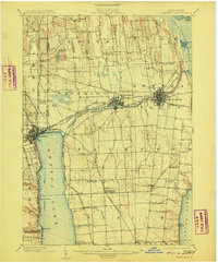
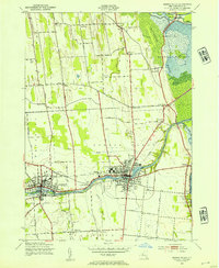
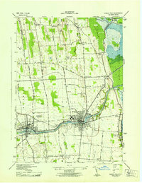
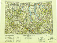
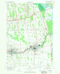
Listed on the National Register of Historic Places in 2017. 9 historic topographic surveys show this location, the earliest from 1902.
One of 40 National Register listings published here for Seneca County · listed in 2017 · category: District.
Sources: the National Register database, National Park Service
Regional context, not property-specific evidence. The federal wildfire occurrence database lists 106 fires within 5 miles of Waterloo Downtown Historic District between 1997 and 2020, burning about 124 acres in total. 9 started naturally. 19 were recorded as arson. Distance is straight-line from the map coordinates, so a fire counted here may appear on a neighbouring settlement's page as well.
| Reported cause | Fires |
|---|---|
| Missing data/not specified/undetermined | 51 |
| Arson/incendiarism | 19 |
| Debris and open burning | 18 |
| Natural | 9 |
| Equipment and vehicle use | 7 |
| Smoking | 2 |
The most recent of them, most recent first, with the day each was reported and the service that recorded it.
| Date | Cause | Size | Reported by | Name on the report |
|---|---|---|---|---|
| 5 September 2004 | Missing data/not specified/undetermined | under an acre | Fire Department of New York | not named |
| 26 September 2016 | Natural | 6.3 acres | Fire Department of New York | N/A |
| 21 September 2010 | Missing data/not specified/undetermined | under an acre | Fire Department of New York | not named |
| 14 September 2019 | Missing data/not specified/undetermined | under an acre | Fire Department of New York | N/A |
| 14 September 2016 | Arson/incendiarism | under an acre | Fire Department of New York | N/A |
| 14 September 2012 | Missing data/not specified/undetermined | under an acre | Fire Department of New York | not named |
| 13 September 2012 | Missing data/not specified/undetermined | under an acre | Fire Department of New York | not named |
| 8 August 2005 | Missing data/not specified/undetermined | under an acre | Fire Department of New York | not named |
Regional context, not property-specific evidence. The federal mineral resources record lists 3 workings within 5 miles of Waterloo Downtown Historic District: 2 producers, 1 past producer. 2 still produce. What was taken out: Limestone, General, Stone, Crushed/Broken, Sand and Gravel, Construction. Distance is straight-line from the map coordinates, so a quarry counted here may appear on a neighbouring settlement's page as well.
| Where | Site | Commodity | Status | Recorded |
|---|---|---|---|---|
| Devils Gulch Pit | Sand and Gravel, Construction | Producer | ||
| Seneca Quarry | Stone, Crushed/Broken | Producer | ||
| Seneca Quarry and Plant | Limestone, General | Past Producer | Sedimentary |
Regional context, not property-specific evidence. The National Weather Service names Waterloo, the town this property stands in, in 29 storm reports between 1996 and 2024: 17 thunderstorm wind, 10 hail, 2 flash flood. No death or injury is recorded in these reports. Each account below is quoted exactly as the forecast office filed it, from the NOAA Storm Events Database, and each date opens the federal record of that event.
| When | Event | Place named | Harm | What the report says |
|---|---|---|---|---|
| September 1998 | Thunderstorm Wind | Waterloo | $250,000 | A long lived severe convective wind system or derecho moved into northern portions of the county just before 100 am EDT. These same storms had caused considerable damage upstream in the Rochester area. Widespread wind damage occurred in the town of Waterloo and also across Seneca Falls. Most of the damage was in the form of downed trees and power lines. From approximately 1255 am to 110 am EDT, the town of Waterloo experienced strong damaging winds and large hail. Many roads in the center of town had to be closed through the morning hours on Labor Day as crews worked to clear fallen trees, live wires, and damaged traffic signals. Downstream in Seneca Falls, similar damage was reported. Just before 120 am EDT, a swath of trees was blown down on the western shores of Cayuga Lake and inflicted minor damage on several small boats anchored in the vicinity. Several vacation homes in this area incurred minor roof and siding damage from large tree limbs which succumbed to the wind. |
| October 2021 | Flash Flood | Waterloo | $100,000 | Numerous roads, and a few homes, were flooded throughout the village. Many roads were closed and a State of Emergency was in effect for the area. |
| May 1996 | Thunderstorm Wind | Waterloo | $12,000 | no account filed |
| July 2018 | Thunderstorm Wind | Waterloo | $10,000 | Strong thunderstorm winds knocked down trees and wires on Inslee Street. |
| June 2005 | Thunderstorm Wind | Waterloo | $10,000 | Thunderstorm winds downed trees and wires. |
| May 1998 | Thunderstorm Wind | Waterloo | $10,000 | A cluster of developing severe thunderstorms moved through central and southern portions of the county. Numerous trees and wires were downed in Waterloo at approximately 6:07 pm EDT. |
| July 2024 | Thunderstorm Wind | Waterloo | $5,000 | Strong thunderstorm winds knocked down trees. One large tree fell onto a home. Unknown if there were any injuries. |
| May 2020 | Thunderstorm Wind | Waterloo | $5,000 | Strong thunderstorm winds brought down a tree on County Route 96. |
| July 2020 | Thunderstorm Wind | Waterloo | $5,000 | Strong thunderstorm winds brought down a tree on West Town Line Road. |
| May 2013 | Thunderstorm Wind | Waterloo | $5,000 | Trees reported down at the intersection of State Route 96 and Burgess Road in the Village of Waterloo. |
| May 2011 | Thunderstorm Wind | Waterloo | $5,000 | A tree was blown down on a camping trailer. |
| June 2015 | Thunderstorm Wind | Waterloo | $4,000 | Thunderstorm winds estimated over 65 knots caused trees and wires to fall down. |
| April 1996 | Flash Flood | Waterloo | $3,000 | no account filed |
| June 2021 | Thunderstorm Wind | Waterloo | $1,000 | Strong thunderstorm winds knocked down a tree across the road. |
| June 2021 | Thunderstorm Wind | Waterloo | $1,000 | Strong thunderstorm winds knocked down a tree onto the road. |
| August 2021 | Thunderstorm Wind | Waterloo | $1,000 | Strong thunderstorm winds knocked down a tree onto Marshall Road. |
| July 2010 | Thunderstorm Wind | Waterloo | $1,000 | Several trees and power lines were blown down. |
| June 2007 | Thunderstorm Wind | Waterloo | - | Trees, wires and utility poles were blown down county-wide. |
| July 2000 | Thunderstorm Wind | Waterloo | - | Trees and wires were blown down by thunderstorm winds acorss the northern portion of Seneca county, mainly around Waterloo. 1/2 inch diameter hail was also reported. |
| July 2014 | Hail | Waterloo | - | no account filed |
| May 2013 | Hail | Waterloo | - | no account filed |
| May 2013 | Hail | Waterloo | - | no account filed |
| May 2013 | Hail | Waterloo | - | no account filed |
| May 2013 | Hail | Waterloo | - | no account filed |
| May 2013 | Hail | Waterloo | - | no account filed |
| May 2013 | Hail | Waterloo | - | no account filed |
| May 2012 | Hail | Waterloo | - | no account filed |
| June 2007 | Hail | Waterloo | - | no account filed |
| June 2006 | Hail | Waterloo | - | no account filed |
United States Geological Survey topographic sheets whose coverage includes this point. Matched by taking the middle of the area the National Park Service maps for this listing, then testing that coordinate against the published boundary of every sheet.
Other National Register properties close enough to walk or drive between, ordered by distance from this one. Both positions come from the same geocoding pass that matched these properties to their map sheets.
| Photograph | Property | Distance | Listed |
|---|---|---|---|
 | US Post Office-Waterloo | under 500 feet | 1989 |
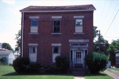 | M'Clintock House | under 500 feet | 1980 |
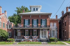 | William H. Burton House | 0.1 miles | 1996 |
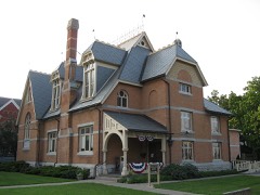 | Waterloo Library | 0.1 miles | 1996 |
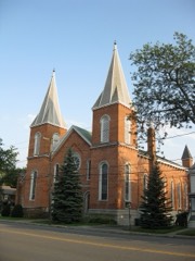 | First Presbyterian Church | 0.1 miles | 1996 |
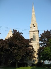 | Saint Paul's Church | 0.2 miles | 1997 |
| National Archives record | The nomination case file for reference 100000895 in Record Group 79. |
| Seneca County | All 40 listed properties in this county. |