Block
BlockFrom the record
One of 338 National Register listings published here for Suffolk County · listed in 2017 · category: Object.
Sources: the National Register database, National Park Service
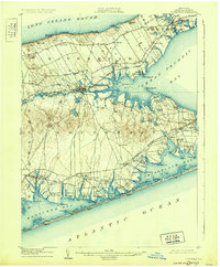
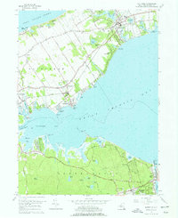
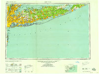
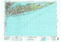
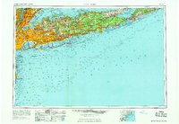
Listed on the National Register of Historic Places in 2017. 12 historic topographic surveys show this location, the earliest from 1903.
One of 338 National Register listings published here for Suffolk County · listed in 2017 · category: Object.
Sources: the National Register database, National Park Service
Regional context, not property-specific evidence. The federal wildfire occurrence database lists 114 fires within 5 miles of Southold Milestone 7 between 2000 and 2020, burning about 44 acres in total. 9 started naturally. 13 were recorded as arson. Distance is straight-line from the map coordinates, so a fire counted here may appear on a neighbouring settlement's page as well.
| Reported cause | Fires |
|---|---|
| Missing data/not specified/undetermined | 78 |
| Arson/incendiarism | 13 |
| Natural | 9 |
| Smoking | 5 |
| Equipment and vehicle use | 4 |
| Recreation and ceremony | 3 |
| Debris and open burning | 2 |
The most recent of them, most recent first, with the day each was reported and the service that recorded it.
| Date | Cause | Size | Reported by | Name on the report |
|---|---|---|---|---|
| 9 September 2014 | Smoking | under an acre | Fire Department of New York | not named |
| 30 September 2018 | Arson/incendiarism | under an acre | Fire Department of New York | N/A |
| 28 September 2019 | Missing data/not specified/undetermined | under an acre | Fire Department of New York | N/A |
| 26 September 2019 | Missing data/not specified/undetermined | under an acre | Fire Department of New York | N/A |
| 24 September 2005 | Missing data/not specified/undetermined | under an acre | Fire Department of New York | not named |
| 15 September 2015 | Natural | under an acre | Fire Department of New York | NA |
| 13 September 2020 | Equipment and vehicle use | under an acre | Fire Department of New York | NA |
| 11 September 2005 | Missing data/not specified/undetermined | under an acre | Fire Department of New York | not named |
Regional context, not property-specific evidence. The National Weather Service names Laurel, the town this property stands in, in 3 storm reports between 2005 and 2022: 1 thunderstorm wind, 1 flash flood, 1 tornado. No death or injury is recorded in these reports. Each account below is quoted exactly as the forecast office filed it, from the NOAA Storm Events Database, and each date opens the federal record of that event.
| When | Event | Place named | Harm | What the report says |
|---|---|---|---|---|
| September 2022 | Tornado (EF0) | Laurel | $100,000 | A National Weather Service storm survey team, in |coordination with Suffolk County Fire Rescue and Emergency |Services has confirmed an EF0 tornado in the Mattituck area of|Suffolk County NY.||Based on analysis of the storm survey findings and OKX dual pol |radar reflectivity, velocity and derived data (including a |tornadic debris signature), it was determined that an EF0 tornado|first touched down at Juniper Hill farms around 1117 pm, damaging|a greenhouse and downing a couple of large trees on the property.||The tornadic circulation likely lifted or skipped along as it|tracked east northeast across a one mile stretch of remote wooded|area, before touching down and shearing several tree tops and|large limbs in the vicinity of Cottage Way, Walnut Place, and |Lipco Road, between Sound Avenue and Old Sound Avenue. Peripheral |straight line wind damage to a large tree was noted near Shirley |Road and Horton Avenue to the north of Sound Avenue as well.||The tornadic circulation likely skipped east northeast in the|vicinity of Old Sound Avenue/Main Street over Love Lane and|Wickham Avenue with spotty tree damage noted, before definitively|touching down once again between Wickham Ave and Mary's Road to |the north of Pike Street, with a large maple tree sheared a few |feet from its base, minor siding and roof damage, and leaf |splatter on the west and south sides of homes. This most |prominent damage path, about 50 to 75 yards in width, continued |across Mary's Road, where 3 evergreen trees were snapped at their |base in a convergent pattern (the 2 southernmost trees laying in a|northeast direction and the northernmost tree laying in a |southeast direction). The tornado continued eastward across the |Mattituck-Cutchogue Jr/Sr high school track, twisting and damaging|a large scoreboard, overturning metals benches, and laying down a|100 ft section of wind fence on the north side of the adjacent |tennis courts in a northerly direction (again consistent with a |convergent wind pattern). The tornado then continued east over the|high school, ripping up large sections of asphalt roofing |material over one of the main buildings. The damage across the |high school grounds was the most severe along the path, consistent|with tornadic winds of 75 to 85 mph.||The tornado then exited east over an area of homes on Village |Lane, causing significant tree and fence damage to several homes, |before likely lifting around 1120 pm as the rotating storm |continued eastward over the farm fields and vineyards that lay to|the east. No visible damage was noted to the east of this point, |marking the presumed end of the tornado path. |
| August 2017 | Flash Flood | Laurel | - | A man was rescued from a Jeep trapped in flood waters on Bray Avenue in Southold that reached over the hood of the vehicle. |
| August 2005 | Thunderstorm Wind | Laurel | - | Trees down across Peconic Bay Boulevard. |
United States Geological Survey topographic sheets whose coverage includes this point. Matched by taking the coordinate the National Park Service records for this property, then testing that coordinate against the published boundary of every sheet.
Other National Register properties close enough to walk or drive between, ordered by distance from this one. Both positions come from the same geocoding pass that matched these properties to their map sheets.
| Photograph | Property | Distance | Listed |
|---|---|---|---|
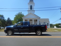 | Jamesport Meeting House | 1.6 miles | 2009 |
 | Jedediah Hawkins House | 1.6 miles | 2008 |
 | Hallock Homestead | 1.6 miles | 1984 |
 | Hallock-Bilunas Farmstead | 1.7 miles | 2003 |
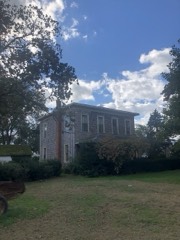 | Downs House and Farm | 2.0 miles | 2016 |
 | Richard Cox House | 2.0 miles | 1986 |
| National Archives record | The nomination case file for reference 100000999 in Record Group 79. |
| Suffolk County | All 338 listed properties in this county. |