Block
BlockFrom the record
One of 83 National Register listings published here for Madison County · listed in 2018 · category: District.
Sources: the National Register database, National Park Service
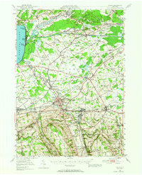
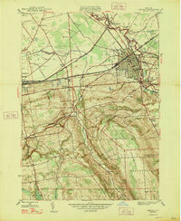
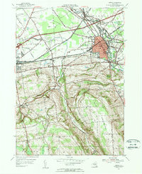
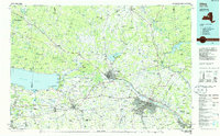
Listed on the National Register of Historic Places in 2018. 13 historic topographic surveys show this location, the earliest from 1895.
One of 83 National Register listings published here for Madison County · listed in 2018 · category: District.
Sources: the National Register database, National Park Service
Regional context, not property-specific evidence. The federal wildfire occurrence database lists 124 fires within 5 miles of Oneida Downtown Commercial Historic District between 2000 and 2020, burning about 84 acres in total. 17 started naturally. 26 were recorded as arson. Distance is straight-line from the map coordinates, so a fire counted here may appear on a neighbouring settlement's page as well.
| Reported cause | Fires |
|---|---|
| Missing data/not specified/undetermined | 62 |
| Arson/incendiarism | 26 |
| Natural | 17 |
| Debris and open burning | 13 |
| Smoking | 3 |
| Equipment and vehicle use | 2 |
| Misuse of fire by a minor | 1 |
The most recent of them, most recent first, with the day each was reported and the service that recorded it.
| Date | Cause | Size | Reported by | Name on the report |
|---|---|---|---|---|
| 7 September 2015 | Arson/incendiarism | under an acre | Fire Department of New York | NA |
| 27 September 2003 | Arson/incendiarism | under an acre | Fire Department of New York | not named |
| 24 September 2016 | Natural | under an acre | Fire Department of New York | N/A |
| 14 September 2019 | Arson/incendiarism | under an acre | Fire Department of New York | N/A |
| 11 September 2005 | Missing data/not specified/undetermined | under an acre | Fire Department of New York | not named |
| 10 September 2012 | Natural | under an acre | Fire Department of New York | not named |
| 7 August 2012 | Missing data/not specified/undetermined | under an acre | Fire Department of New York | not named |
| 6 August 2006 | Missing data/not specified/undetermined | under an acre | Fire Department of New York | not named |
Regional context, not property-specific evidence. The federal mineral resources record lists 2 workings within 5 miles of Oneida Downtown Commercial Historic District: 1 past producer, 1 producer. 1 still produces. What was taken out: Gypsum-Anhydrite, Sand and Gravel, Construction. Distance is straight-line from the map coordinates, so a quarry counted here may appear on a neighbouring settlement's page as well.
| Where | Site | Commodity | Status | Recorded |
|---|---|---|---|---|
| Johnson Sand Pit | Sand and Gravel, Construction | Producer | ||
| West Stockbridge Hill Quarry | Gypsum-Anhydrite | Past Producer |
Regional context, not property-specific evidence. The National Weather Service names Oneida, the town this property stands in, in 35 storm reports between 1994 and 2025: 16 hail, 14 thunderstorm wind, 4 flood, 1 flash flood. No death or injury is recorded in these reports. Each account below is quoted exactly as the forecast office filed it, from the NOAA Storm Events Database, and each date opens the federal record of that event.
| When | Event | Place named | Harm | What the report says |
|---|---|---|---|---|
| September 1998 | Thunderstorm Wind | Oneida | $5,000,000 | The derecho continued to plow towards the east from the Syracuse area into Madison county. Widespread wind damage again resulted, mainly across northern and eastern sections of the county. Several reports of large hail were also received. The line of severe storms first affected Sullivan and Oneida Townships between roughly 145 and 155 am EDT. Trees and power lines were downed throughout the area. Several automobiles in the parking lot of a convenience store in Oneida were damaged from falling trees. The storms ripped through the Lincoln, Stockbridge, and Peterboro areas from 155 am to about 205 am EDT. Numerous reports of golf ball sized hail were taken from skywarn spotters. One of these spotters also measured a wind gust of 75 mph. In Peterboro, close to a dozen homes were damaged from fallen trees or flying debris. One of these homes had its back deck severely damaged and a glass door shattered when the strong winds picked up large pieces of lumber and sent them flying into the backyard. Power outages were experienced by nearly 50,000 customers in the county during the height of the storm. |
| September 2011 | Flood | Oneida | $800,000 | Record flooding occurred along the Oneida Creek near Oneida, NY. The river crested at 15.55 feet according to a USGS high water mark survey. The previous record crest was 15.01 feet from an event back in October of 1976. |
| October 2017 | Thunderstorm Wind | Oneida | $20,000 | A line of thunderstorms produced damaging wind gusts which knocked down trees. |
| June 2002 | Thunderstorm Wind | Oneida | $20,000 | Thunderstorm winds downed large limbs, trees, and lines. One tree fell onto a SUV at the Oneida Animal Hospital. |
| May 2013 | Thunderstorm Wind | Oneida | $10,000 | Trees and wires were blown down across Loomis Road. |
| June 2002 | Flood | Oneida | $10,000 | Heavy thunderstorm rains caused street flooding in the city of Oneida. Approximately 9 inches of water was on Farrier Street. The rain fell on wet ground from earlier thunderstorms that day in addition to rain from earlier in the week. |
| June 2025 | Flash Flood | Oneida | $5,000 | Flooding occurred on I-90 (NYS Thruway) in both directions at After Exit 33. |
| July 2013 | Thunderstorm Wind | Oneida | $5,000 | Trees and wires were blown down on Washington Street. |
| March 2007 | Flood | Oneida | $5,000 | Minor flooding occurred on the Oneida Creek at Oneida from the evening hours of March 14th to the evening of the 15th. The creek at Oneida crested at 13.0 feet which is 2 feet over the flood stage of 11 feet. Over an inch of rain combining with snowmelt caused the minor flooding. |
| June 1994 | Thunderstorm Wind | Oneida | $5,000 | no account filed |
| July 2005 | Thunderstorm Wind | Oneida | $2,000 | Thunderstorm winds downed trees and wires. |
| June 2021 | Thunderstorm Wind | Oneida | $1,500 | Strong thunderstorm winds knocked down a large tree onto a house and across a road. |
| June 2025 | Thunderstorm Wind | Oneida | $1,000 | Strong thunderstorm winds knocked down wires on Patio Circle Drive. |
| May 2021 | Thunderstorm Wind | Oneida | $1,000 | Strong thunderstorm winds knocked down trees onto East Grove Street. |
| January 2018 | Flood | Oneida | - | Minor, low land flooding was occurring along Oneida Creek due to an ice jam. A vehicle was stuck, and filling with water. |
| June 2000 | Thunderstorm Wind | Oneida | - | Local newspapers reported trees and wires down from thunderstorm winds in Oneida. Numerous wires down on Route 46 caused a portion of the road to be closed. |
| June 2013 | Hail | Oneida | - | no account filed |
| May 2013 | Hail | Oneida | - | no account filed |
| June 2013 | Hail | Oneida | - | no account filed |
| June 2011 | Thunderstorm Wind | Oneida | - | no account filed |
| July 2009 | Hail | Oneida | - | no account filed |
| August 2009 | Hail | Oneida | - | no account filed |
| August 2009 | Hail | Oneida | - | no account filed |
| May 2008 | Hail | Oneida | - | no account filed |
| June 2008 | Hail | Oneida | - | no account filed |
| June 2008 | Hail | Oneida | - | no account filed |
| July 2008 | Hail | Oneida | - | no account filed |
| June 2007 | Hail | Oneida | - | no account filed |
| July 2007 | Hail | Oneida | - | no account filed |
| August 2007 | Hail | Oneida | - | no account filed |
| August 2007 | Hail | Oneida | - | no account filed |
| August 2007 | Hail | Oneida | - | no account filed |
| July 2006 | Thunderstorm Wind | Oneida | - | no account filed |
| August 2004 | Hail | Oneida | - | no account filed |
| May 1996 | Thunderstorm Wind | Oneida | - | no account filed |
United States Geological Survey topographic sheets whose coverage includes this point. Matched by taking the middle of the area the National Park Service maps for this listing, then testing that coordinate against the published boundary of every sheet.
Other National Register properties close enough to walk or drive between, ordered by distance from this one. Both positions come from the same geocoding pass that matched these properties to their map sheets.
| Photograph | Property | Distance | Listed |
|---|---|---|---|
| US Post Office-Oneida | under 500 feet | 1989 | |
 | Oneida Armory | 0.2 miles | 1995 |
| Cottage Lawn | 0.6 miles | 1980 | |
| Main-Broad-Grove Streets Historic District | 0.6 miles | 1983 | |
| Mount Hope Reservoir | 2.5 miles | 1997 | |
| DeFerriere House | 2.6 miles | 2007 |
| National Archives record | The nomination case file for reference 100002667 in Record Group 79. |
| Madison County | All 83 listed properties in this county. |