Block
BlockFrom the record
One of 64 National Register listings published here for Tompkins County · listed in 2021 · category: Building.
Sources: the National Register database, National Park Service
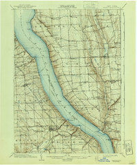
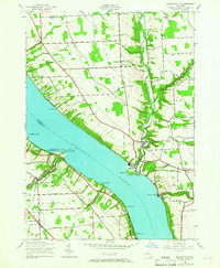
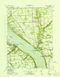
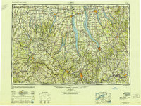
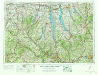
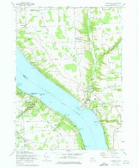
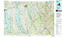
Listed on the National Register of Historic Places in 2021. 9 historic topographic surveys show this location, the earliest from 1902.
One of 64 National Register listings published here for Tompkins County · listed in 2021 · category: Building.
Sources: the National Register database, National Park Service
Regional context, not property-specific evidence. The federal wildfire occurrence database lists 50 fires within 5 miles of Cayuga Preventorium between 2002 and 2020, burning about 42 acres in total. 5 started naturally. 10 were recorded as arson. Distance is straight-line from the map coordinates, so a fire counted here may appear on a neighbouring settlement's page as well.
| Reported cause | Fires |
|---|---|
| Missing data/not specified/undetermined | 24 |
| Arson/incendiarism | 10 |
| Natural | 5 |
| Debris and open burning | 5 |
| Equipment and vehicle use | 3 |
| Smoking | 1 |
| Recreation and ceremony | 1 |
| Misuse of fire by a minor | 1 |
The most recent of them, most recent first, with the day each was reported and the service that recorded it.
| Date | Cause | Size | Reported by | Name on the report |
|---|---|---|---|---|
| 13 September 2007 | Arson/incendiarism | 1.5 acres | Fire Department of New York | not named |
| 9 August 2016 | Natural | 1.3 acres | Fire Department of New York | N/A |
| 7 August 2010 | Missing data/not specified/undetermined | under an acre | Fire Department of New York | not named |
| 24 August 2020 | Equipment and vehicle use | 5.0 acres | Fire Department of New York | NA |
| 19 August 2005 | Missing data/not specified/undetermined | under an acre | Fire Department of New York | not named |
| 5 July 2020 | Equipment and vehicle use | under an acre | Fire Department of New York | NA |
| 4 July 2014 | Arson/incendiarism | under an acre | Fire Department of New York | N/A |
| 18 July 2003 | Natural | under an acre | Fire Department of New York | not named |
Regional context, not property-specific evidence. The federal mineral resources record lists 11 workings within 5 miles of Cayuga Preventorium: 6 past producers, 3 producers, 1 prospect, 1 plant. 4 still produce. What was taken out: Salt, Stone, Crushed/Broken, Sand and Gravel, Construction, Halite. Distance is straight-line from the map coordinates, so a quarry counted here may appear on a neighbouring settlement's page as well.
| Where | Site | Commodity | Status | Recorded |
|---|---|---|---|---|
| Cayuga Crushed Stone Quarry & Mill | Limestone, General | Past Producer | Sedimentary | |
| Cayuga Mine and Mill | Halite | Past Producer | Halite | |
| Cayuga Crushed Stone Inc | Stone, Crushed/Broken | Producer | ||
| Cayuga Crushed Stone Quarry & Mill | Stone, Crushed/Broken | Producer | ||
| Twin Bridge Pit | Sand and Gravel, Construction | Past Producer | Sedimentary | |
| Twin Bridge Pit | Sand and Gravel, Construction | Producer | ||
| Cargill, Inc., Div. of Cayuga Rock | Salt | Plant | ||
| Cayuga Rock Salt Core | Salt | Prospect | ||
| Joe Farkas No.1 Well | Salt | Past Producer | ||
| Remington Company Plant | Salt | Past Producer |
Regional context, not property-specific evidence. The National Weather Service names Ithaca, the town this property stands in, in 82 storm reports between 1993 and 2025: 46 thunderstorm wind, 24 hail, 7 flash flood, 3 lightning. No death or injury is recorded in these reports. Each account below is quoted exactly as the forecast office filed it, from the NOAA Storm Events Database, and each date opens the federal record of that event.
| When | Event | Place named | Harm | What the report says |
|---|---|---|---|---|
| July 2003 | Flash Flood | Ithaca | $500,000 | Heavy rains fell from late afternoon into early evening causing flash flooding of numerous roads from the City of Ithaca to the Dryden area. |
| June 2005 | Lightning | Ithaca | $100,000 | Lightning struck a house starting a fire. The house burned to the ground. |
| August 2013 | Flash Flood | Ithaca | $50,000 | Flood waters covered numerous roads in the area, especially along Routes 96 and 89 to the north of Ithaca. |
| July 1994 | Thunderstorm Wind | Ithaca | $50,000 | Thunderstorms developed in a moist, southwest flow ahead of a cold front. Thunderstorm winds downed trees and power lines. On Route 96 in Tompkins County twenty to thirty large trees were downed. |
| August 1993 | Thunderstorm Wind | Ithaca | $50,000 | no account filed |
| November 2006 | Flash Flood | Ithaca | $25,000 | Roads flooded throughout the county. |
| August 2013 | Flash Flood | Ithaca | $20,000 | Water was reported to be running across Route 89 from near Taughannock Falls, southward to Ithaca. One foot of water and debris was across the road in spots. |
| September 2011 | Flash Flood | Ithaca | $20,000 | Several roads were flooded around the Ithaca area. |
| June 2004 | Thunderstorm Wind | Ithaca | $20,000 | Thunderstorm winds downed trees and wires throughout city. |
| May 1998 | Thunderstorm Wind | Ithaca | $15,000 | A severe thunderstorm moving across the county blew a tree down onto a van in Ithaca at 3:23 pm EDT. |
| August 1995 | Thunderstorm Wind | Ithaca | $12,000 | no account filed |
| July 2019 | Thunderstorm Wind | Ithaca | $10,000 | Strong thunderstorm winds brought down trees on wires. |
| August 2019 | Thunderstorm Wind | Ithaca | $10,000 | Strong thunderstorm winds brought down multiple trees near a nature center. |
| June 2005 | Thunderstorm Wind | Ithaca | $10,000 | Thunderstorm winds downed several trees. |
| June 2017 | Thunderstorm Wind | Ithaca | $8,000 | A thunderstorm moved across the region and became severe. This thunderstorm produced severe winds and knocked over multiple trees and wires. |
| June 2023 | Thunderstorm Wind | Ithaca | $5,000 | Strong thunderstorm winds knocked down multiple trees. |
| June 2021 | Thunderstorm Wind | Ithaca | $5,000 | Strong thunderstorm winds knocked down multiple trees. |
| June 2021 | Thunderstorm Wind | Ithaca | $5,000 | Strong thunderstorm winds knocked down large trees in a park. |
| July 2021 | Thunderstorm Wind | Ithaca | $5,000 | Strong thunderstorm winds brought down multiple trees. |
| July 2020 | Thunderstorm Wind | Ithaca | $5,000 | Strong thunderstorm winds brought down a tree. |
| June 2020 | Lightning | Ithaca | $5,000 | A lightning strike from a thunderstorm caused a tree to catch on fire. |
| June 2019 | Thunderstorm Wind | Ithaca | $5,000 | Strong thunderstorm winds brought down wires onto a roadway in the vicinity of Monroe Street and 3rd Street. |
| August 2019 | Thunderstorm Wind | Ithaca | $5,000 | Strong thunderstorm winds brought down trees. |
| May 2018 | Thunderstorm Wind | Ithaca | $5,000 | Thunderstorm winds blew trees down on wires near the intersection of Elmwood Avenue and Ithaca Road. |
| June 2015 | Thunderstorm Wind | Ithaca | $5,000 | A severe thunderstorm produced severe winds as it moved across the area. The thunderstorm resulted in trees being knocked over around Ithaca. |
| July 2014 | Thunderstorm Wind | Ithaca | $5,000 | Trees and wires were blown down on Ellis Hollow Road. |
| April 2011 | Thunderstorm Wind | Ithaca | $5,000 | Trees were snapped off near the Ithaca/Danby town line, south of Ithaca College. |
| August 2007 | Thunderstorm Wind | Ithaca | $5,000 | Numerous trees and wires were blown down. A piece of a roof was torn off a building in downtown Ithaca. Trees and wires were also blown down in Lansing and Caroline. |
| July 2005 | Thunderstorm Wind | Ithaca | $5,000 | Thunderstorm winds downed trees and wires in the Ithaca area. |
| September 2005 | Thunderstorm Wind | Ithaca | $5,000 | Trees down in several towns throughout the county. |
| June 1994 | Thunderstorm Wind | Ithaca | $5,000 | Thunderstorms rages across the area producing high winds and three-quarter inch hail. The thunderstorm winds downed trees and power lines. Heavy rains...up to three and a half inches...resulted in flash flooding in Lafayette. |
| July 1994 | Thunderstorm Wind | Ithaca | $5,000 | Strong thunderstorms produced damaging winds which downed trees and power lines. Scattered power outages were reported. |
| July 1999 | Thunderstorm Wind | Ithaca | $5,000 | no account filed |
| July 1999 | Thunderstorm Wind | Ithaca | $5,000 | no account filed |
| December 2023 | Flash Flood | East Ithaca | $3,000 | Water is across the road at the intersection of Slaterville Road and Honness Lane and along Slaterville Road for about one half mile. |
| July 2017 | Thunderstorm Wind | Ithaca | $3,000 | A thunderstorm moved across the region and became severe. This thunderstorm produced severe winds and knocked over a tree which landed on power lines in the vicinity of 1350 Tioughanack Blvd. |
| June 2025 | Flash Flood | East Ithaca | $2,000 | Water was reported over Forest Home Drive near Dryden Road. |
| June 2015 | Thunderstorm Wind | Ithaca | $2,000 | Thunderstorm winds estimated greater than 50 knots caused trees to fall over on east shore drive near the city of Ithaca. |
| August 2007 | Thunderstorm Wind | Ithaca | $2,000 | Trees were blown down throughout the city of Ithaca. |
| July 1995 | Thunderstorm Wind | Ithaca | $2,000 | no account filed |
| March 2025 | Thunderstorm Wind | East Ithaca | $1,500 | Strong thunderstorm winds uprooted and snapped a few small trees, knocked down numerous large tree branches and a stop sign around and just off of Cornell University property. |
| July 2023 | Thunderstorm Wind | Ithaca | $1,500 | Strong thunderstorm winds knocked down a tree onto a house on North Aurora Street. |
| July 2025 | Thunderstorm Wind | Ithaca | $1,000 | Strong thunderstorm winds knocked down a tree on Trumansburg Road. |
| July 2025 | Thunderstorm Wind | Ithaca | $1,000 | Strong thunderstorm winds knocked down a large willow tree onto Prospect Street. |
| August 2024 | Thunderstorm Wind | Ithaca | $1,000 | Strong thunderstorm winds knocked down a wire onto a building on Green Street. |
| June 2022 | Thunderstorm Wind | Ithaca | $1,000 | Strong thunderstorm winds knocked down a tree onto a roadway. |
| June 2022 | Thunderstorm Wind | East Ithaca | $1,000 | Strong thunderstorm winds knocked down a tree onto a road at Cornell University. |
| June 2021 | Thunderstorm Wind | Ithaca | $1,000 | Strong thunderstorm winds knocked down a large tree on West Seneca St. |
| June 2008 | Thunderstorm Wind | Ithaca | $1,000 | Trees were blown down in South Hill Terrace. Trees were blown down on a car. |
| June 2021 | Hail | Ithaca | - | A strong thunderstorm produced 1 inch hail. |
| June 2021 | Hail | Ithaca | - | A strong thunderstorm produced 1 inch hail. |
| October 2014 | Hail | Ithaca | - | Penny to nickel size hail fell. |
| September 2013 | Thunderstorm Wind | Ithaca | - | Several trees were blown down near Hangar Theater. |
| September 2013 | Thunderstorm Wind | Ithaca | - | A few trees were blown down in Cass Park and near Judd Road and Cornell University area. |
| August 2009 | Heavy Rain | Ithaca | - | Manhole covers were knocked off due to heavy rain. |
| July 2008 | Heavy Rain | Ithaca | - | An observer reported 1.62 inches of rain in under 30 minutes. |
| June 2007 | Thunderstorm Wind | Ithaca | - | Large branches were knocked down. |
| May 2003 | Hail | Ithaca | - | Dime sized hail fell in Ithaca at Cornell University and in Varna which is in the town of Dryden. |
| May 2000 | Hail | Ithaca | - | Dime sized hail reported just east of Ithaca. Also, a tent was blown over at the Triphammer Mall. |
| June 2000 | Thunderstorm Wind | Ithaca | - | Law enforcement officers reported large tree limbs as well as power lines blown down in Ithaca. |
United States Geological Survey topographic sheets whose coverage includes this point. Matched by taking the middle of the area the National Park Service maps for this listing, then testing that coordinate against the published boundary of every sheet.
Other National Register properties close enough to walk or drive between, ordered by distance from this one. Both positions come from the same geocoding pass that matched these properties to their map sheets.
| Photograph | Property | Distance | Listed |
|---|---|---|---|
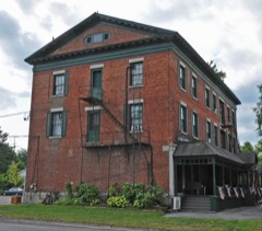 | Rogues Harbor Inn | 2.9 miles | 2009 |
| Methodist Episcopal Church of Jacksonville | 3.1 miles | 2018 | |
| Biggs Memorial Hospital Cottage | 3.6 miles | 2020 | |
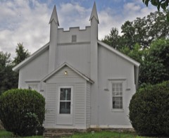 | Hayt's Chapel and Schoolhouse | 3.7 miles | 2005 |
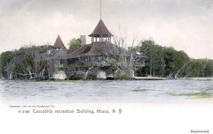 | Cascadilla School Boathouse | 4.8 miles | 1991 |
| Stewart Park | 5.0 miles | 2023 |
| National Archives record | The nomination case file for reference 100006012 in Record Group 79. |
| Tompkins County | All 64 listed properties in this county. |