Block
BlockFrom the record
One of 63 National Register listings published here for Steuben County · listed in 2025 · category: District.
Sources: the National Register database, National Park Service
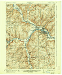
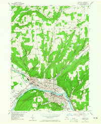
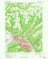
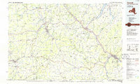
Listed on the National Register of Historic Places in 2025. 9 historic topographic surveys show this location, the earliest from 1914.
One of 63 National Register listings published here for Steuben County · listed in 2025 · category: District.
Sources: the National Register database, National Park Service
Regional context, not property-specific evidence. The federal wildfire occurrence database lists 277 fires within 5 miles of St. Vincent de Paul Roman Catholic Church Complex between 1992 and 2020, burning about 338 acres in total. 15 started naturally. 33 were recorded as arson. Distance is straight-line from the map coordinates, so a fire counted here may appear on a neighbouring settlement's page as well.
| Reported cause | Fires |
|---|---|
| Missing data/not specified/undetermined | 135 |
| Arson/incendiarism | 33 |
| Smoking | 29 |
| Debris and open burning | 28 |
| Equipment and vehicle use | 22 |
| Natural | 15 |
| Recreation and ceremony | 7 |
| Misuse of fire by a minor | 5 |
| Power generation/transmission/distribution | 3 |
The most recent of them, most recent first, with the day each was reported and the service that recorded it.
| Date | Cause | Size | Reported by | Name on the report |
|---|---|---|---|---|
| 9 September 2006 | Smoking | 2.0 acres | Fire Department of New York | not named |
| 6 September 2005 | Smoking | under an acre | Fire Department of New York | not named |
| 28 September 2020 | Recreation and ceremony | 1.6 acres | New York Forest Rangers | WEST HILL FIRE |
| 28 September 2014 | Natural | under an acre | Fire Department of New York | N/A |
| 24 September 2020 | Missing data/not specified/undetermined | 3.8 acres | Fire Department of New York | NA |
| 23 September 2020 | Missing data/not specified/undetermined | 3.8 acres | Fire Department of New York | NA |
| 22 September 2020 | Equipment and vehicle use | under an acre | Fire Department of New York | NA |
| 2 September 2015 | Missing data/not specified/undetermined | under an acre | Fire Department of New York | NA |
Regional context, not property-specific evidence. The federal mineral resources record lists 7 workings within 5 miles of St. Vincent de Paul Roman Catholic Church Complex: 3 producers, 3 past producers, 1 unknown. 3 still produce. What was taken out: Sand and Gravel, Construction, Zirconium. Distance is straight-line from the map coordinates, so a quarry counted here may appear on a neighbouring settlement's page as well.
| Where | Site | Commodity | Status | Recorded |
|---|---|---|---|---|
| Corning Plant | Zirconium | Unknown | ||
| Canada Road Pit | Sand and Gravel, Construction | Producer | ||
| East Corning Pit | Sand and Gravel, Construction | Past Producer | ||
| East Corning Plant | Sand and Gravel, Construction | Past Producer | Sedimentary | |
| East Corning Plant | Sand and Gravel, Construction | Producer | ||
| Rhinehart Sand and Gravel Pit | Sand and Gravel, Construction | Past Producer | Sedimentary | |
| Rhinehart Sand and Gravel Pit | Sand and Gravel, Construction | Producer |
Regional context, not property-specific evidence. The National Weather Service names Corning, the town this property stands in, in 40 storm reports between 1993 and 2025: 26 thunderstorm wind, 13 hail, 1 tornado. The reports record 1 injury. Each account below is quoted exactly as the forecast office filed it, from the NOAA Storm Events Database, and each date opens the federal record of that event.
| When | Event | Place named | Harm | What the report says |
|---|---|---|---|---|
| May 2000 | Thunderstorm Wind | Corning | 1 hurt | Thunderstorm winds brought trees down. There was also some structural damage to houses from falling trees. Many trees were uprooted at the Corning Country Club where a tree fell onto a tent giving minor injuries to one man. Scoreboards set up for a golf tournament were also damaged. Sheet metal building material was ripped from the canopy of a store. |
| August 1993 | Thunderstorm Wind | Corning | $500,000 | no account filed |
| July 2012 | Tornado (EF1) | South Corning | $200,000 | Damage began in heavily wooded property along Welch Road west of the community college. The path moved through the South Corning Community College with most of the damage to trees. It moved down the hill impacting trees and property to the east of the community college and moving into South Corning area. Homes and property were impacted along County Route 44 as the tornado moved east. Two silos were damaged and airborne missiles penetrated a house. There was damage to siding, trim/flashing, and porches. A couple sheds were destroyed. Many homes will have to deal with tree removal. Numerous trees came down in a community just south of 44 on Brown Hollow Road. The tornado ended near Murphy Road. |
| July 2020 | Thunderstorm Wind | South Corning | $10,000 | Strong thunderstorm winds brought down trees and wires. |
| September 2005 | Thunderstorm Wind | Corning | $10,000 | Trees down countywide. Tree on a car in Corning. |
| August 1995 | Thunderstorm Wind | South Corning | $10,000 | A weak cold front crossed the area during the afternoon producing isolated, severe thunderstorms. In Olean, the thunderstorm winds downed a 70-foot willow tree. |
| April 2025 | Thunderstorm Wind | Corning | $5,000 | Strong thunderstorm winds led to multiple reports of trees and wires down in and around Corning. |
| July 2024 | Thunderstorm Wind | Corning | $5,000 | Strong thunderstorm winds knocked down multiple trees in Corning. |
| July 2020 | Thunderstorm Wind | Corning | $5,000 | Strong thunderstorm winds brought down a tree across a road. |
| May 2018 | Thunderstorm Wind | East Corning | $5,000 | Thunderstorm winds blew down tree limbs and wires on Timberline Drive. |
| October 2014 | Thunderstorm Wind | East Corning | $5,000 | Several trees were blown down and shingle damage occurred at a house east of Corning. |
| June 2013 | Thunderstorm Wind | South Corning | $5,000 | Trees were blown down. |
| July 2012 | Thunderstorm Wind | South Corning | $5,000 | Numerous trees were blown down around Corning Community College. |
| June 2021 | Thunderstorm Wind | South Corning | $3,000 | Strong thunderstorm winds knocked down large trees and wires. |
| June 2015 | Thunderstorm Wind | Corning | $3,000 | A severe thunderstorm produced severe winds as it moved across the area. The thunderstorm resulted in wires being knocked down. |
| June 2010 | Thunderstorm Wind | Corning | $2,000 | Trees and wires were blown down on State Route 414 and on Spencer Hill Road in South Corning. |
| July 1995 | Thunderstorm Wind | Corning | $2,000 | no account filed |
| July 2024 | Thunderstorm Wind | Corning | $1,000 | Strong thunderstorm winds broke a healthy 40 foot tall Maple tree in half; another large branch down in the street. |
| July 2024 | Thunderstorm Wind | Corning | $1,000 | Strong thunderstorm winds knocked down a tree onto a house on Reynolds Avenue. |
| July 2007 | Thunderstorm Wind | Corning | $1,000 | A few trees blew down. |
| August 2007 | Thunderstorm Wind | Corning | $1,000 | Trees were blown down by thunderstorm winds. |
| July 2006 | Thunderstorm Wind | Corning | $1,000 | Several trees were knocked down in the city of Corning. |
| March 2022 | Thunderstorm Wind | Corning | - | Strong thunderstorm winds knocked down multiple trees in Corning. |
| June 2007 | Thunderstorm Wind | Corning | - | Several trees were knocked down. |
| April 2006 | Thunderstorm Wind | Corning | - | Large branches and power lines were downed in the city of Corning. |
| July 2003 | Thunderstorm Wind | Corning | - | Thunderstorms winds blew large limbs down. |
| June 2000 | Thunderstorm Wind | Corning | - | Local newspapers reported trees down from thunderstorm winds in Corning and Painted Post. |
| June 2013 | Hail | South Corning | - | no account filed |
| June 2013 | Hail | South Corning | - | no account filed |
| May 2012 | Hail | Corning | - | no account filed |
| April 2008 | Hail | Corning | - | no account filed |
| June 2008 | Hail | East Corning | - | no account filed |
| June 2008 | Hail | Corning | - | no account filed |
| June 2008 | Hail | Corning | - | no account filed |
| August 2008 | Hail | Corning | - | no account filed |
| June 2008 | Hail | Corning | - | no account filed |
| June 2007 | Hail | Corning | - | no account filed |
| July 2007 | Hail | South Corning | - | no account filed |
| August 2007 | Hail | Corning | - | no account filed |
| June 2006 | Hail | Corning | - | no account filed |
United States Geological Survey topographic sheets whose coverage includes this point. Matched by taking the coordinate the National Park Service records for this property, then testing that coordinate against the published boundary of every sheet.
Other National Register properties close enough to walk or drive between, ordered by distance from this one. Both positions come from the same geocoding pass that matched these properties to their map sheets.
| Photograph | Property | Distance | Listed |
|---|---|---|---|
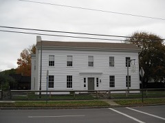 | Jenning's Tavern | 0.3 miles | 1973 |
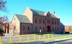 | Corning Armory | 0.7 miles | 2003 |
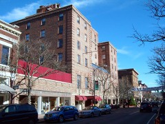 | Market Street Historic District (Boundary Increase) | 0.8 miles | 2000 |
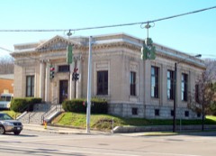 | US Post Office-Corning | 0.9 miles | 1988 |
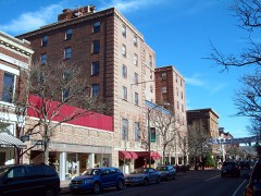 | Market Street Historic District | 1.0 miles | 1974 |
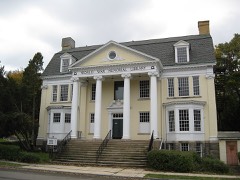 | World War Memorial Library | 1.0 miles | 1995 |
| National Archives record | The nomination case file for reference 100011440 in Record Group 79. |
| Steuben County | All 63 listed properties in this county. |