Block
BlockFrom the record
One of 74 National Register listings published here for Herkimer County · listed in 2014 · category: Building.
Sources: the National Register database, National Park Service
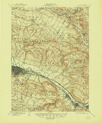
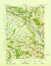
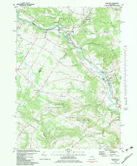
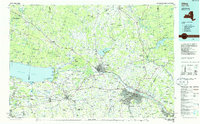
Listed on the National Register of Historic Places in 2014. 11 historic topographic surveys show this location, the earliest from 1898.
One of 74 National Register listings published here for Herkimer County · listed in 2014 · category: Building.
Sources: the National Register database, National Park Service
Regional context, not property-specific evidence. The federal wildfire occurrence database lists 45 fires within 5 miles of James Keith House and Brown-Morey-Davis Farm between 1992 and 2020, burning about 45 acres in total. 6 started naturally. 5 were recorded as arson. Distance is straight-line from the map coordinates, so a fire counted here may appear on a neighbouring settlement's page as well.
| Reported cause | Fires |
|---|---|
| Missing data/not specified/undetermined | 24 |
| Natural | 6 |
| Arson/incendiarism | 5 |
| Debris and open burning | 3 |
| Recreation and ceremony | 3 |
| Other causes | 3 |
| Smoking | 1 |
The most recent of them, most recent first, with the day each was reported and the service that recorded it.
| Date | Cause | Size | Reported by | Name on the report |
|---|---|---|---|---|
| 7 September 2016 | Arson/incendiarism | 1.3 acres | Fire Department of New York | N/A |
| 28 August 2020 | Missing data/not specified/undetermined | 5.0 acres | Fire Department of New York | NA |
| 27 August 2003 | Missing data/not specified/undetermined | under an acre | Fire Department of New York | not named |
| 21 August 2002 | Natural | 2.0 acres | Fire Department of New York | not named |
| 6 July 2009 | Natural | under an acre | Fire Department of New York | not named |
| 29 June 2005 | Missing data/not specified/undetermined | under an acre | Fire Department of New York | not named |
| 8 May 2011 | Missing data/not specified/undetermined | under an acre | Fire Department of New York | not named |
| 3 May 2006 | Missing data/not specified/undetermined | under an acre | Fire Department of New York | not named |
Regional context, not property-specific evidence. The federal mineral resources record lists 5 workings within 5 miles of James Keith House and Brown-Morey-Davis Farm: 4 past producers, 1 producer. 1 still produces. What was taken out: Sand and Gravel, Construction, Limestone, General, Stone, Crushed/Broken. Distance is straight-line from the map coordinates, so a quarry counted here may appear on a neighbouring settlement's page as well.
| Where | Site | Commodity | Status | Recorded |
|---|---|---|---|---|
| Middleville Number 6 Quarry | Limestone, General | Past Producer | Sedimentary | |
| Middleville Number 6 Quarry | Stone, Crushed/Broken | Past Producer | ||
| Bienick Pit | Sand and Gravel, Construction | Past Producer | ||
| Gravesville Pit | Sand and Gravel, Construction | Producer | ||
| Material Sand and Gravel Pit | Sand and Gravel, Construction | Past Producer | Sedimentary |
Regional context, not property-specific evidence. The National Weather Service names Newport, the town this property stands in, in 31 storm reports between 1993 and 2024: 15 thunderstorm wind, 8 flash flood, 4 flood, 3 hail. No death or injury is recorded in these reports. Each account below is quoted exactly as the forecast office filed it, from the NOAA Storm Events Database, and each date opens the federal record of that event.
| When | Event | Place named | Harm | What the report says |
|---|---|---|---|---|
| May 2000 | Flash Flood | Newport | $175,000 | no account filed |
| August 2001 | Thunderstorm Wind | Newport | $80,000 | no account filed |
| October 2019 | Flash Flood | Newport | $75,000 | A bridge at White Creek Road and Newport-Gray Road was washed out. |
| October 2019 | Flash Flood | Newport | $25,000 | Newport Road was washed out. |
| June 2002 | Thunderstorm Wind | Newport | $20,000 | no account filed |
| August 2023 | Flash Flood | Newport | $10,000 | Flash flooding was reported along Honey Hill Road and Strumlock Road in the Town of Newport. |
| August 2023 | Flood | Newport | $5,000 | Tower Road in the Town of Newport was flooded and impassable. |
| August 2023 | Flood | Newport | $5,000 | Flooding continued along Honey Hill Road and Strumlock Road in the Town of Newport. |
| August 2023 | Flash Flood | Newport | $5,000 | Tower Road in the Town of Newport was flooded and impassable. |
| July 1999 | Thunderstorm Wind | Newport | $5,000 | no account filed |
| July 1994 | Thunderstorm Wind | Newport | $5,000 | no account filed |
| August 1993 | Thunderstorm Wind | Newport | $5,000 | no account filed |
| July 1996 | Thunderstorm Wind | Newport | $4,000 | no account filed |
| October 2008 | Heavy Rain | Newport | $1,000 | Heavy rainfall resulted in minor urban flooding of Steuben Road, and Strumlock Road in Newport. In addition, ponding of water was also reported on a few roads near Frankfort. |
| July 2024 | Thunderstorm Wind | Newport | - | Multiple trees were downed along Newport-Gray Road, Rose Valley Road and State Route 28 in the Town of Russia. |
| September 2023 | Thunderstorm Wind | Newport | - | Multiple trees and wires were down. |
| August 2023 | Hail | Newport | - | Image and video received showed large quantities of quarter size hail. |
| August 2021 | Thunderstorm Wind | Newport | - | Trees and wires were downed blocking a road in the Village of Newport. |
| July 2019 | Thunderstorm Wind | Newport | - | Trees and wires were downed. |
| July 2019 | Thunderstorm Wind | Newport | - | A tree was downed on West Street. |
| August 2019 | Thunderstorm Wind | Newport | - | Trees and wires downed. |
| July 2017 | Flash Flood | Newport | - | A mudslide was reported along Route 28 near Newport. |
| July 2014 | Thunderstorm Wind | Newport | - | Trees were reported down in Newport due to thunderstorm winds. |
| July 2014 | Thunderstorm Wind | Newport | - | A tree and wires were downed as a result of thunderstorm winds in Poland, about one mile west of Newport. |
| April 2011 | Flash Flood | Newport | - | A car rescue occurred on Strumlock Road near Honey Hill Road in Newport due to high water from heavy rainfall. |
| July 2010 | Hail | Newport | - | Half-dollar size hail was reported during a thunderstorm in Newport. |
| March 2007 | Flood | Newport | - | Warm temperatures led to snowmelt, which combined with moderate rainfall to create flooding in portions of southern Herkimer county during the early morning hours of Thursday March 15th.|Several roads and bridges were closed due to flooding, including Farrington Road near Newport, State Route 51 in the Ilion Gorge, and State Route 167 between Lyon Road and Dolgeville. |
| November 2006 | Flood | Newport | - | Minor flooding occurred along the Mohawk River at Delta Dam, when it went above its flood stage of 551.5 feet at 9 PM EST on Thursday, November 16th. The river crested at 552.35 feet at 10:30 AM EST on Friday, November 17th, before falling back below flood stage at 8:23 PM EST on Saturday November 18th. |
| November 2006 | Flash Flood | Newport | - | Two mudslides closed Route 28 between Newport and Middleville around 7 PM EST on Thursday November 16th. Additional flooding was reported by emergency management officials near Ilion. |
| September 2005 | Thunderstorm Wind | Newport | - | Trees were blown down. |
| August 2001 | Hail | Newport | - | no account filed |
United States Geological Survey topographic sheets whose coverage includes this point. Matched by taking the middle of the area the National Park Service maps for this listing, then testing that coordinate against the published boundary of every sheet.
Other National Register properties close enough to walk or drive between, ordered by distance from this one. Both positions come from the same geocoding pass that matched these properties to their map sheets.
| Photograph | Property | Distance | Listed |
|---|---|---|---|
 | Newport Stone Arch Bridge | 1.2 miles | 1992 |
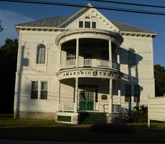 | Masonic Temple-Newport Lodge No. 445 F. & A.M. | 1.3 miles | 2010 |
| Old City Road Stone Arch Bridge | 1.6 miles | 2001 | |
| Perry, Stuart and William Swezey Houses | 1.7 miles | 2012 | |
 | Yale-Cady Octagon House and Yale Lock Factory Site | 1.8 miles | 2007 |
 | Benjamin Bowen House | 2.3 miles | 1998 |
| National Archives record | The nomination case file for reference 13001090 in Record Group 79. |
| Herkimer County | All 74 listed properties in this county. |