Block
BlockFrom the record
One of 62 National Register listings published here for Montgomery County · listed in 1982 · category: District.
Sources: the case file at the National Archives · the National Register database, National Park Service
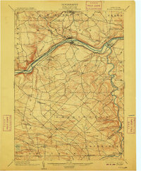
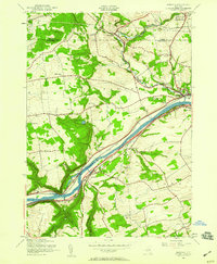
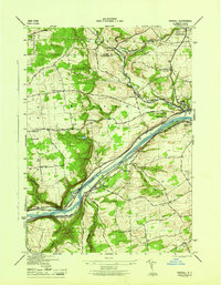
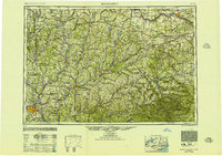
Listed on the National Register of Historic Places in 1982. 10 historic topographic surveys show this location, the earliest from 1896.
One of 62 National Register listings published here for Montgomery County · listed in 1982 · category: District.
Sources: the case file at the National Archives · the National Register database, National Park Service
Regional context, not property-specific evidence. The federal wildfire occurrence database lists 164 fires within 5 miles of Old Courthouse Complex between 2000 and 2020, burning about 110 acres in total. 7 started naturally. 21 were recorded as arson. Distance is straight-line from the map coordinates, so a fire counted here may appear on a neighbouring settlement's page as well.
| Reported cause | Fires |
|---|---|
| Missing data/not specified/undetermined | 96 |
| Arson/incendiarism | 21 |
| Debris and open burning | 15 |
| Smoking | 14 |
| Natural | 7 |
| Equipment and vehicle use | 5 |
| Misuse of fire by a minor | 3 |
| Railroad operations and maintenance | 2 |
| Recreation and ceremony | 1 |
The most recent of them, most recent first, with the day each was reported and the service that recorded it.
| Date | Cause | Size | Reported by | Name on the report |
|---|---|---|---|---|
| 7 September 2007 | Smoking | under an acre | Fire Department of New York | not named |
| 7 September 2005 | Missing data/not specified/undetermined | under an acre | Fire Department of New York | not named |
| 29 September 2017 | Railroad operations and maintenance | under an acre | Fire Department of New York | N/A |
| 26 September 2009 | Misuse of fire by a minor | 2.8 acres | Fire Department of New York | not named |
| 22 September 2014 | Missing data/not specified/undetermined | under an acre | Fire Department of New York | N/A |
| 22 September 2009 | Missing data/not specified/undetermined | under an acre | Fire Department of New York | not named |
| 9 August 2002 | Missing data/not specified/undetermined | 2.0 acres | Fire Department of New York | not named |
| 8 August 2017 | Arson/incendiarism | 2.4 acres | Fire Department of New York | N/A |
Regional context, not property-specific evidence. The federal mineral resources record lists 3 workings within 5 miles of Old Courthouse Complex: 2 producers, 1 occurrence. 2 still produce. What was taken out: Sand and Gravel, Construction, Platinum, Nickel. Distance is straight-line from the map coordinates, so a quarry counted here may appear on a neighbouring settlement's page as well.
| Where | Site | Commodity | Status | Recorded |
|---|---|---|---|---|
| Fonda | Platinum, Nickel | Occurrence | Unknown | |
| Mohawk Sand and Gravel Pit | Sand and Gravel, Construction | Producer | ||
| Randall Pitt | Sand and Gravel, Construction | Producer |
Regional context, not property-specific evidence. The National Weather Service names Fonda, the town this property stands in, in 41 storm reports between 1994 and 2024: 25 thunderstorm wind, 6 flash flood, 6 flood, 3 hail. No death or injury is recorded in these reports. Each account below is quoted exactly as the forecast office filed it, from the NOAA Storm Events Database, and each date opens the federal record of that event.
| When | Event | Place named | Harm | What the report says |
|---|---|---|---|---|
| September 1998 | Thunderstorm Wind | Fonda | $200,000 | no account filed |
| July 2021 | Flash Flood | Fonda | $100,000 | Multiple reports of flash flooding in and around the Village of Fonda. A small creek north of Fonda overflowed its banks causing 6 to 8 inches of water and mud to flow down Broadway (Route 30A) to Main Street (Route 5), causing multiple roads to be closed. Road shoulders were washed out on Old Johnson Road. The Interstate 90 off-ramps were closed at Exit 28 in the village of Fultonville due to flooding. |
| August 1994 | Thunderstorm Wind | Fonda | $50,000 | no account filed |
| May 1998 | Thunderstorm Wind | Fonda | $40,000 | no account filed |
| May 2000 | Flash Flood | Fonda | $25,000 | no account filed |
| May 1998 | Thunderstorm Wind | Fonda | $15,000 | no account filed |
| May 1998 | Thunderstorm Wind | Fonda | $10,000 | no account filed |
| May 1997 | Thunderstorm Wind | Fonda | $6,000 | no account filed |
| June 2014 | Lightning | Fonda | $1,000 | A spotter reported that lightning downed a tree on East Main Street in Fonda. |
| June 1998 | Thunderstorm Wind | Fonda | $1,000 | no account filed |
| June 2024 | Thunderstorm Wind | Fonda | - | Two trees were downed blocking Martin Road. |
| June 2024 | Thunderstorm Wind | Fonda | - | A tree was downed on Route 5S in the town of Glen. |
| July 2024 | Thunderstorm Wind | Fonda | - | Wires were downed along New York Route 5 between the Town of Fonda and the Town of Palatine. |
| June 2023 | Thunderstorm Wind | Fonda | - | Trees and wires were downed in the Town of Mohawk including Commons Road between Veeder Road and State Highway 334 and Hickory Hill Road between Gunnerson Lane and Reservoir Road. |
| July 2023 | Thunderstorm Wind | Fonda | - | A tree was reported down on Keller Drive. |
| July 2023 | Thunderstorm Wind | Fonda | - | A tree was down on Lower Prospect Street that hit two houses. |
| July 2023 | Thunderstorm Wind | Fonda | - | A tree was down at Route 334 near Common Road. |
| July 2023 | Thunderstorm Wind | Fonda | - | Wires were down at 2536 Route 30A with lawn on fire. |
| July 2023 | Flood | Fonda | - | A culvert overflowed with six inches of water over portions of Route 5 and Broadway in the Village of Fonda. |
| February 2022 | Flood | Fonda | - | Standing water and minor flooding was reported around Hickory Hill Road and Route 5 near the Village of Mohawk. |
| July 2021 | Flood | Fonda | - | Multiple roads remained closed in the Village of Fonda due to a combination of water and mud on the roads. Many roads reopened early Tuesday morning. |
| July 2021 | Flood | Fonda | - | Broadway between Route 5 and Wemple Avenue was closed due to flash flooding after an unnamed creek overflowed its banks north of town. |
| July 2021 | Thunderstorm Wind | Fonda | - | Trees and wires were downed on Route 30A between Route 5 in Fonda and Chestnut Street in Johnstown. |
| January 2019 | Flood | Fonda | - | Flooding was reported in the area of Midway Alley, Broadway, and West Main Street in Fonda. |
| July 2019 | Thunderstorm Wind | Fonda | - | Two trees were downed at Broadway and Park. |
| July 2019 | Thunderstorm Wind | Fonda | - | A large tree was downed at Wemple Avenue and Cayadutta Street. |
| July 2019 | Thunderstorm Wind | Fonda | - | Wires were downed on Putman Avenue. |
| July 2019 | Thunderstorm Wind | Fonda | - | Fifteen to twenty trees were downed on Hickory Hill Road. |
| May 2017 | Thunderstorm Wind | Fonda | - | Wires and trees were reported down due to thunderstorm winds. |
| February 2016 | Flood | Fonda | - | State Route 5 was closed between Fonda and Palatine Bridge due to flooding from heavy rainfall occurring over a frozen ground. |
| July 2014 | Thunderstorm Wind | Fonda | - | A tree was reported down and on wires on East Main Street in Fonda due to thunderstorm winds. |
| June 2014 | Flash Flood | Fonda | - | Heavy rain from thunderstorms caused flash flooding on the Van Wie Creek in the town of Root. This caused Argersinger Road, Brumley Road and Anderson Road to be closed. In addition, residents from five homes along Argersinger Road had to be evacuated due to rising flood waters. Debris from flooding washed up on State Route 5S as well. |
| August 2014 | Flash Flood | Fonda | - | Heavy rainfall from thunderstorms led to flash flooding Fonda. Excessive flooding occurred on both Main Street and Broadway in Fonda. Flooding was also reported at the intersection of Route 5 (Main Street) and Route 334 (Cayadutta Street). A State of Emergency was issued for the town due to extent of the flooding. |
| July 2012 | Hail | Fonda | - | Nickel sized hail was reported during a thunderstorm in Fonda. |
| September 2012 | Thunderstorm Wind | Fonda | - | Trees were reported down due to thunderstorm winds approximately 1 mile north of Fonda. |
| June 2011 | Hail | Fonda | - | Ping-pong ball size hail was reported during a thunderstorm by a Weathernet6 observer approximately 2 north-northwest of Fonda. |
| June 2011 | Hail | Fonda | - | Nickel size hail was reported during a thunderstorm in Fonda. |
| January 2010 | Flash Flood | Fonda | - | Streams were reported out of their banks in Fonda. |
| August 2004 | Thunderstorm Wind | Fonda | - | Trees down in township. |
| August 2004 | Thunderstorm Wind | Fonda | - | A NWS survey team determined a microburst took place on Presse Road. Numerous trees down. |
| August 2003 | Flash Flood | Fonda | - | no account filed |
United States Geological Survey topographic sheets whose coverage includes this point. Matched by taking the coordinate the National Park Service records for this property, then testing that coordinate against the published boundary of every sheet.
Other National Register properties close enough to walk or drive between, ordered by distance from this one. Both positions come from the same geocoding pass that matched these properties to their map sheets.
| Photograph | Property | Distance | Listed |
|---|---|---|---|
| Fultonville Historic District | 0.7 miles | 2019 | |
| Walter Butler Homestead | 1.2 miles | 1976 | |
| Danascara Place | 3.1 miles | 2019 | |
 | Glen Historic District | 4.4 miles | 2001 |
| Smith-Voorhees-Covenhoven House | 5.0 miles | 2022 | |
 | Erie Canal | 5.8 miles | 1966 |
| National Archives record | The nomination case file for reference 16000743 in Record Group 79. |
| Montgomery County | All 62 listed properties in this county. |