 Block
Butler, Oklahoma
11 topographic sheets cover this place, the earliest surveyed in 1955 and the latest in 1990. It stands in the Butler census division. It lies in ZIP code area 73625. The Survey maps it on the Butler quadrangle. 208 people lived here at the 2020 count. It stands 1,772 feet above sea level.
Population over time
2 figuresButler fell from 287 to 208 between 2010 and 2020. These are the recorded population figures Wikidata holds for this place, reached through the Geographic Names Information System number this page is keyed on rather than by name, so they belong to this place and not to another of the same name. Most are census counts, but not all are: an early figure may be a founding or settlement estimate, and an estimate published within five years of a census is left out. The change column is computed, and is left blank where more than 20 years separate a figure from the one before it, because a gap that long is not a change between two counts.
| Year | People | Change |
|---|---|---|
| 2010 | 287 | |
| 2020 | 208 | -79 (-28%) |
Topographic sheets covering this place
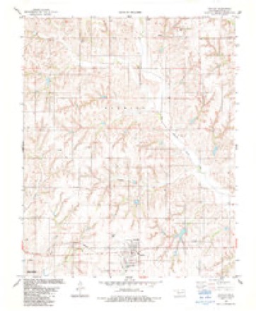
7 surveys from 11 printed sheetsMatched by testing this settlement's coordinate against the published boundary of every sheet in the United States Geological Survey's historical collection. Each opens the scanned sheet at the Survey.
- 1955 USGS Clinton quadrangle1:250000, 3 printings
- 1957 USGS Butler quadrangle1:62500, 2 printings
- 1957 USGS Clinton quadrangle1:250000
- 1976 USGS Butler NW quadrangle1:24000
- 1983 USGS Butler quadrangle1:24000, 2 printings
- 1984 USGS Foss Reservoir quadrangle1:100000
- 1990 USGS Foss Reservoir quadrangle1:100000
Fires near this place
9 since 1995Regional context, not property-specific evidence. The federal wildfire occurrence database lists 9 fires within 5 miles of Butler between 1995 and 2018, burning about 381 acres in total. 2 started naturally. None was recorded as arson. Distance is straight-line from the map coordinates, so a fire counted here may appear on a neighbouring settlement's page as well.
| Reported cause | Fires |
|---|---|
| Missing data/not specified/undetermined | 3 |
| Debris and open burning | 3 |
| Natural | 2 |
| Equipment and vehicle use | 1 |
The most recent of them, most recent first, with the day each was reported and the service that recorded it.
| Date | Cause | Size | Reported by | Name on the report |
|---|---|---|---|---|
| 19 August 2003 | Missing data/not specified/undetermined | 45 acres | Washita National Wildlife Refuge | LAKEVIEW03 |
| 8 July 1999 | Debris and open burning | 38 acres | Washita National Wildlife Refuge | LAKEVIEW99 |
| 27 July 1998 | Natural | 34 acres | Washita National Wildlife Refuge | JOHNSON |
| 25 June 1995 | Debris and open burning | 44 acres | Washita National Wildlife Refuge | ARNETT |
| 26 May 2011 | Missing data/not specified/undetermined | under an acre | Washita National Wildlife Refuge | SQRSPARK |
| 20 May 2013 | Natural | 5.0 acres | Washita National Wildlife Refuge | WASHITA ASSIST |
| 12 May 2018 | Missing data/not specified/undetermined | under an acre | Washita National Wildlife Refuge | BUTLER FIRE |
| 9 April 2009 | Equipment and vehicle use | 47 acres | Washita National Wildlife Refuge | NEWMAN |
Settlements close enough to share some of these fires:
Storms near this place
60 of 79 shownRegional context, not property-specific evidence. The National Weather Service names Butler in 79 storm reports between 1994 and 2026: 47 thunderstorm wind, 24 hail, 6 tornado, 2 flash flood. The reports record 1 injury. Each account below is quoted exactly as the forecast office filed it, from the NOAA Storm Events Database, and each date opens the federal record of that event.
| When | Event | Place named | Harm | What the report says |
|---|---|---|---|---|
| September 1997 | Flash Flood | Butler | 1 hurt | After 7 to 9 inches of rain fell in western Custer County, a normally dry tributary of the Washita River flooded to 12 to 15 feet, washing out the road and tinhorn at a low water crossing. In two separate incidents, a tractor trailer and a car drove into the flood waters. In the first case a car containing four people was washed a few feet downstream, but all occupants escaped without assistance or injury. In the second instance a truck drove into the washed-out road and was overturned by the flooded stream. The driver broke the window and escaped, and was carried 150 yards downstream before grabbing a tree. About two hours later emergency personnel were able to rescue the man from the water. The man suffered from hypothermia and extreme exhaustion and was taken to a hospital for treatment. |
| May 2024 | Tornado (EF2) | Butler | $250,000 | A television storm chaser observed this tornado develop northwest of E0930 Road and N2205 Road moving southeast crossing E0930 Road. Initially the tornado was a narrow tornado, then as it turned east-northeast quickly become a large multiple-vortex tornado as observed visually and in the damage pattern. The total damage width was about 2.7 miles along N2240 Road, including both damaging inflow winds north of the tornado and very strong damaging Rear Flank Downdraft (RFD) winds south of the tornado, but the tornado width itself was about one mile wide based on the damage survey and preliminary mobile radar data from Texas Tech University. The tornado narrowed as it approached US-183 near E0920 Road and dissipated soon afterwards.||Although tree and power pole damage was observed along the entire path, the most significant structure damage occurred along E020 Road from near N2240 Road to just east of US-183. At least two outbuildings were destroyed and two others damaged and one home had roof damage. As the tornado approached N2260 Road, a trailer and a rail car used for storage were blown a significant distance to the west, despite being on the southern periphery of the damage area, giving further evidence of the multiple-vortex tornado.||Preliminary data from a Ka-band mobile research radar from Texas Tech University showed a peak instantaneous velocity of 87.9 m/s (197 mph) at about 30 meters AGL when the tornado was approximately 6 miles west-northwest of Custer City. This was an instantaneous velocity measurement which is not directly compatible with the 3-second average wind velocity used by the EF-scale to determine intensity, but does provide indirect evidence that the tornado was likely stronger locally than the EF2 rating based on the damage survey. |
| May 2024 | Thunderstorm Wind | Butler | $75,000 | A swath of strong winds were observed by storm chasers and damage associated with these winds were observed by a NWS damage survey team. Research meteorologists with the National Severe Storms Laboratory also made measurements of these strong winds (see separate entries). Damage was observed from near and north of State Highway 33 from about 3 miles east of Butler to 7 miles east and east-northeast of Butler. These winds were likely associated with a strong rear-flank downdraft (RFD) of a supercell thunderstorm that eventually produced a tornado that began 7 miles east-northeast of Butler. ||Through this area of damage, numerous (at least a dozen) outbuildings were significantly damaged or destroyed and at least two houses received roof damage. Numerous trees and power poles were also damaged throughout this area. |
| October 2001 | Tornado (F3) | Butler | $50,000 | B1. Custer County portion. About 1 mile northeast of where the tornado crossed into Custer County, a home of wood frame with brick exterior, had most of its interior and exterior walls destroyed. The tornado then continued across an unpopulated area, causing major damage to trees and fences, before dissipating 2.5 miles west of Foss Dam. |
| May 2024 | Thunderstorm Wind | Butler | $25,000 | Thunderstorms winds, likely associated with the rear flank downdraft (RFD) of the supercell moving across Custer County, produced sporadic tree and power pole damage through Butler. Damage also occurred to equipment at the farm cooperative and at least a couple of buildings in town. |
| August 2025 | Thunderstorm Wind | Butler | $5,000 | Powerlines were blown down along East 880 Road. The location is approximate, and the event time is estimated from radar observations. |
| August 2025 | Thunderstorm Wind | Butler | $5,000 | Powerlines were blown down along East 930 Road. The location is approximate, and the event time is estimated from radar observations. |
| April 1999 | Thunderstorm Wind | Butler | $1,000 | no account filed |
| June 1994 | Thunderstorm Wind | Butler | $500 | no account filed |
| March 2026 | Thunderstorm Wind | Butler | - | Butler (BUTL) Mesonet observation. |
| June 2025 | Hail | Butler | - | The report was relayed by emergency management. The location is approximate. |
| May 2024 | Hail | Butler | - | MPing report. |
| May 2024 | Hail | Butler | - | MPing report. |
| May 2024 | Thunderstorm Wind | Butler | - | National Severe Storms Laboratory Mobile Mesonet observation. |
| May 2024 | Thunderstorm Wind | Butler | - | National Severe Storms Laboratory Mobile Mesonet observation. |
| June 2023 | Thunderstorm Wind | Butler | - | Butler (BUTL) Mesonet observation. |
| June 2023 | Thunderstorm Wind | Butler | - | Butler (BUTL) Mesonet observation. |
| June 2023 | Thunderstorm Wind | Butler | - | Butler (BUTL) Mesonet observation. |
| August 2023 | Thunderstorm Wind | Butler | - | Butler (BUTL) Mesonet observation. |
| August 2023 | Thunderstorm Wind | Butler | - | Butler (BUTL) Mesonet observation. |
| August 2023 | Thunderstorm Wind | Butler | - | Butler (BUTL) Mesonet observation. |
| May 2019 | Tornado (EFU) | Butler | - | Two storm chasers observed a tornado in a rural area of northern Custer County north of Butler. No damage was reported and the tornado path is estimated. |
| March 2015 | Hail | Butler | - | No damage reported. |
| April 2015 | Tornado (EF0) | Butler | - | Spotters reported a tornado touched down about 4 miles northwest of Butler. The tornado produced no known damage. |
| May 2015 | Flash Flood | Butler | - | Foss Lake Campground flooded. |
| June 2011 | Thunderstorm Wind | Butler | - | No damage occurred with the wind gust. |
| March 2010 | Tornado (EF0) | Butler | - | Video evidence suggested this tornado occurred after the tornado near Hammon dissipated. No damage occurred with this tornado. |
| July 2010 | Thunderstorm Wind | Butler | - | Minor damage to a hay barn was reported. Monetary damage estimates were not available. |
| March 2004 | Tornado (F0) | Butler | - | Numerous storm chasers observed this short-lived tornado touchdown in open country. No damage was reported. |
| June 2003 | Thunderstorm Wind | Butler | - | Wind was measured by the Oklahoma mesonet. |
| May 2003 | Thunderstorm Wind | Butler | - | Wind was measured by the Oklahoma mesonet. |
| June 2002 | Thunderstorm Wind | Butler | - | Wind was measured by the Oklahoma mesonet. |
| June 2002 | Thunderstorm Wind | Butler | - | Wind was measured by the Oklahoma mesonet. |
| September 2002 | Thunderstorm Wind | Butler | - | Wind was measured by the Oklahoma mesonet. |
| April 2001 | Thunderstorm Wind | Butler | - | Wind was measured by Oklahoma mesonet. |
| May 2001 | Thunderstorm Wind | Butler | - | Wind was measured by Oklahoma mesonet. |
| September 2001 | Thunderstorm Wind | Butler | - | Wind was measured by Oklahoma mesonet. |
| April 1998 | Thunderstorm Wind | Butler | - | measured at the Oklahoma Mesonet site |
| June 1997 | Thunderstorm Wind | Butler | - | measured at the Oklahoma Mesonet site |
| June 1997 | Thunderstorm Wind | Butler | - | measured at the Oklahoma Mesonet site |
| August 1997 | Thunderstorm Wind | Butler | - | measured at the Oklahoma Mesonet site |
| August 1997 | Thunderstorm Wind | Butler | - | measured at the Oklahoma Mesonet site |
| May 2022 | Hail | Butler | - | no account filed |
| December 2022 | Thunderstorm Wind | Butler | - | no account filed |
| April 2019 | Hail | Butler | - | no account filed |
| July 2017 | Thunderstorm Wind | Butler | - | no account filed |
| April 2013 | Hail | Butler | - | no account filed |
| June 2011 | Hail | Butler | - | no account filed |
| May 2011 | Hail | Butler | - | no account filed |
| August 2011 | Thunderstorm Wind | Butler | - | no account filed |
| August 2009 | Thunderstorm Wind | Butler | - | no account filed |
| April 2009 | Hail | Butler | - | no account filed |
| April 2009 | Hail | Butler | - | no account filed |
| April 2009 | Hail | Butler | - | no account filed |
| April 2009 | Hail | Butler | - | no account filed |
| April 2009 | Hail | Butler | - | no account filed |
| May 2009 | Thunderstorm Wind | Butler | - | no account filed |
| July 2009 | Hail | Butler | - | no account filed |
| March 2008 | Thunderstorm Wind | Butler | - | no account filed |
| June 2008 | Thunderstorm Wind | Butler | - | no account filed |
Nearest settlements
The eight closest, with where each one stands in the county. Distances are straight-line, computed from the Geographic Names Information System coordinates.
| Map | Place | Distance | Sheets |
|---|---|---|---|
| McClure | 6.4 miles | 8 | |
| Stafford | 7.7 miles | 10 | |
| Osceola (historical) | 7.9 miles | 8 | |
| Moorewood | 11.2 miles | 8 | |
| Anthon | 11.6 miles | 10 | |
| Arapaho | 12.4 miles | 10 | |
| Ralph | 12.8 miles | 10 | |
| Parkersburg | 13.1 miles | 10 |
Elsewhere
Matched on this settlement's Geographic Names Information System number rather than its name, so it cannot be a different place of the same name in another state.
| Wikipedia article on Butler | An encyclopaedic summary. Its text is share-alike, so it is linked here rather than copied. |
| Wikidata item Q2187508 | The structured record the population and elevation above come from. Public domain (CC0). |
Provenance
This settlement is recorded in the Geographic Names Information System as feature 1090743. The sheet list is computed by point-in-boundary test against the United States Geological Survey's historical topographic inventory. Both are works of the United States government and carry no copyright under 17 U.S.C. 105.
Wildfire. Short, Karen C. 2022. Spatial wildfire occurrence data for the United States, 1992-2020 [FPA_FOD_20221014]. 6th Edition. Fort Collins, CO: Forest Service Research Data Archive. https://doi.org/10.2737/RDS-2013-0009.6 Collected with United States Government funding and usable without additional permissions or fees.
Storms. NOAA National Centers for Environmental Information, Storm Events Database https://www.ncei.noaa.gov/stormevents/ A work of the United States government, no copyright under 17 U.S.C. 105. Narratives are quoted verbatim from the National Weather Service report and are not edited or summarised.