 Block
Calera, Oklahoma
8 topographic sheets cover this place, the earliest surveyed in 1954 and the latest in 1985. It stands in the Durant census division. It lies in ZIP code area 74730. The Survey maps it on the Durant South quadrangle. 2,916 people lived here at the 2020 count. It stands 712 feet above sea level.
Population over time
3 figuresCalera grew from 575 to 2,916 between 1900 and 2020. These are the recorded population figures Wikidata holds for this place, reached through the Geographic Names Information System number this page is keyed on rather than by name, so they belong to this place and not to another of the same name. Most are census counts, but not all are: an early figure may be a founding or settlement estimate, and an estimate published within five years of a census is left out. The change column is computed, and is left blank where more than 20 years separate a figure from the one before it, because a gap that long is not a change between two counts.
| Year | People | Change |
|---|---|---|
| 1900 | 575 | |
| 2010 | 2,164 | |
| 2020 | 2,916 | +752 (+35%) |
Topographic sheets covering this place
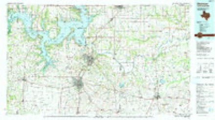
5 surveys from 8 printed sheetsMatched by testing this settlement's coordinate against the published boundary of every sheet in the United States Geological Survey's historical collection. Each opens the scanned sheet at the Survey.
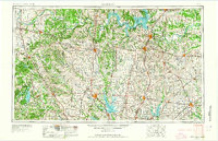
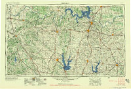
- 1954 USGS Sherman quadrangle1:250000, 2 printings
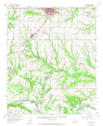
- 1958 USGS Durant quadrangle1:62500, 3 printings
- 1958 USGS Sherman quadrangle1:250000
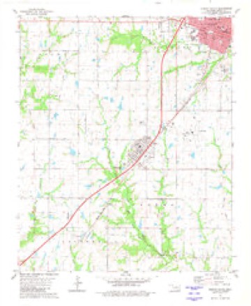
- 1980 USGS Durant South quadrangle1:24000
- 1985 USGS Sherman quadrangle1:100000
Fires near this place
11 since 2006Regional context, not property-specific evidence. The federal wildfire occurrence database lists 11 fires within 5 miles of Calera in 2006, burning about 107 acres in total. 1 started naturally. 5 were recorded as arson. Distance is straight-line from the map coordinates, so a fire counted here may appear on a neighbouring settlement's page as well.
| Reported cause | Fires |
|---|---|
| Arson/incendiarism | 5 |
| Missing data/not specified/undetermined | 3 |
| Debris and open burning | 1 |
| Natural | 1 |
| Equipment and vehicle use | 1 |
The most recent of them, most recent first, with the day each was reported and the service that recorded it.
| Date | Cause | Size | Reported by | Name on the report |
|---|---|---|---|---|
| 28 July 2006 | Missing data/not specified/undetermined | 39 acres | Chickasaw Agency | JACK RABBIT |
| 21 July 2006 | Debris and open burning | 27 acres | Chickasaw Agency | BATES FIRE |
| 11 July 2006 | Equipment and vehicle use | 8.6 acres | Chickasaw Agency | ORCHARD RD |
| 1 July 2006 | Natural | 1.4 acres | Chickasaw Agency | GOGGINS |
| 5 February 2006 | Arson/incendiarism | 1.0 acres | Talihina Agency | SILO |
| 30 January 2006 | Arson/incendiarism | 22 acres | Talihina Agency | JUNIPERORC |
| 25 January 2006 | Arson/incendiarism | under an acre | Talihina Agency | CHUCKS4WAY |
| 19 January 2006 | Missing data/not specified/undetermined | under an acre | Chickasaw Agency | ALABAMA |
Settlements close enough to share some of these fires:
Mines and quarries near this place
1 within 5 milesRegional context, not property-specific evidence. The federal mineral resources record lists 1 working within 5 miles of Calera: 1 past producer. None of them still produces. What was taken out: Sand and Gravel, Construction. Distance is straight-line from the map coordinates, so a quarry counted here may appear on a neighbouring settlement's page as well.
| Where | Site | Commodity | Status | Recorded |
|---|---|---|---|---|
| Unknown Sand Pit | Sand and Gravel, Construction | Past Producer |
Storms near this place
31 since 1993Regional context, not property-specific evidence. The National Weather Service names Calera in 31 storm reports between 1993 and 2025: 14 thunderstorm wind, 11 hail, 3 lightning, 2 flash flood. The reports record 1 death and 5 injuries. Each account below is quoted exactly as the forecast office filed it, from the NOAA Storm Events Database, and each date opens the federal record of that event.
| When | Event | Place named | Harm | What the report says |
|---|---|---|---|---|
| April 2003 | Lightning | Calera | 1 killed | A woman was killed when she was struck by lightning as she was walking to her car. |
| August 2012 | Thunderstorm Wind | Calera | 5 hurt, $45,000 | Widespread damage to trees and power lines reported, with structural damage to homes. One vehicle was blown off the road, and several injuries were also reported. |
| June 1998 | Thunderstorm Wind | Calera | $100,000 | Significant and widespread wind damage was reported in Calera. A roof was blown off a trailer house on the east side of town, at least three trailer houses were destroyed, and one brick home was damaged by downed trees. Numerous barns and outbuildings were damaged and/or unroofed. Three businesses in an industrial complex at the airport sustained structural damage. Fifteen other businesses received minor damage. |
| November 2022 | Tornado (EF1) | Calera | $75,000 | A tornado touched down southwest of Calera crossing US-69 and blowing a semi truck and trailer into the median. A number of unoccupied, unanchored mobile homes just north of US-69 were displaced and damaged including at least one that was rolled and destroyed. The tornado moved northeast, parallel to and just northwest of US-69, and moved into the west and north sides of Calera. A number of trees had damage or were snapped in Calera with at least two houses heavily damaged by falling trees. Other homes in town received shingle damage from the tornado. The tornado dissipated just northeast of the city limits of Calera before reaching Choctaw Road. |
| November 1996 | Lightning | Calera | $35,000 | no account filed |
| June 2025 | Thunderstorm Wind | Calera | $25,000 | A barn was destroyed and trees were blown down near the intersection of Platter Road and Choice Lane. The event time is estimated from radar observations. |
| April 2008 | Lightning | Calera | $10,000 | A lightning strike at a nursing home caused some roof damage. No other damage was reported. Monetary damages were estimated. |
| February 2001 | Thunderstorm Wind | Calera | $10,000 | Four barns were destroyed, and siding was blown off a mobile home. |
| April 1995 | Thunderstorm Wind | Calera | $5,000 | Thunderstorms developed in southwest Oklahoma throughout the afternoon and evening then moved northeastward across south-central and central Oklahoma through the evening, producing eight tornados, large hail, damaging straight-line winds, and flash flooding. Other isolated severe storms in northwest Oklahoma produced large hail. The first tornado, a brief F0, occurred on the Red River six miles southwest of Grandfield in Tillman County and did no reported damage. The storm then moved into Cotton County where it spawned its second, third, and fourth tornados. The second tornado was spotted four miles southwest of Devol and the third was just southeast of Devol. No damage was reported with either tornado and both were rated F0. The fourth tornado of the day began about 2.6 miles north and one-half miles west of Temple in Cotton County and moved east-northeast for two miles before dissipating. Along this path, several trees were uprooted or snapped off at ground level, power lines were downed, and a 200 foot radio tower was snapped, toppling the top half. Several metal sheds were also destroyed. This damage was rated F2. The fifth tornado, an F1, was a brief spin-up just east of the Cotton/Stephens County line, or about two miles west of Corum. The tornado touched down briefly in a field, damaging a metal shed and uprooting several trees. The sixth tornado, an F1, touched down about three miles west-northwest of downtown Comanche and tracked just north of due east, lifting about three miles northwest of Comanche. Several barns and sheds were damaged along this path, ranging from minor shingle damage to complete destruction of outbuildings. At a church about a mile north of Comanche, a steeple was toppled and driven into the church and an outbuilding collapsed at a nearby cemetery. Other damage included a school bus rolled 25 feet, large tree branches downed, and several power lines downed one to two miles northwest of Comanche. This damage was rated as F1 by ground survey teams. The storm continued across Stephens County and produced a seventh tornado, an F1, in Velma. Trees were twisted and the roof was blown off a water pump station. The eighth and final tornado occurred on the Murray/Garvin County line two and one-half miles northwest of Joy (or one and one-half miles southeast of Wynnewood). No damage was reported with this F0 tornado. Aside from the tornados, strong winds, large hail, and flash flooding were also reported. Straight line winds up to 80 mph were reported in Frederick in Tillman County. Windows were broken out of a house by baseball-size hail in Tipton, also in Tillman County. Severe straight-line wind damage occurred in and near Corum between 1715 CST and 1725 CST. The roof of a gift shop was partially removed and a beauty shop housed in a mobile home was completely destroyed. A tractor-semitrailer was overturned, a roof was lifted off a church, and a steeple was blown off. Several trees and signs and two barns were also destroyed. Also in Stephens County severe thunderstorm winds destroyed a barn in Faxon. In Jefferson County trees were snapped and sheet iron was blown off a barn in the northwest part of the county. In Cleveland County severe thunderstorm winds downed two large trees 12 miles east of Noble and snapped one foot tree branches eight miles east of Noble. In Carter County power lines were downed near Healdton and three barns and a wellhouse were destroyed five miles north of Lone Grove. Four houses north of Lone Grove also sustained slight damage to their roofs. In Love County severe winds downed power lines one mile south of Marietta. In Hughes County tree limbs were broken eight miles north of Holdenville by winds reported at 75 mph. In Bryan County four-foot-diameter trees were blown down in Hendrix and large trees were downed and a mobile home was blown onto a Jeep in Calera. Significant damage also occurred in Seminole County where strong straight line winds with the thunderstorm gust front cut a damage path through Wewoka. Twenty-one houses were damaged, mainly from trees falling on them, and 25 trees were downed across roads. A car was overturned by flash flood waters in Stephens County just east of Corum. None of the four passengers were hurt. The thunderstorms in northwest Oklahoma produced hail as large as golf balls 17 miles north of Chester in Major County and eight miles southwest of Alva in Woods County. |
| October 1995 | Thunderstorm Wind | Calera | $5,000 | no account filed |
| June 1998 | Thunderstorm Wind | Calera | $2,000 | Severe thunderstorm winds blew siding off a house, tore the roof from a fruit stand, and downed many trees. |
| May 2020 | Thunderstorm Wind | Calera | $1,000 | Power pole downed. |
| June 1998 | Thunderstorm Wind | Calera | $750 | Telephone poles were blown down. |
| June 2025 | Thunderstorm Wind | Calera | - | An estimated wind gust at the intersection of U.S. Highway 69/75 and Platter Road. The report was relayed by emergency management. |
| May 2024 | Hail | Calera | - | Hail size increased from pea to quarter from 1213-1221 LST. |
| May 2022 | Thunderstorm Wind | Calera | - | Blown transformers. |
| October 2021 | Thunderstorm Wind | Calera | - | Power lines downed and damage reported along highway 70. |
| April 2015 | Hail | Calera | - | No damage reported. |
| May 1995 | Hail | Calera | - | Severe thunderstorms producing large hail moved across southern Oklahoma during the evening of the 3rd. In Comanche County, Ping-Pong ball-size hail lasted for almost 10 minutes and was reported covering the ground southwest of Lawton at 1900 CST. In Stephens County hail as large as baseballs was reported one mile south of Comanche and five miles east of Comanche. In the town of Comanche itself, police car windshields were broken out by large hail. |
| August 1993 | Thunderstorm Wind | Calera | - | Thunderstorms during the early afternoon hours on the 24th produced strong winds which blew the roof off a mobile home in Colbert and downed telephone lines in Calera. |
| June 2019 | Hail | Calera | - | no account filed |
| March 2012 | Hail | Calera | - | no account filed |
| April 2004 | Hail | Calera | - | no account filed |
| June 2004 | Thunderstorm Wind | Calera | - | no account filed |
| May 2003 | Hail | Calera | - | no account filed |
| April 1999 | Hail | Calera | - | no account filed |
| April 1999 | Hail | Calera | - | no account filed |
| March 1998 | Hail | Calera | - | no account filed |
| November 1996 | Flash Flood | Calera | - | no account filed |
| November 1996 | Flash Flood | Calera | - | no account filed |
| March 1996 | Hail | Calera | - | no account filed |
Nearest settlements
The eight closest, with where each one stands in the county. Distances are straight-line, computed from the Geographic Names Information System coordinates.
| Map | Place | Distance | Sheets |
|---|---|---|---|
| Olive | 2.1 miles | 8 | |
| Allison | 4.0 miles | 8 | |
| Durant | 5.1 miles | 8 | |
| Kiersey | 5.3 miles | 14 | |
| Platter | 5.9 miles | 11 | |
| Lee Heights | 6.0 miles | 8 | |
| Old Allison | 6.1 miles | 8 | |
| Mead | 6.2 miles | 11 |
Elsewhere
Matched on this settlement's Geographic Names Information System number rather than its name, so it cannot be a different place of the same name in another state.
| Wikipedia article on Calera | An encyclopaedic summary. Its text is share-alike, so it is linked here rather than copied. |
| Wikidata item Q2260169 | The structured record the population and elevation above come from. Public domain (CC0). |
Provenance
This settlement is recorded in the Geographic Names Information System as feature 1090807. The sheet list is computed by point-in-boundary test against the United States Geological Survey's historical topographic inventory. Both are works of the United States government and carry no copyright under 17 U.S.C. 105.
Wildfire. Short, Karen C. 2022. Spatial wildfire occurrence data for the United States, 1992-2020 [FPA_FOD_20221014]. 6th Edition. Fort Collins, CO: Forest Service Research Data Archive. https://doi.org/10.2737/RDS-2013-0009.6 Collected with United States Government funding and usable without additional permissions or fees.
Mines and quarries. USGS Mineral Resources Data System (MRDS) https://mrdata.usgs.gov/mrds/ A work of the United States government, no copyright under 17 U.S.C. 105.
Storms. NOAA National Centers for Environmental Information, Storm Events Database https://www.ncei.noaa.gov/stormevents/ A work of the United States government, no copyright under 17 U.S.C. 105. Narratives are quoted verbatim from the National Weather Service report and are not edited or summarised.