 Block
Carmen, Oklahoma
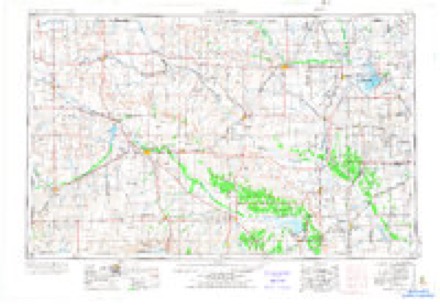
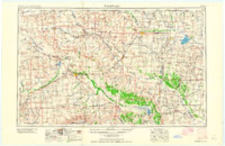
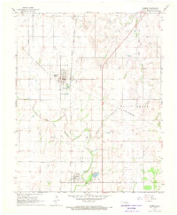
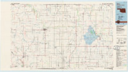
8 topographic sheets cover this place, the earliest surveyed in 1955 and the latest in 1990. It stands in the Carmen census division. It lies in ZIP code area 73726. The Survey maps it on the Carmen quadrangle. 360 people lived here at the 2020 count.
On record in Carmen
Buildings and businesses the archive holds for this place. Each opens its own page, with the source record it came from.
On the National Register 2 records
- Carmen IOOF Homelisted 1984
- Carmen IOOF Lodge No. 84listed 1984
Population over time
2 figuresCarmen grew from 355 to 360 between 2010 and 2020. These are the recorded population figures Wikidata holds for this place, reached through the Geographic Names Information System number this page is keyed on rather than by name, so they belong to this place and not to another of the same name. Most are census counts, but not all are: an early figure may be a founding or settlement estimate, and an estimate published within five years of a census is left out. The change column is computed, and is left blank where more than 20 years separate a figure from the one before it, because a gap that long is not a change between two counts.
| Year | People | Change |
|---|---|---|
| 2010 | 355 | |
| 2020 | 360 | +5 (+1%) |
Topographic sheets covering this place
5 surveys from 8 printed sheetsMatched by testing this settlement's coordinate against the published boundary of every sheet in the United States Geological Survey's historical collection. Each opens the scanned sheet at the Survey.
- 1955 USGS Woodward quadrangle1:250000, 3 printings
- 1958 USGS Woodward quadrangle1:250000, 2 printings
- 1968 USGS Carmen quadrangle1:24000
- 1985 USGS Alva quadrangle1:100000
- 1990 USGS Alva quadrangle1:100000
Storms near this place
24 since 1994Regional context, not property-specific evidence. The National Weather Service names Carmen in 24 storm reports between 1994 and 2026: 9 hail, 9 thunderstorm wind, 4 tornado, 1 lightning. No death or injury is recorded in these reports. Each account below is quoted exactly as the forecast office filed it, from the NOAA Storm Events Database, and each date opens the federal record of that event.
| When | Event | Place named | Harm | What the report says |
|---|---|---|---|---|
| May 2012 | Thunderstorm Wind | Carmen | $100,000 | Widespread damage reported in Carmen. Three foot diameter tree limbs down with loss of electricity to most of the town. Damages are estimated. |
| April 2002 | Tornado (F2) | Carmen | $75,000 | This tornado is a continuation of the tornado that developed in Major County and moved through Woods County. The tornado tracked for another 15 miles in Alfalfa County before dissipating 2 miles southwest of Ingersoll. As the tornado entered Alfalfa County, damage was sustained to outbuildings, trees and power lines, along State Highway 45 to the west of Carmen. Large trees were uprooted or snapped, and a windmill was destroyed along EW 25 Road to the east of NS 253 Road, or about 4.5 miles southwest of Lambert. Along the west side of NS 255 Road, between EW 23 Road and EW 22 Road (about 2.5 miles west of Lambert), a barn roof was removed as was the west section of the barn. Numerous power poles were snapped along EW 22 Road in a ½ mile area to the east of NS 255 Road. Several high-tension power poles were damaged or destroyed west of NS 256 Road and south of EW 21 Road. Significant tree damage and a couple of destroyed outbuildings were observed at the northeast corner of EW 20 and NS 256 Roads, about 5.5 miles southwest of Cherokee. The tornado continued north-northeast with the last damage observed along EW 17 Road just east of NS 257 Road, 2 miles southwest of Ingersoll, or about 4 miles west-northwest of Cherokee.In total, the tornado persisted for 62 minutes and traveled 34 miles. |
| October 1998 | Tornado (F2) | Carmen | $55,000 | no account filed |
| May 2000 | Tornado (F1) | Carmen | $15,000 | This tornado, rated F1, touched down about 5 miles east of Carmen about ½ mile south of the intersection of EW29 Road and NS260 Road in Alfalfa County where scattered damage to trees was observed. At the intersection of EW29 Road and NS260 Road, very large limbs, some a foot or more in diameter, were blown off dozens of trees, while numerous other trees were pushed over. There was also damage to an oil storage tank made of metal. A telephone pole at the intersection was recently replaced and is assumed to have been downed during the tornado. A west to east chain link fence approximately 100 to 200 feet long was also downed southward. Major tree damage was then observed at a property about ½ mile northeast of this location with many trees laying in a westward direction. A well-designed brick home near the trees, lost dozens perhaps hundreds of shingles, especially on the west side of the house. About 1 mile northeast of this location another house sustained a broken window on the north side of the house and minor roof damage, consisting mostly of missing roof shingles. Metal siding was partially peeled back from a nearby storage barn, and a medium-aged pine tree on the west side of the house was snapped halfway to the top. Near the intersection of EW27 Road and NS262 Road damage was observed to 2 metal barns. One barn had sheet metal peeled back on the roof and west and east sides. The roof of a storage building was also blown off in an eastward direction and left nearly intact on the ground. About ½ to 1 mile north and east of this location a poorly constructed barn sustained minor roof and west-side wall damage, while another barn constructed of metal had its 2 west-facing doors blown inward and partially detached from its hinges. Continuing northward trees sustained major damage, and a grain storage silo was tossed a short distance eastward from its original location. The last area of damage was observed about ½ mile north of US Highway 64 on NS264 Road where 4 pieces of sheet metal were blown off a storage barn. |
| July 2024 | Thunderstorm Wind | Carmen | $10,000 | Multiple power poles with varying degrees of thunderstorm wind damage, including a few that were snapped. Time is radar estimated. |
| August 1999 | Lightning | Carmen | $10,000 | no account filed |
| September 2011 | Thunderstorm Wind | Carmen | $8,000 | Six power poles were snapped. Monetary damages were estimated. |
| June 2005 | Thunderstorm Wind | Carmen | $5,000 | One foot diameter trees downed. Power poles were also downed. |
| July 2000 | Thunderstorm Wind | Carmen | $5,000 | Twelve utility poles were downed. |
| October 1994 | Tornado (F1) | Carmen | $5,000 | no account filed |
| June 2005 | Thunderstorm Wind | Carmen | $2,500 | Power lines were downed across Main Street. |
| July 2005 | Thunderstorm Wind | Carmen | $2,500 | Power lines were downed. |
| April 2026 | Hail | Carmen | - | The report was relayed through mPING. The event time was adjusted based on radar observations. |
| August 2015 | Thunderstorm Wind | Carmen | - | No damage reported. |
| June 2000 | Flash Flood | Carmen | - | Highway 8 was closed due to flooding. |
| May 2019 | Hail | Carmen | - | no account filed |
| May 2019 | Hail | Carmen | - | no account filed |
| May 2019 | Hail | Carmen | - | no account filed |
| May 2018 | Hail | Carmen | - | no account filed |
| August 2015 | Hail | Carmen | - | no account filed |
| September 2010 | Hail | Carmen | - | no account filed |
| May 2006 | Thunderstorm Wind | Carmen | - | no account filed |
| April 2004 | Hail | Carmen | - | no account filed |
| May 1999 | Hail | Carmen | - | no account filed |
Nearest settlements
The eight closest, with where each one stands in the county. Distances are straight-line, computed from the Geographic Names Information System coordinates.
Elsewhere
Matched on this settlement's Geographic Names Information System number rather than its name, so it cannot be a different place of the same name in another state.
| Wikipedia article on Carmen | An encyclopaedic summary. Its text is share-alike, so it is linked here rather than copied. |
| Wikidata item Q1911371 | The structured record the population and elevation above come from. Public domain (CC0). |
Provenance
This settlement is recorded in the Geographic Names Information System as feature 1090974. The sheet list is computed by point-in-boundary test against the United States Geological Survey's historical topographic inventory. Both are works of the United States government and carry no copyright under 17 U.S.C. 105.
Storms. NOAA National Centers for Environmental Information, Storm Events Database https://www.ncei.noaa.gov/stormevents/ A work of the United States government, no copyright under 17 U.S.C. 105. Narratives are quoted verbatim from the National Weather Service report and are not edited or summarised.