 Block
Cookietown, Oklahoma
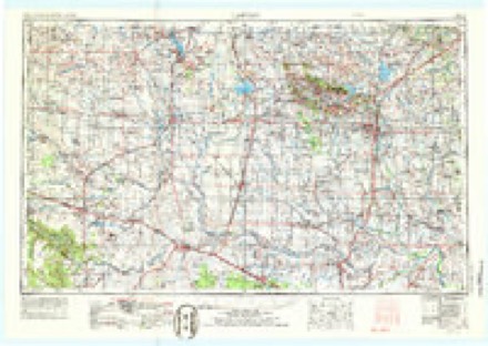
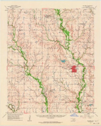
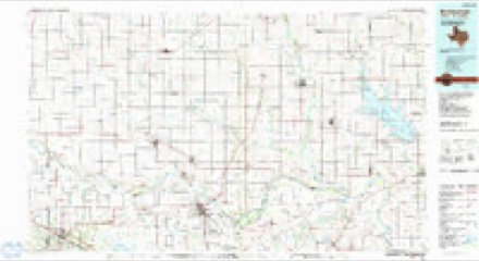
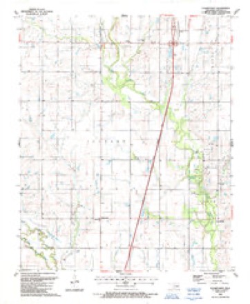
9 topographic sheets cover this place, the earliest surveyed in 1955 and the latest in 1987. It stands in the Walters census division. It lies in ZIP code area 73562. The Survey maps it on the Cookietown quadrangle.
Topographic sheets covering this place
4 surveys from 9 printed sheetsMatched by testing this settlement's coordinate against the published boundary of every sheet in the United States Geological Survey's historical collection. Each opens the scanned sheet at the Survey.
- 1955 USGS Lawton quadrangle1:250000, 5 printings
- 1962 USGS Walters quadrangle1:62500
- 1985 USGS Burkburnett quadrangle1:100000, 2 printings
- 1987 USGS Cookietown quadrangle1:24000
Fires near this place
11 since 2000Regional context, not property-specific evidence. The federal wildfire occurrence database lists 11 fires within 5 miles of Cookietown between 2000 and 2020, burning about 1,761 acres in total. 2 started naturally. None was recorded as arson. Distance is straight-line from the map coordinates, so a fire counted here may appear on a neighbouring settlement's page as well.
| Reported cause | Fires |
|---|---|
| Equipment and vehicle use | 4 |
| Debris and open burning | 2 |
| Natural | 2 |
| Power generation/transmission/distribution | 2 |
| Missing data/not specified/undetermined | 1 |
The most recent of them, most recent first, with the day each was reported and the service that recorded it.
| Date | Cause | Size | Reported by | Name on the report |
|---|---|---|---|---|
| 13 September 2000 | Natural | 4.0 acres | Anadarko Agency | BIG BOW |
| 16 August 2019 | Equipment and vehicle use | 166 acres | Anadarko Agency | WALTER 5 |
| 29 June 2012 | Equipment and vehicle use | 332 acres | Anadarko Agency | DEEP RED CREEK |
| 13 June 2005 | Natural | 125 acres | Anadarko Agency | DRY-RED |
| 11 June 2020 | Equipment and vehicle use | 2.8 acres | Anadarko Agency | 1340 ROAD |
| 15 April 2009 | Debris and open burning | 10 acres | Anadarko Agency | DEEP RED RUN |
| 2 February 2017 | Missing data/not specified/undetermined | 3.0 acres | Anadarko Agency | MILE 15 |
| 12 February 2006 | Power generation/transmission/distribution | 12 acres | Anadarko Agency | ATTYB |
Mines and quarries near this place
9 within 5 milesRegional context, not property-specific evidence. The federal mineral resources record lists 9 workings within 5 miles of Cookietown: 7 past producers, 2 occurrences. None of them still produces. What was taken out: Sand and Gravel, Construction, Copper, Uranium. Distance is straight-line from the map coordinates, so a quarry counted here may appear on a neighbouring settlement's page as well.
| Where | Site | Commodity | Status | Recorded |
|---|---|---|---|---|
| Randlett Northwest-1 | Copper, Uranium | Occurrence | 1955 | |
| Cookietown Northeast-1 | Copper | Occurrence | Stratabound | |
| Unknown Sand and Gravel Pit | Sand and Gravel, Construction | Past Producer | ||
| Unknown Sand and Gravel Pit | Sand and Gravel, Construction | Past Producer | ||
| Unknown Sand and Gravel Pit | Sand and Gravel, Construction | Past Producer | ||
| Unknown Sand and Gravel Pit | Sand and Gravel, Construction | Past Producer | ||
| Unknown Sand and Gravel Pit | Sand and Gravel, Construction | Past Producer | ||
| Unknown Sand and Gravel Pits | Sand and Gravel, Construction | Past Producer | ||
| Unknown Sand and Gravel Pits | Sand and Gravel, Construction | Past Producer |
Storms near this place
29 since 1994Regional context, not property-specific evidence. The National Weather Service names Cookietown in 29 storm reports between 1994 and 2025: 17 hail, 8 thunderstorm wind, 2 tornado, 2 flash flood. No death or injury is recorded in these reports. Each account below is quoted exactly as the forecast office filed it, from the NOAA Storm Events Database, and each date opens the federal record of that event.
| When | Event | Place named | Harm | What the report says |
|---|---|---|---|---|
| May 2025 | Thunderstorm Wind | Cookietown | $50,000 | A semi-trailer was blown over due to thunderstorm winds. The event time and location are estimated from a phone call report and radar observations. |
| August 1997 | Thunderstorm Wind | Cookietown | $7,000 | A truck with a trailer of 350 gallons of diesel fuel was blown over by severe thunderstorm winds. |
| June 1994 | Thunderstorm Wind | Cookietown | $5,000 | no account filed |
| September 2023 | Thunderstorm Wind | Cookietown | - | Relayed images showing wind damage on a farm in the vicinity. The most significant damage occurred to a large metal barn, which had its roof fully removed. Time is radar estimated. |
| May 2016 | Thunderstorm Wind | Cookietown | - | A metal grain silo was wrapped around the highway divider cable at mile marker 16 on I-44. The time of this report was estimated based on radar. |
| July 2014 | Flash Flood | Cookietown | - | Walters Fire Department responded to a high water rescue near Walters. Exact location unknown. Time of event corrected. Damage estimates unknown. |
| April 2013 | Hail | Cookietown | - | No damage was reported. |
| May 2012 | Thunderstorm Wind | Cookietown | - | Public reported 60 mph winds. No damage was reported. |
| June 2007 | Flash Flood | Cookietown | - | Numerous locations on US HWY 281 between Cookietown and Randlett had water covering the road. Also, locations between Cookietown and Walters had water covering the road. |
| June 1995 | Hail | Cookietown | - | Severe thunderstorms began in southern Oklahoma during the afternoon of June 9th, and continued through early morning of the 10th. Other severe thunderstorms developed in northern and central Oklahoma during the late afternoon and evening of the 9th. In all, large hail, severe straight-line winds, flash flooding, and nine tornados were reported. The first five tornados occurred with a single storm in eastern Greer County early in the afternoon. The first tornado occurred one mile west of Mangum, and the second occurred four miles south of Granite. The third tornado was reported five miles south of Granite at Highway 6 and U.S. 283, and the fourth was spotted seven miles south of Granite on Highway 6. The 5th tornado was spotted five miles southeast of Granite. No damage was reported with any of these tornados, and all were rated as F0. The sixth tornado occurred at the Lugert dam one mile north-northeast of Lugert in Kiowa County. No damage was reported along its path, and the tornado was rated F0. The seventh tornado, a brief F0, also occurred in Kiowa County six miles south of Gotebo. The eighth tornado, an F2, occurred with a separate storm in Seminole County in central Oklahoma early in the evening. The damage path was 5.25 miles long and 400 yards wide, at its maximum width. The tornado was first spotted south of Seminole near the intersection of Highway 125 and Highway 377. It travelled east-northeast, crossed Highway 361 and Highway 9 east, and then lifted two miles east of Seminole north of Highway 9. At least 12 houses in two housing additions (one-quarter mile north of 361 and Highway 9) received extensive damage. In southeast Seminole, 16 homes sustained minor damage and one home had major damage. One death was attributed indirectly to the tornado, when a man suffered a heart attack while taking shelter from the storm. The ninth and final tornado was reported four miles southwest of Grandfield in Tillman County. No damage was reported and the tornado was rated as F0. The largest hail reported with these storms reached two-inch-diameter one mile west of Mangum in Greer County and at Hobart Municipal Airport south of Hobart in Kiowa County. Severe thunderstorm winds gusted to 67 mph at the Oklahoma Mesonet site at Red Rock in Noble County. In addition, flash flooding was reported in southwest Oklahoma. In Cotton County Highway 281 was closed south of Cookietown, Highway 70 was flooded in Taylor, and Highway 5 was flooded near Walters. In Tillman County Highway 70 was closed southwest of Grandfield. |
| May 2025 | Hail | Cookietown | - | no account filed |
| April 2011 | Hail | Cookietown | - | no account filed |
| April 2011 | Hail | Cookietown | - | no account filed |
| April 2011 | Hail | Cookietown | - | no account filed |
| May 2009 | Hail | Cookietown | - | no account filed |
| March 2004 | Thunderstorm Wind | Cookietown | - | no account filed |
| April 2004 | Thunderstorm Wind | Cookietown | - | no account filed |
| March 2003 | Hail | Cookietown | - | no account filed |
| May 2003 | Hail | Cookietown | - | no account filed |
| April 2002 | Hail | Cookietown | - | no account filed |
| May 2001 | Hail | Cookietown | - | no account filed |
| August 1997 | Hail | Cookietown | - | no account filed |
| April 1996 | Hail | Cookietown | - | no account filed |
| May 1996 | Hail | Cookietown | - | no account filed |
| June 1995 | Hail | Cookietown | - | no account filed |
| July 1995 | Tornado (F0) | Cookietown | - | no account filed |
| July 1995 | Tornado (F0) | Cookietown | - | no account filed |
| April 1994 | Hail | Cookietown | - | no account filed |
| May 1994 | Hail | Cookietown | - | no account filed |
Nearest settlements
The eight closest, with where each one stands in the county. Distances are straight-line, computed from the Geographic Names Information System coordinates.
Elsewhere
Matched on this settlement's Geographic Names Information System number rather than its name, so it cannot be a different place of the same name in another state.
| Wikipedia article on Cookietown | An encyclopaedic summary. Its text is share-alike, so it is linked here rather than copied. |
| Wikidata item Q5167115 | The structured record the population and elevation above come from. Public domain (CC0). |
Provenance
This settlement is recorded in the Geographic Names Information System as feature 1100316. The sheet list is computed by point-in-boundary test against the United States Geological Survey's historical topographic inventory. Both are works of the United States government and carry no copyright under 17 U.S.C. 105.
Wildfire. Short, Karen C. 2022. Spatial wildfire occurrence data for the United States, 1992-2020 [FPA_FOD_20221014]. 6th Edition. Fort Collins, CO: Forest Service Research Data Archive. https://doi.org/10.2737/RDS-2013-0009.6 Collected with United States Government funding and usable without additional permissions or fees.
Mines and quarries. USGS Mineral Resources Data System (MRDS) https://mrdata.usgs.gov/mrds/ A work of the United States government, no copyright under 17 U.S.C. 105.
Storms. NOAA National Centers for Environmental Information, Storm Events Database https://www.ncei.noaa.gov/stormevents/ A work of the United States government, no copyright under 17 U.S.C. 105. Narratives are quoted verbatim from the National Weather Service report and are not edited or summarised.