 Block
Cordell, Oklahoma
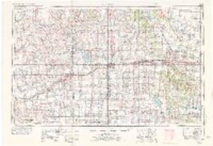
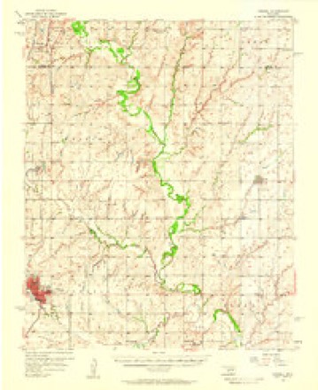
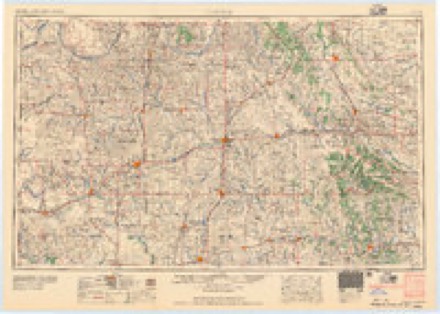
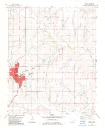
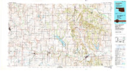
9 topographic sheets cover this place, the earliest surveyed in 1955 and the latest in 1986. It stands in the Central Washita census division. It lies in ZIP code area 73632. The Survey maps it on the Cordell quadrangle.
Research this city
On record in Cordell
Buildings and businesses the archive holds for this place. Each opens its own page, with the source record it came from.
On the National Register 2 records
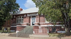 Cordell Carnegie Public Librarylisted 1989
 Washita County Courthouselisted 1984
Topographic sheets covering this place
5 surveys from 9 printed sheetsMatched by testing this settlement's coordinate against the published boundary of every sheet in the United States Geological Survey's historical collection. Each opens the scanned sheet at the Survey.
- 1955 USGS Clinton quadrangle1:250000, 3 printings
- 1956 USGS Cordell quadrangle1:62500, 2 printings
- 1957 USGS Clinton quadrangle1:250000
- 1983 USGS Cordell quadrangle1:24000
- 1986 USGS Anadarko quadrangle1:100000, 2 printings
Fires near this place
2 since 2005Regional context, not property-specific evidence. The federal wildfire occurrence database lists 2 fires within 5 miles of Cordell between 2005 and 2011, burning about 6 acres in total. None started naturally. None was recorded as arson. Distance is straight-line from the map coordinates, so a fire counted here may appear on a neighbouring settlement's page as well.
| Reported cause | Fires |
|---|---|
| Debris and open burning | 1 |
| Missing data/not specified/undetermined | 1 |
The most recent of them, most recent first, with the day each was reported and the service that recorded it.
| Date | Cause | Size | Reported by | Name on the report |
|---|---|---|---|---|
| 23 June 2005 | Missing data/not specified/undetermined | 1.0 acres | Concho Field Office | WALK |
| 14 January 2011 | Debris and open burning | 5.0 acres | Kickapoo Field Office | TIRE CREEK |
Settlements close enough to share some of these fires:
Mines and quarries near this place
1 within 5 milesRegional context, not property-specific evidence. The federal mineral resources record lists 1 working within 5 miles of Cordell: 1 past producer. None of them still produces. What was taken out: Clay. Distance is straight-line from the map coordinates, so a quarry counted here may appear on a neighbouring settlement's page as well.
| Where | Site | Commodity | Status | Recorded |
|---|---|---|---|---|
| Unknown Shale Pit | Clay | Past Producer |
Storms near this place
60 of 89 shownRegional context, not property-specific evidence. The National Weather Service names Cordell in 89 storm reports between 1993 and 2025: 57 hail, 16 thunderstorm wind, 7 flash flood, 6 tornado. The reports record 9 injuries. Each account below is quoted exactly as the forecast office filed it, from the NOAA Storm Events Database, and each date opens the federal record of that event.
| When | Event | Place named | Harm | What the report says |
|---|---|---|---|---|
| October 2001 | Tornado (F3) | Cordell | 9 hurt, $100,000,000 | C1. This tornado developed on the southwest side of Cordell, where a mobile home and metal warehouse were blown into a farmhouse. The tornado then moved through south, east and northeast portions of Cordell, including a business district and a large residential area. Most damage south of Main Street was rated F0 or F1. North of Main Street, the damage path widened to approximately 500 yards, with the tornado then inflicting widespread F1 to F2 damage up to 12th Street. Hundreds of homes were damaged in this area. As the tornado began to exit the northeast side of Cordell, F3 damage was sustained to several homes on 9th Street, just west of Crider Road. An F4 rating was considered; however, the structural integrity of most structures was at or below average, and was taken into consideration. Another interesting note is that several eye-witnesses reported that the tornado was widest and contained the most violent-looking winds at this time. The tornado eventually exited Cordell and dissipated 3.5 miles northeast of town. The Oklahoma State Emergency Management Office estimated that 477 single-family homes were damaged, 132 considered uninhabitable. In addition, 40 businesses were damaged, 22 considered uninhabitable. Damage was estimated near 100 million dollars, and nine injuries were reported. |
| April 2024 | Tornado (EF1) | Cordell | $250,000 | The Cordell Tornado developed about a mile south of Cordell along County Road E1200 just west of US Highway 183. A couple of metal buildings were damaged along E1200 Road along with trees and power lines. Debris from these buildings were found about 300 yards north. The tornado moved north and northeast into Cordell near US-183 and Caddo Street and moving across the southern and eastern portions of Cordell causing roof damage for dozens of homes and a few businesses. The tornado dissipated soon after moving through a neighborhood on the northeast edge of Cordell. |
| May 2001 | Thunderstorm Wind | Cordell | $25,000 | The roof was damaged at Cordell Airport. |
| October 2018 | Flash Flood | Cordell | $10,000 | A police car was flooded. |
| August 2006 | Thunderstorm Wind | Cordell | $7,500 | Power poles were downed. A barn roof was also blown off. |
| January 2013 | Thunderstorm Wind | Cordell | $6,000 | The damage occurred along a path from two miles south of Cordell to two miles east of Cordell. Four power poles were downed. |
| September 1993 | Thunderstorm Wind | Cordell | $5,000 | no account filed |
| May 1997 | Thunderstorm Wind | Cordell | $500 | Power lines were blown down by severe thunderstorm winds. |
| August 1997 | Thunderstorm Wind | Cordell | $500 | Severe thunderstorm winds snapped power poles along Hwy 152. |
| June 2000 | Lightning | Cordell | $300 | Lightning struck a pine tree on East Normal Street, destroying it. |
| May 1996 | Thunderstorm Wind | Cordell | $10 | no account filed |
| June 2025 | Thunderstorm Wind | Cordell | - | An estimated wind gust from a broadcast media storm chaser. The location is approximate. |
| April 2024 | Hail | Cordell | - | MPing report. |
| April 2024 | Hail | Cordell | - | MPing report. |
| April 2024 | Hail | Cordell | - | MPing report. |
| July 2023 | Thunderstorm Wind | Cordell | - | Social media image showing large (1224-inch diameter) trees snapped. Time is radar estimated. |
| May 2019 | Flash Flood | Cordell | - | Several roadways closed due to flash flooding, including Hwy 183 and Market. |
| May 2019 | Tornado (EFU) | Cordell | - | While the Rocky tornado was moving north-northeast between Rocky and Cordell, spotters observed a second simultaneous tornado that was estimated to be about 5 miles south-southwest of Cordell. Darkness prevented observers from distinguishing rather this was a satellite tornado around the Rocky tornado or a tornado along a parallel path. No damage was observed. |
| April 2015 | Hail | Cordell | - | No damage reported. |
| April 2015 | Hail | Cordell | - | No damage reported. |
| May 2015 | Flash Flood | Cordell | - | State highway 152 shut down west of Cordell due to water over the road. |
| February 2009 | Thunderstorm Wind | Cordell | - | A hangar at the Cordell airport was heavily damaged. The scoreboard at the Cordell Lady Blue Devils Softball field was knocked down. Monetary estimates were not available. |
| August 2007 | Flash Flood | Cordell | - | Several roads in Cordell were barricaded off due to the rising water. |
| August 2007 | Tornado (EF0) | Cordell | - | The tornado was reported by the Cordell fire chief. The tornado lasted approximately 10 minutes. No damage was reported. |
| June 2003 | Heavy Rain | Cordell | - | Water was reported over county road. |
| May 2001 | Tornado (F0) | Cordell | - | An off-duty National Weather Service meteorologist observed this brief tornado near Cordell. No damage was observed or reported. |
| May 2001 | Tornado (F0) | Cordell | - | An off-duty National Weather Service meteorologist observed this tornado north of Cordell. Although the tornado lasted for approximately 4 minutes, no structures were affected. |
| May 2022 | Hail | Cordell | - | no account filed |
| April 2017 | Hail | Cordell | - | no account filed |
| May 2017 | Hail | Cordell | - | no account filed |
| April 2015 | Hail | Cordell | - | no account filed |
| April 2015 | Hail | Cordell | - | no account filed |
| March 2013 | Hail | Cordell | - | no account filed |
| May 2012 | Hail | Cordell | - | no account filed |
| June 2012 | Hail | Cordell | - | no account filed |
| August 2009 | Hail | Cordell | - | no account filed |
| March 2009 | Hail | Cordell | - | no account filed |
| April 2009 | Hail | Cordell | - | no account filed |
| July 2009 | Thunderstorm Wind | Cordell | - | no account filed |
| July 2009 | Hail | Cordell | - | no account filed |
| July 2009 | Thunderstorm Wind | Cordell | - | no account filed |
| March 2008 | Hail | Cordell | - | no account filed |
| March 2008 | Hail | Cordell | - | no account filed |
| March 2008 | Hail | Cordell | - | no account filed |
| June 2008 | Thunderstorm Wind | Cordell | - | no account filed |
| June 2007 | Heavy Rain | Cordell | - | no account filed |
| August 2006 | Thunderstorm Wind | Cordell | - | no account filed |
| June 2005 | Hail | Cordell | - | no account filed |
| September 2005 | Hail | Cordell | - | no account filed |
| September 2005 | Hail | Cordell | - | no account filed |
| May 2004 | Hail | Cordell | - | no account filed |
| May 2004 | Hail | Cordell | - | no account filed |
| May 2004 | Hail | Cordell | - | no account filed |
| May 2004 | Hail | Cordell | - | no account filed |
| May 2004 | Hail | Cordell | - | no account filed |
| May 2004 | Hail | Cordell | - | no account filed |
| June 2004 | Hail | Cordell | - | no account filed |
| June 2004 | Hail | Cordell | - | no account filed |
| May 2004 | Hail | Cordell | - | no account filed |
| May 2004 | Hail | Cordell | - | no account filed |
Nearest settlements
The eight closest, with where each one stands in the county. Distances are straight-line, computed from the Geographic Names Information System coordinates.
| Map | Place | Distance | Sheets |
|---|---|---|---|
| Bessie | 6.6 miles | 9 | |
| Braithwaite | 6.8 miles | 11 | |
| Dill City | 7.8 miles | 11 | |
| Cloud Chief | 8.1 miles | 9 | |
| Rocky | 10.0 miles | 9 | |
| Rainy (historical) | 10.2 miles | 9 | |
| Burns Flat | 10.4 miles | 11 | |
| Lake Valley | 10.7 miles | 9 |
Provenance
This settlement is recorded in the Geographic Names Information System as feature 1102841. The sheet list is computed by point-in-boundary test against the United States Geological Survey's historical topographic inventory. Both are works of the United States government and carry no copyright under 17 U.S.C. 105.
Wildfire. Short, Karen C. 2022. Spatial wildfire occurrence data for the United States, 1992-2020 [FPA_FOD_20221014]. 6th Edition. Fort Collins, CO: Forest Service Research Data Archive. https://doi.org/10.2737/RDS-2013-0009.6 Collected with United States Government funding and usable without additional permissions or fees.
Mines and quarries. USGS Mineral Resources Data System (MRDS) https://mrdata.usgs.gov/mrds/ A work of the United States government, no copyright under 17 U.S.C. 105.
Storms. NOAA National Centers for Environmental Information, Storm Events Database https://www.ncei.noaa.gov/stormevents/ A work of the United States government, no copyright under 17 U.S.C. 105. Narratives are quoted verbatim from the National Weather Service report and are not edited or summarised.