 Block
Davenport, Oklahoma
10 topographic sheets cover this place, the earliest surveyed in 1905 and the latest in 1990. It stands in the Chandler census division. It lies in ZIP code area 74026. It stands on Chuckaho Creek. The Survey maps it on the Davenport quadrangle. 809 people lived here at the 2020 count. It stands 843 feet above sea level.
On record in Davenport
Buildings and businesses the archive holds for this place. Each opens its own page, with the source record it came from.
On the National Register 1 record
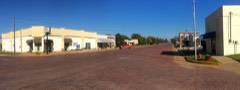 Davenport Broadway Avenue Brick Streetlisted 2004
Population over time
3 figuresDavenport fell from 881 to 809 between 2000 and 2020. These are the recorded population figures Wikidata holds for this place, reached through the Geographic Names Information System number this page is keyed on rather than by name, so they belong to this place and not to another of the same name. Most are census counts, but not all are: an early figure may be a founding or settlement estimate, and an estimate published within five years of a census is left out. The change column is computed, and is left blank where more than 20 years separate a figure from the one before it, because a gap that long is not a change between two counts.
| Year | People | Change |
|---|---|---|
| 2000 | 881 | |
| 2010 | 814 | -67 (-8%) |
| 2020 | 809 | -5 (-1%) |
Topographic sheets covering this place
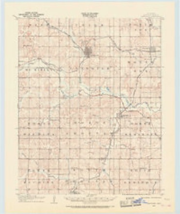
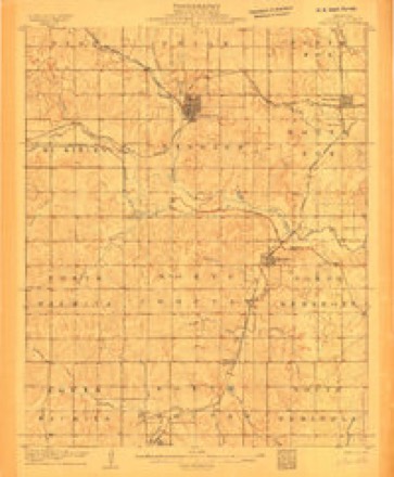
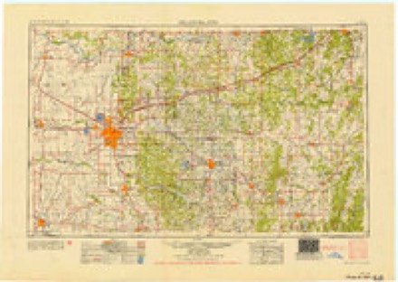
7 surveys from 10 printed sheetsMatched by testing this settlement's coordinate against the published boundary of every sheet in the United States Geological Survey's historical collection. Each opens the scanned sheet at the Survey.
- 1905 USGS Chandler quadrangle1:62500
- 1907 USGS Chandler quadrangle1:62500, 2 printings
- 1954 USGS Oklahoma City quadrangle1:250000
- 1957 USGS Oklahoma City quadrangle1:250000, 3 printings
- 1963 USGS Oklahoma City quadrangle1:250000
- 1974 USGS Davenport quadrangle1:24000
- 1990 USGS Bristow quadrangle1:100000
Fires near this place
2 since 2016Regional context, not property-specific evidence. The federal wildfire occurrence database lists 2 fires within 5 miles of Davenport in 2016, burning about 1,201 acres in total. None started naturally. None was recorded as arson. Distance is straight-line from the map coordinates, so a fire counted here may appear on a neighbouring settlement's page as well.
| Reported cause | Fires |
|---|---|
| Missing data/not specified/undetermined | 2 |
The most recent of them, most recent first, with the day each was reported and the service that recorded it.
| Date | Cause | Size | Reported by | Name on the report |
|---|---|---|---|---|
| 5 March 2016 | Missing data/not specified/undetermined | 890 acres | Oklahoma Division of Forestry | HILL |
| 8 February 2016 | Missing data/not specified/undetermined | 311 acres | Oklahoma Division of Forestry | CHUCKAHO |
Settlements close enough to share some of these fires:
Mines and quarries near this place
7 within 5 milesRegional context, not property-specific evidence. The federal mineral resources record lists 7 workings within 5 miles of Davenport: 5 past producers, 2 producers. 2 still produce. What was taken out: Dolomite. Distance is straight-line from the map coordinates, so a quarry counted here may appear on a neighbouring settlement's page as well.
| Where | Site | Commodity | Status | Recorded |
|---|---|---|---|---|
| Unknown Dolomite Pit | Dolomite | Producer | ||
| Unknown Dolomite Pit | Dolomite | Past Producer | ||
| Unknown Dolomite Pit | Dolomite | Past Producer | ||
| Unknown Dolomite Pit | Dolomite | Past Producer | ||
| Unknown Dolomite Pit | Dolomite | Past Producer | ||
| Unknown Dolomite Pit | Dolomite | Past Producer | ||
| Unknown Dolomite Pit | Dolomite | Producer |
Storms near this place
9 since 1994Regional context, not property-specific evidence. The National Weather Service names Davenport in 9 storm reports between 1994 and 2023: 5 thunderstorm wind, 1 flash flood, 1 tornado, 1 flood. No death or injury is recorded in these reports. Each account below is quoted exactly as the forecast office filed it, from the NOAA Storm Events Database, and each date opens the federal record of that event.
| When | Event | Place named | Harm | What the report says |
|---|---|---|---|---|
| May 2003 | Tornado (F1) | Davenport | $500,000 | This tornado began just south-southwest of Davenport and moved northeast through southeastern portions of town. The tornado continued northeast entering the Stroud city limits southwest of downtown before dissipating within town, east of downtown. The tornado began northwest of the intersection of Santa Fe Avenue and EW091 Road. Shortly after touching down, the tornado peeled the southwest side of a barn roof. The tornado entered the Davenport city limits causing minor tree damage. A metal roof was slightly peeled just north of the intersection of Broadway and Frisco Street. The tornado continued across southern and eastern portions of town downing tree limbs and breaking a few windows. On the east edge of Davenport, the left field light standards of the baseball field were blown over and a referee box behind home plate had blown north-northwestward about 30 feet and broken apart. The right field light standards appeared intact. The only notable damage in town was on the eastern edge (to the southwest of the baseball field) where a sturdy wood-frame car port was apparently lifted and then collapsed on the owner's SUV. Minor damage to shingles and siding continued as the tornado moved northeast towards Stroud.The first area of damage of note within Stroud occurred north of West Elm Street approximately 0.4 miles west of Highway 377. Numerous tree limbs and small decorative trees were downed along with sections of privacy fences blown over and shingle damage to several homes. As the tornado continued northeast, one of two areas of F1 damage was found near the center of town. A home just southwest of the corner of South 9th Avenue and West Oak Street had a missing roof. The home sustained the heaviest roof damage in the southwest corner where all ceiling joists were missing. The ceiling/roof section was found upside down about 100 feet northeast of the house with the ceiling fan still attached but badly damaged. The east half of the small house still had a ceiling. A car port on the north side of the house was still attached but showed cracks indicating it may have shifted. A small home behind this house had a portion of its roof and siding peeled off. Other nearby damage occurred just west of Highway 377, halfway between West Joe Street and West Hillcrest Street. An engineered metal storage building had the southeast corner of roof and east wall blown out with the south wall caved in.The other area of F1 damage began along the railroad tracks on North First Street just east of South 4th Avenue where an open metal storage structure collapsed. More damage was noted at a building behind the fire station (located just north of the railroad tracks and just east of North 3rd Avenue). The south-facing cinder block wall of this building fell outward. About half of the roofing material, including tar paper, was missing from this roof. Vehicle windows were also broken in this location.The remainder of damage in town was light, typified by shingles missing, large tree limbs downed, garage doors damaged, windows broken, and fences downed. The track appeared to end somewhat abruptly at the east edge of town, where a food storage facility and another industrial building did not appear to have much damage.In Stroud seventy homes were damaged with six rendered uninhabitable. Nine businesses were also damaged. |
| June 2023 | Thunderstorm Wind | Davenport | - | Chandler Municipal Airport (KCQB) observation. |
| September 2023 | Thunderstorm Wind | Davenport | - | Chandler Municipal Airport (KCQB) observation. |
| September 2023 | Hail | Davenport | - | Relayed via the Lincoln County Emergency Management Office. |
| August 2019 | Flood | Davenport | - | Water rescue performed between 3520 and 3540 on E 900 road. |
| June 2003 | Thunderstorm Wind | Davenport | - | no account filed |
| May 2003 | Thunderstorm Wind | Davenport | - | no account filed |
| November 1996 | Flash Flood | Davenport | - | no account filed |
| August 1994 | Thunderstorm Wind | Davenport | - | no account filed |
Nearest settlements
The eight closest, with where each one stands in the county. Distances are straight-line, computed from the Geographic Names Information System coordinates.
| Map | Place | Distance | Sheets |
|---|---|---|---|
| Kendrick | 5.6 miles | 10 | |
| Chandler | 6.1 miles | 10 | |
| Stroud | 6.4 miles | 10 | |
| Sparks | 7.3 miles | 10 | |
| Midlothian | 9.5 miles | 10 | |
| Arlington | 9.8 miles | 10 | |
| Sac and Fox Agency (historical) | 9.9 miles | 10 | |
| Parkland | 10.2 miles | 10 |
Elsewhere
Matched on this settlement's Geographic Names Information System number rather than its name, so it cannot be a different place of the same name in another state.
| Wikipedia article on Davenport | An encyclopaedic summary. Its text is share-alike, so it is linked here rather than copied. |
| Wikidata item Q2203179 | The structured record the population and elevation above come from. Public domain (CC0). |
Provenance
This settlement is recorded in the Geographic Names Information System as feature 1091940. The sheet list is computed by point-in-boundary test against the United States Geological Survey's historical topographic inventory. Both are works of the United States government and carry no copyright under 17 U.S.C. 105.
Wildfire. Short, Karen C. 2022. Spatial wildfire occurrence data for the United States, 1992-2020 [FPA_FOD_20221014]. 6th Edition. Fort Collins, CO: Forest Service Research Data Archive. https://doi.org/10.2737/RDS-2013-0009.6 Collected with United States Government funding and usable without additional permissions or fees.
Mines and quarries. USGS Mineral Resources Data System (MRDS) https://mrdata.usgs.gov/mrds/ A work of the United States government, no copyright under 17 U.S.C. 105.
Storms. NOAA National Centers for Environmental Information, Storm Events Database https://www.ncei.noaa.gov/stormevents/ A work of the United States government, no copyright under 17 U.S.C. 105. Narratives are quoted verbatim from the National Weather Service report and are not edited or summarised.