 Block
Eva, Oklahoma
6 topographic sheets cover this place, the earliest surveyed in 1954 and the latest in 1982. It stands in the West Texas census division. It lies in ZIP code area 73949. The Survey maps it on the Eva quadrangle.
On record in Eva
Buildings and businesses the archive holds for this place. Each opens its own page, with the source record it came from.
On the National Register 1 record
- Eva Woodframe Grain Elevatorlisted 1983
Topographic sheets covering this place
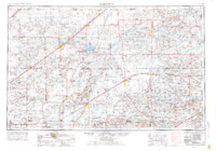
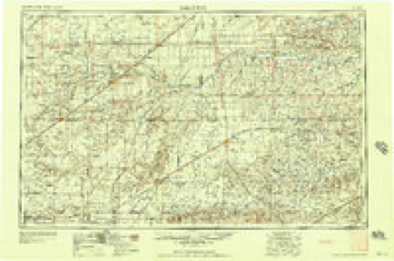
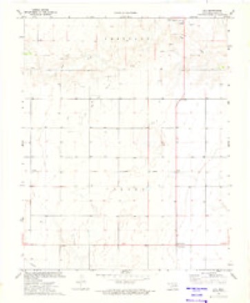
4 surveys from 6 printed sheetsMatched by testing this settlement's coordinate against the published boundary of every sheet in the United States Geological Survey's historical collection. Each opens the scanned sheet at the Survey.
- 1954 USGS Perryton quadrangle1:250000, 3 printings
- 1958 USGS Perryton quadrangle1:250000
- 1973 USGS Eva quadrangle1:24000
- 1982 USGS Guymon quadrangle1:100000

Mines and quarries near this place
6 within 5 milesRegional context, not property-specific evidence. The federal mineral resources record lists 6 workings within 5 miles of Eva: 5 past producers, 1 producer. 1 still produces. What was taken out: Sand and Gravel, Construction, Limestone, General. Distance is straight-line from the map coordinates, so a quarry counted here may appear on a neighbouring settlement's page as well.
| Where | Site | Commodity | Status | Recorded |
|---|---|---|---|---|
| Unknown Caliche Pit | Limestone, General | Past Producer | ||
| Unknown Gravel Pit | Sand and Gravel, Construction | Past Producer | ||
| Unknown Gravel Pit | Sand and Gravel, Construction | Producer | ||
| Unknown Sand Pit | Sand and Gravel, Construction | Past Producer | ||
| Unknown Sand Pit | Sand and Gravel, Construction | Past Producer | ||
| Unknown Sand Pit | Sand and Gravel, Construction | Past Producer |
Storms near this place
60 of 100 shownRegional context, not property-specific evidence. The National Weather Service names Eva in 100 storm reports between 1993 and 2025: 53 hail, 34 thunderstorm wind, 11 tornado, 2 flash flood. No death or injury is recorded in these reports. Each account below is quoted exactly as the forecast office filed it, from the NOAA Storm Events Database, and each date opens the federal record of that event.
| When | Event | Place named | Harm | What the report says |
|---|---|---|---|---|
| June 1999 | Thunderstorm Wind | Eva | $500,000 | Report of roofs blown off homes between Eva and Hough. |
| August 2011 | Thunderstorm Wind | Eva | $30,000 | Local law enforcement officials in Texas County reported that the thunderstorm wind gusts had pushed a pole barn one hundred yards into a house and that the debris was scattered about one quarter to one half miles past the house. Also, there was damage to the house and that a swing set was overturned by the thunderstorm wind gusts. There were no reports of injuries or fatalities. |
| May 1995 | Hail | Eva | $20,000 | Severe thunderstorms moved through the Oklahoma panhandle dropping large hail up to golf ball-size. The damage in Eva and Guymon was mostly to automobiles. |
| June 2010 | Thunderstorm Wind | Eva | $8,000 | The Texas County Oklahoma Emergency Manager reported that the strong thunderstorm winds caused a cell phone tower to buckle at the intersection of Oklahoma State Highway 95 and U.S. Highway 64. No injuries were reported. |
| May 2024 | Hail | Eva | $5,000 | Hail covered the highway at the intersection of highways 64 and 95. Most hail was about nickel size with the largest being golf ball size. |
| May 2024 | Hail | Eva | $5,000 | no account filed |
| June 1994 | Hail | Eva | $5,000 | no account filed |
| June 1994 | Hail | Eva | $5,000 | no account filed |
| June 2025 | Hail | Eva | $3,000 | no account filed |
| August 2025 | Thunderstorm Wind | Eva | - | A likely downburst produced a peak wind gust of 59 mph. |
| July 2025 | Thunderstorm Wind | Eva | - | The mesonet site located eleven miles to the northeast of Eva recorded a severe wind gust at 1535 CDT and the final wind gust at 1545 CDT. The peak wind gust was 67mph which occurred at 1540 CDT. |
| July 2025 | Thunderstorm Wind | Eva | - | A 58 mph wind gust was observed at the mesonet site located eleven miles to the northeast of Eva. This was associated with decaying showers. The temperature and dewpoint readings leading up to the wind gust suggested that a very small heat burst may have occurred as well. |
| May 2023 | Hail | Eva | - | Spotter reports hail of 0.9 in diameter, approximately 6 miles southeast of Elkhart, KS. Approximately 3 miles east of Highway 95. |
| April 2022 | Hail | Eva | - | A storm chaser reported multiple hail reports ranging from 2 to 2.75 with a storm that traveled from the SSW to NNE across HWY 95 north of Eva. |
| May 2022 | Thunderstorm Wind | Eva | - | This was the station located 11 miles north of Eva. |
| June 2022 | Thunderstorm Wind | Eva | - | First gust was 72 mph at 2105CDT and severe wind gusts continued through 2115CDT. |
| June 2022 | Thunderstorm Wind | Eva | - | Gusted to 60 mph at 0340CDT with a max wind gust of 66 mph at 0345CDT. The last wind gust upwards of 59 mph was at 0350CDT. |
| July 2021 | Hail | Eva | - | Mostly dime to nickel size with a few stones up to the size of quarters. Reported by a local feed lot. |
| July 2020 | Thunderstorm Wind | Eva | - | The Oklahoma Mesonet station 12 miles northeast of Eva measured gusts of 61 MPH range during this time period. |
| July 2020 | Thunderstorm Wind | Eva | - | The Oklahoma Mesonet station 12 miles northeast of Eva measured gusts in the 59 to 60 MPH range during this time period. The highest gust of 60 MPH occurred at 0214CST. |
| May 2019 | Hail | Eva | - | Golf ball size hail with heavy rain. |
| May 2019 | Hail | Eva | - | Time of report was estimated by radar. |
| May 2018 | Thunderstorm Wind | Eva | - | Eva mesonet reported a 60 mph wind gust. |
| May 2017 | Hail | Eva | - | Late report of golf ball size hail reported via Facebook. Time estimated by radar. |
| April 2016 | Tornado (EF0) | Eva | - | Very minimal damage was noted in a farmhouse complex. Damage included a metal roof partially peeled back, a broken power pole and tractor trailer rolled onto its side. This tornado was rated EF-0 with estimated peak wind of 80 mph. |
| April 2016 | Tornado (EF0) | Eva | - | This tornado was witnessed by spotters and storm chasers approximately 5 to 6 miles north-northeast of Eva. No damage was reported. EF-0 rating was assigned. |
| April 2016 | Flash Flood | Eva | - | Heavy rain overnight caused flooding across western portions of Texas County. The flooding increased as rain persisted through early afternoon. Some county roads were closed due to flowing water. |
| April 2016 | Tornado (EF0) | Eva | - | A brief tornado was observed by emergency managers and storm chasers just southwest of Eva. The tornado lasted for just under one minute and no damage was observed. The tornado was assigned an EF-0 rating. |
| April 2016 | Tornado (EF1) | Eva | - | The tornado destroyed two out buildings, a silo and snapped a power pole. Based on damage only on central and northeast portion of farmhouse complex damaged, the tornado likely touched down in the complex and continued into open country from there. The tornado was rated EF-1 with estimated peak wind of 104 mph. |
| April 2016 | Tornado (EF0) | Eva | - | Trained spotter reported a tornado on the ground for several minutes north of Eva and near highway 95. This storm already had a history of producing tornadoes. No damage occurred as the tornado remained in open grasslands. |
| April 2016 | Hail | Eva | - | Hail up to two inches in diameter fell just southwest of Yarbrough, or about 5 miles east-southeast of Sturgis. |
| June 2015 | Hail | Eva | - | Quarter size hail was reported 14 miles west-northwest of Guymon. |
| November 2015 | Hail | Eva | - | Penny to quarter size hail was covering Highway 95 south of Elkhart, about 9 miles east-northeast of Sturgis. |
| June 2014 | Thunderstorm Wind | Eva | - | A cluster of thunderstorms moved out of southeastern Colorado and southwestern Kansas and into the Oklahoma Panhandle during the evening hours of the 30th. As this cluster of thunderstorms moved over the town of Eva (Texas County), the KVII schoolnet site 8 miles north of Eva (Texas County) reported a 61 mph downburst gust. After producing this downburst the cluster of thunderstorms continued to move to the southeast. |
| June 2014 | Hail | Eva | - | A discrete thunderstorm developed over Texas County during the early afternoon hours of the 6th. The thunderstorm intensified quickly then became downdraft dominated. A member of the public 12 miles north of Texhoma (Texas County) was underneath this downdraft and reported penny size hail (0.75 inch). The thunderstorms quickly diminished after producing this hail. |
| August 2013 | Thunderstorm Wind | Eva | - | A discrete supercell moved across Texas County during the early evening hours of the 14th. The Texas County Emergency Manager reported that this thunderstorm produced a 65 to 70 mph wind gust which lasted several minutes 5 miles east southeast of the town of Eva (Texas County). After producing this prolonged gust, it continued moving to the south and exited the Oklahoma Panhandle. |
| May 2010 | Hail | Eva | - | The storm chaser reported the hail three miles southeast of Doolin Oklahoma. |
| May 2010 | Tornado (EF0) | Eva | - | The tornado touched down at 1951 CST and lifted at 1953 CST about four miles west northwest of Eva Oklahoma. The tornado became rain wrapped at 1951 CST. The tornado path length and path width were estimated. The tornado remained over open country and no damage or injuries were reported. |
| July 2009 | Thunderstorm Wind | Eva | - | A trained spotter estimated the thunderstorm wind gusts just south of Eva. |
| May 2007 | Tornado (EF0) | Eva | - | The tornado developed over open country five miles north northwest of Eva Oklahoma and remained on the ground for less than one minute. The tornado remained over open country and the path length and path width were estimated. No damage or injuries were reported. |
| May 2007 | Tornado (EF0) | Eva | - | The tornado developed over open country five miles east northeast of Eva Oklahoma at 1849 CST and remained on the ground for less than a minute. The tornado path length and path width were estimated. No damage or injuries were reported. |
| August 2002 | Flash Flood | Eva | - | Water was reported covering the road. |
| June 1999 | Tornado (F0) | Eva | - | The tornado remained over open country and the track was estimated. |
| June 1999 | Tornado (F0) | Eva | - | The tornado remained over open country and the track was estimated. |
| September 1995 | Hail | Eva | - | Hail to golf ball-size was reported by the Oklahoma Highway Patrol. Some minor damage in the form of broken window was reported. The extent of damage is unknownnown, but believed to be light. |
| May 1995 | Hail | Eva | - | Severe thunderstorms moved through the Oklahoma panhandle dropping large hail up to golf ball-size. The damage in Eva and Guymon was mostly to automobiles. |
| May 1995 | Hail | Eva | - | Severe thunderstorms moved through the Oklahoma panhandle dropping large hail up to golf ball-size. The damage in Eva and Guymon was mostly to automobiles. |
| May 1993 | Hail | Eva | - | Severe thunderstorms which produced two strong tornadoes and four weak tornadoes moved northward along a dryline through Beaver County on the evening of the 5th. The first tornado developed 13 miles south-southeast of Guymon at 1738 CST and moved northward 12 miles before dissipating 4.5 miles east-southeast of Guymon at 1815CST. This F3 tornado destroyed a farm southeast of Guymon. An F0 tornado touched down six miles southwest of Hardesty at 1755 CST and traveled north approximately one mile before dissipating. The third tornado (F1) developed approximately 15 miles east-northeast of Guymon at 1810 CST and traveled two miles north before dissipating. The fourth tornado (F0) developed two miles southwest of Eva at 1847 CST and traveled 1/2 mile north before dissipating. Another F0 tornado developed 18 miles north-northeast of Guymon at 1850 CST and moved north two miles before dissipating. The 6th and largest tornado developed eight miles north of Optima at 1854 CST and moved north 11 miles north before crossing into Kansas 13 miles east-southeast of Hugoton at 1915 CST. The width of the 1st tornado was approximately 500 yards with the width of the 6th tornado around 1200 yards. All of the tornadoes tracked over mostly open pasturelands and as a result, damage was relatively minor. A dozen cattle were killed by flying debris, several power lines were snapped and numerous irrigation systems suffered damage. Hailstones damaged patrol cars and broke out several windshields near Hardesty and near Hooker. |
| September 1993 | Hail | Eva | - | Severe thunderstorms which developed during the late afternoon and evening hours on the 7th produced large hail. Hail up to 2.00 inches in diameter broke windshields 1 mile southwest of Keyes. |
| June 2025 | Thunderstorm Wind | Eva | - | no account filed |
| July 2024 | Thunderstorm Wind | Eva | - | no account filed |
| July 2024 | Thunderstorm Wind | Eva | - | no account filed |
| June 2024 | Thunderstorm Wind | Eva | - | no account filed |
| June 2023 | Hail | Eva | - | no account filed |
| June 2023 | Thunderstorm Wind | Eva | - | no account filed |
| June 2023 | Thunderstorm Wind | Eva | - | no account filed |
| April 2022 | Thunderstorm Wind | Eva | - | no account filed |
| October 2021 | Thunderstorm Wind | Eva | - | no account filed |
| June 2019 | Hail | Eva | - | no account filed |
| June 2018 | Hail | Eva | - | no account filed |
Nearest settlements
The eight closest, with where each one stands in the county. Distances are straight-line, computed from the Geographic Names Information System coordinates.
Elsewhere
Matched on this settlement's Geographic Names Information System number rather than its name, so it cannot be a different place of the same name in another state.
| Wikipedia article on Eva | An encyclopaedic summary. Its text is share-alike, so it is linked here rather than copied. |
| Wikidata item Q5414983 | The structured record the population and elevation above come from. Public domain (CC0). |
Provenance
This settlement is recorded in the Geographic Names Information System as feature 1100401. The sheet list is computed by point-in-boundary test against the United States Geological Survey's historical topographic inventory. Both are works of the United States government and carry no copyright under 17 U.S.C. 105.
Mines and quarries. USGS Mineral Resources Data System (MRDS) https://mrdata.usgs.gov/mrds/ A work of the United States government, no copyright under 17 U.S.C. 105.
Storms. NOAA National Centers for Environmental Information, Storm Events Database https://www.ncei.noaa.gov/stormevents/ A work of the United States government, no copyright under 17 U.S.C. 105. Narratives are quoted verbatim from the National Weather Service report and are not edited or summarised.