 Block
Fairview, Oklahoma
9 topographic sheets cover this place, the earliest surveyed in 1955 and the latest in 1986. It stands in the Fairview census division. It lies in ZIP code area 73737. The Survey maps it on the Fairview quadrangle. 2,740 people lived here at the 2020 count. It stands 1,302 feet above sea level.
On record in Fairview
Buildings and businesses the archive holds for this place. Each opens its own page, with the source record it came from.
On the National Register 2 records
- First United Methodist Churchlisted 2010
- Major County Courthouselisted 1984
Population over time
2 figuresFairview grew from 2,579 to 2,740 between 2010 and 2020. These are the recorded population figures Wikidata holds for this place, reached through the Geographic Names Information System number this page is keyed on rather than by name, so they belong to this place and not to another of the same name. Most are census counts, but not all are: an early figure may be a founding or settlement estimate, and an estimate published within five years of a census is left out. The change column is computed, and is left blank where more than 20 years separate a figure from the one before it, because a gap that long is not a change between two counts.
| Year | People | Change |
|---|---|---|
| 2010 | 2,579 | |
| 2020 | 2,740 | +161 (+6%) |
Topographic sheets covering this place
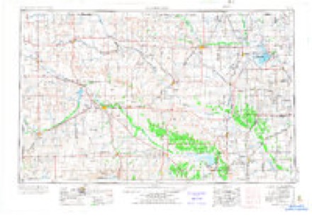
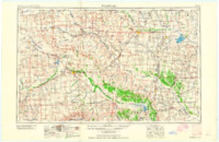
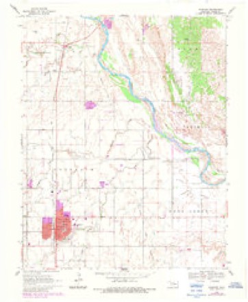
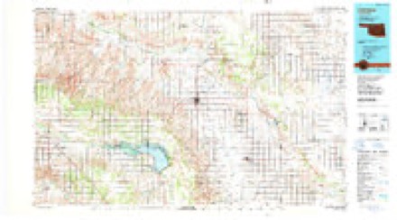
4 surveys from 9 printed sheetsMatched by testing this settlement's coordinate against the published boundary of every sheet in the United States Geological Survey's historical collection. Each opens the scanned sheet at the Survey.
- 1955 USGS Woodward quadrangle1:250000, 3 printings
- 1958 USGS Woodward quadrangle1:250000, 2 printings
- 1969 USGS Fairview quadrangle1:24000, 2 printings
- 1986 USGS Fairview quadrangle1:100000, 2 printings
Mines and quarries near this place
1 within 5 milesRegional context, not property-specific evidence. The federal mineral resources record lists 1 working within 5 miles of Fairview: 1 producer. All of them still produce. What was taken out: Sand and Gravel, Construction. Distance is straight-line from the map coordinates, so a quarry counted here may appear on a neighbouring settlement's page as well.
| Where | Site | Commodity | Status | Recorded |
|---|---|---|---|---|
| Cherokee Paving Co Gravel Pit | Sand and Gravel, Construction | Producer |
Storms near this place
60 of 78 shownRegional context, not property-specific evidence. The National Weather Service names Fairview in 78 storm reports between 1994 and 2026: 34 thunderstorm wind, 32 hail, 6 flash flood, 3 tornado. No death or injury is recorded in these reports. Each account below is quoted exactly as the forecast office filed it, from the NOAA Storm Events Database, and each date opens the federal record of that event.
| When | Event | Place named | Harm | What the report says |
|---|---|---|---|---|
| September 2008 | Flash Flood | Fairview | $400,000 | At least 100 homes were damaged due to flooding. Numerous streets were also closed due to the very high water. Monetary damages were estimated. |
| June 2008 | Thunderstorm Wind | Fairview | $60,000 | Widespread wind damage was reported in and around Fairview. Seventeen utility poles were blown down. The press box at the high school was blown down and destroyed. Several windows at an automobile dealership were broken. Roof damage was reported at several other businesses. At the Fairview Sooner Co-Op, two silos were destroyed, ruining the 7,000 bushels of grain inside. Monetary damages were estimated. |
| May 2001 | Thunderstorm Wind | Fairview | $50,000 | A grain silo was destroyed, and numerous trees were downed at Fairview Lakeside Country Club. |
| May 2000 | Thunderstorm Wind | Fairview | $40,000 | A large swath of damaging straight-line winds also accompanied the Major County tornado along and east of the its path. In addition to more tree damage, an irrigation system was damaged 4 miles southeast of Fairview; a grain storage bin and barn were blown over, and numerous bales of hay were blown eastward. At times the damage area was several miles wide. |
| May 2000 | Tornado (F1) | Fairview | $25,000 | This tornado formed about 10 miles west-southwest of Fairview in Major County and tracked northeastward mainly over farmland before dissipating. Although most of the damage was sustained to trees, which alone warranted an F1 rating, a house was partially unroofed 2 miles southwest of Cedar Springs, while a travel trailer and barn were destroyed. |
| September 2007 | Flash Flood | Fairview | $15,000 | Nearly six inches of rain in just a couple of hours resulted in rapidly rising water in Fairview. Several homes sustained damage as water entered. Several streets around town had to be closed due to water running over top of them. The county sheriff also reported two cars washed off the roadway due to the high water near Ames. . Monetary damages were estimated. |
| June 2018 | Flash Flood | Fairview | $10,000 | Water entered one home in Fairview and approached other homes. |
| July 2000 | Thunderstorm Wind | Fairview | $6,000 | A large plate glass window was broken at Pratt's on West Central Avenue, and power poles were downed. |
| September 2021 | Thunderstorm Wind | Fairview | $5,000 | Damage to barn and power lines downed. |
| August 2017 | Thunderstorm Wind | Fairview | $5,000 | A powerpole down and metal shed were destroyed. |
| April 2001 | Thunderstorm Wind | Fairview | $3,000 | Power poles were downed. |
| June 2008 | Thunderstorm Wind | Fairview | $2,000 | A power line was blown down onto OK Highway 8. The road had to be closed for a short time. Monetary damages were estimated. |
| May 1999 | Lightning | Fairview | $2,000 | no account filed |
| September 2005 | Thunderstorm Wind | Fairview | $250 | Four to five inch tree limbs were downed. |
| July 2000 | Thunderstorm Wind | Fairview | $200 | Trees were downed. |
| March 2026 | Thunderstorm Wind | Fairview | - | Fairview (FAI2) Mesonet observation. |
| March 2026 | Thunderstorm Wind | Fairview | - | Fairview (FAI2) Mesonet observation. |
| June 2025 | Thunderstorm Wind | Fairview | - | Fairview (FAI2) Mesonet observation. |
| May 2024 | Hail | Fairview | - | Social media image. Time is radar estimated. |
| May 2024 | Hail | Fairview | - | MPing report. |
| May 2024 | Hail | Fairview | - | Social media image. Time is radar estimated. |
| May 2024 | Hail | Fairview | - | Social media image. Time is radar estimated. |
| August 2024 | Hail | Fairview | - | MPing report. |
| June 2023 | Thunderstorm Wind | Fairview | - | Tree damage in the town of Fairview. Time is radar estimated. |
| May 2019 | Thunderstorm Wind | Fairview | - | Wind damage on Beck and Sixth Street. Older, possibly already dead, tree toppled onto street. Time estimate from radar. |
| May 2019 | Thunderstorm Wind | Fairview | - | Estimated 70-80 mph winds. |
| May 2019 | Thunderstorm Wind | Fairview | - | Estimated wind gusts. |
| June 2018 | Flash Flood | Fairview | - | Sylvia street was under two to three feet of water from heavy rainfall. |
| May 2015 | Tornado (EF1) | Fairview | - | A tornado developed northwest of Fairview and moved northeast, brushing the northwest corner of Cleo Springs, and moved into Alfalfa County 1.5 miles east of state highway 8. A house northwest of Fairview was moved off of the foundation (DI 2, DOD 5, est. winds 105-110 mph.) Northeast along the tornado path, damage was observed to trees, outbuildings and utility poles as it approached and passed near the northwest corner of Cleo Springs. North and northeast of Cleo Springs, a mobile home was damaged. The storm moved northeast and overturned a truck as it moved into Alfalfa County to the east of state highway 8. |
| May 2011 | Tornado (EF0) | Fairview | - | This tornado is labeled A2 (SW of Fairview brief tornado). A number of storm chasers observed this tornado to the southwest of Fairview. No known damage occurred. |
| May 2010 | Hail | Fairview | - | The hail report was relayed by KWTV-9. |
| September 2008 | Heavy Rain | Fairview | - | The measured rainfall was 9.23 inches, much of it falling in a six to eight hour period. |
| June 2007 | Flash Flood | Fairview | - | Several county roads were closed near Fairview due to high water. |
| July 2005 | Thunderstorm Wind | Fairview | - | Wind was measured by the Oklahoma mesonet. |
| July 2005 | Thunderstorm Wind | Fairview | - | Wind was measured by the Oklahoma mesonet. |
| May 2003 | Thunderstorm Wind | Fairview | - | Wind was measured by the Oklahoma mesonet. |
| May 2001 | Thunderstorm Wind | Fairview | - | Wind was measured by Oklahoma mesonet. |
| September 1997 | Thunderstorm Wind | Fairview | - | measured at the Oklahoma Mesonet site |
| September 1997 | Thunderstorm Wind | Fairview | - | measured at Oklahoma Mesonet site |
| August 1997 | Thunderstorm Wind | Fairview | - | measured at the Oklahoma Mesonet site |
| September 1997 | Thunderstorm Wind | Fairview | - | measured at the Oklahoma Mesonet site |
| August 1997 | Thunderstorm Wind | Fairview | - | measured at the Oklahoma Mesonet site |
| September 1997 | Thunderstorm Wind | Fairview | - | measured at the Oklahoma Mesonet site |
| April 2025 | Hail | Fairview | - | no account filed |
| September 2021 | Thunderstorm Wind | Fairview | - | no account filed |
| May 2020 | Hail | Fairview | - | no account filed |
| May 2020 | Hail | Fairview | - | no account filed |
| July 2020 | Thunderstorm Wind | Fairview | - | no account filed |
| May 2019 | Flash Flood | Fairview | - | no account filed |
| May 2019 | Hail | Fairview | - | no account filed |
| May 2018 | Hail | Fairview | - | no account filed |
| April 2016 | Hail | Fairview | - | no account filed |
| June 2016 | Thunderstorm Wind | Fairview | - | no account filed |
| July 2013 | Thunderstorm Wind | Fairview | - | no account filed |
| June 2011 | Hail | Fairview | - | no account filed |
| May 2011 | Hail | Fairview | - | no account filed |
| May 2011 | Hail | Fairview | - | no account filed |
| May 2011 | Hail | Fairview | - | no account filed |
| September 2011 | Hail | Fairview | - | no account filed |
| April 2009 | Hail | Fairview | - | no account filed |
Nearest settlements
The eight closest, with where each one stands in the county. Distances are straight-line, computed from the Geographic Names Information System coordinates.
| Map | Place | Distance | Sheets |
|---|---|---|---|
| Orienta | 6.3 miles | 9 | |
| Cedar Springs | 6.5 miles | 8 | |
| Isabella | 7.8 miles | 8 | |
| Dane | 8.2 miles | 8 | |
| West Cleo | 9.5 miles | 8 | |
| Cleo Springs | 9.6 miles | 8 | |
| Cheyenne Valley | 11.7 miles | 9 | |
| Piper | 13.0 miles | 8 |
Elsewhere
Matched on this settlement's Geographic Names Information System number rather than its name, so it cannot be a different place of the same name in another state.
| Wikipedia article on Fairview | An encyclopaedic summary. Its text is share-alike, so it is linked here rather than copied. |
| Wikidata item Q941217 | The structured record the population and elevation above come from. Public domain (CC0). |
Provenance
This settlement is recorded in the Geographic Names Information System as feature 1092705. The sheet list is computed by point-in-boundary test against the United States Geological Survey's historical topographic inventory. Both are works of the United States government and carry no copyright under 17 U.S.C. 105.
Mines and quarries. USGS Mineral Resources Data System (MRDS) https://mrdata.usgs.gov/mrds/ A work of the United States government, no copyright under 17 U.S.C. 105.
Storms. NOAA National Centers for Environmental Information, Storm Events Database https://www.ncei.noaa.gov/stormevents/ A work of the United States government, no copyright under 17 U.S.C. 105. Narratives are quoted verbatim from the National Weather Service report and are not edited or summarised.