 Block
Geary, Oklahoma
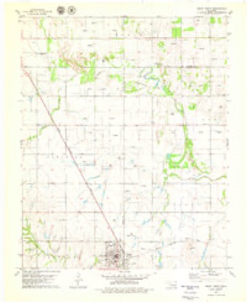
10 topographic sheets cover this place, the earliest surveyed in 1942 and the latest in 1985. It stands in the Geary census division. It lies in ZIP code area 73040. The Survey maps it on the Geary North quadrangle.
On record in Geary
Buildings and businesses the archive holds for this place. Each opens its own page, with the source record it came from.
On the National Register 3 records
 Gillespie Buildinglisted 1989
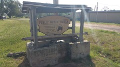 Public Water Troughlisted 1989
- Jesse Chisholm Grave Sitelisted 1971
Topographic sheets covering this place
5 surveys from 10 printed sheetsMatched by testing this settlement's coordinate against the published boundary of every sheet in the United States Geological Survey's historical collection. Each opens the scanned sheet at the Survey.
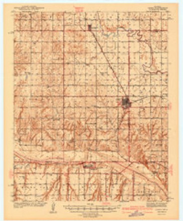
- 1942 USGS Geary quadrangle1:62500, 3 printings
- 1955 USGS Clinton quadrangle1:250000, 3 printings
- 1957 USGS Clinton quadrangle1:250000
- 1979 USGS Geary North quadrangle1:24000
- 1985 USGS Watonga quadrangle1:100000, 2 printings
Fires near this place
41 since 1997Regional context, not property-specific evidence. The federal wildfire occurrence database lists 41 fires within 5 miles of Geary between 1997 and 2020, burning about 1,771 acres in total. None started naturally. 8 were recorded as arson. Distance is straight-line from the map coordinates, so a fire counted here may appear on a neighbouring settlement's page as well.
| Reported cause | Fires |
|---|---|
| Missing data/not specified/undetermined | 18 |
| Debris and open burning | 9 |
| Arson/incendiarism | 8 |
| Equipment and vehicle use | 5 |
| Fireworks | 1 |
The most recent of them, most recent first, with the day each was reported and the service that recorded it.
| Date | Cause | Size | Reported by | Name on the report |
|---|---|---|---|---|
| 7 August 2019 | Equipment and vehicle use | 22 acres | Concho Field Office | BISON |
| 20 August 2001 | Equipment and vehicle use | 10 acres | Concho Field Office | GRANDVIEW |
| 17 August 2005 | Missing data/not specified/undetermined | under an acre | Concho Field Office | KATE |
| 16 August 2006 | Missing data/not specified/undetermined | under an acre | Concho Field Office | GEARY |
| 5 July 1998 | Fireworks | 8.0 acres | Concho Field Office | POWDER |
| 29 July 1998 | Missing data/not specified/undetermined | 5.0 acres | Concho Field Office | LONGNECK |
| 20 July 2011 | Missing data/not specified/undetermined | 100 acres | Concho Field Office | YELLOW BRIDGE |
| 20 July 2008 | Debris and open burning | 240 acres | Concho Field Office | CACTUS |
Settlements close enough to share some of these fires:
Mines and quarries near this place
1 within 5 milesRegional context, not property-specific evidence. The federal mineral resources record lists 1 working within 5 miles of Geary: 1 producer. All of them still produce. What was taken out: Sand and Gravel, Construction. Distance is straight-line from the map coordinates, so a quarry counted here may appear on a neighbouring settlement's page as well.
| Where | Site | Commodity | Status | Recorded |
|---|---|---|---|---|
| Geary Pit & Plant | Sand and Gravel, Construction | Producer |
Storms near this place
54 since 1994Regional context, not property-specific evidence. The National Weather Service names Geary in 54 storm reports between 1994 and 2025: 36 hail, 11 thunderstorm wind, 5 tornado, 1 heavy rain. The reports record 4 injuries. Each account below is quoted exactly as the forecast office filed it, from the NOAA Storm Events Database, and each date opens the federal record of that event.
| When | Event | Place named | Harm | What the report says |
|---|---|---|---|---|
| May 2024 | Thunderstorm Wind | Geary | 2 hurt, $125,000 | A swath of significant straight-line wind damage was identified across portions of far southern Blaine County, associated with the rear-flank downdraft of a nearby tornadic thunderstorm. A mobile home was destroyed about 4 miles east of Hydro that caused two injuries. Numerous wooden power poles were snapped, large trees uprooted, and a center irrigation pivot was overturned along the path. Multiple wood and metal outbuildings were also damaged, including at least one destroyed, and a house near the intersection of County Road 1000 and Oklahoma Highway 58 had shingles removed. Both the wind path and time are estimated. |
| August 2007 | Thunderstorm Wind | Geary | 2 hurt, $84,000 | Widespread wind damage was reported in and around Geary as strong winds battered the city for several hours. Numerous trees, power poles, and power lines were downed. The Fast Lane Food Mart had its awning ripped off. Numerous signs were blown over. Part of the roof of the nursing home was ripped off. Two persons were injured while evacuating the nursing home. Siding was also removed from a house, and the garage doors were blown inward. Monetary damages were estimated. |
| May 2004 | Tornado (F2) | Geary | $1,500,000 | The second tornado of this storm began 3 miles NE of American Horse Lake, or 9 miles WNW of Geary. This tornado also was obscured by rain for much of its life cycle, but was documented at close range by the Doppler on Wheels (DOW). The center of the tornadic circulation initially moved ESE, approaching American Horse Road around 1824 (all times CST), 6-7 miles WNW of Geary, then turned to the ENE. Damage occurred over a wide swath to the right of the center of circulation, and was the combined result of the tornado and damaging winds from the very strong mesocyclone within which it was embedded. A peak instantaneous wind gust was measured by the DOW at 81 m/s (157 knots, or 181 mph) at a height of 6.5 meters AGL in the mesocyclone circulation just north of Geary at 1836. Four miles NW of Geary, several smaller-scale vortices developed around the initial circulation center - one of which became the dominant circulation and formed about a half a mile south of the original center at 1832. Due to continuity of the parent mesocyclone circulation and the continuous damage path, these circulation centers are considered to be sub-vortices within the same tornado, and not separate tornadoes. The newly-formed circulation center moved slightly south of due east, and crossed US270/281 at 1837 CST, 2 miles NNW of Geary. The tornado crossed into Canadian County at 1838 CST, 11.8 WNW of Calumet.The tornado caused widespread tree damage with trees downed or uprooted across the area. Several barns were also damaged or destroyed in Blaine county. A house sustained some roof damage and power lines were downed in the area. A stock trailer was found rolled and farm machinery damaged. An old church one mile north of Geary also lost its roof. |
| June 2025 | Thunderstorm Wind | Geary | $10,000 | Several power poles were blown down in the community of Geary. The event time is estimated from radar observations. |
| August 2022 | Thunderstorm Wind | Geary | $5,000 | Barn and power pole damaged. |
| May 2003 | Hail | Geary | $3,500 | Several windows were reported broken. |
| May 2024 | Tornado (EF1) | Geary | $2,000 | Trees were damaged near N2540 Road to the southeast of American Horse Lake. |
| May 1996 | Thunderstorm Wind | Geary | $1,500 | no account filed |
| June 2002 | Thunderstorm Wind | Geary | $10 | Large tree limbs were downed. |
| November 1996 | Thunderstorm Wind | Geary | $10 | no account filed |
| May 2024 | Hail | Geary | - | Social media image. Time is radar estimated and location is approximate. |
| May 2024 | Tornado (EF0) | Geary | - | Numerous spotters and chasers observed an anticyclonic tornado develop west of Bridgeport. Drone imagery of damage by the ranch owner shows the tornado developed in Blaine County less than one hundred yards north of the Caddo County line and moved southeast quickly crossing into Caddo County. Some light tree damage was observed in Blaine County. |
| May 2023 | Tornado (EF0) | Geary | - | A storm chaser observed a landspout tornado while driving on Interstate 40 just west of the Caddo-Canadian County line with a photo shared on social media. This appears to be associated with an echo of radar reflectivity of less than 5 dBZ. No damage was reported. The location is estimated but believed to be within 1 or 2 miles based on geolocation of the photograph. |
| June 2020 | Thunderstorm Wind | Geary | - | Barn destroyed. Some roof damage to a house. |
| April 2017 | Thunderstorm Wind | Geary | - | No damage reported. |
| April 2017 | Hail | Geary | - | Reported via MPing. |
| October 2016 | Thunderstorm Wind | Geary | - | No damage reported. |
| May 2013 | Hail | Geary | - | Hail reported from NSSL SHAVE project. No damages reported. |
| May 2009 | Hail | Geary | - | A large amount of golf ball-size hail covered the ground. |
| May 2009 | Hail | Geary | - | The hail was accompanied by estimated 50 to 60 mph winds. |
| August 2007 | Heavy Rain | Geary | - | A total of 11.03 inches of rainfall was recorded between 7 AM on the 18th and 7 AM on the 19th. The report was courtesy of COCORAHS. |
| June 2007 | Flash Flood | Geary | - | High water closed a few country roads. |
| May 1999 | Tornado (F0) | Geary | - | Tornado E1. See summary at end of May 3rd storm reports. |
| May 2019 | Hail | Geary | - | no account filed |
| April 2017 | Hail | Geary | - | no account filed |
| May 2012 | Hail | Geary | - | no account filed |
| June 2011 | Hail | Geary | - | no account filed |
| June 2011 | Hail | Geary | - | no account filed |
| February 2008 | Hail | Geary | - | no account filed |
| October 2007 | Hail | Geary | - | no account filed |
| June 2005 | Thunderstorm Wind | Geary | - | no account filed |
| September 2005 | Hail | Geary | - | no account filed |
| September 2005 | Hail | Geary | - | no account filed |
| May 2004 | Hail | Geary | - | no account filed |
| March 2004 | Hail | Geary | - | no account filed |
| May 2004 | Hail | Geary | - | no account filed |
| May 2004 | Hail | Geary | - | no account filed |
| August 2004 | Hail | Geary | - | no account filed |
| March 2003 | Hail | Geary | - | no account filed |
| May 2003 | Hail | Geary | - | no account filed |
| May 2003 | Hail | Geary | - | no account filed |
| May 2000 | Hail | Geary | - | no account filed |
| April 1999 | Hail | Geary | - | no account filed |
| April 1999 | Hail | Geary | - | no account filed |
| April 1999 | Hail | Geary | - | no account filed |
| May 1999 | Hail | Geary | - | no account filed |
| May 1999 | Hail | Geary | - | no account filed |
| June 1998 | Hail | Geary | - | no account filed |
| June 1998 | Hail | Geary | - | no account filed |
| June 1997 | Hail | Geary | - | no account filed |
| May 1997 | Hail | Geary | - | no account filed |
| February 1995 | Hail | Geary | - | no account filed |
| April 1994 | Hail | Geary | - | no account filed |
| March 1994 | Hail | Geary | - | no account filed |
Nearest settlements
The eight closest, with where each one stands in the county. Distances are straight-line, computed from the Geographic Names Information System coordinates.
| Map | Place | Distance | Sheets |
|---|---|---|---|
| Greenfield | 7.5 miles | 11 | |
| Hydro | 14.9 miles | 8 | |
| Watonga | 15.6 miles | 7 | |
| Bucher | 19.6 miles | 7 | |
| Hitchcock | 23.4 miles | 7 | |
| Eagle City | 25.4 miles | 9 | |
| Carlton | 28.5 miles | 8 | |
| Carleton | 28.6 miles | 8 |
Provenance
This settlement is recorded in the Geographic Names Information System as feature 1093156. The sheet list is computed by point-in-boundary test against the United States Geological Survey's historical topographic inventory. Both are works of the United States government and carry no copyright under 17 U.S.C. 105.
Wildfire. Short, Karen C. 2022. Spatial wildfire occurrence data for the United States, 1992-2020 [FPA_FOD_20221014]. 6th Edition. Fort Collins, CO: Forest Service Research Data Archive. https://doi.org/10.2737/RDS-2013-0009.6 Collected with United States Government funding and usable without additional permissions or fees.
Mines and quarries. USGS Mineral Resources Data System (MRDS) https://mrdata.usgs.gov/mrds/ A work of the United States government, no copyright under 17 U.S.C. 105.
Storms. NOAA National Centers for Environmental Information, Storm Events Database https://www.ncei.noaa.gov/stormevents/ A work of the United States government, no copyright under 17 U.S.C. 105. Narratives are quoted verbatim from the National Weather Service report and are not edited or summarised.