 Block
Hooker, Oklahoma
6 topographic sheets cover this place, the earliest surveyed in 1954 and the latest in 1982. It stands in the Hooker census division. It lies in ZIP code area 73945. The Survey maps it on the Hooker quadrangle. 1,802 people lived here at the 2020 count. It stands 2,986 feet above sea level.
On record in Hooker
Buildings and businesses the archive holds for this place. Each opens its own page, with the source record it came from.
On the National Register 2 records
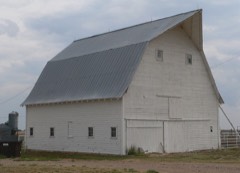 Elmer Baker Barnlisted 2012
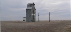 Hooker Woodframe Grain Elevatorlisted 1983
Population over time
2 figuresHooker fell from 1,918 to 1,802 between 2010 and 2020. These are the recorded population figures Wikidata holds for this place, reached through the Geographic Names Information System number this page is keyed on rather than by name, so they belong to this place and not to another of the same name. Most are census counts, but not all are: an early figure may be a founding or settlement estimate, and an estimate published within five years of a census is left out. The change column is computed, and is left blank where more than 20 years separate a figure from the one before it, because a gap that long is not a change between two counts.
| Year | People | Change |
|---|---|---|
| 2010 | 1,918 | |
| 2020 | 1,802 | -116 (-6%) |
Topographic sheets covering this place
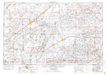
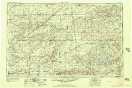
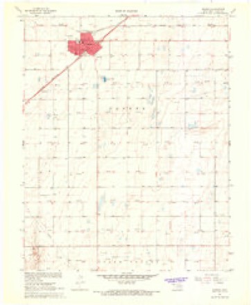
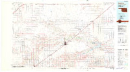
4 surveys from 6 printed sheetsMatched by testing this settlement's coordinate against the published boundary of every sheet in the United States Geological Survey's historical collection. Each opens the scanned sheet at the Survey.
- 1954 USGS Perryton quadrangle1:250000, 3 printings
- 1958 USGS Perryton quadrangle1:250000
- 1967 USGS Hooker quadrangle1:24000
- 1982 USGS Guymon quadrangle1:100000
Fires near this place
1 since 2020Regional context, not property-specific evidence. The federal wildfire occurrence database lists 1 fire within 5 miles of Hooker in 2020, burning about 400 acres in total. None started naturally. None was recorded as arson. Distance is straight-line from the map coordinates, so a fire counted here may appear on a neighbouring settlement's page as well.
| Reported cause | Fires |
|---|---|
| Railroad operations and maintenance | 1 |
The most recent of them, most recent first, with the day each was reported and the service that recorded it.
| Date | Cause | Size | Reported by | Name on the report |
|---|---|---|---|---|
| 17 June 2020 | Railroad operations and maintenance | 400 acres | Oklahoma Division of Forestry | MILE 43 |
Settlements close enough to share some of these fires:
Storms near this place
60 of 139 shownRegional context, not property-specific evidence. The National Weather Service names Hooker in 139 storm reports between 1993 and 2025: 94 thunderstorm wind, 38 hail, 3 tornado, 2 flash flood. The reports record 1 injury. Each account below is quoted exactly as the forecast office filed it, from the NOAA Storm Events Database, and each date opens the federal record of that event.
| When | Event | Place named | Harm | What the report says |
|---|---|---|---|---|
| June 2009 | Hail | Hooker | 1 hurt, $8,000 | The Texas County Emergency Manager reported golf ball to base ball size hail in Hooker. The hail broke numerous windows on homes and also busted numerous windshields on vehicles. One person was injured from baseball size hail. |
| May 2001 | Thunderstorm Wind | Hooker | $500,000 | An old granary was picked up and dropped on drills...a garage was moved off its foundation...and a windmill was twisted beyond repair. The high winds also destroyed two grain bins blowing debris through other out buildings and twisting and folding the pipe TV antenna pole. The winds also broke more than eighteen of Tri-County Electic Cooperative's distribution poles. Some wheat and corn fields were leveled by tons of tiny wind-driven hail. |
| June 2003 | Thunderstorm Wind | Hooker | $165,000 | Five mobile homes were completely destroyed and six more mobile homes were damaged near the town of Optima. Also...seventy electric poles belonging to Tri-County Electric were sheared off by the high winds. |
| June 2008 | Thunderstorm Wind | Hooker | $147,000 | The Beaver County Emergency Manager reported that two carports were destroyed...one roof of a mobile home was damaged...and eight other mobile homes received lesser damage. Emergency Management trained spotters estimated the wind gusts to be between sixty and seventy knots. |
| June 2003 | Thunderstorm Wind | Hooker | $130,000 | Several storage buildings around the town of Hooker were damaged along with three transmission poles belonging to Xcel Energy were blown down between Guymon and Hooker. This resulted in a power outage which lasted for up to three and a half hours. |
| September 2001 | Hail | Hooker | $100,000 | Damage was reported to vehicles parked outside and also sidings and roofs were full of holes along with many broken windows and torn screens. Trees were stripped of their leaves and many small branches were broken out of the trees with even some larger branches downed. |
| May 2008 | Thunderstorm Wind | Hooker | $67,000 | Outflow winds from thunderstorms downed several power lines and fifteen power poles in Hooker and west of Hooker with a report of two small grass fires ongoing. Power was lost in Hooker for about six hours. The downed power poles west of Hooker on U.S. Highway 54 and north sparked a wheat stubble fire. Then...high winds apparently blew a county equipment shed apart...opening a gas line that was ignited by a spark from metal or electricity. The county lost some pieces of equipment but most items stored in the shed were saved. |
| May 2008 | Thunderstorm Wind | Hooker | $50,000 | A county barn was blown over damaging a few houses and vehicles. Power lines were also reported to be blown down. No injuries were reported. |
| June 2000 | Thunderstorm Wind | Hooker | $25,000 | Several large trees were uprooted and limbs broken by the high winds...fences were blown down...roof shingles were peeled back and windows were broken in the town of Hooker. |
| September 2001 | Thunderstorm Wind | Hooker | $20,000 | Damage reported to power poles and homes. Also...windshields of cars were reported blown out. |
| March 2000 | Thunderstorm Wind | Hooker | $20,000 | A barn was blown over and there were trees down. |
| May 1996 | Tornado (F0) | Hooker | $10,000 | no account filed |
| May 1996 | Tornado (F0) | Hooker | $10,000 | no account filed |
| August 2025 | Thunderstorm Wind | Hooker | - | A decaying thunderstorm produced a minor heat burst over Hooker. The temperature increased and dewpoint decreased in conjunction with the severe wind gust. |
| June 2024 | Flash Flood | Hooker | - | A report was received of 1 foot of water over the roadway at the intersection of Illinois St and Ireland St. Water was higher than the bottom of an SUV. |
| June 2024 | Flood | Hooker | - | A total of 7.90 of rain fell between 2100CDT on the 18th and 1300CDT on the 19th with many homes flooded. |
| May 2022 | Thunderstorm Wind | Hooker | - | This was the station located near Hooker. |
| June 2022 | Thunderstorm Wind | Hooker | - | The mesonet also measured a wind gust of 67 mph at 0035 CDT. |
| June 2021 | Thunderstorm Wind | Hooker | - | Emergency management reported 18 wheeler trucks blown of the road SW of Tyrone. |
| March 2019 | Thunderstorm Wind | Hooker | - | Thunderstorm wind caused damage to brick building. |
| June 2018 | Thunderstorm Wind | Hooker | - | Late report from trained spotter of estimated 60 mph wind gust. Time estimated from radar. |
| July 2018 | Thunderstorm Wind | Hooker | - | Roofed ripped off trailer, damage to 4 or 5 trailers on NE side of Hooker. Winds estimated 70 to 80 mph. |
| May 2017 | Hail | Hooker | - | Baseball size hail reported with numerous windows broken and damage to property. |
| May 2017 | Thunderstorm Wind | Hooker | - | Estimated wind gust of 70 MPH. |
| June 2017 | Thunderstorm Wind | Hooker | - | Emergency Manager estimated winds to be 60 MPH with the thunderstorm. |
| July 2015 | Thunderstorm Wind | Hooker | - | The Oklahoma Mesonet site located one mile west of Hooker measured a wind gust of 59 mph. |
| November 2015 | Hail | Hooker | - | Quarter size hail was reported 1 mile south of Guymon. |
| June 2014 | Thunderstorm Wind | Hooker | - | A cluster of thunderstorms moved out of southeastern Colorado and southwestern Kansas and into the Oklahoma Panhandle during the evening hours of the 30th. As this cluster of thunderstorms moved over the town of Hooker (Texas County), the KVII schoolnet 3 miles north-northeast of Hooker (Texas County) reported a 62 mph downburst gust. After producing this downburst the cluster of thunderstorms continued to move to the southeast. |
| August 2014 | Thunderstorm Wind | Hooker | - | As a diminishing thunderstorm neared the town of Hooker (Texas County), the Oklahoma mesonet site 1 mile west of Hooker (Texas County) measured a 60 mph thunderstorm downburst. After producing this gust, the thunderstorm continued to diminish and did not produce any further severe weather. |
| May 2014 | Thunderstorm Wind | Hooker | - | A decaying thunderstorm moved across Texas County during the evening hours of the 22nd. As it neared the city of Hooker (Texas County), the Oklahoma mesonet site 1 miles west of Hooker measured a 58 mph thunderstorm downburst gust. This storm continued to move eastward after producing this gust. |
| June 2013 | Hail | Hooker | - | A line of thunderstorms developed across the Central Plains and moved southeastward into the Oklahoma Panhandle during the evening hours of the 16th. As an embedded thunderstorm within the line moved towards the city of Guymon (Texas County), a trained storm spotter 2 miles north of Hooker (Texas County) reported quarter size hail (1.00 inch). The line of thunderstorms preceded across the Oklahoma Panhandle before exiting shortly before midnight on the 17th. |
| June 2013 | Hail | Hooker | - | A line of thunderstorms developed over southeastern Colorado and moved to the southeast into the northern portion of the Oklahoma Panhandle counties. Upon entering the Panhandle the line took a left turn and began moving to the east. As the line moved near Hooker (Texas County), a trained storm spotter in Hooker (Texas Panhandle) reported quarter size hail (1.00 inch). The line of thunderstorms continued moving to the east across the northern portion of the county after producing this hail. |
| June 2013 | Thunderstorm Wind | Hooker | - | A thunderstorm developed south of Guymon (Texas County) during the early evening hours of the 3rd. This thunderstorm cut off the inflow for another thunderstorm which produced quarter (1 inch) size hail over the city. This thunderstorm took an northeastern tack as it intensified over Guymon (Texas County). As this thunderstorm moved over the Oklahoma Mesonet site 1 mile west of Hooker (Texas County) it produced a 58 mph gust. After producing this gust the storm began to weaken and would later merge with another thunderstorm over Beaver County. |
| August 2013 | Flash Flood | Hooker | - | Heavy rain from a squall line led to flash flooding across eastern Texas County. The Oklahoma Department of Transportation reported that flash flooding caused the closure of roads across the eastern portion of the county as they had become impassable. Once precipitation ended over this portion of the county, the flooding slowly receded with some roads still flooded after midnight of the 8th. No swift water rescues or stranded motorist were reported in association to this flash flooding. |
| August 2013 | Thunderstorm Wind | Hooker | - | A squall line moved across the Oklahoma Panhandle during the late night hours of the 7th. As the squall line moved across Texas County, the Oklahoma Mesonet site 1 mile west of Hooker (Texas County) reported a 65 mph thunderstorm wind gust. The squall line continued to move to the east after producing this gust and exited the panhandle by midnight of the 8th. |
| August 2013 | Thunderstorm Wind | Hooker | - | A squall line moved across the Oklahoma Panhandle during the late night hours of the 7th. As the squall line moved across Texas County, the Oklahoma Mesonet site 1 mile west of Hooker (Texas County) reported a 60 mph thunderstorm wind gust. The squall line continued to move to the east after producing this gust and exited the panhandle by midnight of the 8th. |
| August 2013 | Heavy Rain | Hooker | - | A squall line moved across Texas County during the evening hours of the 7th. The heavy rain produced by this squall line caused minor flooding on State Highway 94 5 miles south of the town of Hooker (Texas County) as reported by the Oklahoma Department of Transportaiton. Once precipiation ended over this portion of Texas County, flood waters slowly receded. No swift water rescues or stranded motorists were reported in association to this minor flooding. |
| August 2013 | Thunderstorm Wind | Hooker | - | A squall line moved across the Oklahoma Panhandle during the late night hours of the 7th. As the squall line moved across Texas County, the Oklahoma Mesonet site 1 mile west of Hooker (Texas County) reported a 65 mph thunderstorm wind gust. The squall line continued to move to the east after producing this gust and exited the panhandle by midnight of the 8th. |
| August 2013 | Thunderstorm Wind | Hooker | - | A squall line moved across the Oklahoma Panhandle during the late night hours of the 7th. As the squall line moved across Texas County, the KVII Schoolnet site at Hooker Junior High School 3 miles north-northeast of Hooker (Texas County) reported a 59 mph thunderstorm wind gust. The squall line continued to move to the east after producing this gust and exited the panhandle by midnight of the 8th. |
| October 2008 | Thunderstorm Wind | Hooker | - | The thunderstorm wind gust was measured at the Oklahoma Mesonet station located one mile west of Hooker. |
| June 2007 | Thunderstorm Wind | Hooker | - | Measured at the Hooker Oklahoma Mesonet located one mile west of the town of Hooker Oklahoma. |
| July 2005 | Thunderstorm Wind | Hooker | - | Reported by a city official that several large trees were blown over in the town of Hooker Oklahoma. |
| June 2005 | Thunderstorm Wind | Hooker | - | Measured at the Oklahoma MesoNet station near Hooker Oklahoma. |
| June 1999 | Tornado (F0) | Hooker | - | Texas County Sheriff's Office and Hooker Police Department reported a brief tornado touchdown. The tornado track was estimated. |
| June 1997 | Thunderstorm Wind | Hooker | - | Measured by the Oklahoma Mesonetwork observation. |
| July 1997 | Thunderstorm Wind | Hooker | - | Reported by Oklahoma Mesonet. |
| May 1997 | Thunderstorm Wind | Hooker | - | Measured by Oklahoma Mesonetwork. |
| July 1995 | Thunderstorm Wind | Hooker | - | Strong thunderstorms over the Oklahoma panhandle producted winds just ,over the severe threshold. Northwest of Guymon some outbuildings were damaged. |
| July 1995 | Hail | Hooker | - | Quarter size hail was reported by TV meteorologist. |
| August 1995 | Thunderstorm Wind | Hooker | - | Oklahoma mesonet at Hooker reported winds of 69 MPH. |
| May 1995 | Hail | Hooker | - | Morning thunderstorms produced marginal severe weather and heavy rains. The high winds west of Gray blew a barn over. By noon the heavy rains required the closing of several roads around Guymon. |
| June 1994 | Thunderstorm Wind | Hooker | - | Severe thunderstorms rolled through the Oklahoma panhandle bringing strong winds and hail up to baseball size. Numerous automobile windows were broken and the roofs of many homes sustained serious damage. |
| June 1994 | Thunderstorm Wind | Hooker | - | Severe thunderstorms rolled through the Oklahoma panhandle bringing strong winds and hail up to baseball-size. Numerous automobile windows were broken and the roofs of many homes sustained serious damage. |
| June 2025 | Hail | Hooker | - | no account filed |
| July 2025 | Thunderstorm Wind | Hooker | - | no account filed |
| June 2024 | Thunderstorm Wind | Hooker | - | no account filed |
| May 2023 | Hail | Hooker | - | no account filed |
| July 2023 | Thunderstorm Wind | Hooker | - | no account filed |
| June 2023 | Thunderstorm Wind | Hooker | - | no account filed |
| June 2023 | Hail | Hooker | - | no account filed |
Nearest settlements
The eight closest, with where each one stands in the county. Distances are straight-line, computed from the Geographic Names Information System coordinates.
Elsewhere
Matched on this settlement's Geographic Names Information System number rather than its name, so it cannot be a different place of the same name in another state.
| Wikipedia article on Hooker | An encyclopaedic summary. Its text is share-alike, so it is linked here rather than copied. |
| Wikidata item Q2609168 | The structured record the population and elevation above come from. Public domain (CC0). |
Provenance
This settlement is recorded in the Geographic Names Information System as feature 1093899. The sheet list is computed by point-in-boundary test against the United States Geological Survey's historical topographic inventory. Both are works of the United States government and carry no copyright under 17 U.S.C. 105.
Wildfire. Short, Karen C. 2022. Spatial wildfire occurrence data for the United States, 1992-2020 [FPA_FOD_20221014]. 6th Edition. Fort Collins, CO: Forest Service Research Data Archive. https://doi.org/10.2737/RDS-2013-0009.6 Collected with United States Government funding and usable without additional permissions or fees.
Storms. NOAA National Centers for Environmental Information, Storm Events Database https://www.ncei.noaa.gov/stormevents/ A work of the United States government, no copyright under 17 U.S.C. 105. Narratives are quoted verbatim from the National Weather Service report and are not edited or summarised.