 Block
Joy, Oklahoma
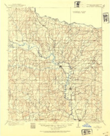
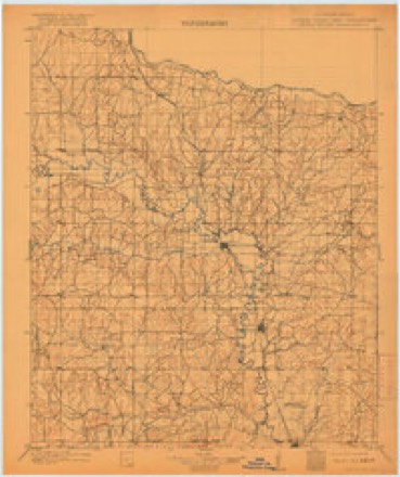
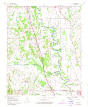
15 topographic sheets cover this place, the earliest surveyed in 1898 and the latest in 1986. It stands in the West Murray census division. It lies in ZIP code area 73098. It stands on Turkey Sandy Creek. The Survey maps it on the Joy quadrangle.
Topographic sheets covering this place
6 surveys from 15 printed sheetsMatched by testing this settlement's coordinate against the published boundary of every sheet in the United States Geological Survey's historical collection. Each opens the scanned sheet at the Survey.
- 1898 USGS Pauls Valley quadrangle1:125000
- 1902 USGS Pauls Valley quadrangle1:125000, 5 printings
- 1957 USGS Ardmore quadrangle1:250000, 3 printings
- 1963 USGS Ardmore quadrangle1:250000, 2 printings
- 1965 USGS Joy quadrangle1:24000, 2 printings
- 1986 USGS Pauls Valley quadrangle1:100000, 2 printings
Fires near this place
7 since 1997Regional context, not property-specific evidence. The federal wildfire occurrence database lists 7 fires within 5 miles of Joy between 1997 and 2011, burning about 5,575 acres in total. 1 started naturally. None was recorded as arson. Distance is straight-line from the map coordinates, so a fire counted here may appear on a neighbouring settlement's page as well.
| Reported cause | Fires |
|---|---|
| Equipment and vehicle use | 3 |
| Debris and open burning | 2 |
| Recreation and ceremony | 1 |
| Natural | 1 |
The most recent of them, most recent first, with the day each was reported and the service that recorded it.
| Date | Cause | Size | Reported by | Name on the report |
|---|---|---|---|---|
| 14 July 2011 | Equipment and vehicle use | 8.8 acres | Chickasaw Agency | HOTTLE FIRE |
| 13 July 2011 | Natural | 4,800 acres | Chickasaw National Recreation Area | ARBUCKLE COMPLEX |
| 11 April 2003 | Debris and open burning | 600 acres | Chickasaw Agency | MUSTANG |
| 15 March 2005 | Equipment and vehicle use | 1.0 acres | Chickasaw Agency | JOY |
| 3 January 2011 | Equipment and vehicle use | 46 acres | Chickasaw Agency | DULANEY |
| 29 January 2011 | Recreation and ceremony | 19 acres | Chickasaw Agency | FIRE PIT |
| 26 January 1997 | Debris and open burning | 100 acres | Chickasaw Agency | AMOS |
Settlements close enough to share some of these fires:
Mines and quarries near this place
10 of 17 shownRegional context, not property-specific evidence. The federal mineral resources record lists 17 workings within 5 miles of Joy: 15 past producers, 1 occurrence, 1 producer. 1 still produces. What was taken out: Sand and Gravel, Construction, Stone, Crushed/Broken, Lead, Copper. Distance is straight-line from the map coordinates, so a quarry counted here may appear on a neighbouring settlement's page as well.
| Where | Site | Commodity | Status | Recorded |
|---|---|---|---|---|
| Brady East | Lead, Copper, Silver, Chromium, Molybdenum, Vanadium | Occurrence | 1974 | |
| Dolese Bros Limestone Pit | Stone, Crushed/Broken | Producer | ||
| Unknown Limestone Pit | Stone, Crushed/Broken | Past Producer | ||
| Unknown Limestone Pit | Stone, Crushed/Broken | Past Producer | ||
| Unknown Limestone Pit | Stone, Crushed/Broken | Past Producer | ||
| Unknown Limestone Pit | Stone, Crushed/Broken | Past Producer | ||
| Unknown Limestone Pit | Stone, Crushed/Broken | Past Producer | ||
| Unknown Limestone Pit | Stone, Crushed/Broken | Past Producer | ||
| Unknown Gravel Pit | Sand and Gravel, Construction | Past Producer | ||
| Unknown Gravel Pit | Sand and Gravel, Construction | Past Producer |
Storms near this place
12 since 1993Regional context, not property-specific evidence. The National Weather Service names Joy in 12 storm reports between 1993 and 2024: 6 hail, 5 tornado, 1 thunderstorm wind. No death or injury is recorded in these reports. Each account below is quoted exactly as the forecast office filed it, from the NOAA Storm Events Database, and each date opens the federal record of that event.
| When | Event | Place named | Harm | What the report says |
|---|---|---|---|---|
| May 2016 | Tornado (EF3) | Joy | $4,000,000 | After the Katie tornado dissipated, the storm produced another tornado that developed just west of US-77 between Wynnewood and Davis. Some tree damage was noted between the Washita River and US-77. The tornado moved about three miles through open land before damaging or destroying numerous houses and other structures along and near Palmer Road and Buel Green Road to the northwest and north of Sulphur. Through this time, the tornado grew to nearly one mile in width. Numerous houses from Meadow road to just east of US-177 received EF3 damage. Near Meadow Road and Burnside Road, cars parked near a destroyed barn were displaced about 280 yards to the east. Preliminary analysis of winds from the Doppler on Wheels mobile research radar provided by the Center for Severe Weather Research indicated approximately 218 mph (+/-) at 17 meters AGL near US-177 N of Buel Green Road, however there were no structures in the immediate vicinity of this wind maximum to give a corresponding damage rating.||The tornado moved east-northeast after crossing US-177 with the path width gradually diminishing. The tornado moved along the Murray-Pontotoc County line affecting both counties for the last three miles before dissipating about 2 miles south-southwest of Roff. The center line of the tornado did move into Pontotoc County approximately three miles southwest of Roff. |
| November 2024 | Tornado (EF0) | Joy | - | An off-duty Storm Prediction Center employee observed a small tornado cross U.S. Highway 77 south of Wynnewood, or about 0.3 miles south of the Garvin-Murray County line. Some tree limb damage was observed. |
| May 2015 | Tornado (EF0) | Joy | - | Emergency management spotters and a storm chaser observed a tornado estimated to be about 1 miles west of US-177 and 4 to 5 miles north of State Highway 7. No damage was reported. |
| May 2010 | Tornado (EF1) | Joy | - | This is a continuation of the Garvin county tornado that began 7 miles west-southwest of Wynnewood. Structural damage was concentrated in and around the community of Joy, along Joy Rd. east of Hwy 77. Several barns and outbuildings were heavily damaged, and some homes had roof damage. Extensive tree and power pole/line damage was also noted. Further to the east-northeast a home lost part of its roof. Monetary damage estimates were not available. |
| May 1997 | Tornado (F0) | Joy | - | A brief tornado was observed east of Joy. No reported damage. |
| August 2020 | Hail | Joy | - | no account filed |
| March 2017 | Hail | Joy | - | no account filed |
| May 2016 | Hail | Joy | - | no account filed |
| May 2002 | Hail | Joy | - | no account filed |
| April 1996 | Hail | Joy | - | no account filed |
| March 1994 | Hail | Joy | - | no account filed |
| April 1993 | Thunderstorm Wind | Joy | - | no account filed |
Nearest settlements
The eight closest, with where each one stands in the county. Distances are straight-line, computed from the Geographic Names Information System coordinates.
| Map | Place | Distance | Sheets |
|---|---|---|---|
| Washita | 3.3 miles | 15 | |
| Chigley | 3.4 miles | 15 | |
| Iona | 6.2 miles | 15 | |
| Davis | 6.3 miles | 15 | |
| Jollyville | 9.2 miles | 16 | |
| Oak Grove | 9.4 miles | 13 | |
| Cedar Village | 10.5 miles | 16 | |
| Sulphur | 11.0 miles | 13 |
Elsewhere
Matched on this settlement's Geographic Names Information System number rather than its name, so it cannot be a different place of the same name in another state.
| Wikipedia article on Joy | An encyclopaedic summary. Its text is share-alike, so it is linked here rather than copied. |
| Wikidata item Q6296971 | The structured record the population and elevation above come from. Public domain (CC0). |
Provenance
This settlement is recorded in the Geographic Names Information System as feature 1094267. The sheet list is computed by point-in-boundary test against the United States Geological Survey's historical topographic inventory. Both are works of the United States government and carry no copyright under 17 U.S.C. 105.
Wildfire. Short, Karen C. 2022. Spatial wildfire occurrence data for the United States, 1992-2020 [FPA_FOD_20221014]. 6th Edition. Fort Collins, CO: Forest Service Research Data Archive. https://doi.org/10.2737/RDS-2013-0009.6 Collected with United States Government funding and usable without additional permissions or fees.
Mines and quarries. USGS Mineral Resources Data System (MRDS) https://mrdata.usgs.gov/mrds/ A work of the United States government, no copyright under 17 U.S.C. 105.
Storms. NOAA National Centers for Environmental Information, Storm Events Database https://www.ncei.noaa.gov/stormevents/ A work of the United States government, no copyright under 17 U.S.C. 105. Narratives are quoted verbatim from the National Weather Service report and are not edited or summarised.