 Block
Lawton, Oklahoma
13 topographic sheets cover this place, the earliest surveyed in 1946 and the latest in 1991. It stands in the Lawton census division. It lies in ZIP code area 73501. It lies near Rock Island Depot. The Survey maps it on the Lawton quadrangle. 90,381 people lived here at the 2020 count. It stands 1,112 feet above sea level.
On record in Lawton
Buildings and businesses the archive holds for this place. Each opens its own page, with the source record it came from.
On the National Register 12 of 17 shown
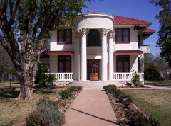 Mattie Beal Houselisted 1975
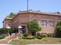 Carnegie Librarylisted 1976
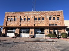 Central Fire Stationlisted 2016
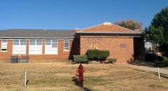 Douglass Schoollisted 2008
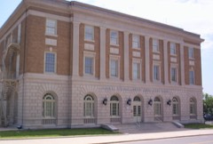 Federal Building and US Courthouselisted 2000
 First Christian Churchlisted 1985
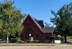 First Presbyterian Church of Lawtonlisted 1979
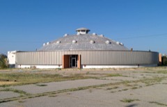 Lawton National Guard Armorylisted 2007
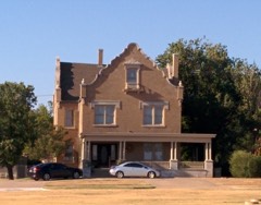 Mahoney-Clark Houselisted 1982
 Methodist Episcopal Church, Southlisted 1985
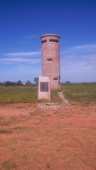 Old Tower Twolisted 1974
- Building 309, Fort Sill Indian Schoollisted 1973
Population over time
2 figuresLawton fell from 96,867 to 90,381 between 2010 and 2020. These are the recorded population figures Wikidata holds for this place, reached through the Geographic Names Information System number this page is keyed on rather than by name, so they belong to this place and not to another of the same name. Most are census counts, but not all are: an early figure may be a founding or settlement estimate, and an estimate published within five years of a census is left out. The change column is computed, and is left blank where more than 20 years separate a figure from the one before it, because a gap that long is not a change between two counts.
| Year | People | Change |
|---|---|---|
| 2010 | 96,867 | |
| 2020 | 90,381 | -6,486 (-7%) |
Topographic sheets covering this place
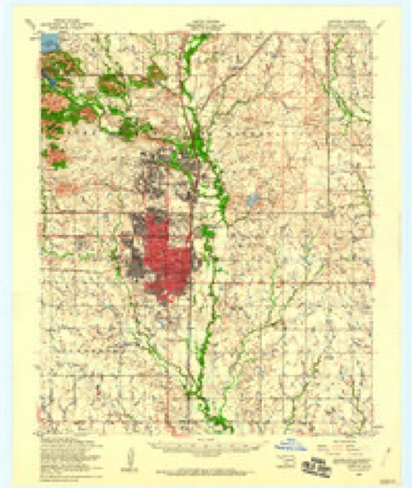
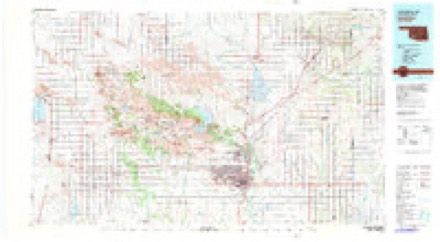
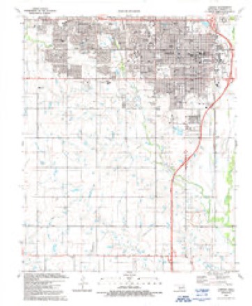
6 surveys from 13 printed sheetsMatched by testing this settlement's coordinate against the published boundary of every sheet in the United States Geological Survey's historical collection. Each opens the scanned sheet at the Survey.
- 1946 USGS Lawton quadrangle1:62500, 2 printings
- 1955 USGS Lawton quadrangle1:250000, 5 printings
- 1956 USGS Lawton quadrangle1:24000, 3 printings
- 1956 USGS Lawton quadrangle1:62500
- 1981 USGS Lawton quadrangle1:100000
- 1991 USGS Lawton quadrangle1:24000
Photographs
8 of 14 photographs shown, 1916 to 2020Taken for the Office of War Information and the Farm Security Administration, who photographed the country between 1935 and 1944. Works of United States government photographers, with no known restriction on use. Each opens its catalogue record.
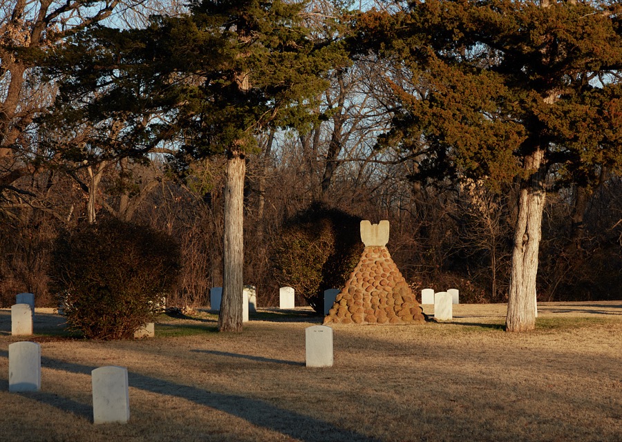
Highsmith, Carol M, 2020. Library of Congress

Highsmith, Carol M, 2020. Library of Congress

Highsmith, Carol M, 2020. Library of Congress
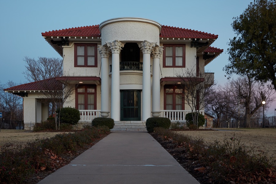
Highsmith, Carol M, 2020. Library of Congress
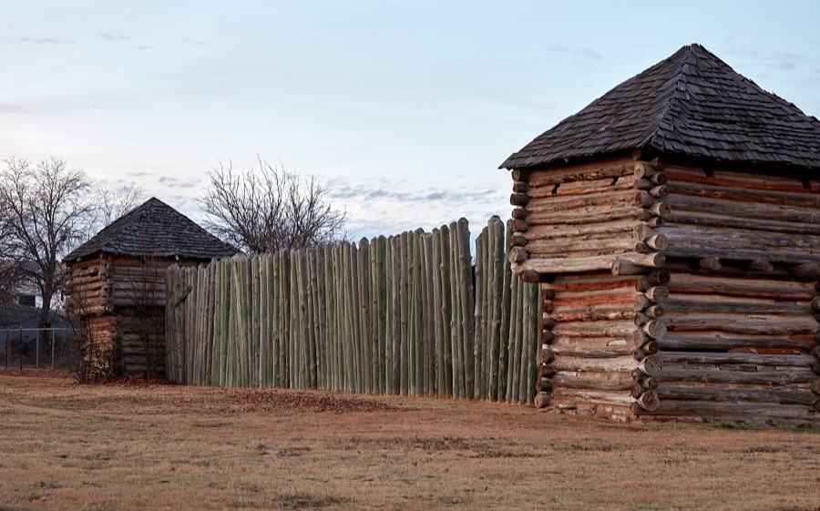
Highsmith, Carol M, 2020. Library of Congress

Hine, Lewis Wickes, 1916. Library of Congress
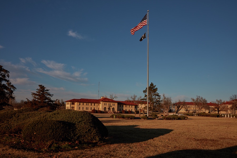
Highsmith, Carol M, 2020. Library of Congress

Hine, Lewis Wickes, 1916. Library of Congress
Every photograph of Comanche County
Fires near this place
45 since 2001Regional context, not property-specific evidence. The federal wildfire occurrence database lists 45 fires within 5 miles of Lawton between 2001 and 2020, burning about 841 acres in total. None started naturally. 8 were recorded as arson. Distance is straight-line from the map coordinates, so a fire counted here may appear on a neighbouring settlement's page as well.
| Reported cause | Fires |
|---|---|
| Debris and open burning | 13 |
| Arson/incendiarism | 8 |
| Equipment and vehicle use | 6 |
| Fireworks | 6 |
| Missing data/not specified/undetermined | 5 |
| Smoking | 4 |
| Power generation/transmission/distribution | 2 |
| Recreation and ceremony | 1 |
The most recent of them, most recent first, with the day each was reported and the service that recorded it.
| Date | Cause | Size | Reported by | Name on the report |
|---|---|---|---|---|
| 3 September 2012 | Arson/incendiarism | 1.0 acres | Anadarko Agency | SE-BISHOP |
| 2 September 2012 | Arson/incendiarism | 1.0 acres | Anadarko Agency | RAILROAD & BISHOP |
| 12 September 2012 | Missing data/not specified/undetermined | 20 acres | Anadarko Agency | SE-BISHOP-3 |
| 30 August 2009 | Debris and open burning | 60 acres | Anadarko Agency | HIGHLAND |
| 24 August 2001 | Missing data/not specified/undetermined | 1.0 acres | Anadarko Agency | MULLEN |
| 21 August 2019 | Power generation/transmission/distribution | under an acre | Anadarko Agency | HIGHLAND |
| 5 July 2012 | Fireworks | 1.0 acres | Anadarko Agency | KOOMBZ RD. |
| 4 July 2008 | Fireworks | 5.0 acres | Anadarko Agency | MAJOR-CLUSTER |
Settlements close enough to share some of these fires:
Mines and quarries near this place
4 within 5 milesRegional context, not property-specific evidence. The federal mineral resources record lists 4 workings within 5 miles of Lawton: 3 past producers, 1 occurrence. None of them still produces. What was taken out: Sand and Gravel, Construction, Copper. Distance is straight-line from the map coordinates, so a quarry counted here may appear on a neighbouring settlement's page as well.
| Where | Site | Commodity | Status | Recorded |
|---|---|---|---|---|
| Wolf Creek-1 | Copper | Occurrence | 1936 | |
| Unknown Gravel Pit | Sand and Gravel, Construction | Past Producer | ||
| Unknown Gravel Pit | Sand and Gravel, Construction | Past Producer | ||
| Unknown Gravel Pit | Sand and Gravel, Construction | Past Producer |
Storms near this place
60 of 360 shownRegional context, not property-specific evidence. The National Weather Service names Lawton in 360 storm reports between 1993 and 2026: 183 hail, 117 thunderstorm wind, 48 flash flood, 7 flood. The reports record 3 deaths and 5 injuries. Each account below is quoted exactly as the forecast office filed it, from the NOAA Storm Events Database, and each date opens the federal record of that event.
| When | Event | Place named | Harm | What the report says |
|---|---|---|---|---|
| May 2001 | Thunderstorm Wind | Lawton | 1 killed, $11,000,000 | Wind damage to buildings, homes, trees, and infrastructure was reported city-wide. A telephone pole fell on and killed a passenger riding on a motorcycle. |
| June 2016 | Flash Flood | Lawton | 1 killed, $10,000 | A 94 year old man was on his way to church when his truck was swept off the road and into a flooding creek. His body was recovered, still in his truck, Monday afternoon.|Several vehicles stranded in high water near Sheridan and B streets. Water was over one foot deep at the intersection of 27th street and G ave. 11th Street near Numu was closed due to high water. Interstate 44 was closed by high water near Rogers Lane. One foot deep water flowed over Mound road and Cache road. SE 60th and Bishop was impassable due to high water. A car was stranded in rushing water one mile east of I-44 on Gore ave. Several high water rescues were ongoing. |
| June 2010 | Flash Flood | Lawton | 1 killed | Numerous roads were closed due to high water. Several motorists had to be rescued after their automobiles stalled in the high water. One person drowned while trying to push his car out of the high water near NW Farris and 13th Street. No other serious injuries were reported. |
| January 2001 | Lightning | Lawton | 5 hurt | Lightning struck the ground near a group of 34 soldiers training at the East Range, sending 5 of them to the hospital for treatment. |
| August 2002 | Thunderstorm Wind | Lawton | $250,000 | The roof was damaged at Hugh Bish Elementary School. |
| August 2007 | Flash Flood | Lawton | $200,000 | The bridge at Bemel Road was severely damaged. Also, several county roads and bridges in and around Fletcher were closed due to high water. Monetary damages were estimated. |
| March 2004 | Thunderstorm Wind | Lawton | $200,000 | Wind gust was measured by ultimeter anemometer on SW 45th Street at 1404 CST. The house across the street lost many shingles on west facing slope of roof. Power lines were downed across town. The football concession stand at Cameron University was picked up and thrown into a nearby parking lot damaging 50 vehicles. |
| May 2007 | Flash Flood | Lawton | $70,000 | Forty people had to be evacuated due to the rapidly rising water. A creek bridge was reported washed out near the Wichita Mountain Estates. Five horses drowned after a failed rescue attempt. Several roads were closed due to the high water. Monetary damages were estimated. |
| June 2025 | Flash Flood | Lawton | $50,000 | Roadway flooding along Lee Boulevard due to water rise from nearby Numu Creek. Several cars became stranded in floodwaters at this location. The event time is approximate. |
| May 2016 | Thunderstorm Wind | Lawton | $45,000 | A 15 inch tree branch was snapped and landed on the roof of a home. Two large trees were also uprooted. There were also a few power poles snapped. |
| June 2023 | Thunderstorm Wind | Lawton | $30,000 | Outermost layer of roof decking of a two-story apartment blown off due to thunderstorm wind. Time is radar estimated. |
| June 2007 | Flash Flood | Lawton | $30,000 | Up to 100 homes in the Garden Village Addition were evacuated due to rising water. Monetary Damages were estimated. |
| January 2026 | Thunderstorm Wind | Lawton | $25,000 | AC units and bleachers were damaged at MacArthur Middle School. The event time is estimated from radar observations. |
| May 2016 | Flash Flood | Lawton | $25,000 | A city park was reported under water with up to 3 feet of water present. At least one vehicle was stranded. |
| August 2012 | Thunderstorm Wind | Lawton | $25,000 | At NW 112th and NW Cache Rd., 5-6 power poles were blown down. Roof damage and blown out windows were also reported at this location. |
| October 2004 | Thunderstorm Wind | Lawton | $25,000 | A strong wind gust peeled the tin roof and siding off of the Veterans Center. There was also roof damage to a school and several homes on the east side of town. Damage was reported by KSWO-TV in Lawton, Oklahoma. |
| October 2000 | Lightning | Lawton | $25,000 | Lightning struck an insulator on West Gore Blvd. and 67th Street causing a power outage to about 1100 homes. |
| August 1997 | Thunderstorm Wind | Lawton | $25,000 | Severe thunderstorm winds downed power lines, limbs, and trees throughout Lawton and Fort Sill. Windows were also blown out on Fort Sill. |
| May 2019 | Flash Flood | Lawton | $20,000 | Cars stuck in high water and a couple water rescues from flooded out cars. |
| May 2016 | Flash Flood | Lawton | $20,000 | A storm chaser reported roads were becoming impassable. The broadcast media, KSWO-TV, also relayed a report of water rescues on the west side of Lawton. Many roads were reported impassable or closed. |
| May 2015 | Flash Flood | Lawton | $20,000 | Water up over vehicle tires. |
| June 1999 | Thunderstorm Wind | Lawton | $20,000 | no account filed |
| May 2008 | Thunderstorm Wind | Lawton | $15,000 | Power lines and power poles were blown down at several locations across the city. Six-hundred residents were without power for a short time. Monetary damages were estimated. |
| May 2007 | Flash Flood | Lawton | $15,000 | Numerous city streets were closed due to high water. Two home were also flooded. Monetary damages were estimated. |
| June 2005 | Thunderstorm Wind | Lawton | $15,000 | One business was reported to have the roof blown off. |
| June 2002 | Flash Flood | Lawton | $15,000 | High water forced the closings of the intersection of NW 14th and Andrews Road and two other intersections. One vehicle was abandoned in high water. |
| August 1999 | Thunderstorm Wind | Lawton | $15,000 | no account filed |
| October 2000 | Lightning | Lawton | $13,000 | Lightning struck an air conditioning unit causing some curtains to catch fire. Significant fire and smoke damage occurred to the master bedroom. |
| May 2024 | Hail | Lawton | $10,000 | Relayed image. Additional confirmation from the public of a cracked window. Time is radar estimated. |
| October 2023 | Flash Flood | Lawton | $10,000 | Social media image and relayed reports showing flooding in/around the city of Lawton. This included multiple vehicles stalled in floodwaters, mainly along Lee and Gore Boulevards. Time is estimated. |
| July 2023 | Thunderstorm Wind | Lawton | $10,000 | Relayed image showing 6 power poles snapped or blown down just west of the Southeast Lee Boulevard and Southeast 45th Street intersection. Time is radar estimated. |
| September 2017 | Flash Flood | Lawton | $10,000 | A report was relayed by broadcast media of flooding at the intersection of 53rd and Gore Blvd. Water was reported to be coming into a vehicle at this intersection. |
| May 2015 | Flash Flood | Lawton | $10,000 | Low lying areas along roads covered in water. Ditches were overflowing with water rising into yards of homes. |
| May 2015 | Flash Flood | Lawton | $10,000 | Rainfall rates of two inches per hour observed. Numerous streets flooded, with water flooding yards and encroaching on homes. |
| August 2006 | Thunderstorm Wind | Lawton | $7,500 | Several power lines and poles were downed across central and eastern parts of Lawton. Power lines and tree limbs were also reported down on Fort Sill. |
| August 2023 | Thunderstorm Wind | Lawton | $5,000 | Relayed images showing power poles blown down in at least two locations in the vicinity of Northwest Cache Road and Northwest 67th Street. Time is radar estimated. |
| July 2021 | Flash Flood | Lawton | $5,000 | Water rescue with water coming into vehicle. |
| August 2017 | Thunderstorm Wind | Lawton | $5,000 | Several shingles were blown off roof along with several 1 to 2 inch tree limbs down. |
| May 2016 | Thunderstorm Wind | Lawton | $5,000 | A high tension utility pole was knocked over/snapped. |
| May 2006 | Thunderstorm Wind | Lawton | $5,000 | Railroad storage buildings blown over into roadway on the west side of the city. |
| June 2003 | Thunderstorm Wind | Lawton | $5,000 | Several trees and power lines were downed. A metal storage shed was damaged with portions of the roof blocking a street. |
| May 1993 | Thunderstorm Wind | Lawton | $5,000 | no account filed |
| January 1998 | Thunderstorm Wind | Lawton | $4,000 | Severe thunderstorm winds blew the steeple off a church roof. |
| April 2003 | Thunderstorm Wind | Lawton | $2,500 | Tree limbs were downed. Some roofs and outbuildings were also damaged. |
| April 2024 | Thunderstorm Wind | Lawton | $2,000 | Relayed image showing a power pole snapped in half. Time is radar estimated. |
| June 2019 | Thunderstorm Wind | Lawton | $2,000 | Large trees damaged or uprooted, light structural damage. |
| April 2016 | Thunderstorm Wind | Lawton | $2,000 | Power lines and poles downed by wind. |
| May 2010 | Thunderstorm Wind | Lawton | $2,000 | Several tree limbs were downed on the west side of Lawton. Monetary damages were estimated. |
| March 2009 | Thunderstorm Wind | Lawton | $2,000 | An awning was ripped off a building at Southwest 52nd and Lee Boulevard. Monetary damages were estimated. |
| June 2003 | Thunderstorm Wind | Lawton | $2,000 | Power lines were downed. |
| May 1998 | Thunderstorm Wind | Lawton | $1,800 | no account filed |
| December 2018 | Thunderstorm Wind | Lawton | $1,000 | Power outages reported on the west side of Lawton, OK. |
| August 2017 | Thunderstorm Wind | Lawton | $1,000 | Power pole downed. |
| March 2015 | Thunderstorm Wind | Lawton | $1,000 | Limbs blown off trees. |
| May 2013 | Thunderstorm Wind | Lawton | $1,000 | Observer reported small limbs down, along with nickel size hail. |
| September 2005 | Thunderstorm Wind | Lawton | $1,000 | A wind gust downed limbs and power lines. A large tree was also downed in the yard of a house on Northwest 17th. |
| June 1998 | Thunderstorm Wind | Lawton | $750 | Severe thunderstorm winds downed 6 utility poles. |
| June 1996 | Lightning | Lawton | $500 | no account filed |
| June 2006 | Thunderstorm Wind | Lawton | $200 | Three inch diameter tree limbs were downed. |
| September 1997 | Thunderstorm Wind | Lawton | $10 | Severe thunderstorm winds snapped 4-inch diameter tree limbs. |
Nearest settlements
The eight closest, with where each one stands in the county. Distances are straight-line, computed from the Geographic Names Information System coordinates.
| Map | Place | Distance | Sheets |
|---|---|---|---|
| Kiowa and Commanche Agency (historical) | 1.0 miles | 13 | |
| Sneed Acres | 1.9 miles | 16 | |
| Artillery Village | 2.4 miles | 16 | |
| Corral Crossing | 4.0 miles | 16 | |
| Grenade Crossing | 4.2 miles | 16 | |
| Chatto Crossing | 5.3 miles | 16 | |
| Peachtree Crossing | 5.4 miles | 16 | |
| Four Mile Crossing | 6.1 miles | 16 |
Elsewhere
Matched on this settlement's Geographic Names Information System number rather than its name, so it cannot be a different place of the same name in another state.
| Wikipedia article on Lawton | An encyclopaedic summary. Its text is share-alike, so it is linked here rather than copied. |
| Wikidata item Q503336 | The structured record the population and elevation above come from. Public domain (CC0). |
Provenance
This settlement is recorded in the Geographic Names Information System as feature 1094539. The sheet list is computed by point-in-boundary test against the United States Geological Survey's historical topographic inventory. Both are works of the United States government and carry no copyright under 17 U.S.C. 105.
Wildfire. Short, Karen C. 2022. Spatial wildfire occurrence data for the United States, 1992-2020 [FPA_FOD_20221014]. 6th Edition. Fort Collins, CO: Forest Service Research Data Archive. https://doi.org/10.2737/RDS-2013-0009.6 Collected with United States Government funding and usable without additional permissions or fees.
Mines and quarries. USGS Mineral Resources Data System (MRDS) https://mrdata.usgs.gov/mrds/ A work of the United States government, no copyright under 17 U.S.C. 105.
Storms. NOAA National Centers for Environmental Information, Storm Events Database https://www.ncei.noaa.gov/stormevents/ A work of the United States government, no copyright under 17 U.S.C. 105. Narratives are quoted verbatim from the National Weather Service report and are not edited or summarised.