 Block
Marlow, Oklahoma
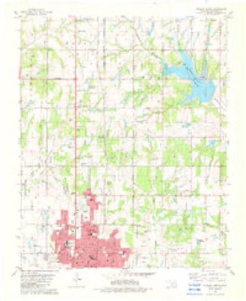
16 topographic sheets cover this place, the earliest surveyed in 1902 and the latest in 1986. It stands in the Duncan census division. It lies in ZIP code area 73055. The Survey maps it on the Duncan North quadrangle.
On record in Marlow
Buildings and businesses the archive holds for this place. Each opens its own page, with the source record it came from.
On the National Register 2 records
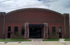 Marlow Armorylisted 1994
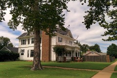 Montgomery-Linam Houselisted 1983
Topographic sheets covering this place
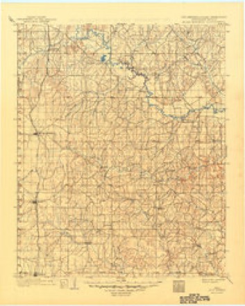
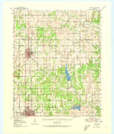
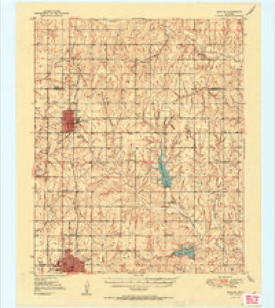
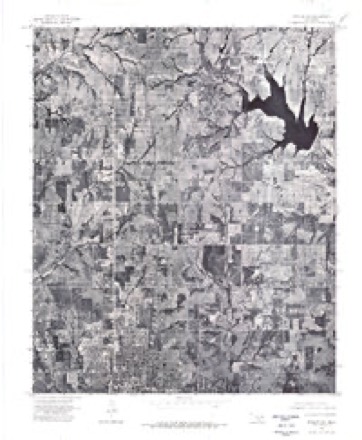
8 surveys from 16 printed sheetsMatched by testing this settlement's coordinate against the published boundary of every sheet in the United States Geological Survey's historical collection. Each opens the scanned sheet at the Survey.
- 1902 USGS Rush Springs quadrangle1:125000, 4 printings
- 1950 USGS Marlow quadrangle1:62500
- 1951 USGS Marlow quadrangle1:62500, 2 printings
- 1957 USGS Ardmore quadrangle1:250000, 3 printings
- 1963 USGS Ardmore quadrangle1:250000, 2 printings
- 1975 USGS Marlow SW quadrangle1:24000
- 1982 USGS Duncan North quadrangle1:24000
- 1986 USGS Pauls Valley quadrangle1:100000, 2 printings
Fires near this place
5 since 2005Regional context, not property-specific evidence. The federal wildfire occurrence database lists 5 fires within 5 miles of Marlow between 2005 and 2018, burning about 696 acres in total. None started naturally. 1 was recorded as arson. Distance is straight-line from the map coordinates, so a fire counted here may appear on a neighbouring settlement's page as well.
| Reported cause | Fires |
|---|---|
| Missing data/not specified/undetermined | 3 |
| Equipment and vehicle use | 1 |
| Arson/incendiarism | 1 |
The most recent of them, most recent first, with the day each was reported and the service that recorded it.
| Date | Cause | Size | Reported by | Name on the report |
|---|---|---|---|---|
| 12 August 2008 | Equipment and vehicle use | 25 acres | Chickasaw Agency | ROAD SCRATCH |
| 25 March 2006 | Missing data/not specified/undetermined | 4.0 acres | Chickasaw Agency | TUCKER |
| 16 March 2008 | Missing data/not specified/undetermined | under an acre | Chickasaw Agency | IMPERIAL RUBBER |
| 24 December 2005 | Missing data/not specified/undetermined | 500 acres | Chickasaw Agency | GATLIN |
| 14 January 2018 | Arson/incendiarism | 167 acres | Chickasaw Agency | PLAINSMAN |
Settlements close enough to share some of these fires:
Mines and quarries near this place
3 within 5 milesRegional context, not property-specific evidence. The federal mineral resources record lists 3 workings within 5 miles of Marlow: 3 past producers. None of them still produces. What was taken out: Sand and Gravel, Construction. Distance is straight-line from the map coordinates, so a quarry counted here may appear on a neighbouring settlement's page as well.
| Where | Site | Commodity | Status | Recorded |
|---|---|---|---|---|
| Unknown Gravel Pit | Sand and Gravel, Construction | Past Producer | ||
| Unknown Gravel Pit | Sand and Gravel, Construction | Past Producer | ||
| Unknown Gravel Pit | Sand and Gravel, Construction | Past Producer |
Storms near this place
60 of 150 shownRegional context, not property-specific evidence. The National Weather Service names Marlow in 150 storm reports between 1993 and 2026: 81 hail, 49 thunderstorm wind, 11 flash flood, 7 tornado. No death or injury is recorded in these reports. Each account below is quoted exactly as the forecast office filed it, from the NOAA Storm Events Database, and each date opens the federal record of that event.
| When | Event | Place named | Harm | What the report says |
|---|---|---|---|---|
| July 2012 | Thunderstorm Wind | Marlow | $200,000 | Widespread wind damage was reported in Marlow. Numerous trees were blown down with power lines and poles downed. Hail up to the size of tennis balls combined with the winds also damaged roofs and took out windows of homes. Wind gusts were estimated to be greater than 70 mph. Monetary damage estimated. |
| May 2015 | Flash Flood | Marlow | $100,000 | Flood waters reported in school building. |
| April 2024 | Thunderstorm Wind | Marlow | $75,000 | Multiple trees and power lines blown down throughout the community of Marlow. The metal roof of an event center was blown off. Time is radar estimated. |
| April 2020 | Tornado (EF1) | Marlow | $75,000 | A tornado developed just northwest of the city limits of Marlow and moved east-southeast into far northern portions of the city of Marlow. Near the beginning of the tornado, numerous buildings on a farm on the north side of Ballpark Road were heavily damaged, including most of the roof off of a home and an outbuilding. The tornado moved east-southeast breaking large trees and utility poles along Ballpark Road. A number of trees were damaged at the Marlow cemetery on the northeast side of Marlow. |
| March 2004 | Thunderstorm Wind | Marlow | $75,000 | A mobile home was severely damaged when its roof was taken off. A roof was also blown off a home. Power lines, tree limbs, and two fences were downed. |
| August 1999 | Lightning | Marlow | $75,000 | Lightning struck three oil tanks, igniting a fire. The fire destroyed one of the tanks and severely damaged the other two. |
| August 1997 | Lightning | Marlow | $40,000 | Lightning struck and set fire to a house, completely gutting the home. |
| May 2013 | Thunderstorm Wind | Marlow | $30,000 | Large trees up to 16 inches in diameter snapped. Minor structural damage also occurred to roofs and fences. |
| May 2013 | Tornado (EF1) | Marlow | $20,000 | Several storm chasers and spotters observed a tornado that developed southeast of Marlow, and moved northeast to between Marlow and Bray. Minor damage to trees and power lines was reported. No injuries or fatalities occurred. |
| October 1999 | Thunderstorm Wind | Marlow | $20,000 | no account filed |
| August 2009 | Thunderstorm Wind | Marlow | $10,000 | Several large tree branches and power lines were downed throughout the time. Monetary damages were estimated. |
| February 1999 | Thunderstorm Wind | Marlow | $6,000 | no account filed |
| May 2018 | Thunderstorm Wind | Marlow | $5,000 | Numerous trees damaged by strong winds. Tree limbs up to 14 inches in diameter snapped. Roof damage to several homes and structures in Marlow. Time estimated with radar. |
| June 2005 | Thunderstorm Wind | Marlow | $5,000 | The strong wind gust caused roof damage and power poles to snap. |
| May 1995 | Thunderstorm Wind | Marlow | $5,000 | ,,,,,,,,Lightning Duncan and Marlow,07,1817CST,,,0,0,?,?,Flash Flooding |
| August 2009 | Thunderstorm Wind | Marlow | $2,000 | A large tree was blown down in the Clear Creak Area. Monetary damages were estimated. |
| May 1999 | Thunderstorm Wind | Marlow | $2,000 | no account filed |
| May 1999 | Thunderstorm Wind | Marlow | $1,100 | no account filed |
| June 2005 | Tornado (F0) | Marlow | $1,000 | The brief tornado was viewed by a storm chaser east of Marlow. The only known damage occurred at St. York Baptist church located 2 miles south of Highway 29 on Cason Road. The church sustained some minor damage to its roof, mainly shingles blown off, and tree limbs downed. |
| February 2001 | Thunderstorm Wind | Marlow | $500 | A barn and trees were blown down. |
| March 1998 | Thunderstorm Wind | Marlow | $500 | Power poles were blown down by a line of thunderstorms, with winds estimated at 50 to 55 mph. |
| August 1997 | Thunderstorm Wind | Marlow | $500 | Trees and power lines were blown down. |
| June 1997 | Thunderstorm Wind | Marlow | $100 | Severe thunderstorm winds downed a large tree and knocked out power to the eastern part of town. |
| June 1997 | Thunderstorm Wind | Marlow | $100 | Several trees were toppled by severe thunderstorm winds. |
| June 1997 | Thunderstorm Wind | Marlow | $100 | Severe thunderstorm winds downed trees and tree limbs. |
| October 1997 | Thunderstorm Wind | Marlow | $10 | Severe thunderstorm winds blew limbs from trees. |
| March 2026 | Hail | Marlow | - | The report was relayed by law enforcement. |
| April 2026 | Hail | Marlow | - | Hailfall at the intersection of U.S. Highway 81 and Oklahoma Highway 29 in Marlow. |
| May 2025 | Hail | Marlow | - | Hail size increased from quarter-size to ping pong ball-size between 1438 and 1441 LST. |
| April 2025 | Flash Flood | Marlow | - | Significant roadway flooding in areas near Marlow Elementary School. Event time is approximate. |
| November 2025 | Hail | Marlow | - | An image was shared on social media. The location is approximate, and the event time is estimated from radar observations. |
| April 2024 | Flash Flood | Marlow | - | Flash flooding reported throughout the community of Duncan. A social media video showed significant roadway flooding near the intersection of U.S. Highway 81 and Oklahoma Highway 7. Event time is approximate. |
| May 2024 | Hail | Marlow | - | Relayed by emergency management. |
| April 2024 | Flash Flood | Marlow | - | Water flowing across the roadway, with an estimated depth of 6 inches, near the intersection of U.S. Highway 81 and Apache Street in the community of Marlow. Event time is approximate. |
| April 2024 | Thunderstorm Wind | Marlow | - | A broad swath of wind damage spread from west of Marlow near 3 Mile Road south of Nabor Road, northeast to just north of Marlow. A few trees were snapped, power poles were damaged and one shed was destroyed. Time is estimated. |
| June 2023 | Hail | Marlow | - | MPing report. |
| July 2023 | Thunderstorm Wind | Marlow | - | Social media image showing a 1224-inch diameter tree uprooted along with several large tree limbs blown down. Time is radar estimated. |
| May 2020 | Thunderstorm Wind | Marlow | - | Trees down in area of 11TH and Choctaw. Several power outages. |
| May 2020 | Flash Flood | Marlow | - | Flood waters threatening home. |
| April 2020 | Hail | Marlow | - | Pea to baseballs fell for 17 minutes. |
| May 2019 | Thunderstorm Wind | Marlow | - | Public reported by phone call. |
| June 2018 | Thunderstorm Wind | Marlow | - | No damage reported. |
| May 2016 | Tornado (EFU) | Marlow | - | Numerous spotters and storm chasers observed a tornado near State Highway 7 to the southeast of the town of Central High. No significant damage was reported. |
| May 2015 | Flash Flood | Marlow | - | Up to a foot of water on McCurdy road north of Duncan. No damage reported. |
| May 2015 | Flash Flood | Marlow | - | Water over south bound lane of Highway 81 north of Highway 7 junction. No damage reported. |
| May 2015 | Flash Flood | Marlow | - | Up to a foot of water running over Highway 81. No damage reported. |
| October 2014 | Thunderstorm Wind | Marlow | - | Trees blown down in Marlow. |
| May 2013 | Tornado (EF0) | Marlow | - | A brief tornado was reported via Spotter Network near Marlow. No damage was reported and the tornado lasted a very short time. |
| April 2012 | Hail | Marlow | - | The hail was reported on the north side of town. |
| July 2012 | Hail | Marlow | - | No damage was reported. |
| April 2011 | Hail | Marlow | - | The hail was reported on 8-Mile Road west of Central High. |
| March 2009 | Hail | Marlow | - | The hail was reported on Highway 7. |
| November 2008 | Hail | Marlow | - | Quarter to golfball size hail was reported. |
| June 2007 | Flash Flood | Marlow | - | Several streets were closed due to high water. |
| June 2005 | Tornado (F0) | Marlow | - | This tornado was observed by an off-duty Storm Prediction Center meteorologist and several other chasers. |
| June 2005 | Tornado (F0) | Marlow | - | The brief, small tornado was observed by two off-duty Storm Prediction Center(SPC) meteorologists in an open field just south of the Marlow city limits. No damage was reported. |
| June 2005 | Hail | Marlow | - | Hail was reported by KWTV Channel 9 in Oklahoma City. |
| October 2000 | Flash Flood | Marlow | - | Highway 29 was closed from Marlow to Highway 76 due to high water. |
| April 1998 | Flash Flood | Marlow | - | Flash flooding washed out a road and flooded two streets. |
| July 1994 | Hail | Marlow | - | Thunderstorms in central and western Oklahoma during the early morning hours on the 1st produced hail up to golf ball-size and damaging winds. Thunderstorm winds broke off large tree limbs in Ames. |
Nearest settlements
The eight closest, with where each one stands in the county. Distances are straight-line, computed from the Geographic Names Information System coordinates.
| Map | Place | Distance | Sheets |
|---|---|---|---|
| Duncan | 6.1 miles | 16 | |
| Hope | 6.5 miles | 16 | |
| Dixie Park | 7.1 miles | 15 | |
| Central High | 7.4 miles | 12 | |
| Oklahoma Hills | 7.6 miles | 15 | |
| Oil City | 7.8 miles | 12 | |
| Bray | 8.0 miles | 16 | |
| Nellie | 9.0 miles | 12 |
Elsewhere
Matched on this settlement's Geographic Names Information System number rather than its name, so it cannot be a different place of the same name in another state.
| Wikidata item Q35725138 | The structured record the population and elevation above come from. Public domain (CC0). |
Provenance
This settlement is recorded in the Geographic Names Information System as feature 1777408. The sheet list is computed by point-in-boundary test against the United States Geological Survey's historical topographic inventory. Both are works of the United States government and carry no copyright under 17 U.S.C. 105.
Wildfire. Short, Karen C. 2022. Spatial wildfire occurrence data for the United States, 1992-2020 [FPA_FOD_20221014]. 6th Edition. Fort Collins, CO: Forest Service Research Data Archive. https://doi.org/10.2737/RDS-2013-0009.6 Collected with United States Government funding and usable without additional permissions or fees.
Mines and quarries. USGS Mineral Resources Data System (MRDS) https://mrdata.usgs.gov/mrds/ A work of the United States government, no copyright under 17 U.S.C. 105.
Storms. NOAA National Centers for Environmental Information, Storm Events Database https://www.ncei.noaa.gov/stormevents/ A work of the United States government, no copyright under 17 U.S.C. 105. Narratives are quoted verbatim from the National Weather Service report and are not edited or summarised.