 Block
Perry, Oklahoma
9 topographic sheets cover this place, the earliest surveyed in 1955 and the latest in 1990. It stands in the Perry census division. It lies in ZIP code area 73077. It stands on Calf Creek. The Survey maps it on the Perry quadrangle. 4,484 people lived here at the 2020 count. It stands 1,010 feet above sea level.
Research this city
On record in Perry
Buildings and businesses the archive holds for this place. Each opens its own page, with the source record it came from.
On the National Register 6 records
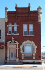 First National Bank and Trust Company Buildinglisted 1979
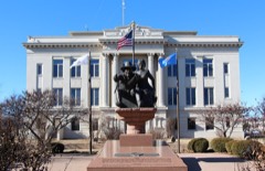 Noble County Courthouselisted 1984
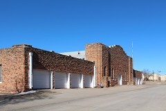 Perry Armorylisted 1988
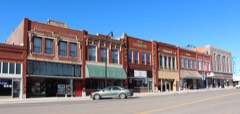 Perry Courthouse Square Historic Districtlisted 2003
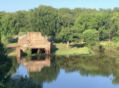 Perry Lake Parklisted 2007
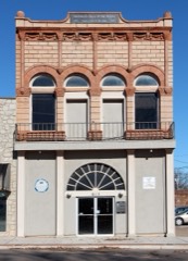 Wolleson-Nicewander Buildinglisted 1979
Surveyed buildings and structures 3 records
- Atchison, Topeka, Santa Fe Railroad Station, Perryfederal building survey, 7 photographs
- Perry Courthouse Square Historic District, Roughly bounded by Birch, Elm, Sixth and Seventh Streets, Perryfederal building survey, 1 photograph
- St. Louis, San Francisco Railroad Station, Perryfederal building survey, 7 photographs
Population over time
2 figuresPerry fell from 5,126 to 4,484 between 2010 and 2020. These are the recorded population figures Wikidata holds for this place, reached through the Geographic Names Information System number this page is keyed on rather than by name, so they belong to this place and not to another of the same name. Most are census counts, but not all are: an early figure may be a founding or settlement estimate, and an estimate published within five years of a census is left out. The change column is computed, and is left blank where more than 20 years separate a figure from the one before it, because a gap that long is not a change between two counts.
| Year | People | Change |
|---|---|---|
| 2010 | 5,126 | |
| 2020 | 4,484 | -642 (-13%) |
Topographic sheets covering this place
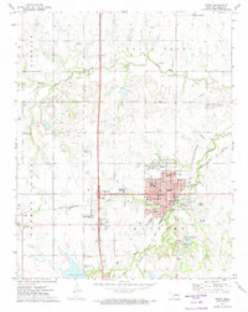
4 surveys from 9 printed sheetsMatched by testing this settlement's coordinate against the published boundary of every sheet in the United States Geological Survey's historical collection. Each opens the scanned sheet at the Survey.
- 1955 USGS Enid quadrangle1:250000, 4 printings
- 1958 USGS Enid quadrangle1:250000, 2 printings
- 1972 USGS Perry quadrangle1:24000, 2 printings
- 1990 USGS Enid quadrangle1:100000
Photographs
4 photographs, 1939Taken for the Office of War Information and the Farm Security Administration, who photographed the country between 1935 and 1944. Works of United States government photographers, with no known restriction on use. Each opens its catalogue record.
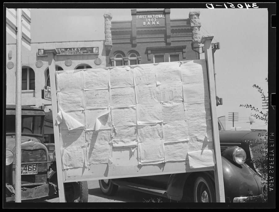
Lee, Russell, 1939. Library of Congress
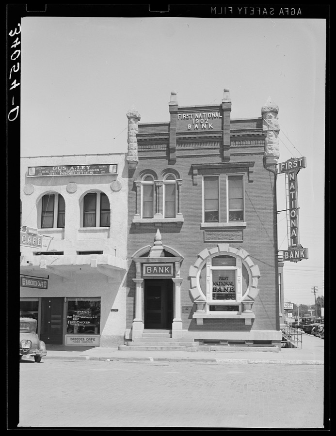
Lee, Russell, 1939. Library of Congress
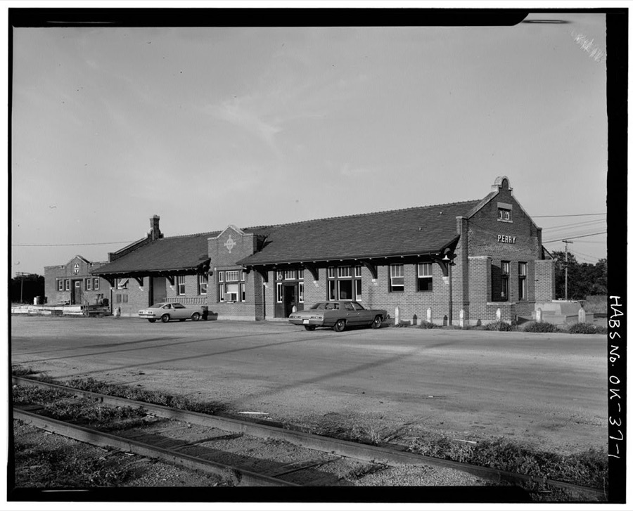
Photographer not recorded. Library of Congress
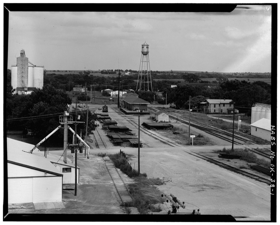
Photographer not recorded. Library of Congress
Fires near this place
3 since 2000Regional context, not property-specific evidence. The federal wildfire occurrence database lists 3 fires within 5 miles of Perry between 2000 and 2016, burning about 1,573 acres in total. None started naturally. None was recorded as arson. Distance is straight-line from the map coordinates, so a fire counted here may appear on a neighbouring settlement's page as well.
| Reported cause | Fires |
|---|---|
| Missing data/not specified/undetermined | 3 |
The most recent of them, most recent first, with the day each was reported and the service that recorded it.
| Date | Cause | Size | Reported by | Name on the report |
|---|---|---|---|---|
| 2 March 2016 | Missing data/not specified/undetermined | 272 acres | Oklahoma Division of Forestry | ORLANDO |
| 27 February 2016 | Missing data/not specified/undetermined | 301 acres | Oklahoma Division of Forestry | PERRY LAKE |
| 3 October 2000 | Missing data/not specified/undetermined | 1,000 acres | Oklahoma Division of Forestry | PERRY |
Settlements close enough to share some of these fires:
Mines and quarries near this place
10 of 18 shownRegional context, not property-specific evidence. The federal mineral resources record lists 18 workings within 5 miles of Perry: 15 past producers, 2 occurrences, 1 unknown. None of them still produces. What was taken out: Sand and Gravel, Construction, Clay, Copper, Stone, Crushed/Broken. Distance is straight-line from the map coordinates, so a quarry counted here may appear on a neighbouring settlement's page as well.
| Where | Site | Commodity | Status | Recorded |
|---|---|---|---|---|
| Unknown Shale Pit | Clay, Stone, Crushed/Broken | Past Producer | ||
| Unknown Shale Pit | Clay, Sand and Gravel, Construction | Past Producer | ||
| Perry North-1 | Copper | Occurrence | 1946 | |
| Perry-1 | Copper | Occurrence | 1946 | |
| Unknown Sandstone Pit | Stone, Crushed/Broken | Past Producer | ||
| Unknown Sandstone Pit | Stone, Crushed/Broken | Past Producer | ||
| Unknown Shale Pit | Clay | Past Producer | ||
| Unknown Shale Pit | Clay | Past Producer | ||
| Unknown Shale Pit | Clay | Past Producer | ||
| Unknown Shale Pit | Clay | Past Producer |
Storms near this place
60 of 105 shownRegional context, not property-specific evidence. The National Weather Service names Perry in 105 storm reports between 1993 and 2025: 51 hail, 40 thunderstorm wind, 6 tornado, 3 flash flood. The reports record 11 injuries. Each account below is quoted exactly as the forecast office filed it, from the NOAA Storm Events Database, and each date opens the federal record of that event.
| When | Event | Place named | Harm | What the report says |
|---|---|---|---|---|
| May 1999 | Tornado (F2) | Perry | 10 hurt, $3,000,000 | Tornado B20 (Noble County portion). On January 10, 2001 tornadoes B20 and B21 were combined and will be identified as B21. Tornado B21 no longer exists. Please see summary at end of May 3rd storm reports for more information. |
| August 2011 | Thunderstorm Wind | Perry | 1 hurt | A mobile home was blown onto its side, injuring one person inside .Fence panels and large limbs were blown down. Monetary damages were estimated. |
| May 1993 | Thunderstorm Wind | Perry | $500,000 | no account filed |
| March 1997 | Thunderstorm Wind | Perry | $50,000 | Three mobile homes were destroyed and five others were heavily damaged by severe thunderstorm winds at a mobile home park 8 miles east of Perry. On US 64, a camping trailer 6 miles east of Perry was completely destroyed. It was described by the owner as having been "put in a press and squashed". In Perry the Elks lodge roof was damaged and some bleachers from a ball field were blown into a road. Numerous tree, power lines, and signs were also downed in Perry. |
| April 1994 | Thunderstorm Wind | Perry | $50,000 | no account filed |
| May 1993 | Thunderstorm Wind | Perry | $50,000 | no account filed |
| December 1999 | Tornado (F1) | Perry | $38,000 | Refer to summary at end of Dec 2nd storm reports for more information. |
| October 1998 | Tornado (F1) | Perry | $30,000 | no account filed |
| June 2024 | Thunderstorm Wind | Perry | $25,000 | Multiple confirmations/images of thunderstorm wind damage in and around the community of Perry. This included multiple trees uprooted and at least one outbuilding destroyed. Time is radar estimated. |
| June 2024 | Hail | Perry | $25,000 | Social media image. Additional image/confirmation of siding and window damage to at least one house due to wind-driven hailfall. Time is radar estimated. |
| March 2004 | Flash Flood | Perry | $25,000 | A report from the public indicated that flash flooding had occurred during the afternoon hours of March 4, and that some local roads had washed away and trees had been uprooted by floodwaters near Perry, OK. |
| May 2019 | Thunderstorm Wind | Perry | $10,000 | Damage relayed through media story. The roof of a barn was blown about 200 yard away along with damage to a few walls of the barn. |
| July 2006 | Thunderstorm Wind | Perry | $10,000 | Cars were blown off Interstate 35 near mile marker 194 and Highway 412. |
| August 2011 | Thunderstorm Wind | Perry | $6,000 | Several power lines were downed, some of which caused small fires. Monetary damages were estimated. |
| March 2008 | Tornado (EF0) | Perry | $5,000 | The brief tornado damaged a hay barn and shed 6 miles north and 1 mile east of Perry. No other damage was reported. Monetary damages were estimated. |
| April 1994 | Thunderstorm Wind | Perry | $5,000 | no account filed |
| June 1999 | Lightning | Perry | $3,000 | no account filed |
| June 1999 | Lightning | Perry | $3,000 | no account filed |
| November 2015 | Thunderstorm Wind | Perry | $2,500 | Winds caused some damage to a deck and knocked over a couple of sheds. |
| June 2002 | Lightning | Perry | $2,000 | Lightning struck several power lines, causing power outages across the city. |
| May 1999 | Thunderstorm Wind | Perry | $2,000 | no account filed |
| July 2000 | Thunderstorm Wind | Perry | $1,000 | A door was blown off a hangar at Perry Airport. |
| August 2006 | Thunderstorm Wind | Perry | $750 | A tree was blown over onto a county road. |
| July 2000 | Thunderstorm Wind | Perry | $500 | Large tree limbs and power lines were downed. |
| April 2008 | Thunderstorm Wind | Perry | $400 | A trampoline was blown several feet into the trees. Monetary damages were estimated. |
| July 2000 | Thunderstorm Wind | Perry | $200 | Trees were downed. Wind gust was measured at Perry Airport. |
| June 1997 | Thunderstorm Wind | Perry | $200 | Severe thunderstorms winds downed numerous limbs throughout Perry and snapped two power poles. |
| June 2002 | Thunderstorm Wind | Perry | $10 | Large tree limbs were downed. |
| August 1997 | Thunderstorm Wind | Perry | $10 | Tree limbs up to six inches in diameter were blown from trees. |
| June 2025 | Thunderstorm Wind | Perry | - | Trees and power lines were blown down in the community of Perry. The location is approximate, and the event time is estimated from radar observations. |
| May 2024 | Thunderstorm Wind | Perry | - | Personal weather station measurement. |
| June 2024 | Thunderstorm Wind | Perry | - | Personal weather station measurement. |
| June 2024 | Hail | Perry | - | MPing report. |
| June 2022 | Thunderstorm Wind | Perry | - | Trees downed, time estimated from radar. |
| May 2019 | Thunderstorm Wind | Perry | - | Trees and power poles downed. |
| May 2019 | Flood | Perry | - | Five to 7 inches of rainfall across Noble county. Parts of US-77, SH-15, US-64, and US-177 closed due to flooding. |
| May 2019 | Flash Flood | Perry | - | Water was rushing over Highway 64. |
| April 2019 | Thunderstorm Wind | Perry | - | Estimated 65 mph gusts. |
| May 2018 | Hail | Perry | - | Time of hail fall estimated. Found and measured at 248 pm. |
| May 2018 | Hail | Perry | - | Time of hail fall estimated. Found measured at 245 pm. |
| April 2014 | Hail | Perry | - | Report received from KFOR news. |
| August 2011 | Thunderstorm Wind | Perry | - | Tree branches 6-7 inches in diameter were blown down. Monetary damages were estimated. |
| April 2010 | Thunderstorm Wind | Perry | - | Pea-size hail that covered the ground was also reported with the wind gust. |
| May 2010 | Thunderstorm Wind | Perry | - | No damage was reported with the wind gust. |
| May 2008 | Hail | Perry | - | The report was relayed by the SHAVE project. |
| June 2004 | Hail | Perry | - | Hail was observed at the Highway 64 exit of Interstate 35. |
| June 2004 | Thunderstorm Wind | Perry | - | Wind was observed at the Highway 64 exit of Interstate 35. |
| May 1997 | Flash Flood | Perry | - | Water covered US Hwy 64 west of US Hwy 177. |
| April 1994 | Hail | Perry | - | Severe thunderstorms in central Oklahoma during the afternoon hours on the 10th produced hail up to golf ball-size. |
| October 1994 | Thunderstorm Wind | Perry | - | A line of severe thunderstorms moving east at 50 mph across western and central Oklahoma produced winds up to 79 mph. In Ellis County, the announcers stand and stock pens at the county fairgrounds in Arnett were heavily damaged. Trees and power lines were blown down in Butler in Custer County. In Blaine County, a camper trailer was blown over onto a boat in Eagle City and a roof was blown off a barn 6 miles west of Watonga. Trees were downed and a trailer house was blown down in Watonga. Trees were also reported down in Calumet in Canadian County and a 10-inch tree limb was blown down in Okarche in Kingfisher County. In Oklahoma County, a roof was blown off a house 0.5 mile NW of the Britton and Rockwell Roads intersection in northwest Oklahoma City and a truck was blown off the road at the Edmond Road/Peidmont Road intersection 6 miles west of downtown Edmond. In downtown Edmond a roof was blown off a business. Windows were blown out of a building and power lines were downed in Noble County. A large tree was uprooted in Blanchard in McClain County. |
| May 2022 | Thunderstorm Wind | Perry | - | no account filed |
| May 2018 | Hail | Perry | - | no account filed |
| May 2018 | Hail | Perry | - | no account filed |
| April 2017 | Hail | Perry | - | no account filed |
| August 2016 | Hail | Perry | - | no account filed |
| June 2013 | Hail | Perry | - | no account filed |
| June 2011 | Hail | Perry | - | no account filed |
| June 2009 | Hail | Perry | - | no account filed |
| May 2008 | Hail | Perry | - | no account filed |
| June 2007 | Heavy Rain | Perry | - | no account filed |
Nearest settlements
The eight closest, with where each one stands in the county. Distances are straight-line, computed from the Geographic Names Information System coordinates.
| Map | Place | Distance | Sheets |
|---|---|---|---|
| McMahon | 2.9 miles | 9 | |
| Gansel | 4.5 miles | 9 | |
| Black Bear | 5.1 miles | 9 | |
| Drace | 5.6 miles | 9 | |
| Otoe | 8.6 miles | 9 | |
| Lucien | 8.9 miles | 8 | |
| Sumner | 9.1 miles | 10 | |
| Petes Corner | 9.8 miles | 10 |
Elsewhere
Matched on this settlement's Geographic Names Information System number rather than its name, so it cannot be a different place of the same name in another state.
| Wikipedia article on Perry | An encyclopaedic summary. Its text is share-alike, so it is linked here rather than copied. |
| Wikidata item Q2191790 | The structured record the population and elevation above come from. Public domain (CC0). |
Provenance
This settlement is recorded in the Geographic Names Information System as feature 1096555. The sheet list is computed by point-in-boundary test against the United States Geological Survey's historical topographic inventory. Both are works of the United States government and carry no copyright under 17 U.S.C. 105.
Wildfire. Short, Karen C. 2022. Spatial wildfire occurrence data for the United States, 1992-2020 [FPA_FOD_20221014]. 6th Edition. Fort Collins, CO: Forest Service Research Data Archive. https://doi.org/10.2737/RDS-2013-0009.6 Collected with United States Government funding and usable without additional permissions or fees.
Mines and quarries. USGS Mineral Resources Data System (MRDS) https://mrdata.usgs.gov/mrds/ A work of the United States government, no copyright under 17 U.S.C. 105.
Storms. NOAA National Centers for Environmental Information, Storm Events Database https://www.ncei.noaa.gov/stormevents/ A work of the United States government, no copyright under 17 U.S.C. 105. Narratives are quoted verbatim from the National Weather Service report and are not edited or summarised.