 Block
Pocola, Oklahoma
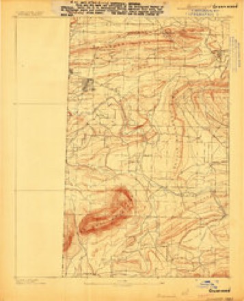
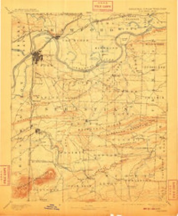
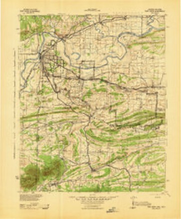
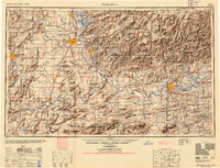
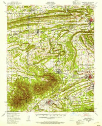
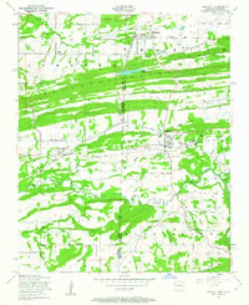
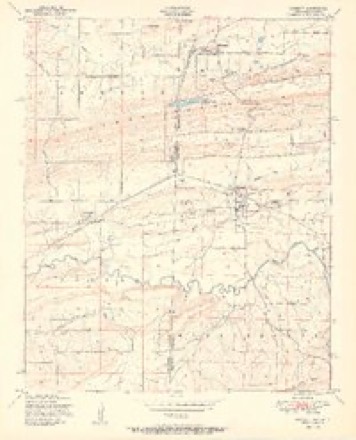
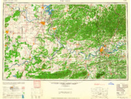
23 topographic sheets cover this place, the earliest surveyed in 1887 and the latest in 1987. It stands in the Pocola census division. It lies in ZIP code area 74902. The Survey maps it on the Hackett quadrangle. 4,255 people lived here at the 2020 count. It stands 482 feet above sea level.
Research this city
Population over time
2 figuresPocola grew from 4,056 to 4,255 between 2010 and 2020. These are the recorded population figures Wikidata holds for this place, reached through the Geographic Names Information System number this page is keyed on rather than by name, so they belong to this place and not to another of the same name. Most are census counts, but not all are: an early figure may be a founding or settlement estimate, and an estimate published within five years of a census is left out. The change column is computed, and is left blank where more than 20 years separate a figure from the one before it, because a gap that long is not a change between two counts.
| Year | People | Change |
|---|---|---|
| 2010 | 4,056 | |
| 2020 | 4,255 | +199 (+5%) |
Topographic sheets covering this place
12 surveys from 23 printed sheetsMatched by testing this settlement's coordinate against the published boundary of every sheet in the United States Geological Survey's historical collection. Each opens the scanned sheet at the Survey.
- 1887 USGS Greenwood quadrangle1:62500
- 1890 USGS Fort Smith quadrangle1:125000, 7 printings
- 1943 USGS Fort Smith quadrangle1:125000
- 1946 USGS Fort Smith quadrangle1:250000
- 1947 USGS Greenwood quadrangle1:62500
- 1948 USGS Hackett quadrangle1:24000, 3 printings
- 1951 USGS Hackett quadrangle1:24000, 2 printings
- 1965 USGS Fort Smith quadrangle1:250000
- 1967 USGS Fort Smith quadrangle1:250000
- 1978 USGS Fort Smith quadrangle1:250000, 2 printings
- 1978 USGS Fort Smith quadrangle1:100000, 2 printings
- 1987 USGS Hackett quadrangle1:24000
Fires near this place
33 since 1993Regional context, not property-specific evidence. The federal wildfire occurrence database lists 33 fires within 5 miles of Pocola between 1993 and 2019, burning about 797 acres in total. 1 started naturally. 5 were recorded as arson. Distance is straight-line from the map coordinates, so a fire counted here may appear on a neighbouring settlement's page as well.
| Reported cause | Fires |
|---|---|
| Missing data/not specified/undetermined | 11 |
| Debris and open burning | 8 |
| Equipment and vehicle use | 5 |
| Arson/incendiarism | 5 |
| Smoking | 2 |
| Misuse of fire by a minor | 1 |
| Natural | 1 |
The most recent of them, most recent first, with the day each was reported and the service that recorded it.
| Date | Cause | Size | Reported by | Name on the report |
|---|---|---|---|---|
| 28 September 1994 | Missing data/not specified/undetermined | 4.0 acres | Oklahoma Division of Forestry | not named |
| 15 September 2011 | Debris and open burning | 1.0 acres | Arkansas Forestry Commission | not named |
| 8 August 2011 | Missing data/not specified/undetermined | 1.0 acres | Arkansas Forestry Commission | not named |
| 30 August 2006 | Equipment and vehicle use | 4.0 acres | Oklahoma Division of Forestry | 20463 |
| 20 August 2019 | Missing data/not specified/undetermined | 1.0 acres | Arkansas Forestry Commission | not named |
| 15 August 2001 | Equipment and vehicle use | 4.0 acres | Arkansas Forestry Commission | not named |
| 4 July 2012 | Arson/incendiarism | 12 acres | Arkansas Forestry Commission | not named |
| 30 July 1999 | Smoking | 1.0 acres | Arkansas Forestry Commission | not named |
Settlements close enough to share some of these fires:
Mines and quarries near this place
6 within 5 milesRegional context, not property-specific evidence. The federal mineral resources record lists 6 workings within 5 miles of Pocola: 4 producers, 2 past producers. 4 still produce. What was taken out: Sand and Gravel, Construction, Stone, Crushed/Broken, Stone, Dimension, Clay. Distance is straight-line from the map coordinates, so a quarry counted here may appear on a neighbouring settlement's page as well.
| Where | Site | Commodity | Status | Recorded |
|---|---|---|---|---|
| Ibison Pit | Stone, Dimension | Past Producer | ||
| Unknown Shale Pit | Clay | Past Producer | ||
| Building Stone Quarry | Sand and Gravel, Construction | Producer | ||
| Hamilton Pit | Stone, Crushed/Broken | Producer | ||
| Miller Pit | Sand and Gravel, Construction | Producer | ||
| Rock Island Stone | Stone, Crushed/Broken | Producer |
Storms near this place
60 of 62 shownRegional context, not property-specific evidence. The National Weather Service names Pocola in 62 storm reports between 1993 and 2026: 31 hail, 25 thunderstorm wind, 4 flash flood, 2 tornado. The reports record 4 injuries. Each account below is quoted exactly as the forecast office filed it, from the NOAA Storm Events Database, and each date opens the federal record of that event.
| When | Event | Place named | Harm | What the report says |
|---|---|---|---|---|
| February 1997 | Thunderstorm Wind | Pocola | 4 hurt, $540,000 | no account filed |
| May 2015 | Flash Flood | Pocola | $75,000 | A low water bridge was washed out by high water. Portions of Barnes Road were washed out by flooding. |
| June 1999 | Thunderstorm Wind | Pocola | $70,000 | Strong winds damaged three mobile homes in Pocola. Trees falling onto power lines caused power outages to 2,000 electric customers in Pocola, Scullyville, and Murry Spur. |
| June 2009 | Hail | Pocola | $50,000 | no account filed |
| May 1993 | Thunderstorm Wind | Pocola | $50,000 | no account filed |
| April 2017 | Hail | Pocola | $25,000 | no account filed |
| March 2026 | Thunderstorm Wind | Pocola | $10,000 | Strong thunderstorm wind damaged an outbuilding. |
| July 2011 | Thunderstorm Wind | Pocola | $10,000 | A few homes sustained roof damage and one barn was damaged by strong thunderstorm winds. |
| July 2004 | Thunderstorm Wind | Pocola | $10,000 | Thunderstorm winds estimated in excess of 70 miles an hour blew the roof off a trailer home. |
| August 2014 | Thunderstorm Wind | Pocola | $5,000 | Strong thunderstorm wind blew down numerous large tree limbs and power lines. |
| March 2009 | Thunderstorm Wind | Pocola | $5,000 | Thunderstorm winds estimated at 70 miles an hour blew down power lines and destroyed a barn. |
| July 2005 | Thunderstorm Wind | Pocola | $5,000 | Thunderstorm winds estimated at 80 miles an hour blew part of a roof off a building. Numerous trees and large tree limbs were blown down as well. |
| November 1998 | Tornado (F1) | Pocola | $5,000 | A tornado touched down about halfway between Pocola and Arkoma, moving to the northeast across the Arkansas state line. This tornado continued through the Fort Smith area, producing F1 damage and a 5-mile path length before finally lifting at the Fort Smith Regional Airport. Only one mile of the tornado's path was in Oklahoma. The tornado was 200 yards wide at its widest point in Arkansas. The tornado caused quite a bit of damage in the Fort Smith area but caused relatively little damage in Oklahoma.For more information on this tornado, see the separate entry for it in the northwest Arkansas Storm Data. |
| September 2000 | Thunderstorm Wind | Pocola | $3,000 | Thunderstorm winds blew down numerous power lines. |
| May 2025 | Thunderstorm Wind | Pocola | $2,000 | Strong thunderstorm wind blew off shingles from a roof. |
| June 2014 | Thunderstorm Wind | Pocola | $2,000 | Strong thunderstorm wind blew down several trees and snapped power lines. |
| June 2009 | Thunderstorm Wind | Pocola | $1,000 | Thunderstorm wind estimated at 60 miles an hour blew down power lines. |
| July 2020 | Thunderstorm Wind | Pocola | - | Thunderstorm wind gusts were measured to 60 mph by a storm spotter. |
| May 2015 | Thunderstorm Wind | Pocola | - | Thunderstorm wind gusts were estimated to 65 mph. |
| August 2013 | Thunderstorm Wind | Pocola | - | Strong thunderstorm wind blew down several trees and snapped numerous large tree limbs. |
| July 2012 | Thunderstorm Wind | Pocola | - | Strong thunderstorm wind blew down large tree limbs. |
| May 2011 | Flash Flood | Pocola | - | Several streets in and around Pocola were impassable due to high water. |
| April 2011 | Flash Flood | Pocola | - | Several county roads around Pocola were flooded. |
| March 2010 | Thunderstorm Wind | Pocola | - | Five inch diameter tree limbs were blown down. |
| June 2009 | Thunderstorm Wind | Pocola | - | Thunderstorm winds estimated at 70 miles an hour blew down a few trees. |
| September 2008 | Flash Flood | Pocola | - | Four to six inches of rain caused flooding, which resulted in a road in Pocola to be closed. |
| May 2003 | Thunderstorm Wind | Pocola | - | Thunderstorm winds estimated at 70 miles an hour blew trees down. |
| June 2003 | Thunderstorm Wind | Pocola | - | Thunderstorm winds estimated at 70 miles an hour blew down a few trees. |
| March 1997 | Hail | Pocola | - | Isolated severe thunderstorms developed in Le Flore County of southeast Oklahoma during the early afternoon of March 1st. The storms produced nickel size hail 1 mile southwest of Heavener and 4 miles southwest of Heavener and dime size hail 3 miles west of Pocola. |
| June 1995 | Hail | Pocola | - | Severe thunderstorms developed in eastern Oklahoma during the afternoon of June 23rd. Strong thunderstorm winds in the city of Tulsa downed trees at the intersection of 56th Street South and Mingo Road and also downed five-inch-diameter tree limbs near the intersection of 36th Street South and 134th East Avenue. Trees were also blown down in downtown Tulsa by 60 mph winds. Golf ball-size hail fell at the intersection of 56th Street South and Mingo Road in the city of Tulsa, and nickel-size hail fell at Pocola, at the Timber Ridge Industrial Park three miles northeast of Broken Arrow, and at a couple other locations in the city of Tulsa. Dime- to nickel-size hail fell at Stilwell, and dime-size hail fell at several other locations in eastern Oklahoma. Very heavy rainfall from the thunderstorms also resulted in major street flooding in the city of Tulsa. Water covered some roads in Tulsa to a depth of three to four feet, and several vehicles were stranded in high water. |
| March 1993 | Hail | Pocola | - | Numerous strong to severe thunderstorms developed in southwestern Oklahoma during the afternoon hours on the 29th and moved eastward into central and eastern Oklahoma during the evening and nighttime hours. Four weak tornadoes occurred in Oklahoma with this outbreak of severe weather. An F0 tornado occurred 2 miles west of Elk City and knocked down power poles and power lines. An F0 tornado briefly touched down in an open field in extreme southeast Tillman County 6 miles southeast of Grandfield, with no damage reported. The third tornado had the longest path of the four. This tornado traveled along a 5-mile path from 4 miles east of Alex to 3 miles west of Criner. The tornado was narrowrow (35 yards wide) and produced mainly F0 damage with a small area of F1 damage in McClain County. The fourth tornado developed after midnight in Lincoln County and moved into Okfuskee County along its 4.5-mile path from two miles southeast of Prague to 2.5 miles west-southwest of Paden. The tornado was an F1 and averaged 100 yards in width. The tornado rolled an abandoned bus 75 feet to the east-southeast and lifted a camper trailer 75 feet to the north. The tornado also tossed an 18-foot horse trailer into a barn, demolishing both structures. The tornado produced an estimated $250,000 in damage. Large hail also accompanied many of the storms. Softball-size hail was reported in Texola and near Sayre. Baseball-size hail fell shortly before 2200 CST and then again after 2300 CST in Waurika. The large hail in combination with strong winds and flash flooding caused between $250,000 and $500,000 in damage in Waurika. Numerous other locations in southwest Oklahoma received quarter- to golfball-size hail. Strong winds also caused widespread damage throughout southwest, central, and eastern Oklahoma. During the evening hours, a very small but intense microburst destroyed a building in Verden. Damage was estimated at $45,000. Strong thunderstorm winds near 70 mph blew out windows at several businesses in Frederick and blew a portion of the roof off the Frederick Middle School. Strong thunderstorm winds blew down a power line near Hammon, and winds estimated at between 70 and 80 mph occurred near Granite. In Dover, a downburst produced winds estimated at 60 mph which destroyed a mobile home, downed a power pole and some trees and broke off numerous tree limbs up to 10 inches in diameter. In Okmulgee County, severe thunderstorm winds during the early morning hours of the 30th blew an unoccupied mobile home over 5 miles to the west of Beggs. Strong winds in Alex broke off tree limbs, downed several power poles, and tore part of a roof off of a house. High winds from a thunderstorm, severely damaged a sheet metal barn and blew down trees 2 miles south-southeast of Prague. Winds from severe thunderstorms blew down numerous trees along a path from 2 miles southeast of Prague to 4 miles east of Prague. Strong winds downed trees 5 miles south of Randlett. Widespread flash flooding was reported with these storms. High water in Waurika flooded three homes. One home which was not occupied had about a foot of water flowing through it. A few other homes in Waurika were sandbagged to help keep flood waters out. In Cotton County, water was flowing over Highway 36 south of Route 70, over a road 1 to 2 miles south of Randlett, and over a roadway 3 miles south and 0.5 mile west of Devol during the evening hours of the 29th. Near Comanche travel was reduced to one lane due to water covering Highway 81. In Jefferson County, high water covered Highway 81 about 2 miles north of Addington. Lightning strikes also caused damage during these storms. A home in Shattuck was struck by lightning. The fire resulting from the lightning damaged electronic equipment and started a grass fire in the backyard of the home. A fire from a lightning strike destroyed a trailer 2 miles west of Comanche. A lightning strike to a home 6 miles north of Waurika resulted in minor damage. In Quinton, lightning struck and killed several cattle. |
| October 2022 | Hail | Pocola | - | no account filed |
| April 2020 | Hail | Pocola | - | no account filed |
| March 2019 | Hail | Pocola | - | no account filed |
| April 2017 | Hail | Pocola | - | no account filed |
| April 2016 | Hail | Pocola | - | no account filed |
| March 2015 | Hail | Pocola | - | no account filed |
| July 2012 | Hail | Pocola | - | no account filed |
| July 2012 | Hail | Pocola | - | no account filed |
| February 2009 | Hail | Pocola | - | no account filed |
| May 2008 | Hail | Pocola | - | no account filed |
| January 2006 | Hail | Pocola | - | no account filed |
| April 2006 | Hail | Pocola | - | no account filed |
| May 2006 | Thunderstorm Wind | Pocola | - | no account filed |
| March 2004 | Hail | Pocola | - | no account filed |
| June 2004 | Hail | Pocola | - | no account filed |
| May 2004 | Hail | Pocola | - | no account filed |
| July 2004 | Hail | Pocola | - | no account filed |
| August 2003 | Thunderstorm Wind | Pocola | - | no account filed |
| May 2003 | Hail | Pocola | - | no account filed |
| May 2003 | Hail | Pocola | - | no account filed |
| April 2001 | Thunderstorm Wind | Pocola | - | no account filed |
| June 2001 | Thunderstorm Wind | Pocola | - | no account filed |
| June 2001 | Hail | Pocola | - | no account filed |
| May 2000 | Hail | Pocola | - | no account filed |
| May 2000 | Hail | Pocola | - | no account filed |
| May 1998 | Hail | Pocola | - | no account filed |
| April 1998 | Hail | Pocola | - | no account filed |
| February 1998 | Hail | Pocola | - | no account filed |
| February 1997 | Tornado (F0) | Pocola | - | no account filed |
Nearest settlements
The eight closest, with where each one stands in the county. Distances are straight-line, computed from the Geographic Names Information System coordinates.
| Map | Place | Distance | Sheets |
|---|---|---|---|
| Cedar Knobb | 1.9 miles | 23 | |
| Rock Island | 3.4 miles | 23 | |
| Cedars | 3.5 miles | 25 | |
| Braden | 3.9 miles | 15 | |
| Murry Spur | 4.2 miles | 15 | |
| Williams | 5.9 miles | 14 | |
| Skullyville | 6.2 miles | 14 | |
| Fort Coffee | 6.9 miles | 15 |
Elsewhere
Matched on this settlement's Geographic Names Information System number rather than its name, so it cannot be a different place of the same name in another state.
| Wikipedia article on Pocola | An encyclopaedic summary. Its text is share-alike, so it is linked here rather than copied. |
| Wikidata item Q2198735 | The structured record the population and elevation above come from. Public domain (CC0). |
Provenance
This settlement is recorded in the Geographic Names Information System as feature 1100754. The sheet list is computed by point-in-boundary test against the United States Geological Survey's historical topographic inventory. Both are works of the United States government and carry no copyright under 17 U.S.C. 105.
Wildfire. Short, Karen C. 2022. Spatial wildfire occurrence data for the United States, 1992-2020 [FPA_FOD_20221014]. 6th Edition. Fort Collins, CO: Forest Service Research Data Archive. https://doi.org/10.2737/RDS-2013-0009.6 Collected with United States Government funding and usable without additional permissions or fees.
Mines and quarries. USGS Mineral Resources Data System (MRDS) https://mrdata.usgs.gov/mrds/ A work of the United States government, no copyright under 17 U.S.C. 105.
Storms. NOAA National Centers for Environmental Information, Storm Events Database https://www.ncei.noaa.gov/stormevents/ A work of the United States government, no copyright under 17 U.S.C. 105. Narratives are quoted verbatim from the National Weather Service report and are not edited or summarised.