 Block
Stillwater, Oklahoma
10 topographic sheets cover this place, the earliest surveyed in 1893 and the latest in 1990. It stands in the Stillwater census division. It lies in ZIP code area 74074. The Survey maps it on the Stillwater South quadrangle. 48,394 people lived here at the 2020 count. It stands 984 feet above sea level.
Research this city
On record in Stillwater
Buildings and businesses the archive holds for this place. Each opens its own page, with the source record it came from.
On the National Register 12 of 21 shown
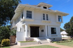 James E. Berry Houselisted 1980
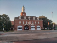 Campus Fire Stationlisted 2004
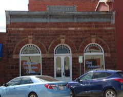 Citizens Bank Buildinglisted 1981
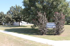 Cottonwood Community Centerlisted 1980
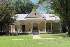 William Frick Houselisted 1980
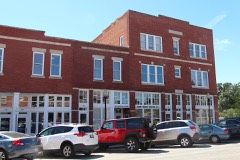 Hoke Buildinglisted 1983
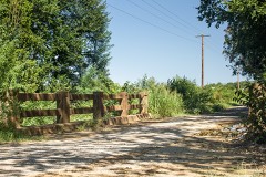 Long Branch Creek Bridgelisted 2014
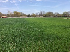 Magruder Plotslisted 1979
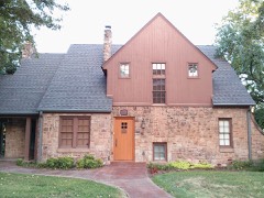 Murphy Houselisted 1986
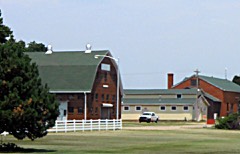 Oklahoma A & M College Agronomy Barn and Seed Houselisted 2004
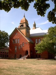 Old Central, Oklahoma State Universitylisted 1971
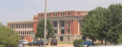 Payne County Courthouselisted 1984
Surveyed buildings and structures 7 records
- Boomer Lake Park, Bounded by East Richmond Road to the north, West Franklin Lane to the south, North Washington Street to the west, and North Husband Street to the east, Stillwaterfederal building survey, 1 photograph
- Couch Park, East 12th Avenue and East Alcott Avenue, Stillwaterfederal building survey, 1 photograph
- Oklahoma State University Campus, Bounded by McElroy Road, North Duck Street, North Knoblock Street & West University Avenue, Stillwaterfederal building survey, 1 photograph
- Oklahoma State University Campus, Stillwaterfederal building survey, 10 photographs
- Oklahoma State University, Boys Dormitory, Northwest corner of Hester Street & Athletic Avenue, Stillwaterfederal building survey, 28 photographs
- Thomas N. Berry Estate, 2802 South Perkins Road, Stillwaterfederal building survey, 1 photograph
- Thomas N. Berry Estate, U.S. Route 177, Stillwaterfederal building survey, 7 photographs
Population over time
2 figuresStillwater grew from 45,688 to 48,394 between 2010 and 2020. These are the recorded population figures Wikidata holds for this place, reached through the Geographic Names Information System number this page is keyed on rather than by name, so they belong to this place and not to another of the same name. Most are census counts, but not all are: an early figure may be a founding or settlement estimate, and an estimate published within five years of a census is left out. The change column is computed, and is left blank where more than 20 years separate a figure from the one before it, because a gap that long is not a change between two counts.
| Year | People | Change |
|---|---|---|
| 2010 | 45,688 | |
| 2020 | 48,394 | +2,706 (+6%) |
Topographic sheets covering this place
5 surveys from 10 printed sheetsMatched by testing this settlement's coordinate against the published boundary of every sheet in the United States Geological Survey's historical collection. Each opens the scanned sheet at the Survey.
- 1893 USGS Stillwater quadrangle1:62500
- 1955 USGS Enid quadrangle1:250000, 4 printings
- 1958 USGS Enid quadrangle1:250000, 2 printings
- 1967 USGS Stillwater South quadrangle1:24000, 2 printings
- 1990 USGS Enid quadrangle1:100000
Photographs
8 of 19 photographs shown, 2020Taken for the Office of War Information and the Farm Security Administration, who photographed the country between 1935 and 1944. Works of United States government photographers, with no known restriction on use. Each opens its catalogue record.
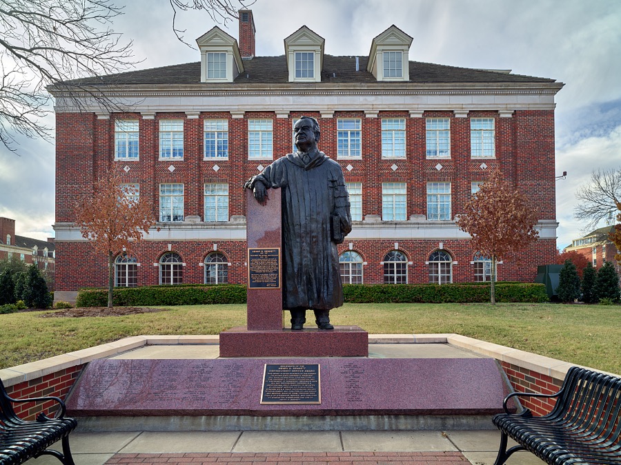
Highsmith, Carol M, 2020. Library of Congress
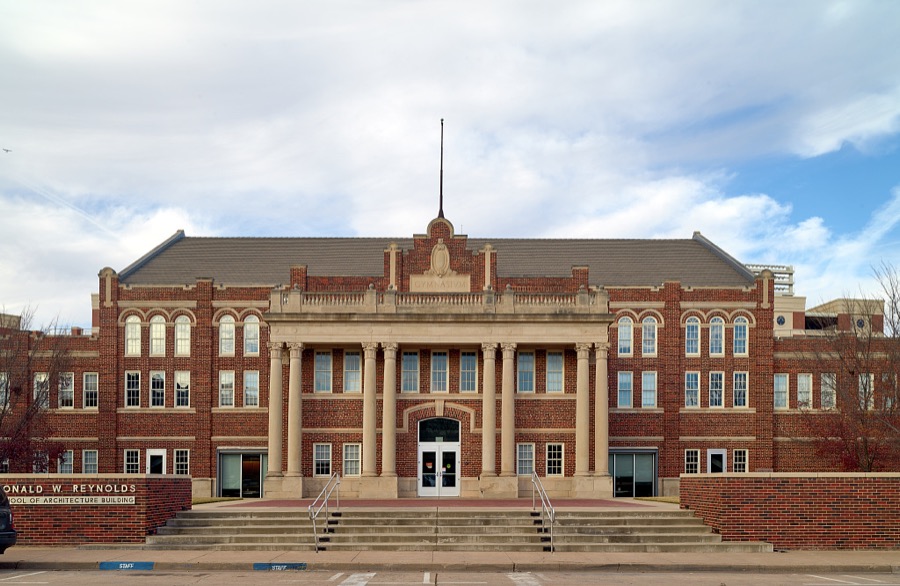
Highsmith, Carol M, 2020. Library of Congress

Highsmith, Carol M, 2020. Library of Congress
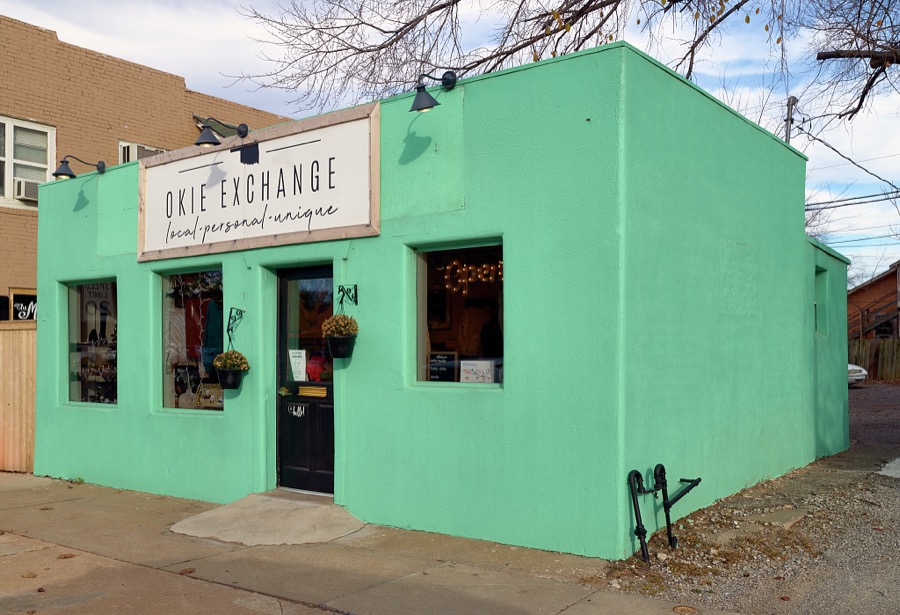
Highsmith, Carol M, 2020. Library of Congress
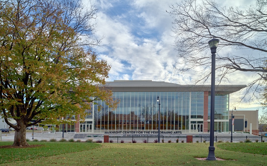
Highsmith, Carol M, 2020. Library of Congress
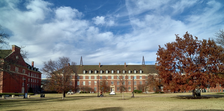
Highsmith, Carol M, 2020. Library of Congress
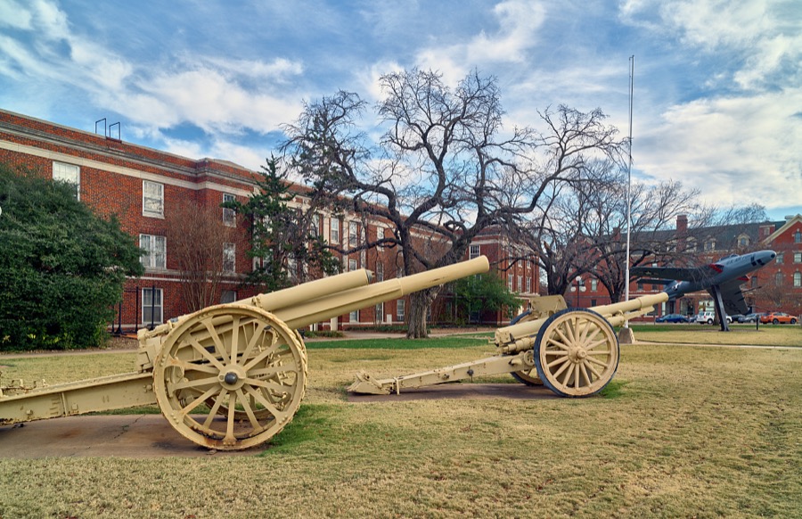
Highsmith, Carol M, 2020. Library of Congress
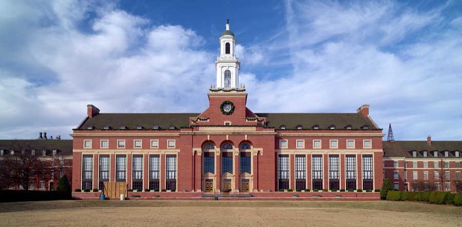
Highsmith, Carol M, 2020. Library of Congress
Every photograph of Payne County
Fires near this place
1 since 2006Regional context, not property-specific evidence. The federal wildfire occurrence database lists 1 fire within 5 miles of Stillwater in 2006, burning about 250 acres in total. None started naturally. None was recorded as arson. Distance is straight-line from the map coordinates, so a fire counted here may appear on a neighbouring settlement's page as well.
| Reported cause | Fires |
|---|---|
| Missing data/not specified/undetermined | 1 |
The most recent of them, most recent first, with the day each was reported and the service that recorded it.
| Date | Cause | Size | Reported by | Name on the report |
|---|---|---|---|---|
| 5 January 2006 | Missing data/not specified/undetermined | 250 acres | Oklahoma Division of Forestry | STILLWATER 1 |
Mines and quarries near this place
2 within 5 milesRegional context, not property-specific evidence. The federal mineral resources record lists 2 workings within 5 miles of Stillwater: 2 occurrences. None of them still produces. What was taken out: Copper. Distance is straight-line from the map coordinates, so a quarry counted here may appear on a neighbouring settlement's page as well.
| Where | Site | Commodity | Status | Recorded |
|---|---|---|---|---|
| Stillwater East-3 | Copper | Occurrence | 1975 | |
| Stillwater East-4 | Copper | Occurrence | 1972 |
Storms near this place
60 of 215 shownRegional context, not property-specific evidence. The National Weather Service names Stillwater in 215 storm reports between 1993 and 2026: 101 hail, 88 thunderstorm wind, 12 flash flood, 5 tornado. The reports record 1 death and 4 injuries. Each account below is quoted exactly as the forecast office filed it, from the NOAA Storm Events Database, and each date opens the federal record of that event.
| When | Event | Place named | Harm | What the report says |
|---|---|---|---|---|
| May 1999 | Tornado (F2) | Stillwater | 1 killed, 3 hurt, $100,000 | Tornado B20 (Payne County portion). On January 10,2001 tornadoes B20 and B21 were combined and will be identified as B20. Tornado B21 no longer exists. See summary at end of May 3rd storm reports for more information. |
| September 1998 | Lightning | Stillwater | 1 hurt | no account filed |
| June 2004 | Thunderstorm Wind | Stillwater | $75,000 | Wind gusts caused minor damage to several dorms and the stadium at Oklahoma State University. An 18 by 24 foot roof structure that covers the boiler and water reservoir at a Best Western was also heavily damaged. Widespread tree damage was reported around town. |
| June 2007 | Flash Flood | Stillwater | $50,000 | Twenty-five to thirty roads were barricaded or closed. A few residences had to be evacuated by boat. Cars were stalled/flooded due to high water on a US-177 feeder road on the north side of town. Widespread street flooding was reported throughout Stillwater. The golf course was also reported under water. Monetary damages were estimated. |
| April 1994 | Hail | Stillwater | $50,000 | no account filed |
| July 1994 | Hail | Stillwater | $50,000 | no account filed |
| July 1994 | Thunderstorm Wind | Stillwater | $50,000 | no account filed |
| January 2026 | Thunderstorm Wind | Stillwater | $25,000 | Thunderstorm winds damaged the roof of a building on the campus of Oklahoma State University. The event location is approximate. |
| June 1999 | Thunderstorm Wind | Stillwater | $25,000 | no account filed |
| April 2006 | Thunderstorm Wind | Stillwater | $15,000 | A pole barn under construction, near the intersection of 6th Street and Country Club, was lifted and thrown over 8 city blocks. |
| June 2001 | Flood | Stillwater | $15,000 | Cars stalled in high water. |
| May 2019 | Tornado (EF0) | Stillwater | $10,000 | An outbuilding and detached garage were significantly damaged by a brief QLCS tornado. |
| September 2015 | Thunderstorm Wind | Stillwater | $10,000 | Several tree limbs and whole trees blew down, with some of the limbs going through roofs. |
| June 2013 | Thunderstorm Wind | Stillwater | $10,000 | Minor skylight damage at Walmart from wind gusts. Tree also blown down near this location. Time estimated. |
| August 2009 | Thunderstorm Wind | Stillwater | $10,000 | Several 10-15 inch diameter tree limbs were downed, some of them falling on top of power lines. At least 6,200 people were without power for around an hour. Monetary damages were estimated. |
| July 2007 | Flash Flood | Stillwater | $10,000 | Major street flooding was reported by the emergency manager. Several vehicles stalled in the rapidly rising water. Monetary damages were estimated. |
| August 2005 | Thunderstorm Wind | Stillwater | $10,000 | A portion of the roof of a house on East 11th Avenue was removed exposing 3 bedrooms, a bathroom, and a stairwell. |
| March 1997 | Thunderstorm Wind | Stillwater | $10,000 | An unoccupied mobile home was overturned on HWY 177 north of Stillwater. |
| June 2007 | Thunderstorm Wind | Stillwater | $8,000 | A tree fell on a house and car near the Stillwater high school. Monetary damages were estimated. |
| August 2009 | Thunderstorm Wind | Stillwater | $7,000 | A billboard and power pole were blown to the ground. Monetary damages were estimated. |
| August 2023 | Flash Flood | Stillwater | $5,000 | Report of flooded roadways in northern portions of the community of Stillwater. Vehicles reported stranded with water up to their bumpers. Time is estimated. |
| August 2018 | Thunderstorm Wind | Stillwater | $5,000 | Tree limb down on a car. Time estimated from radar. |
| August 2018 | Thunderstorm Wind | Stillwater | $5,000 | Tree down on a power line. Time estimated from radar. |
| July 2016 | Thunderstorm Wind | Stillwater | $5,000 | Significant tree damage occurred in Stillwater. Media relayed a viewer report via Twitter of a substantial tree down on fence. Time estimated via radar. |
| April 2008 | Flash Flood | Stillwater | $5,000 | Numerous streets in Stillwater were closed due to high water. Other roads around the county were also closed due to high water running over top of them. No damages were reported. |
| April 2006 | Thunderstorm Wind | Stillwater | $5,000 | A small building used at the entrance of Tumbleweed Dance Hall and Concert Arena to check IDs, etc. was blown over into a chain-link fence. |
| August 2002 | Lightning | Stillwater | $5,000 | Lightning struck a transmission line, causing a power outage. |
| April 1999 | Thunderstorm Wind | Stillwater | $5,000 | no account filed |
| October 1998 | Tornado (F0) | Stillwater | $5,000 | no account filed |
| May 2000 | Lightning | Stillwater | $4,000 | no account filed |
| July 2011 | Thunderstorm Wind | Stillwater | $3,000 | A piece of the roof at Cowboy book was blown onto a vehicle. Monetary damages were estimated. |
| March 2000 | Thunderstorm Wind | Stillwater | $3,000 | A roof was blown off a home, and billboard signs were downed on the west side of Stillwater. In addition, outbuildings were destroyed, and power lines were downed near the intersection of Highway 51 and Cottonwood Blvd. |
| August 2015 | Thunderstorm Wind | Stillwater | $2,000 | Large trees were snapped by wind. |
| August 2011 | Thunderstorm Wind | Stillwater | $2,000 | A tree was blown over and several large tree limbs were snapped on the campus of Oklahoma State University. Monetary damages were estimated. |
| August 2001 | Thunderstorm Wind | Stillwater | $2,000 | Trees and power poles were downed at Stillwater Municipal Airport. |
| May 2000 | Thunderstorm Wind | Stillwater | $2,000 | Numerous trees were uprooted. |
| August 1996 | Thunderstorm Wind | Stillwater | $2,000 | no account filed |
| September 2015 | Thunderstorm Wind | Stillwater | $1,000 | Large tree limbs were blown down, including a 4-inch tree limb blown down onto a patio roof. |
| August 2001 | Thunderstorm Wind | Stillwater | $1,000 | Power poles were downed. |
| July 2000 | Thunderstorm Wind | Stillwater | $500 | Two oak trees and one maple tree were downed. |
| March 1999 | Lightning | Stillwater | $500 | Lightning struck near a substation knocking out power to portions of southwest Stillwater. |
| November 1998 | Thunderstorm Wind | Stillwater | $500 | no account filed |
| May 2006 | Thunderstorm Wind | Stillwater | $250 | Tree limbs, up to 12 inches in diameter, were downed. |
| August 2005 | Thunderstorm Wind | Stillwater | $150 | Three to four inch diameter tree limbs were downed on the west side of town. |
| August 2006 | Thunderstorm Wind | Stillwater | $100 | Five inch diameter tree limbs were snapped. |
| April 2026 | Hail | Stillwater | - | Reported by a broadcast media storm chaser. The location is approximate. |
| January 2026 | Thunderstorm Wind | Stillwater | - | A tree was blown down on Husband Street, just north of Stillwater High School. The event location is approximate, and the time is estimated from radar observations. |
| April 2025 | Hail | Stillwater | - | The report was relayed through mPING. |
| May 2025 | Hail | Stillwater | - | Hailfall occurred near the intersection of 19th Street and Western Road. |
| May 2024 | Thunderstorm Wind | Stillwater | - | Social media image showing a tree blown down. Time is radar estimated. |
| May 2023 | Thunderstorm Wind | Stillwater | - | Numerous 2+ inch diameter tree limbs blown down across portions of the Oklahoma State University campus. |
| May 2019 | Thunderstorm Wind | Stillwater | - | Large tree blown over. Twitter report with a picture. |
| June 2019 | Flash Flood | Stillwater | - | Water moving across the road. |
| May 2019 | Hail | Stillwater | - | Reported through Mping. |
| May 2019 | Flood | Stillwater | - | Road closed south of 32nd at Stillwater Creek. Also several home and vehicle rescues within town. |
| August 2018 | Thunderstorm Wind | Stillwater | - | Social media video showed 6-8 inch diameter tree limb snapped from tree. Time estimated from radar. |
| August 2018 | Thunderstorm Wind | Stillwater | - | Six to eight inch limb downed. Time estimated from radar. |
| August 2018 | Flood | Stillwater | - | Multiple streets and intersections with flooding in Stillwater. |
| August 2018 | Flash Flood | Stillwater | - | Car swept off road by floodwater. 1 to 2 feet of water on roadway. |
| October 2017 | Flash Flood | Stillwater | - | Street flooding reported with stalled vehicles. |
Nearest settlements
The eight closest, with where each one stands in the county. Distances are straight-line, computed from the Geographic Names Information System coordinates.
Elsewhere
Matched on this settlement's Geographic Names Information System number rather than its name, so it cannot be a different place of the same name in another state.
| Wikipedia article on Stillwater | An encyclopaedic summary. Its text is share-alike, so it is linked here rather than copied. |
| Wikidata item Q852714 | The structured record the population and elevation above come from. Public domain (CC0). |
Provenance
This settlement is recorded in the Geographic Names Information System as feature 1098541. The sheet list is computed by point-in-boundary test against the United States Geological Survey's historical topographic inventory. Both are works of the United States government and carry no copyright under 17 U.S.C. 105.
Wildfire. Short, Karen C. 2022. Spatial wildfire occurrence data for the United States, 1992-2020 [FPA_FOD_20221014]. 6th Edition. Fort Collins, CO: Forest Service Research Data Archive. https://doi.org/10.2737/RDS-2013-0009.6 Collected with United States Government funding and usable without additional permissions or fees.
Mines and quarries. USGS Mineral Resources Data System (MRDS) https://mrdata.usgs.gov/mrds/ A work of the United States government, no copyright under 17 U.S.C. 105.
Storms. NOAA National Centers for Environmental Information, Storm Events Database https://www.ncei.noaa.gov/stormevents/ A work of the United States government, no copyright under 17 U.S.C. 105. Narratives are quoted verbatim from the National Weather Service report and are not edited or summarised.