 Block
From the record
One of 170 National Register listings published here for Oklahoma County · listed in 2001 · category: District.
Sources: the case file at the National Archives · the National Register database, National Park Service
Listed on the National Register of Historic Places in 2001.
One of 170 National Register listings published here for Oklahoma County · listed in 2001 · category: District.
Sources: the case file at the National Archives · the National Register database, National Park Service
Regional context, not property-specific evidence. The federal mineral resources record lists 6 workings within 5 miles of Charles G. Jones Farmstead: 6 past producers. None of them still produces. What was taken out: Sand and Gravel, Construction. Distance is straight-line from the map coordinates, so a quarry counted here may appear on a neighbouring settlement's page as well.
| Where | Site | Commodity | Status | Recorded |
|---|---|---|---|---|
| Pit No. 1 | Sand and Gravel, Construction | Past Producer | ||
| Unknown Gravel Pit | Sand and Gravel, Construction | Past Producer | ||
| Unknown Gravel Pit | Sand and Gravel, Construction | Past Producer | ||
| Unknown Sand Pit | Sand and Gravel, Construction | Past Producer | ||
| Unknown Sand Pit | Sand and Gravel, Construction | Past Producer | ||
| Unknown Sand Pit | Sand and Gravel, Construction | Past Producer |
Regional context, not property-specific evidence. The National Weather Service names Jones, the town this property stands in, in 35 storm reports between 1994 and 2026: 18 hail, 7 thunderstorm wind, 4 flash flood, 4 tornado. The reports record 2 deaths and 10 injuries. Each account below is quoted exactly as the forecast office filed it, from the NOAA Storm Events Database, and each date opens the federal record of that event.
| When | Event | Place named | Harm | What the report says |
|---|---|---|---|---|
| September 1998 | Thunderstorm Wind | Jones | 1 killed, 10 hurt, $2,000,000 | no account filed |
| July 2010 | Flash Flood | Jones | 1 killed | Several inches of rain fell into just a few hours over the southeast half of Oklahoma. Widespread flash flooding occurred, especially near creeks and streams. A few high water rescues occurred at both residences and cars as the water rose rapidly. The most significant flooding occurred near and around Lightning Creek. Several homes were flooded by the creek. Unfortunately, a 13-year old boy drowned after falling into creek near SE 40th Street and Santa Fe Avenue. No other injuries were reported. Monetary damage estimates were not available. |
| November 2004 | Tornado (F1) | Jones | $1,000,000 | This tornado remained within the city limits of Jones affecting southern portions of the town. The tornado began near the intersection of Northeast 63rd and Hiwassee Road and moved ENE to just southwest of the intersection of Britton Road and Indian Meridian Road.According to Jones Emergency Management, the first tornado damage appeared east of Hiwassee Road on NE 63rd, where several trees were broken or uprooted along with power lines and poles downed. Damage continues to the 6300-6400 block of N Cedar Creek where several trees were damaged and minor roof damage to newly constructed homes occurred. More damage was located in the 7100-7300 block of N Henney, mostly trees with some minor roof damage. All houses in the 14000-14500 block of Teresa had minor roof damage and a few windows broken, along with numerous trees damaged, and outbuildings damaged or destroyed, some of which were of sound construction.Additional damage to trees and homes along E Wilshire from the 13800 block eastward to the 15100 block. A few outbuildings and sheds were destroyed in this area. Several homes in the 7200-7700 block of Rolling Oaks also had minor roof damage with trees down in the area. The 7700-7900 block of Oakwood Way also had homes with roof and tree damage. Also minor damage to the Diamond P Farms at 8505 N Indian Meridian occurred before lifting.Overall, 52 homes and 1 business were affected with minor roof damage and broken windows. Several outbuildings, barns, and sheds were damaged or destroyed along with numerous trees and power lines downed and a few power poles broken. |
| May 1999 | Tornado (F1) | Jones | $60,000 | Tornado A14. See summary at end of May 3rd storm reports. |
| July 2022 | Thunderstorm Wind | Jones | $10,000 | Downed power poles reported. |
| April 2016 | Tornado (EF1) | Jones | $10,000 | A tornado touched down near Westminister and Memorial Roads and moved northeast dissipating northeast of Triple XXX Road and Coffee Creek Road. One house near the end of the tornado path suffered significant roof damage. Otherwise, damage along the path was primarily to trees and power lines. |
| May 1999 | Tornado (F0) | Jones | $10,000 | Tornado A13. See summary at end of May 3rd storm reports. |
| August 2003 | Thunderstorm Wind | Jones | $250 | Three inch diameter tree limbs were downed on Hiwassee Road. |
| March 2026 | Hail | Jones | - | Multiple confirmations of hailfall in Jones, including a shared image showing a ruler measurement. |
| June 2024 | Thunderstorm Wind | Jones | - | Tree blown down, blocking portions of the roadway, near the intersection of Douglas Boulevard and Northeast 108th Street. Time is radar estimated. |
| June 2021 | Thunderstorm Wind | Jones | - | Power lines downed. Time radar estimated. |
| September 2020 | Flood | Jones | - | Street flooding reported. |
| August 2019 | Flash Flood | Jones | - | MPING report. Roads closed, vehicles stranded. |
| September 2018 | Flash Flood | Jones | - | Memorial road was closed at Henney road due to flood damage and reported sink hole. |
| April 2009 | Hail | Jones | - | The spotter also estimated 60 mph winds with the hail. |
| May 2000 | Funnel Cloud | Jones | - | Funnel cloud was halfway to the ground and narrow in shape. |
| March 2025 | Hail | Jones | - | no account filed |
| July 2022 | Thunderstorm Wind | Jones | - | no account filed |
| November 2021 | Hail | Jones | - | no account filed |
| May 2015 | Hail | Jones | - | no account filed |
| May 2015 | Hail | Jones | - | no account filed |
| May 2009 | Hail | Jones | - | no account filed |
| June 2009 | Hail | Jones | - | no account filed |
| June 2008 | Hail | Jones | - | no account filed |
| June 2007 | Hail | Jones | - | no account filed |
| March 2003 | Hail | Jones | - | no account filed |
| March 2003 | Hail | Jones | - | no account filed |
| April 2003 | Hail | Jones | - | no account filed |
| May 2003 | Hail | Jones | - | no account filed |
| June 2003 | Hail | Jones | - | no account filed |
| June 2003 | Hail | Jones | - | no account filed |
| July 2000 | Thunderstorm Wind | Jones | - | no account filed |
| March 1999 | Hail | Jones | - | no account filed |
| November 1996 | Flash Flood | Jones | - | no account filed |
| March 1994 | Hail | Jones | - | no account filed |
No historic map-sheet match is published for this property yet. That does not mean no map exists. This record needs a coordinate-quality review before it can be joined to a sheet boundary. Browse the county's mapped places while that work is pending.
Other National Register properties close enough to walk or drive between, ordered by distance from this one. Both positions come from the same geocoding pass that matched these properties to their map sheets.
| Photograph | Property | Distance | Listed |
|---|---|---|---|
| "Ringing the Wild Horse" Site | 2.0 miles | 1971 | |
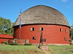 | Arcadia Round Barn | 5.7 miles | 1977 |
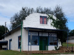 | Edward Richardson Building | 5.7 miles | 2017 |
| Arcadia Route 66 Roadbed | 5.7 miles | 1999 | |
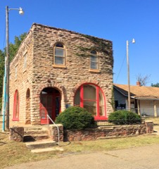 | Tuton's Drugstore | 5.7 miles | 1980 |
| Dr. William L. and Susie Price Haywood Estate | 6.9 miles | 2024 |
| National Archives record | The nomination case file for reference 01000658 in Record Group 79. |
| Oklahoma County | All 170 listed properties in this county. |