 Block
From the record
One of 48 National Register listings published here for Lincoln County · listed in 2003 · category: District.
Sources: the case file at the National Archives · the National Register database, National Park Service
Listed on the National Register of Historic Places in 2003.
One of 48 National Register listings published here for Lincoln County · listed in 2003 · category: District.
Sources: the case file at the National Archives · the National Register database, National Park Service
Regional context, not property-specific evidence. The federal wildfire occurrence database lists 2 fires within 5 miles of Ozark Trails Section of Route 66 between 2016 and 2018, burning about 897 acres in total. None started naturally. None was recorded as arson. Distance is straight-line from the map coordinates, so a fire counted here may appear on a neighbouring settlement's page as well.
| Reported cause | Fires |
|---|---|
| Power generation/transmission/distribution | 1 |
| Missing data/not specified/undetermined | 1 |
The most recent of them, most recent first, with the day each was reported and the service that recorded it.
| Date | Cause | Size | Reported by | Name on the report |
|---|---|---|---|---|
| 6 March 2018 | Power generation/transmission/distribution | 7.0 acres | Southern Plains Regional Office | BRIGHT PATH |
| 5 March 2016 | Missing data/not specified/undetermined | 890 acres | Oklahoma Division of Forestry | HILL |
Regional context, not property-specific evidence. The federal mineral resources record lists 8 workings within 5 miles of Ozark Trails Section of Route 66: 7 past producers, 1 producer. 1 still produces. What was taken out: Stone, Crushed/Broken, Sand and Gravel, Construction, Sand and Gravel, Construction, Stone, Crushed/Broken, Dolomite, Clay. Distance is straight-line from the map coordinates, so a quarry counted here may appear on a neighbouring settlement's page as well.
| Where | Site | Commodity | Status | Recorded |
|---|---|---|---|---|
| Unknown Clay Pit | Clay | Past Producer | ||
| Unknown Dolomite Pit | Dolomite | Producer | ||
| Unknown Gravel Pit | Sand and Gravel, Construction, Stone, Crushed/Broken | Past Producer | ||
| Unknown Sandstone Pit | Stone, Crushed/Broken, Sand and Gravel, Construction | Past Producer | ||
| Unknown Sandstone Pit | Stone, Crushed/Broken, Sand and Gravel, Construction | Past Producer | ||
| Unknown Sandstone Pit | Sand and Gravel, Construction, Stone, Crushed/Broken | Past Producer | ||
| Unknown Sandstone Pit | Sand and Gravel, Construction, Stone, Crushed/Broken | Past Producer | ||
| Unknown Sandstone Pit | Stone, Crushed/Broken, Sand and Gravel, Construction | Past Producer |
Regional context, not property-specific evidence. The National Weather Service names Stroud, the town this property stands in, in 41 storm reports between 1993 and 2026: 20 hail, 13 thunderstorm wind, 3 tornado, 3 flash flood. The reports record 1 death and 2 injuries. Each account below is quoted exactly as the forecast office filed it, from the NOAA Storm Events Database, and each date opens the federal record of that event.
| When | Event | Place named | Harm | What the report says |
|---|---|---|---|---|
| May 2016 | Flash Flood | Stroud | 1 killed, 2 hurt, $100,000 | Media and law enforcement reported significant flash flooding in and around Stroud. The turnpike was also closed due to high water and a bad vehicular accident. Over 6 feet of water was reported covering Route 66 in some places. Several water rescues were reported. One person was also killed in their vehicle between Stroud and Davenport due to high water. Two others were hospitalized. |
| June 1995 | Tornado (F2) | Stroud | $500,000 | no account filed |
| May 1995 | Thunderstorm Wind | Stroud | $50,000 | no account filed |
| October 1997 | Lightning | Stroud | $25,000 | Lightning struck a crude oil tank, causing an explosion and blowing the tank off its base. The resulting fire destroyed a nearby small office. |
| August 2025 | Thunderstorm Wind | Stroud | $10,000 | Damage to trees and power poles in the community of Stroud. The location is approximate, and the event time is estimated from radar observations. |
| April 2011 | Thunderstorm Wind | Stroud | $8,000 | Minor building and sign damage occurred as a result of the RFD portion of the storm. Monetary damages were estimated. |
| August 2007 | Flash Flood | Stroud | $5,000 | Very heavy rainfall flooded portions of the Highland Dairy Farm, including the Dairy storage section of the property. Monetary damages were estimated. |
| June 1999 | Lightning | Stroud | $4,000 | no account filed |
| July 2006 | Thunderstorm Wind | Stroud | $3,500 | Two inch diameter tree limbs were downed. An awning at a business was also blown down. |
| February 2001 | Thunderstorm Wind | Stroud | $500 | Power lines were downed. |
| June 1997 | Thunderstorm Wind | Stroud | $100 | A tree of unknown size blocked the road at the intersection of Highways 99 and 66. |
| March 2026 | Hail | Stroud | - | The location is approximate. |
| November 2025 | Hail | Stroud | - | The report was relayed through mPING. The event time is adjusted based on radar observations. |
| May 2024 | Hail | Stroud | - | MPing report. |
| April 2024 | Thunderstorm Wind | Stroud | - | Roof damage to an apartment building. Time is radar estimated. |
| May 2024 | Hail | Stroud | - | MPing report. |
| July 2017 | Thunderstorm Wind | Stroud | - | No damage reported. |
| April 2016 | Thunderstorm Wind | Stroud | - | No damage was reported. |
| April 2011 | Thunderstorm Wind | Stroud | - | A few small trees were blown down. The damage was done by the RFD portion of the storm. Monetary damages were estimated. |
| April 2011 | Tornado (EF0) | Stroud | - | Numerous sources (storm chasers, emergency managers, local media) reported a brief tornado that occurred over an open field. No damage was reported as a result of the tornado, although some minor damage occurred as as result of the RFD. The time was approximate. |
| October 2011 | Hail | Stroud | - | The hail report was relayed by KOCO-TV. |
| October 2000 | Flash Flood | Stroud | - | Numerous roads in and around Stroud were closed due to high water, including Highway 99 north of Stroud and Highway 66 west of Stroud. |
| November 2022 | Hail | Stroud | - | no account filed |
| April 2017 | Hail | Stroud | - | no account filed |
| May 2016 | Hail | Stroud | - | no account filed |
| October 2011 | Hail | Stroud | - | no account filed |
| May 2008 | Hail | Stroud | - | no account filed |
| May 2006 | Hail | Stroud | - | no account filed |
| July 2006 | Thunderstorm Wind | Stroud | - | no account filed |
| July 2005 | Hail | Stroud | - | no account filed |
| April 2004 | Hail | Stroud | - | no account filed |
| April 2004 | Hail | Stroud | - | no account filed |
| August 2003 | Hail | Stroud | - | no account filed |
| March 2002 | Hail | Stroud | - | no account filed |
| June 2001 | Hail | Stroud | - | no account filed |
| September 2001 | Thunderstorm Wind | Stroud | - | no account filed |
| October 2000 | Hail | Stroud | - | no account filed |
| June 1999 | Thunderstorm Wind | Stroud | - | no account filed |
| March 1997 | Hail | Stroud | - | no account filed |
| May 1994 | Tornado (F0) | Stroud | - | no account filed |
| March 1993 | Hail | Stroud | - | no account filed |
No historic map-sheet match is published for this property yet. That does not mean no map exists. This record needs a coordinate-quality review before it can be joined to a sheet boundary. Browse the county's mapped places while that work is pending.
Other National Register properties close enough to walk or drive between, ordered by distance from this one. Both positions come from the same geocoding pass that matched these properties to their map sheets.
| Photograph | Property | Distance | Listed |
|---|---|---|---|
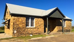 | Stroud School, Old | 2.6 miles | 1997 |
 | Davenport Broadway Avenue Brick Street | 3.3 miles | 2004 |
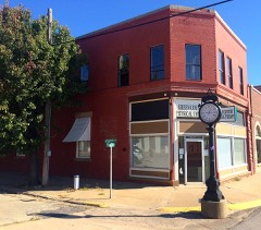 | Hotel Lincoln | 3.4 miles | 1995 |
| Bon Ton House | 3.4 miles | 1986 | |
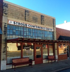 | William Alfred Mensch Building | 3.4 miles | 2000 |
| Moses Keokuk House | 3.5 miles | 1973 |
| National Archives record | The nomination case file for reference 03001235 in Record Group 79. |
| Lincoln County | All 48 listed properties in this county. |