BlockBefore
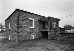
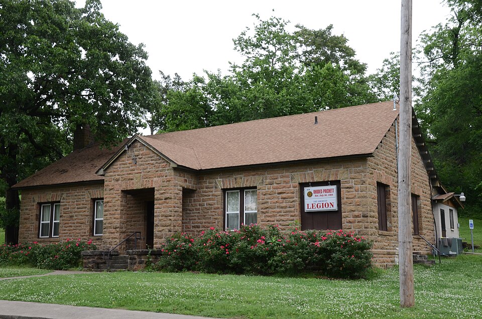
Photograph of American Legion Hut
Photograph by Valis55, CC BY-SA 3.0. Via Wikimedia Commons.

American Legion Hut

Listed on the National Register of Historic Places in 2006.

From the record

One of 20 National Register listings published here for Cherokee County · listed in 2006 · category: Building.

Sources: the case file at the National Archives · the National Register database, National Park Service · the Wikipedia article
The listing

  • What is counted as historic. The nomination lists 1 building as contributing to the listing.
  • Address. Tehlequah City Park, jct. of E Shawnee St. and N. Brookside Ave., Oklahoma, 74464
  • When was it listed? August 2006
  • Category. building
  • Census division. Tahlequah
  • Architectural style. rustic architecture
  • National Register reference number. 06000798 - the number the National Park Service assigned this property when it was listed, and the key its nomination file is catalogued under at the National Archives.

Fires near this property

366 since 1992

Regional context, not property-specific evidence. The federal wildfire occurrence database lists 366 fires within 5 miles of American Legion Hut between 1992 and 2020, burning about 2,563 acres in total. 17 started naturally. 94 were recorded as arson. Distance is straight-line from the map coordinates, so a fire counted here may appear on a neighbouring settlement's page as well.

Reported cause Fires
Missing data/not specified/undetermined103
Debris and open burning95
Arson/incendiarism94
Equipment and vehicle use23
Natural17
Recreation and ceremony10
Smoking10
Misuse of fire by a minor7
Power generation/transmission/distribution4
Railroad operations and maintenance2
Other causes1

The most recent of them, most recent first, with the day each was reported and the service that recorded it.

DateCause SizeReported by Name on the report
8 September 2000Debris and open burning4.0 acresOklahoma Division of Forestrynot named
8 September 1998Equipment and vehicle useunder an acreOklahoma Division of Forestrynot named
7 September 2000Arson/incendiarismunder an acreOklahoma Division of Forestrynot named
6 September 2010Arson/incendiarism50 acresCherokee Nation TribeTAHLEQUAH CEMETERY
5 September 2010Arson/incendiarism20 acresOklahoma Division of Forestry30469
4 September 2010Missing data/not specified/undetermined5.0 acresOklahoma Division of Forestry30467
30 September 2016Debris and open burning2.0 acresOklahoma Division of Forestrynot named
3 September 2000Arson/incendiarismunder an acreOklahoma Division of Forestrynot named

Every fire recorded in Cherokee County

Mines and quarries near this property

7 within 5 miles

Regional context, not property-specific evidence. The federal mineral resources record lists 7 workings within 5 miles of American Legion Hut: 6 past producers, 1 producer. 1 still produces. What was taken out: Sand and Gravel, Construction, Stone, Crushed/Broken, Silica, Clay. Distance is straight-line from the map coordinates, so a quarry counted here may appear on a neighbouring settlement's page as well.

Where SiteCommodity StatusRecorded
Charley Ryals Chert PitSilicaPast Producer
Unknown Limestone PitStone, Crushed/BrokenPast Producer
Unknown Shale PitClayPast Producer
Unknown Gravel PitSand and Gravel, ConstructionPast Producer
Unknown Gravel PitSand and Gravel, ConstructionProducer
Unknown Gravel PitsSand and Gravel, ConstructionPast Producer

Every working recorded in Cherokee County

Map coverage status

No historic map-sheet match is published for this property yet. That does not mean no map exists. This record needs a coordinate-quality review before it can be joined to a sheet boundary. Browse the county's mapped places while that work is pending.

Listed places nearby

6 within 8 miles

Other National Register properties close enough to walk or drive between, ordered by distance from this one. Both positions come from the same geocoding pass that matched these properties to their map sheets.

Photograph PropertyDistance Listed
Cherokee Supreme Court Buildingunder 500 feet1974
Tahlequah Armoryunder 500 feet1994
Cherokee National Jailunder 500 feet1974
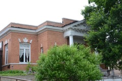
Tahlequah Carnegie Library0.3 miles2003
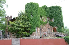
French-Parks House0.3 miles1985
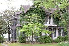
M.E. Franklin House0.3 miles2006

Sources for this property

National Archives recordThe nomination case file for reference 06000798 in Record Group 79.
Wikipedia articleCommunity-written account of this property, licensed CC BY-SA.
Cherokee CountyAll 20 listed properties in this county.

Provenance

  • Listing record. National Park Service National Register of Historic Places, listed-properties dataset, current to 2026-05-22.
  • Map join. Address geocoded through the United States Census geocoder, then tested against the published boundary of every sheet in the USGS Historical Topographic Map Collection.
  • How this page is made. Listing fields come from federal records; map-sheet coverage is a labelled coordinate-to-boundary calculation, not a source-field claim.
  • Wildfire. Short, Karen C. 2022. Spatial wildfire occurrence data for the United States, 1992-2020 [FPA_FOD_20221014]. 6th Edition. Fort Collins, CO: Forest Service Research Data Archive. https://doi.org/10.2737/RDS-2013-0009.6 Collected with United States Government funding and usable without additional permissions or fees.
  • Mines and quarries. USGS Mineral Resources Data System (MRDS) https://mrdata.usgs.gov/mrds/ A work of the United States government, no copyright under 17 U.S.C. 105.